
The Cheviot Goat Ultra was one of those events I’d never heard of or considered entering until one of my friends mentioned it – however as I may have mentioned before in this blog, I’m very easily lead. It also seemed like a very good idea… reasonably good idea… good idea… definitely an idea anyway, as the last leg of the Spine Race goes through the Cheviots and that was the bit I didn’t get to. It was also in December so my theory was if I could get round the Cheviots then it should be a breeze in June.
Anyway I entered, Storm Arwen happened, the route got modified, we travelled up to Alnwick for the start, Northumbria declared a state of emergency and the race had to be cancelled less than 24 hours before it was due to start.
After a couple of weeks the organisers presented us with three options: transfer to the December 2022 event, a new event in Summer or a rescheduled 2021 event in March. As I was primarily using this a Spine training run, the March event seemed perfect. We would also have literally twice as much daylight as we would have had in December, which, to me at least, was a definite win.
As it happened the two people that got me into the Goat in the first place also took the ‘March’ option so the banter regarding who was most likely to drown in a bog (me), who was most likely to get hopelessly lost (me again) and who was most likely to get hopelessly lost and then drown in a bog (still me) could continue.
Since December I had realised that had the event gone ahead I would have been at best a DNF and at worst a casualty. By all accounts the weather that weekend on the Cheviots became horrendous, freezing temperatures, high winds and snow. To be fair many of the people that do the Goat do it to test themselves in precisely those conditions. I realised I had definitely ‘dodged a bullet’, as one of the people I chatted to on the race that went up onto the Cheviots on the original date of the race put it. In order to be a little more prepared I had a bargain £30 down jacket from the Trespass closing down sale and spare gloves, hat and waterproof socks in my pack. As this was to be a Spine training run, I basically had virtually all my Spine kit in my pack (apart from my poo shovel, this is a recent addition to the kit list and I’m still researching which shovel is best for burying poo with – it’s a glamourous race, the Spine). In fact my pack was so large compared to many others that was asked if I was planning on bivvying out overnight on the Cheviots.
Race check-in was done on Friday evening, it was quick, efficient, I was given a map, a couple of trackers were attached to my pack and my photo was taken in case it was needed for an obituary. Mountain Rescue also checked I had spare clothes and a survival bag as their preference was not to need to find me at all but if they did have to then the preference was to find me alive and relatively warm in my survival bag, rather than a hypothermic medical emergency. Oh and they gave me a map, which was nice but I felt unlikely to help.
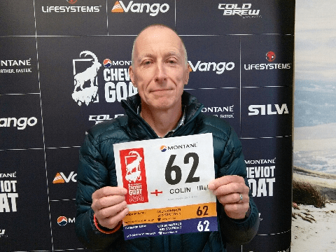
Anyway I had my pack packed, my two drop bags packed and my race clothing selected, I was as ready as I was ever going to be. The weather forecast looked good, I had a new GPS watch with maps and everything on it plus my handheld GPS so I was hoping not to get too lost. I reckoned I was as ready as I was ever going to be so at 4am on Saturday 19th of March 2022 I got out of bed, got dressed, ate porridge and Sharon drove me to the start at Ingram.
One thing the ‘Essex Goats’ were agreed on was the choice of footwear for the event, Inov8 X-talon Ultra 260s – even if Jackie had never actually run in hers…

From this point onwards I am going to have to upset Drew, one of the the race organisers. The Cheviot Goat has a reputation for being a tough race in difficult December weather. We were asked at the race briefing, in order to ‘protect the brand’, not to post pictures with blue skies and sunshine. I’m fairly sure that was joke but if it wasn’t then if any of the Cold Brew team should happen across this blog then please stop reading now…

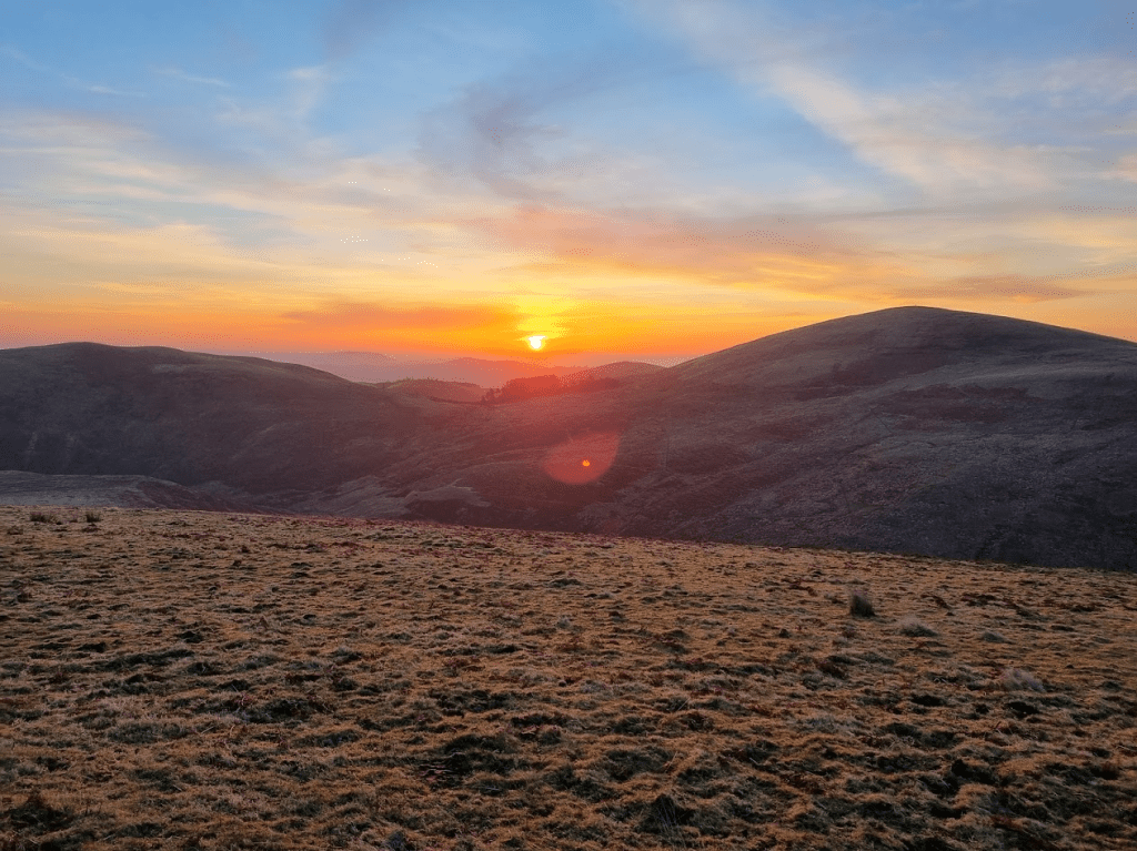
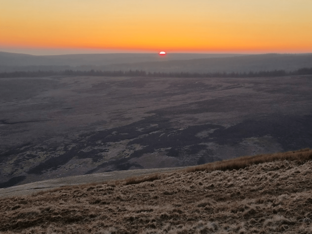
At 6am on the dot we were off and jogging along a reasonably decent track with a gentle incline. Soon after we got to see the most beautiful sunrise, which as usual, my photographic skills failed to do justice.
As I passed the Thieves’ Road Plantation I was remined of why the event was postponed from December.

After about eight miles of deceptively easy running, we turned off Salter’s Road and onto moorland. Obviously I face planted fairly soon after. It was a bit of a comedy fall as I stumbled forward, the weight of my pack stopped me quite regaining my feet but I managed to run, bent double, until I took the tactical decision to stop running and fall gently forward into the grass. no harm done but a warning that I needed to be a bit more careful from now on.
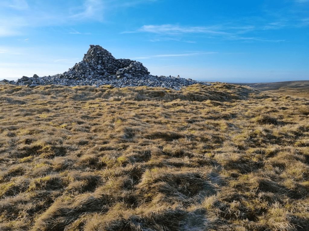
The course then took an upward turn for a fairly steep climb up to Hogdon Law and its very impressive cairn.
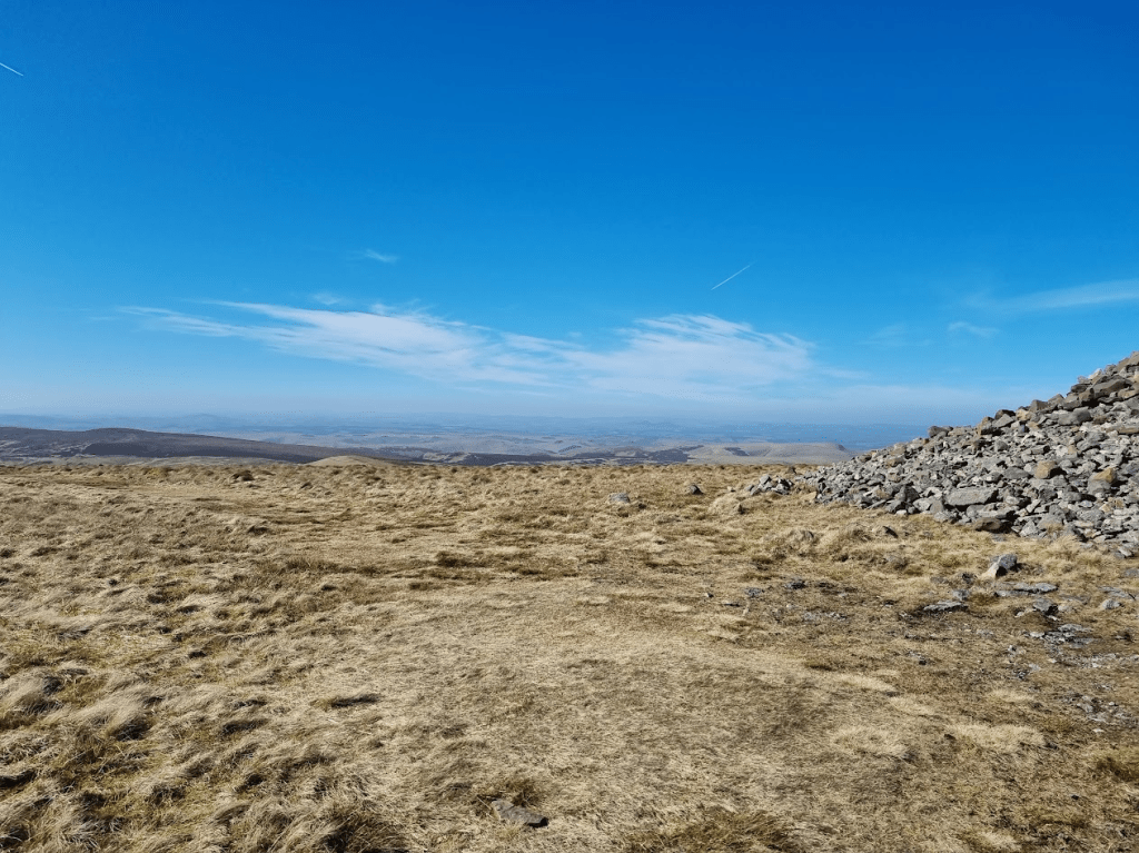
From there it was downhill, becoming quite steep downhill, with great views until I reached the additional water point. I had decided to carry 2.5 litres of water (actually Tailwind) from the start and so had plenty of water and so left it for those that might need it.
Obviously what went down had to go back up again but I don’t remember anything too horrific and after passing Shillhope Law I dropped into Barrowburn and the first checkpoint. I arrived at almost exactly 11am, a full hour earlier than I had expected. I was given soup, coffee and my drop bag. At this point things were going so well I didn’t feel the need to even open my drop bag. I refilled my soft flasks from the two hard bottles I was carrying and decided that should be enough liquid. I had purchased a filter bottle, partly to give me the 3 litres of water capacity required for the Spine but also as an emergency water source. I had seen enough streams already to be confident that I could find water should I need to. To be fair, I was regularly finding water with my feet whether I wanted to or not.
The next leg was the one I was most interested in as it included a few miles of the Pennine Way. However before then there was the small matter of an additional loop up to Windy Gyle, which had been added to make up for the reduction in mileage caused by the removal of the trip into Scotland after Storm Arwen. The extra loop was fairly easy to follow but it did include a very steep drop down to Trows burn, followed naturally by a steep climb back up.
Once at Windy Gyle I was very excited to find a sign for the Pennine Way. One of my fellow runners could see my excitement and very kindly took a picture of me with the sign.
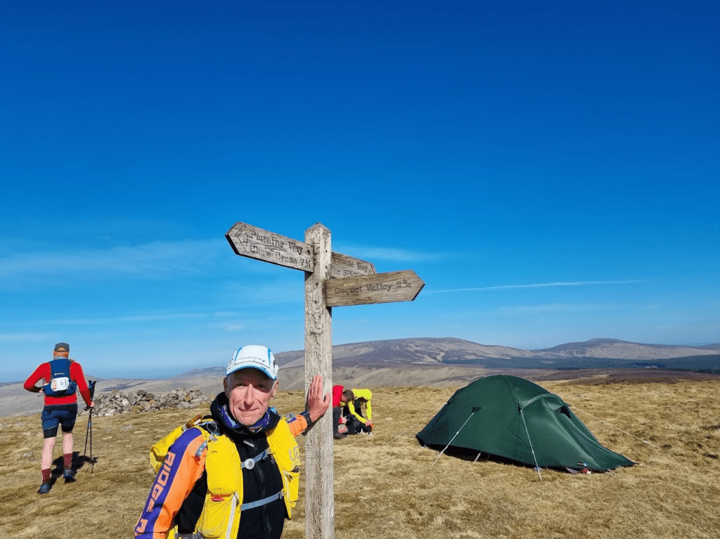
As I was now on the border between Scotland and England I felt I should take photos to show how different each country is.
Once on the actual Pennine Way I wasn’t sure if I was happy or disappointed. The path was slabbed like several of the boggier sections I had covered in June. On the one hand this was a good thing but I couldn’t help feeling slightly disappointed that after all that effort to get onto the Pennine Way in Cheviots it was much like much of the rest of it.
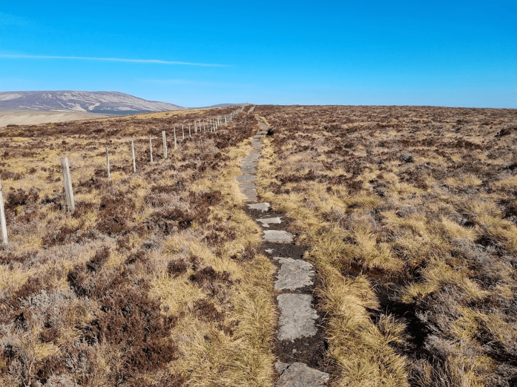
The next 5 miles would take me to the top of the Cheviot. Although that would be the highest point of the run, I wasn’t too worried. Firstly, the path was easy, mostly slabbed with a few rougher sections. Secondly there was actually only about 200 metres of climb from where I was to the top. Obviously being me I couldn’t make this totally straightforward and sure enough I learned a valuable lesson. There were various points on the Pennine Way where the slabs were either missing, leaving a bottomless bog, or just slightly submerged and safe to walk on. Within sight of the summit there was such an area. I very carefully probed with my walking pole to find the slightly submerged slabs. The valuable lesson is to put my foot in the same place as the pole found the slab, not a few inches to the left into a bottomless bog… I should confess this wasn’t my first major bog related error. At some point, I’m not sure where, I was going uphill through bog, wondering why so much water could stay uphill instead of doing the decent thing and running to the bottom. I was with two other runners at this point. At one particularly wet section my companions turned sharp right to go around it. We were following a fence line and I noticed a rail along the bottom of the fence I could kind of slide along over the wet bit. what I hadn’t noticed was that the wet bit extended further than the rail. I pulled myself out of the bog and my fellow runners were kind enough not to laugh too much.
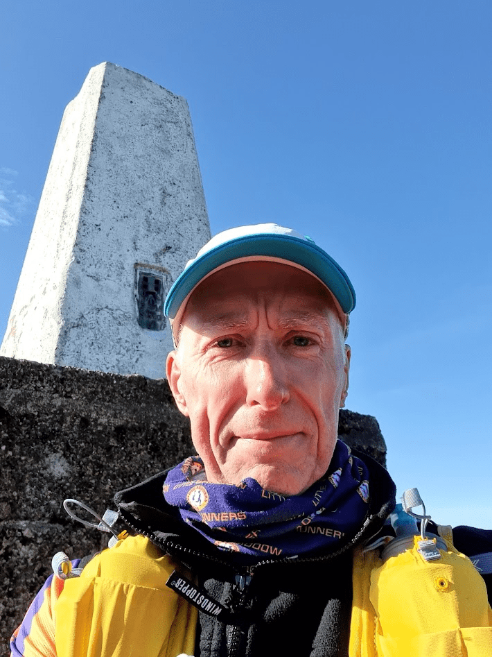
I finally arrived at the top of the Cheviot which, if I’m honest, was a bit underwhelming. It’s not a very pointy peak but it does have a big pointy concrete thing to show you where the top is.
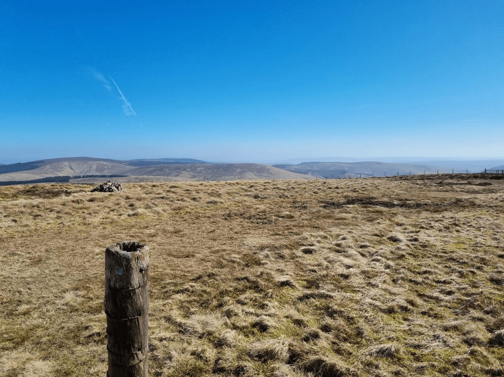
I was very happy as I’d reached the Cheviot by quarter to three in the afternoon and so felt fairly confident of achieving my next aim, to get to Checkpoint Two before dark. After coming off the out and back section from the Cheviot I was a little unsure of the exact route, it was down and along a fence line but there was a stone wall there as well and a lot of loose rock. I picked my way carefully downwards until the route became more obvious. I should have been grateful for the excitement as the next few miles weren’t my favourite. It was a couple of miles jogging along with a fence on my right, until I crossed Salter’s Road where a marshal told me to switch to having the fence on my left – I could barely contain my excitement.
After the small summits of Bloodybush Edge and Cushat Law it was back down to Salter’s Road and an easy jog to Checkpoint Two. I was there by quarter to six and assured by one of the marshals that my ambition for a same day finish was very realistic. I was less certain as I knew it would be dark in an hour or so but it was still good that someone had confidence in me. I had more coffee and got my bottles refilled with water. I picked up two sachets of Tailwind in case I wanted to add them to my bottle but I never did. Realistically I knew I probably wasn’t taking in enough calories but I felt OK so I trusted my body and set off on the last leg of the adventure.
After half an hour the sun set and it started getting dark.
It was still light-ish when I did the out and back to Coldlaw Cairn. I probably should have got my torch out earlier but eventually I succumbed and put my jacket back on (I’d taken it off at the first checkpoint), swapped to my woolly hat and of course, put my head torch on. I did have a few problems with my jacket. It has a double zip and until both sliders are engaged it won’t do up. My fingers were quite cold and I struggled to line up both sliders. Eventually I managed it but on reflection I should have stuck with my plan, which would have seen me do all this prep at Checkpoint Two.
At this point I have to mention the moon. it was amazing. It was red. Then it was huge, white and to be honest, a bit annoying. I didn’t take any photos.
I was now only about ten miles from the finish but the cheviot Goat wasn’t going to let me off easily. The last ‘out and back’ summit was Hedgehope Hill. The approach was via Standrop Rigg, it was dark, there was a fence line to follow along with a path. I took the path – I thought. I kept losing the path and ending up wading through heather. I knew I was boldly going where no runner had gone before when I disturbed two sleeping grouse. However I kept pushing on and finally met a marshal a few metres from the summit marker. ‘Do I have to go right to the marker?’ ‘you tell me, I won’t tell anyone if you don’t’. Needless to say after that I felt compelled to walk the last few metres and touch the marker.
There were still a few twists and turns to come but I was getting nearer. A small peak at Dunmoor Hill lead to a downhill run to Cunyan Crags. I remembered the original course description mentioning the Crags and suggesting staying to the left was a good move. I found there was a very narrow path following a fence through them and took that. I wasn’t sure of the exact route but with the aid of my GPS watch I pushed on and picked up the path down to the road. There was mile or so to do along the road and then it was the last example of the organisers sense of humour. It’s less than a mile to the finish from the point where the course turns up for one last climb around Brough Law. Fortunately Brough Law isn’t particularly boggy and was very easy to navigate and so I found my way around quite easily. I also saw that I was comfortably on target for a same day finish. To be honest I relaxed a bit too much and ended up doing a bit of a sprint to avoid losing two places right at the end. I finished in an official time of 17 hours 39 minute and 20 seconds.
How did my fellow Essex Goats do? Ian finished only 20 seconds behind me. Jackie had been finished for literally hours taking only 13 hours and 42 minutes to finish 6th female. Sharon was at the finish to greet me and guide me to food. We sat and talked in the café for a while before Sharon and I went back to our B&B, the Tavern Steakhouse and Lodge at Alnwick. I feel I have to mention this place as, when I told them what I was doing, they told us we could keep the room for an extra 2 hours on Sunday so we could get some rest before travelling home – thank you Tavern!
All in all the Cheviot Goat was a very positive experience. I know many people would say that I haven’t really done the Goat as it wasn’t really winter and the weather was too good. I don’t care, it was hard enough for me and I felt it was an excellent experience to take forward to the Spine. My new GPS watch was great for navigating and much easier to use with poles than my handheld one. The handheld GPS was still useful as it was easier to zoom in and out and get my bearings. I also had some waypoints marked to indicate which side of fences I should be. It was also very useful when I saw some unexpected headtorches in the dark. Looking at the overall map revealed they were on a different loop of the course that I had already completed and so were of no concern to me – for once my navigation was spot on. My pack worked well, it was comfortable, didn’t rub and comfortably held all my kit. I had bought some Dexshell waterproof socks as they seemed to be very highly rated. This was my first run in them and they were very comfortable and kept my feet dry and blister free.
There are 90 days left to the Spine Race – more than ever, the only way is Pennine!
