
I don’t spend much time looking for races to do as I’m easily led and so just seem to jump onto races other people have found for me. This one started as an invite to a WhatsApp group. Once I’d joined the group of course I had to do the race, didn’t I?
Anyway the Fellsman is a bit different to most races I’ve done. It’s old, very old, older than me even, it started in 1962. Due to Foot and Mouth causing 2001 to be postponed and the 2020 and 2021 events being cancelled due to Covid, 2023 was the 59th time it had happened. It’s also not run by a running club or an events company, it’s run by the Keighley Scout Service Network. I also doesn’t have a fixed route, which, for someone with my navigational skills, could make life interesting…
Not only does it not have a fixed route, a lot of the land it passes over is private and access is negotiated only for the race. this means that recceing a lot of the race is not possible and very much discouraged as it could jeopardise access for the race if people start trespassing at other times of the year.
The kit list was also a little different. Obviously as a Spine racer I’m used to extensive kit lists but, as I said, this one was a bit different. It included five long sleeve tops, one of which had to be waterproof. Although this sounds a lot, in practice it’s only actually one more than I might usually take. The Spine specifies a waterproof jacket, a warm mid-layer and a base layer, which is three, plus I was always going to run in a long sleeved top – which makes four. The two pairs of long trousers was slightly different as the Fellsman specifies that they have to be running or walking trousers (running tights are OK), of which one pair must be waterproof, the Spine requires waterproof trousers plus a base layer. This did change my kit choice slightly. I would have preferred the option of starting in shorts and carrying my heavier waterproofs, which would have meant I would still have to carry another pair of ‘trousers’, so I as I decided to start in tights and carry my lightest waterproof trousers. There was a requirement to carry 300 grams of emergency food – which seemed quite a lot – but no requirement to carry any water at all, which did seem very strange. Most of the rest of the kit was standard although the usual ‘foil blanket’ actually had to be a foil poncho and the contents of the first aid kit were quite well specified. Anyway I never argue against the kit list and as I was taking my Fastpack 20 I wasn’t stuck for space.
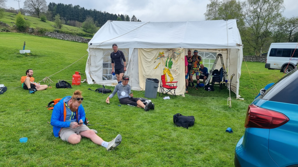
Four of us from the Fellsman WhatsApp group arranged to travel up in Ian’s luxury van/camper (the fifth member of the group wasn’t as easily swayed as me and decided that staying at home was a much better idea). Ian was ‘Tent Man’ from my very first ultra, Saltmarsh 2013, we’ve been running and racing together ever since. Terry first entered the Fellsman in 1998 and had a few finishes and a couple of DNFs to his name. Bubs had been terrifying me with tales of just how could it was in 2022 and how he had actually used all five long sleeved tops.
The journey up was fairly uneventful except I was made to have MacDonalds. This wasn’t actually a bad as I feared and they did give me plenty of ketchup to disguise the taste. We arrived a Threshfield (the finish of the race) at somewhere around 5:30 in the evening I think. The car park for the event was at a quarry a short distance from the school so there was a shuttle bus to the school. We also met Neil in the car park, another local(ish) runner from just over the border in Suffolk.
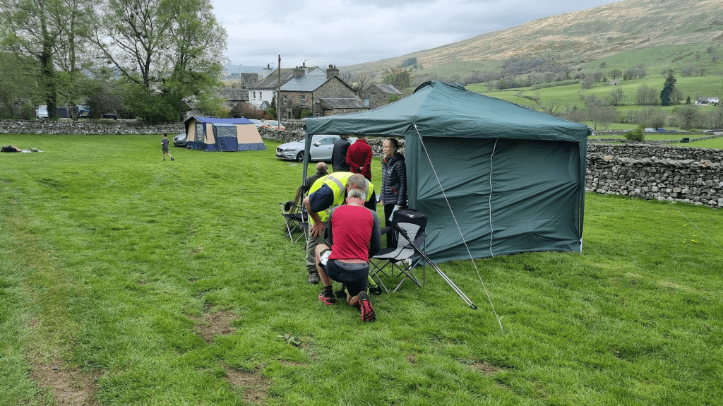
The first thing we needed to do was pass kit check. Terry showed his experience by having his kit easily available in a plastic box, not stuffed tightly into his pack like mine was. I don’t know why I hadn’t done the same as I had done it for the Spine and (as I would prove) it was a lot easier than the kit explosion my kit check turned into. We were near the front of the kit check queue, which was good as we would be bussed to the start in the morning. By checking in early we hoped to get places on the last coach at 6:30 rather than the 5:45 one, which we all did. The lady doing my kit check was very patient as I laboriously unpacked my pack but at least I did have everything and so I was given a small piece of paper to present at registration the next morning. We had booked ourselves places in the school hall to sleep overnight so the next stage was to go and claim our territory and raid the gym storage room for some mats. The number sleeping in the hall had been restricted to 50. As it was I don’t think there were more than about 30 in there so space wasn’t an issue.
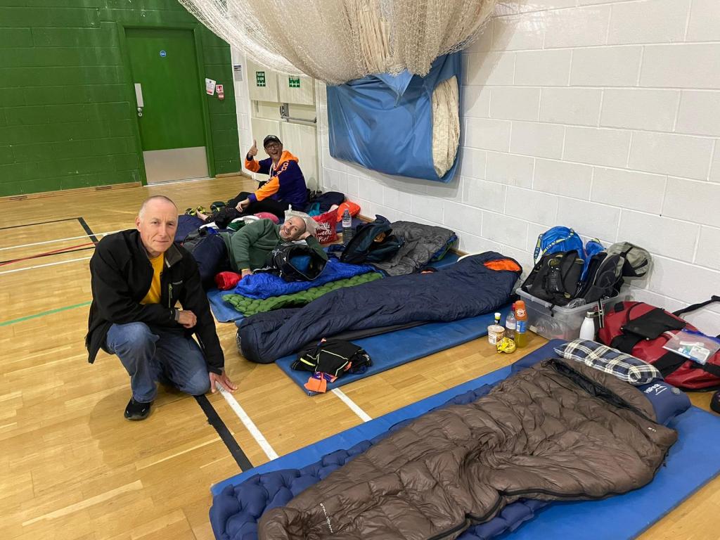
We had also all booked food. The food was OK but I must admit the quantity wasn’t overly generous. However by getting more bread every time I went for a tea refill I think I managed to get enough to eat. After that it was time for bed…
After a fairly decent night’s sleep we got up for breakfast – predictably I went for a bacon sandwich. As I’d got everything sorted the night before and we could just leave our beds so they were there for our return, I couldn’t possibly be late could I? You’d have thought not but I was still in the toilet as everyone was being rounded up for the bus…
The bus trip was uneventful apart from the highlight of going through Gargrave and passing the legendary Co-op – which I obviously had to point out to my colleagues. They seemed a bit underwhelmed by it if I’m honest. Anyway we were soon at Ingleton and going through check in. Fortunately I hadn’t lost my kit check paper and was given a tracker, an orange thing that looked like a watch but was actually a transponder to check into each checkpoint with and my tally. The tally is a bit of Fellsman history. It’s a plastic disc with all the checkpoints around the edge, which is clipped at every checkpoint. miss a checkpoint, your disc doesn’t get clipped and you are disqualified. Realistically, with the tracker, the transponder and the fact that someone writes down you number at every checkpoint, it’s probably not completely necessary any more but it is part of the event history and apparently they send it to you afterwards with your certificate as a memento. We also optimistically entered ourselves as a team, The Sandbaggers – so called due to all the pre-race banter in which none of us were fit, fast, going to be racing… the usual pre-race nonsense.

There was short welcome speech and a minutes silence for a long time Fellsman volunteer who had recently passed away and then it was time for the race to start. This was the first indication that the Fellsman is ‘different’. In every other race I’ve ever done, when the starter says ‘Go!’ everyone runs in roughly the same direction – if they don’t they are going the wrong way. Some of the Fellsman route is mandated, much is obvious. The rest – as I was soon to find – mainly involves bogs. However as there is no mandated route off the starting field, people shot off in all directions. My fellow Sandbaggers headed straight for a high steep bank and scrambled up that so I followed them. Once outside the field I think pretty much everyone ended up on the same foot path towards Ingleborough, first peak and checkpoint of the event, also the second highest at 724m.
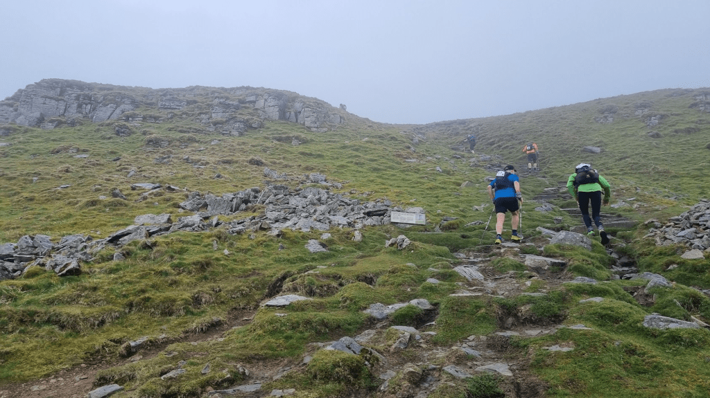
After leaving Ingleborough the descent soon became very steep and technical and so I inevitably had to multitask – get down, get out of everyone else’s way because I was so slow, oh, and be absolutely petrified whilst doing it. Fortunately this turned out to be the only really tricky technical bit en-route and eventually I made it down and arrived at the second checkpoint at Hill Inn. The Fellsman has a large number of checkpoints, 25 to be precise, not including the start and finish. This is because it is (mainly) a point-to-point event rather than a fixed course, if there were no checkpoints it would simply be a race from Ingleton to Threshfield via whatever route you liked. Due to this not all the checkpoints have food and water at them, only the ‘roadside’ ones. Obviously the road at the peak of Ingleborough is conspicuous by it’s absence so checkpoint two was my first opportunity to refill my bottle and stock up on biscuits. I had my bottle refilled with orange squash, an idea someone beside me thought was excellent and did the same. Every roadside checkpoint had orange squash so I stuck to filling my bottles with that for the whole race.

After Ingleborough it was a very tough climb up to the the highest point on the course, Whernside at 736m. I’d been over Pen-y-Ghent on the Spine Race so I had now completed the Yorkshire Three Peaks. I don’t think I get a certificate or anything though.

After Whernside it was another roadside checkpoint at Kingsdale followed by another climb to Gragareth. The race was now starting to get interesting. It wasn’t that he first bits weren’t interesting, they were, but they were also quite busy with walkers and runners from the Yorkshire Three Peaks Race which is on he same day. Gragareth didn’t seem to be quite a much of a tourist hotspot.
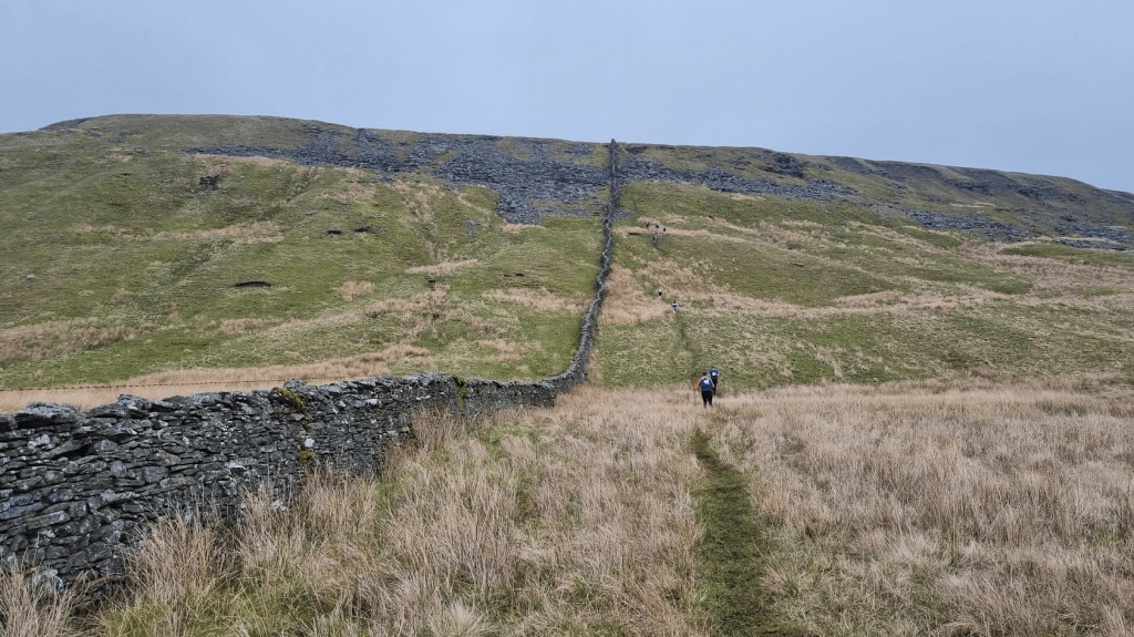
There was little change of elevation between Gragareth and the next hilltop checkpoint at Great Coum. Navigation was easy as you just followed a wall. The advice was to stick to the left side of the wall as it meant you didn’t have to climb over any adjoining walls. It did however mean you had to run though bogs. Most of the boggy bits could be jumped or avoided. One of the ones I found was just about jumpable if you got it right. I sort of tripped, stumbled and jumped into the middle of it instead. It wasn’t quite waist deep but was very wet.
After Great Coum the wall following continued, descending towards Flinter Gill. The wall gave way to following a well defined track. Another runner caught up with me and warned me that the path became quite rocky and ankle testing. I thanked her for the warning. I didn’t see her again as I managed to slip over and land heavily on my bum way before the tricky bit.
At the end of the track I caught up another runner. A very smartly dressed gentleman asked if we knew the short cut. The other runner said he did so I said nothing and followed him. He didn’t know the short cut. fortunately the previously mentioned smartly dressed chap saw us go the wrong way and called us back and pointed us the right way for the short cut.
The next checkpoint was a roadside one at Dent and was quite busy. A lot of people appeared to be having a bit of a break there as it was about a third of the way through the event. I had some coffee and a sausage roll and probably some biscuits.
There was also a kit check at Dent. Fortunately I still had everything. I did try and leave my poles behind but the kit check man called me back before I wandered off too far.
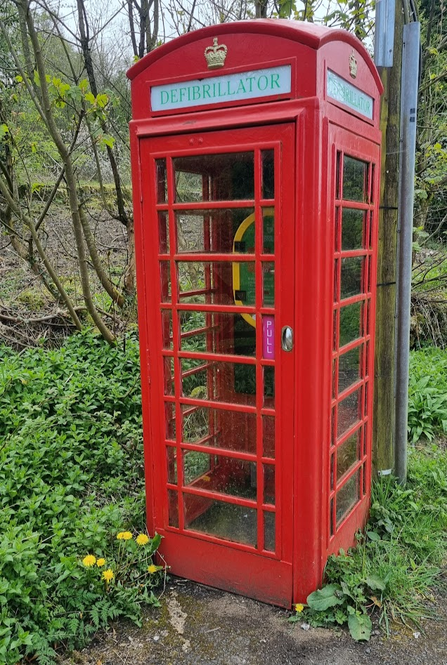
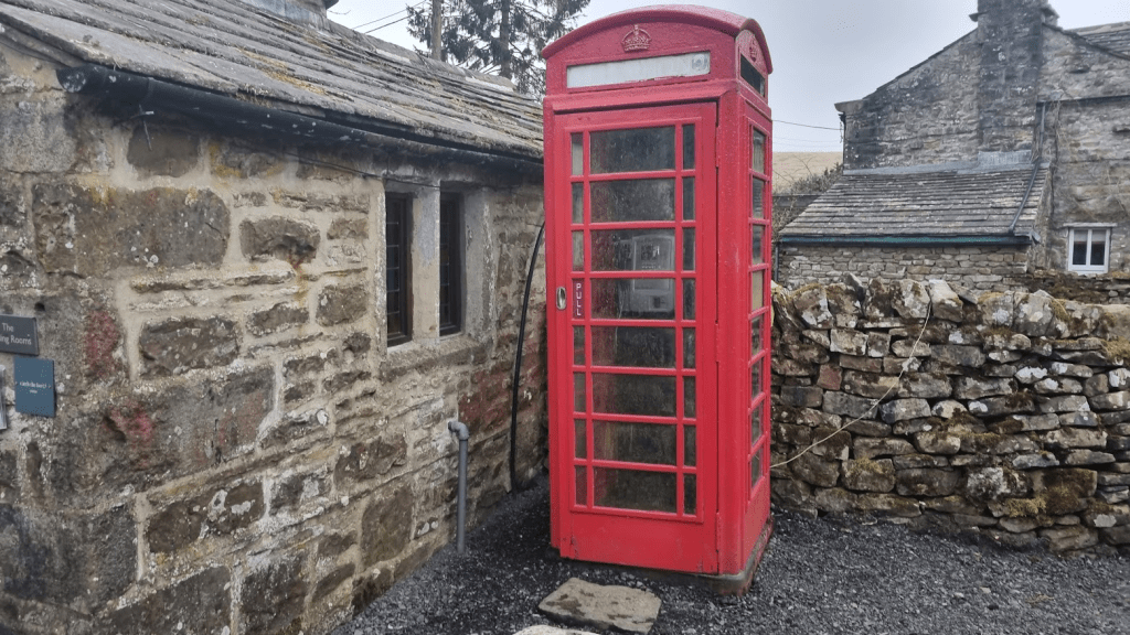
I liked Dent, it has a phone box.
After Dent there was a road, then a well defined path and then the first of the ‘Brave and Bold’ sections as I was calling the bits where you had absolutely nothing at all to follow apart from a GPS track – or a compass bearing if you are going old-school. My route followed the Dales highway until it passed a ruin, at which point I was to strike out across country until I reached Blea Moor, checkpoint nine. If I was lucky I’d find the ‘trod’, an unmarked route that had been walked by sufficient people to create a path. You know a race is old when it has its own language. I did occasionally find ‘trods’ at various points on the event but after my experience on Blenkinsopp Common on my first Spine attempt I knew you could waste a lot of time hopping backwards and forwards looking for paths – and that was on the Pennine Way, there was no guarantee a path even existed up on Blea Moor. Looking at the GPX file of my route I seemed to do quite well and got there fairly directly – I don’t remember falling in any bogs either but that might just be due to my bad memory.
There was a path from Blea Moor. My route followed a fence to a main footpath but I saw others take a more direct route through the fence. As I could see a ‘trod’ on my route I stuck with it, I had no idea what the other route would be like although Terry took it and said later it was OK and there was a trod there too. I was now running directly over Bleamoor Tunnel on the Settle to Carlisle line and passed one of the air shafts which was cut into the tunnel to allow the smoke and steam out in the days of steam trains (they still run steam trains along it).

On the way down from the tunnel the path passed through a garden (it was either Dent Head Farm or somewhere else). There was a path through the garden and ordinarily I would have carefully followed the path and kept off the garden. However on the path was a large angry goose. He had clearly taken ownership of said path and was making it quite clear I should stay away so had to resort to walking over the grass to avoid the aforementioned foul tempered fowl.
I jogged along the road section to checkpoint 10 at Stonehouse. I think I had some more coffee and some biscuits. As I was about to leave I bumped into Ian as he exited the toilet tent having just arrived. We exchanged pleasantries and I told him I’d see him later when he caught me up. He said he wouldn’t but there is a fairly consistent pattern when we do events together that I set off quickly and slow down and Ian does the opposite and so often catches me later in the race.
Shortly after leaving Stonehouse the route lead me through the Arten Gill Viaduct on the Settle to Carlisle line. This isn’t the famous ‘Harry Potter’ viaduct, that’s Ribblehead but is one of three viaducts on the line and, at 36m high, is the second tallest after the one at Crosby Garrett.

Despite having had a few falls, sore feet and very sore muscles, I was quite enjoying life at this point. the sun had made a brief appearance and the route was quite interesting. However it was time for another long climb, eventually arriving at checkpoint 11 on top of Great Knoutberry Hill. It may have only been a ‘hill’ but it was still 672m high. The last checkpoint had been at only 254m, over 400m of climb in around 2 miles. Great Knoutberry is an ‘out and back’. I passed Ian going into the checkpoint as I was running out – he was only about half a mile behind me.
My route took me back along the track I’d left to turn up to Great Knoutberry and onto the Pennine Bridleway. However everyone else was following a trod directly in line with the path down. I followed them. I’m not sure that I shouldn’t have done my own thing. I soon lost the path and was basically trudging through the grass in the general direction of a gate through a wall down to checkpoint 12 at Redshaw. I did pass a photographer after I’d gone through the gate, which is always a good thing as it usually indicates you are in the right sort of place. I also had a hotdog and some coffee at the checkpoint.
From checkpoint 12 to checkpoint 13 at Snaizeholme was only about a mile along an obvious path. As a result I got a bit of a shock when the lady with the small child ready to clip my tally said it was checkpoint 15! Fortunately she was joking – even I’m not that bad at navigating.
I set off from the checkpoint at a fairly brisk pace but soon, inevitably, Ian caught me up. I expected him to push on but he decided he fancied some company so we started running together. We joined the infamous Cam high Road, and Ian had to listen to me ranting on about why this was the most pointless, stupid, miserable section of footpath in Britain. Fortunately we soon turned off towards Dodd Fell.
Dodd Fell was another ‘Brave and Bold’ section so it was good to have some company. We got to Checkpoint 14 on the top without too much trouble. Coming down was slightly more challenging but the aim was to hit a wall and follow it to the road. We executed the plan fairly well, especially as visibility wasn’t the best, but I think we could have saved ourselves half a mile by going through the wall where it had a wooden section to allow water to flow down. The rest of the wall was a bit challenging to scale – quite high and with an additional wire top section – but we might have got through there. Anyway a short walk down the road took us to the turn for the path to the next checkpoint at Fleet Moss. This was another roadside one and produced coffee, tinned fruit and one of my favourite foods which is not seen often enough on races in my opinion, rice pudding!
The next bit was not great if I’m honest. It’s not really the organisers fault. As I said at the start, a lot of the race is on private land and for some reason they are no longer allowed to go over Middle Tongue and so the race has to follow the road for over three and a half miles. It is downhill but that wasn’t so comfortable by now – so while I’m running down a road, it seems like a good time to mention shoes. There was a lot of discussion about footwear before this race. within our group the shoe of choice was the Inov8 X-Talon 260 Ultra. I’d used this on two Cheviot Goat races and the Haworth Hobble and had been very happy with it. However I was a bit concerned about the amount of hard trail on this event as they are much more suited to mud and bog. As it was they were excellent and almost life-saving on the steep wet climbs, not so good on some of the wet rock and a bit firm on the hard sections. However I think my biggest mistake was a) not wearing liners with the waterproof socks and b) not going up half a size to account for the fact I was using quite thick waterproof socks on this event. As a result by now my feet were sore and when I checked my feet after the event I found several quite large grazes on them. However Ian seemed to be suffering even more with his feet so I tried not to moan too much. I think the X-Talons were the right choice but with liner socks and a larger size next time (next time??? what am I saying???)
Anyway although the road to the Deepdale checkpoint may have been less than ideal, its saving grace was the phone box (complete with phone) at Oughtershaw. The actual checkpoint was also very picturesque on the River Wharfe. So picturesque in fact that you would have thought I’d have taken a picture but no, just the phone box.
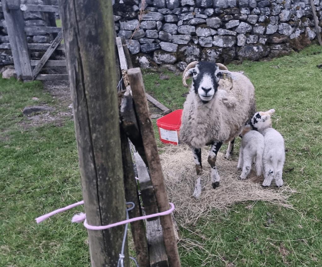
After we left the checkpoint we passed some very cute lambs. These came over and nuzzled our hands whilst mum looked over with a slightly worried expression on her face (I’m making that up really – I can’t really read sheep’s expressions). I tried to take a photo but due to the limited number of pockets on the front of my pack my phone had been sharing a pocket with several biscuits for the last few hours, including a rapidly disintegrating fig roll. By the time I’d wiped the crumbs of the camera the lambs had got hungry and gone over to mum to feed. I took a picture anyway.
By now the light was fading and we were about to go for another ‘Brave and Bold’ adventure across Cray Moor. I must admit, I don’t remember too much about this section and the GPS route doesn’t look too mad so I can only assume we passed checkpoint 17 at Chapel Moor and checkpoint 18 at Hell Gap without too much drama. I think it was a bit boggy but that may just be an extrapolation from my memory of ever other off-road bit of the course rather than a genuine memory.
Checkpoint 19 was another roadside one at Cray. I drank coffee (with sugar for added energy) and made a cheese and Marmite sandwich.
By now we were starting to run out of climbs and I was becoming optimistic that a sub 20 hour finish was possible. However there was still the little matter of Buckden Pike – and Great Whernside.
The climb to Buckden Pike followed Cray Gill for a while. Our GPX file had us on the left side, we went right. Now I’m home looking at a map it appears there are routes both sides. However we decided to correct our ‘error’ by scrambling down to the Gill and back up again. Well, Ian did. I sort of slid to the bottom, didn’t see were Ian had gone up, tried to climb up, failed, went back down, found a slightly less impossible climb up and eventually re-joined Ian – who by now was a bit worried as apparently he’d been shouting to ask if I was OK. I was basically in a trench and so hadn’t heard him and he had started trying to work out how he was going to explain this to Sharon… Anyway this was one of those points where I was very glad of the X-Talons or I’d never have managed to climb out. Of course I could have gone 50m to my left to a crossing point – I know that now…
Once the Gill had been dealt with it was a straight trek up to checkpoint 20, Buckden Pike at 702m. From there it was a case of following a wall for a while until we hit Walden Road followed by Starbottom Fell Road – at least that’s what it says on the map I’m looking at, I have no recollection of any of that looking remotely road like. It must have a least been a track I guess as we found checkpoint 21 at Top Mere. From there we continued along Starbottom ‘Road’ until we turned off to Park Rash, the penultimate roadside checkpoint. It had cocktail sausages. I ate cocktail sausages, a lot of cocktail sausages. I like cocktail sausages on checkpoints.
The good news was we’d only dropped about 200m from Buckden Pike and Great Whernside is only 2m higher than Buckden Pike. The bad news was I was knackered and 202m of up seemed a very long way. However Great Whernside was the last big climb and there were only two checkpoints left to have clipped on our tallies. Even better, once we got to checkpoint 24 at Capplestone Gate it was hard to go wrong (although we did see one group try). From the checkpoint we just had to keep the wall on our right until we joined Bycliffe Road (which almost was) and turn off onto Green Lane, which was sporadically marked with poles and beacons.
Finally we arrived at the last checkpoint at Yarnbury. We didn’t stay long as it was only two miles along a real road through Grassington to Threshfield and the finish. Although it was almost impossible to go wrong we both kept checking the route as we really didn’t want bonus miles at this stage. Sub 20 was easy, sub 19 impossible so we threw in a bit of running just for the look of the thing. I tried to photograph the telephone box in Grassington but by now my phone was more biscuit than camera and Ian quickly became bored of my futile attempts to make it work. Quite what the woman was doing standing in the square at 4am we didn’t find out. She told us she was nothing to do with the event but didn’t volunteer any further information and we just carried on. Eventually we crossed the river, ran up the last bit of road to the school and checked in 19 hours and 19 minutes – very happy with that. Ian, being a total gentleman, even let me tap in first. Terry had finished some hours (about 3 of them) ahead of us and Bubs was a couple of hours behind us. The most important thing was that the Sandbaggers had a 100% finish rate.
There was food available but I just took the shower, bed option. A few hours later I was a bit hungry and although dinner had been a bit disappointing, breakfast certainly wasn’t. Scrambled eggs, beans, sausage and of course, bacon. Followed by a cheeky bacon sandwich with double bacon.
We stopped for the prize giving and then set off home. We stopped at Burger King. you’ll never guess what was in my burger…
So the inevitable question is – would I do it again? Well, I’ll be honest it was a lot of type two fun – that’s the sort that’s only fun when you’ve finished. The event itself was incredibly well organised, everyone was friendly and competent. you could argue that after 60 years they should be but a lot has changed over that time – the event used to go the opposite direction for a start. Shuttle buses were great, the checkpoints were great (flat Coke as drink option would go down very well with a lot of the runners though). The kit check and all the administration was well handled. Personally I think the kit list could maybe be tweaked slightly to be more in line with other similar events but equally maybe a slightly ‘different’ kit list is part of the race’s character. With the trackers and transponders the tally could be dropped but definitely shouldn’t be – that is absolutely part of the race’s character. It was bit demoralising at first but as more and more segments got clipped it really felt like I was getting somewhere.
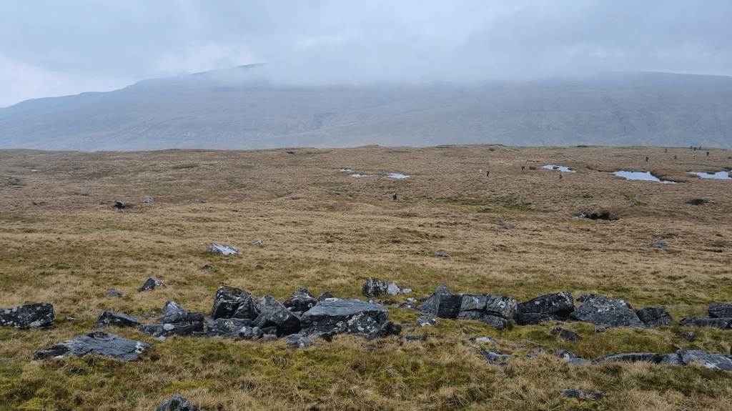
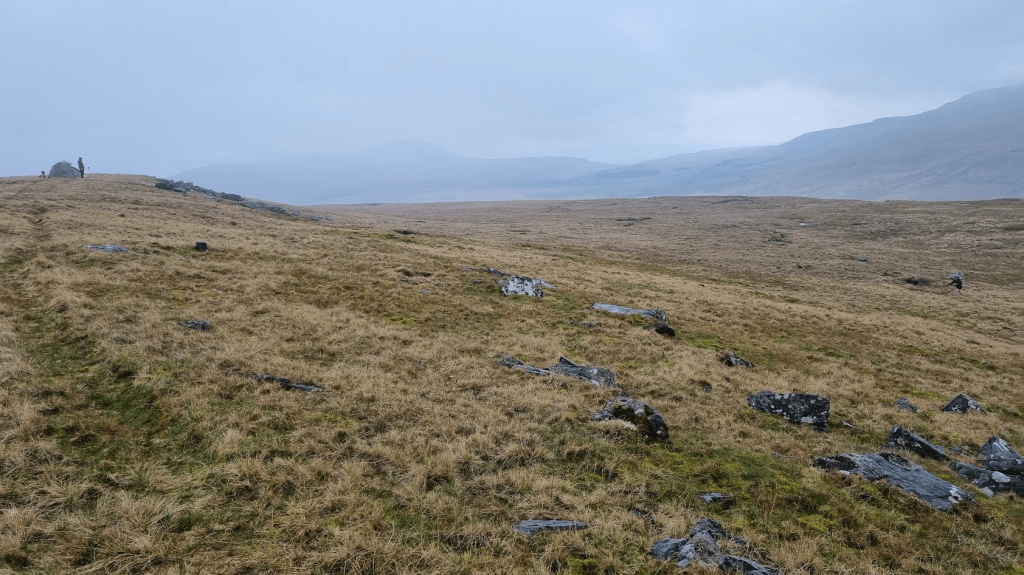
What about the route? Well it has the potential to be beautiful – sadly it was a bit grey and misty (and then dark and misty) so I didn’t see it at its best. In terms of terrain it manages to distil all the variations in terrain you would encounter on the full Spine Race into 60 miles in my opinion. You’ve got rocky tracks, waist deep bogs (if you aren’t careful), some roads, steep slippery climbs, steep slippery descents and of course ‘the trod’. I don’t think I’ve ever had so much variation over that sort of distance before. This makes it a challenge but a good one – grip or comfort? Can you find shoes with enough of both?
The fact there is no completely defined route or official GPX file pushed me right out of my comfort zone. However the fact I spent several weeks plotting out my own GPX file, with every point mentioned in the instructions waymarked, meant that although I’d not run any of it before (apart from the Cam £$%^& High Road) I had some familiarity with the route and could remember certain key parts. I’ll be honest, bashing my way through bogs in the dark trying to find barely existent paths is not my favourite sort of running but it is excellent practice for the Spine Race!
I’ve been asked how it compares to the other ‘grim’ (as my friends call them) races I’ve done. Cheviot Goat, Lakeland 100 and of course the Spine. I’ve thought long and hard and I would say it’s harder than the Goat, just because the terrain is more varied, bog is quite a big part of the Fellsman but the Goat has more bog and less hard trails. I think its even harder than Lakeland 100. It is obviously shorter and only involves one night but Lakeland is mainly on fairly well defined paths, only has a bit of bog and goes over the passes rather than insisting on going to the top of everything. Obviously the Spine is harder as its 4 1/2 times as long but mile for mile I’d call it a tie.
So will I do it again? Well I’m 60 next year and its the 60th time the race will have been run so it sort of seems rude not to…
I’ll finish (finally) by saying a big thank you to the organisers for such a well run event and to my fellow Sandbaggers for making it such a great weekend. A particular thank you to Ian, who I’m sure could have run much faster than me but made the latter stages (especially the night ones) much more pleasant (even if he did keep moaning about his feet).
Until the next blog entry, the only way is still Pennine!
