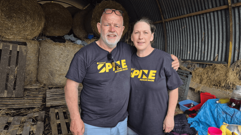
After I completed the full Summer spine in 2022, I persuaded Sharon to join me for the Sprint in 2023. she didn’t hate that so in 2024 we did Challenger South. She did hate that but still decided she would like to do the Challenger North anyway to complete the Pennine Way.
As our Challenger South journey had ended at the Green Dragon in Hardraw, it seemed a logical place for our Challenger North journey to begin. The train journey to Garsdale went smoothly enough but I was a little worried that some Spiners on our train appeared to have organised Taxis for their onward journey to the Hawes area. We were planning on catching the ‘Little White Bus’, which I was expecting to see at the station – it wasn’t there. Obviously the correct reaction is to walk backwards and forwards between the station platforms trying to decipher timetables of various vintages whilst not phoning a taxi. I eventually worked out that the bus didn’t actually meet this particular train but arrived some minutes after. I worked this out as said bus arrived…
Anyway we checked into the Green Dragon, got the last table for dinner and all was well in the end. I had a quick kit faff because it was at least 18 hours since I’d last checked the contents of my bag.
The next morning we had breakfast, checked off our kit against the kit list and walked across the bridge to the Challenger North start for kit check. We also caught up with Mick Browne, an ultra-running legend in my eyes, and regular Spine runner and volunteer.
I know some people get stressed by kit check and I knew some of my kit (specifically my insulated jacket) was marginal but I wasn’t worried. I have quite a good relationship with the Spine kit guru, Lindley Chambers, and had already checked the suitability of most of my kit so I was quietly confident. Sharon has now entered three Spine races and this was her second full kit check. This wasn’t a problem as she tends to have all my really good, lightweight, Spine kit, and I have to make do with my old kit. Anyway kit check was passed, the rest of race check-in completed and we went back to the Green Dragon.

By complete coincidence Tom, one of my tent mates from my first MDS was also doing Challenger North. He’d done the Challenger South a few years ago and would be running with Luke, who he met on the aforesaid event. We had lunch with them after they had done their kit check.
The next morning we had our trackers fitted, dropped our drop bags, and went back to the Green Dragon for breakfast. Full breakfast service didn’t start until 8am but they kindly provided a very comprehensive Continental breakfast from 7am for us and the other Spiners staying there. After that it was back out for the start of the 2025 Summer Spine Challenger North!

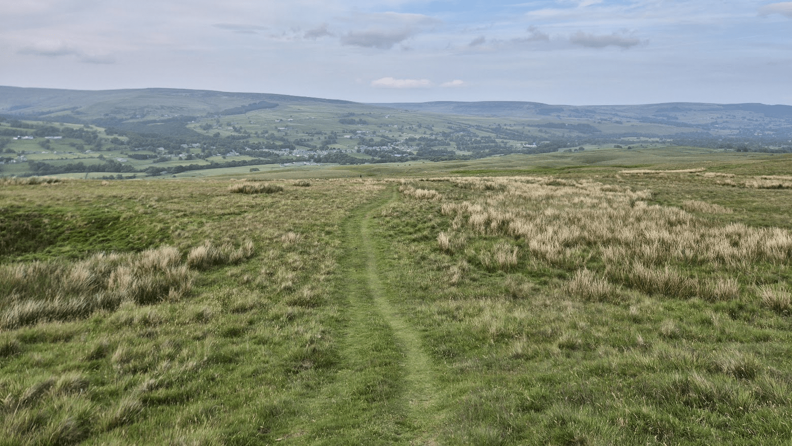
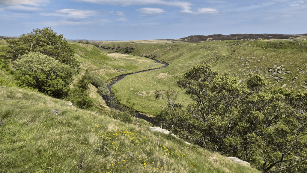
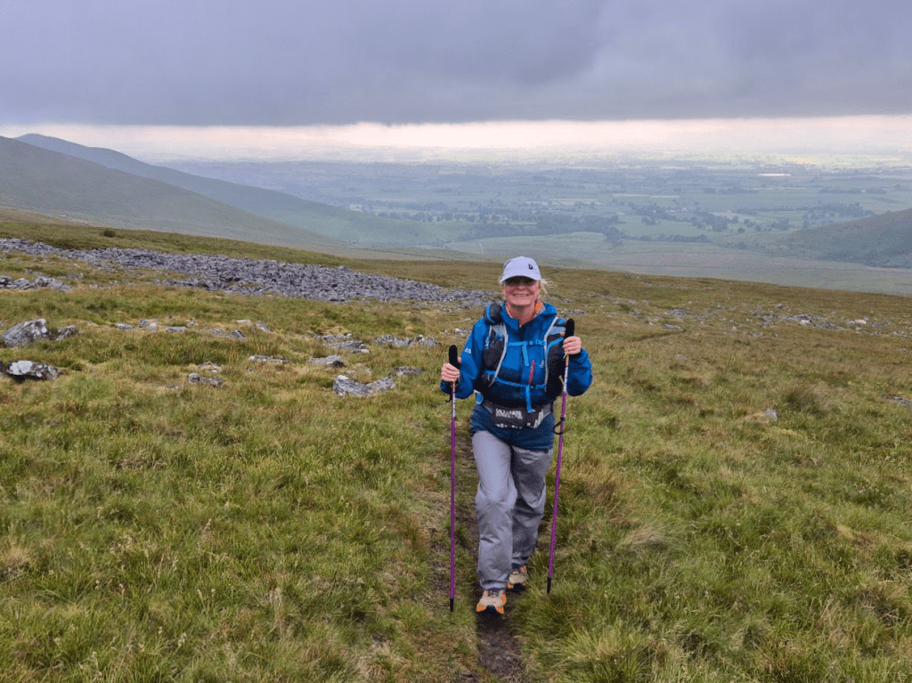
Obviously I’ve done the Pennine Way before but we had also recced quite a lot of the first couple of legs so we both knew what was coming. The first four and a half miles or so from Hardraw are all uphill as the route climbs to the highest point on the first leg, Great Shunner Fell. Obviously this early in the race the runners aren’t too spread out and my attempt to take a selfie at the top was rescued by another competitor (sorry, didn’t get you name or number) who kindly offered to take our picture. There were a few people taking photos and selfies and why not? It was a nice day and we’d just completed the biggest climb of the leg, all was good – only another 150 odd miles to go.

After all the climbing we were rewarded with a long downhill section to Thwaite and some great views on the way.

I caused a certain amount of consternation as we arrived in Thwaite, by running off in completely the wrong direction. There was a safety team and a very welcome pop-up cake and squash stop outside the café in the village. I had previously checked and found that the café was closed on Monday but the owners of the hotel attached to it had very kindly provided some refreshment for hungry, thirsty Spiners.
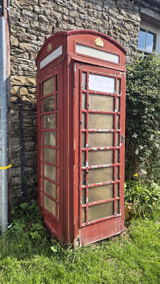
So why was I running off in the other direction? Those of you that know me might be able to guess… Usually when I’ve arrived in Thwaite it’s been with a 108 more miles in my legs and I’m just focussed on keeping going. This time I was just under 8 miles in and so had the energy to go round the corner to find the Thwaite telephone box. It wasn’t in the best condition but I added it to my ‘collection’ anyway.
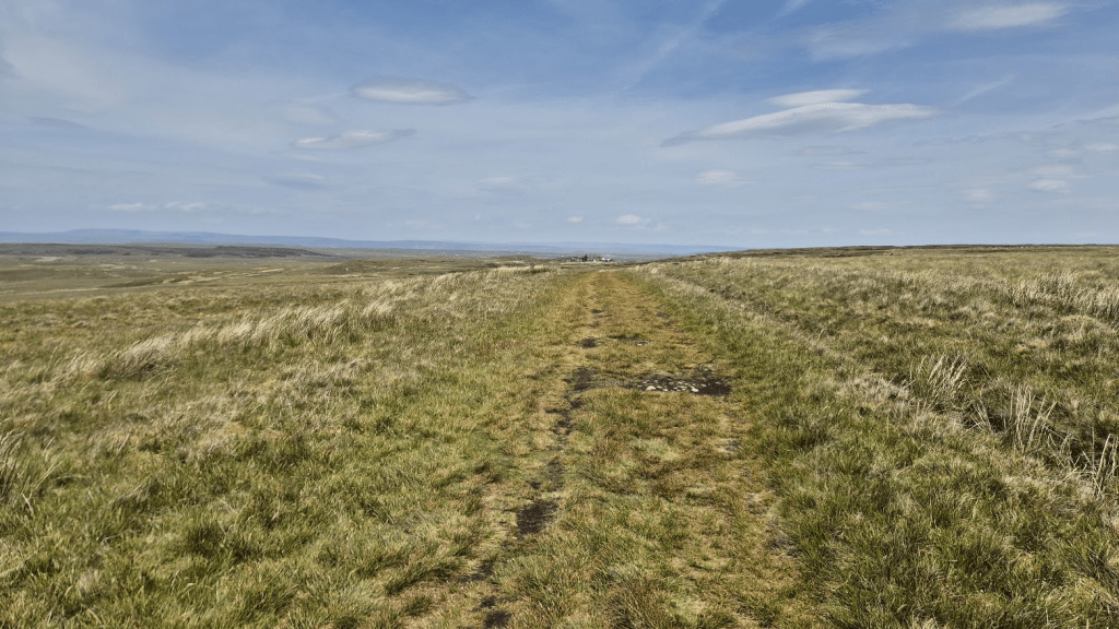
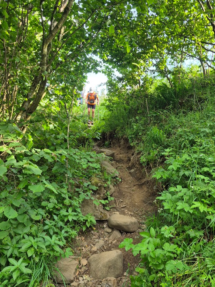
Upon leaving Thwaite there is a short, sharp climb to reach the path through the North Gang Scar. This path annoys me. As it goes through the scar, there are a lot of rocks to negotiate. It is by no means the worst part of the Pennine Way for that (we’ll reach that bit later) but it annoys me because there appears to be a perfectly good path along the river the Pennine Way could take instead – especially as just outside Keld we go back down to the river anyway. I appreciate my annoyance isn’t rational as the entire Pennine Way could be rerouted to avoid many annoying bits (Cam High Road?) but I have a relationship with the Pennine Way now, and, as in most relationships, I can put up with most of its annoying habits but there is always one that just grates. On the plus side, you do get some amazing views up there.

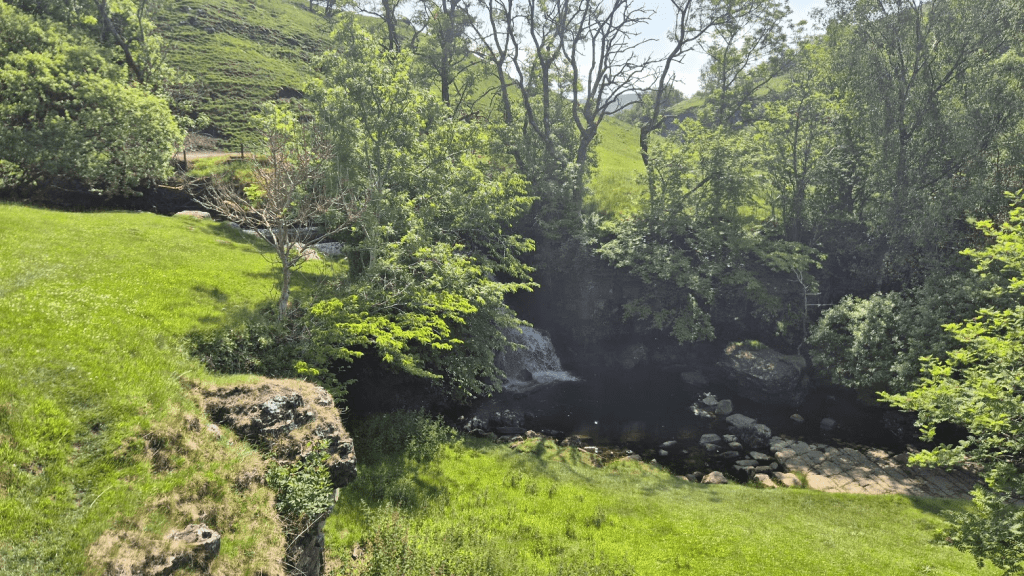
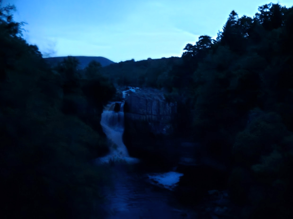
It’s also less than three miles, of which only two are annoying so I’ll try and chill out next time I’m there. Anyway we were soon passing East Gill Force, which meant we would be crossing Black Moor, Low Brown Hill (you can guess what that looks like) and Stonesdale Moor to arrive at the legendary Tan Hill Inn.
It does take longer to get to the pub from the first sighting than it seems it should. Whilst the path seems to be headed straight for the Inn, it takes a few twists and turns on the way.
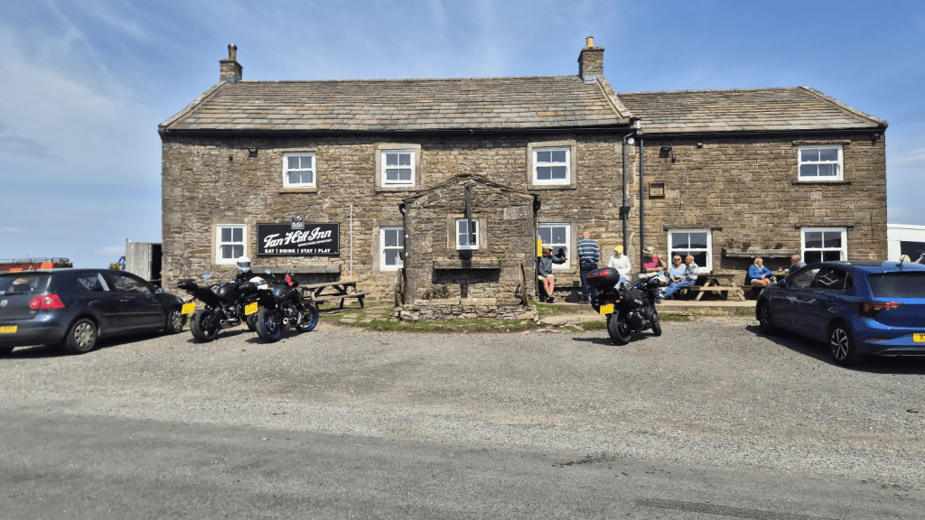
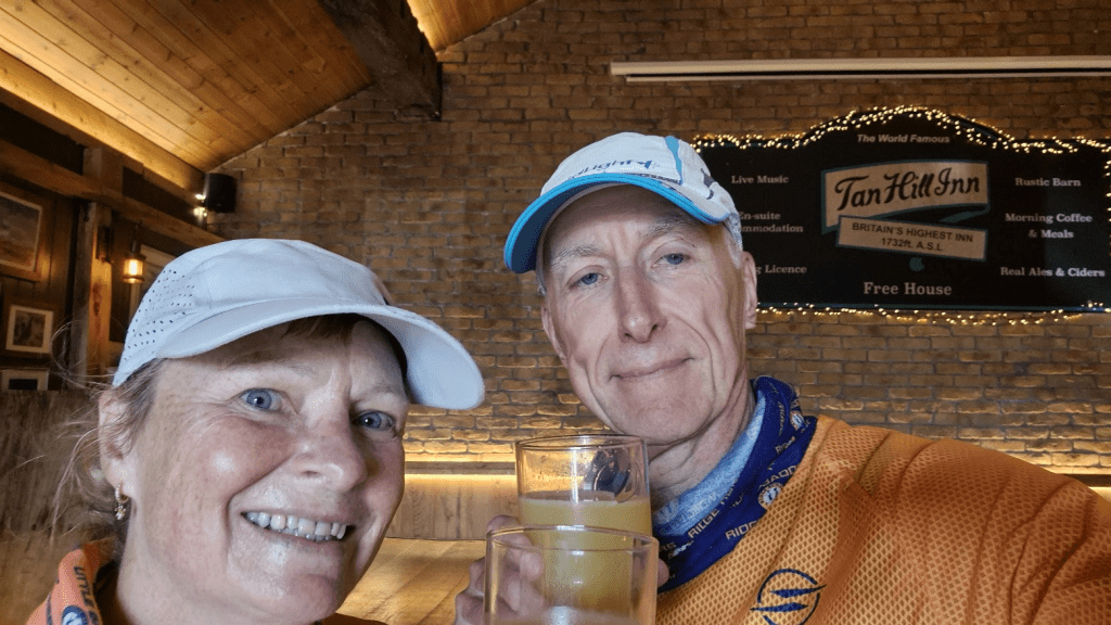
Our plan was to have a drink (non-alcoholic, as per race rules) and some chips, so we did. Slightly surprisingly we had caught up with Dan and Luke and ran with them for a couple of miles to the pub. However their plan didn’t have as long a pub stop as us so they left some time before we did. Sharon’s feet were already starting to blister and she changed into waterproof socks for the moors ahead.
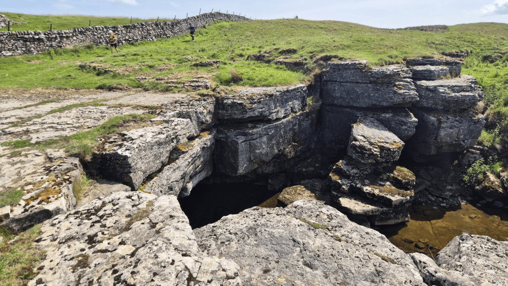
After we left the pub, Sleightholme Moor beckoned. This can be notoriously boggy but the bigger worry this time was the massive sinkhole that had opened up, which would apparently quite happily swallow any errant Spiner without trace.
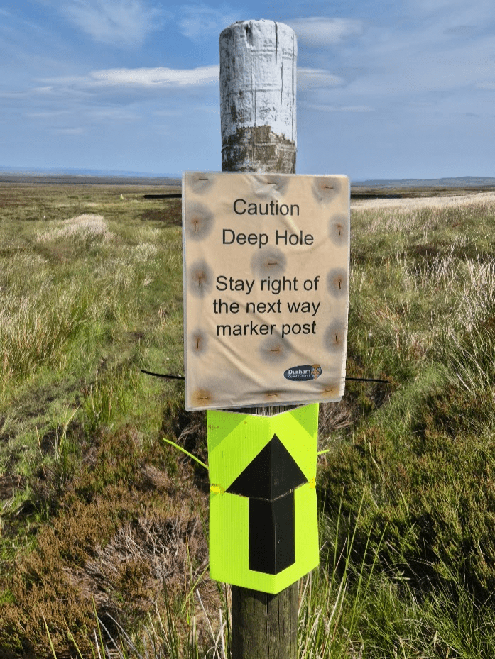
Fortunately the route to avoid being swallowed had been well marked and we passed the hole without incident.

It’s just under three miles across the moor before you join Sleightholme Road but, like so much of the Pennine Way, it seems longer.

A small climb and yet more moor took us to God’s Bridge – a naturally formed bridge over the River Greta.
After God’s Bridge the Pennine Way crosses the A66 through a stock tunnel and then… more moor.
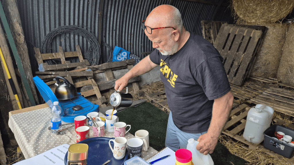
All the moor was worth it though when we got to Clove Lodge. I’d stopped in the barn there on the Winter Spine and been very grateful of it. This time it had outdone itself in terms of variety of stock (Coke, orange juice and Tunnocks Teacakes were our items of choice) and we got to meet the person responsible, the very lovely Angela.

After a bit more moor, we came to the reservoirs at Grassholme. I’d seen in the press there were drought warnings and the level of the reservoirs seemed to bear that out.

When I did the Winter Spine, there was a simply amazing couple stood at the B6276 road crossing at about 10 ‘o’ clock at night, in the freezing cold and probably snow, who had opened a gate so we didn’t have to climb a stile and were handing out some incredibly tasty flapjack.
As we approached the stile I remembered the couple fondly and noticed that this time we would have to climb it as the gate was closed. I wasn’t quite prepared for what we found the other side of the wall though. On our way across the fields we had seen a sign. I assumed it would be asking Spiners not to sleep in the nearby derelict barn but instead it was a sign for ‘The Nettlepot Café’, something I was entirely unfamiliar with but sounded possibly interesting – so interesting I almost immediately forgot about it. I was quickly reminded about it though when it turned out that the lovely couple from Winter 2024 had significantly upped their game and turned the hut by the side of the road into an entirely free pop-up stop for Spine racers!
We had a choice of tea, coffee, squash, I think there was fruit and biscuits on offer too but, for me, it just had to be the home-made flapjack again. I learnt that the couple were Neville and Gail (I hope that’s the right spelling) and that Gail had gone to get some more supplies including a new offering of home-made ginger cake. She was expected back soon. Strangely my cup of coffee lasted just long enough to see Gail return. I can confirm the ginger cake is as good as the flapjack!
I have since discovered that Nettlepot is a small collection of buildings about quarter of a mile South-West of the Pennine Way. There only appears to be around half a dozen building at most but on the OS map it is still split into East and West Nettlepot. We were assured there was only one more hill and we would be on our way down to Middleton-in-Teesdale.

Sure enough we climbed for about a mile and could see the town ahead of us.

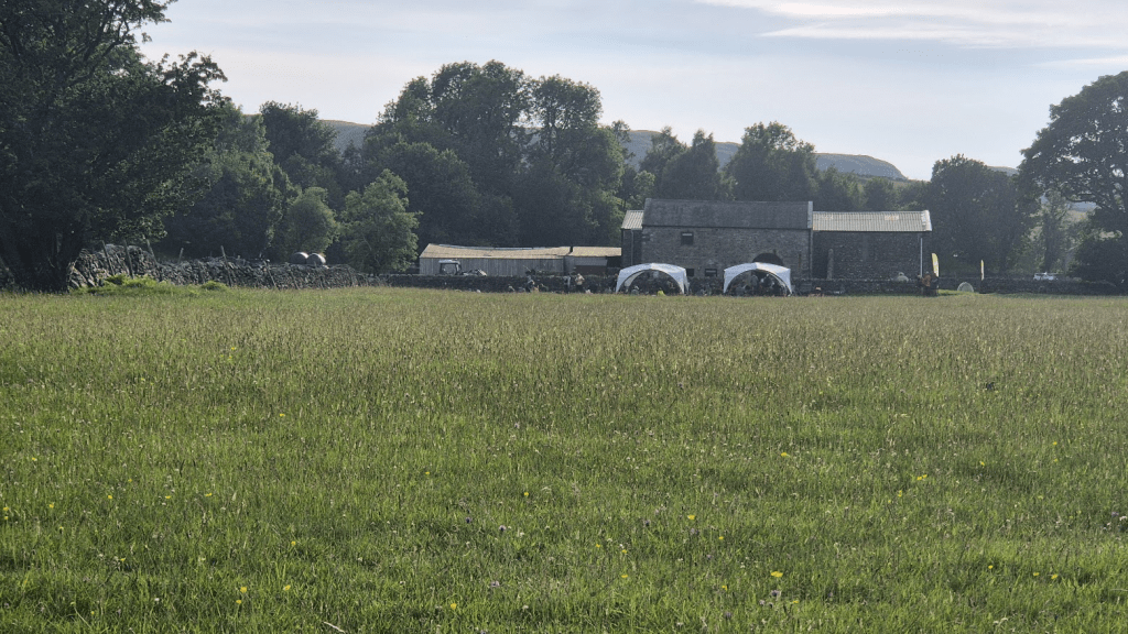
We had done the very last section along the river only a few weeks before on a recce so Sharon knew the path and soon our first checkpoint came into view.
It was still a bit of a trek once we could see the checkpoint as we had to go around the wildflower meadow rather than directly to the CP but we soon got there – Leg One done!
Tom and Luke were at the checkpoint and took our photo – we did our best to look as if we were enjoying ourselves.

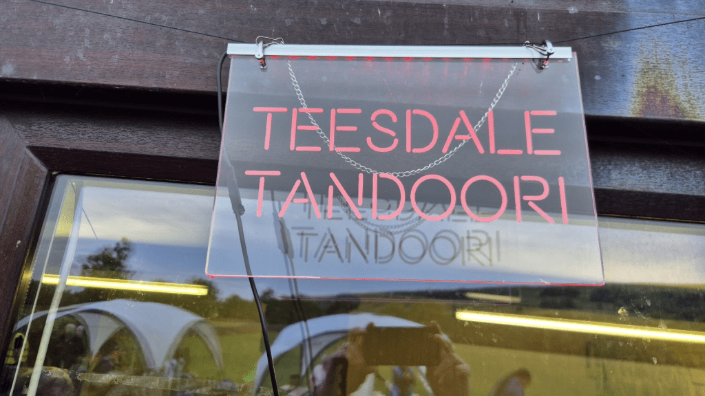
The checkpoint styles itself ‘The Teesdale Tandoori’ as the main dish on offer is korma, rice and naan bread. Apparently it is on Google Maps. I hadn’t learned anything from my Winter experience and ate the naan far too quickly and had to drink copious amounts of squash to ease it down.
Julian, a fellow Spiner I had randomly met when I was running to a dance competition in Colchester (not to compete), was volunteering at the checkpoint. All the volunteers are great but its especially good to see a familiar face. Sharon was struggling to eat and wasn’t feeling great. She had a number of blisters which had to be dealt with. We had the hydrogel squares that Dr. Ryan had used to such great effect on my feet on Uzbekistan so I was hoping we could patch her up and relieve some of her pain. I was in reasonably good shape and ate enough curry (and rice pudding, and biscuits) for both of us.
We stayed at the checkpoint for about three hours in total before setting out again. The sun had set and we would be trekking through the entire of Monday night. Sharon wasn’t feeling great and it was fairly dark so we agreed we would walk until it was either light or she felt OK, whichever came last. As I mentioned we’d recced Middleton to Dufton a few weeks previously so she had seen the highlights of the Tees section of the Pennine Way, which was just as well as I wasn’t expecting us to get to High Cup Nick before sunrise. When I first attempted the Spine in 2021 I took a photo of Stoodley Pike at night and was rewarded with a black subject on a black background. Phone cameras have improved massively since then and I was able to get a couple of pictures along the river despite the low light.

Whilst on the section by the Tees, we had been passed by, and then passed when she stopped to put waterproofs on, Jo, an Australian Spiner. We also picked up an American gentleman whose name I never got, as he dropped back from us at some point. We met him at a point where navigation is very easy in daylight as you can see the stile and the footpath sign, but much harder in the dark. He had gone slightly wrong and retraced his steps. I had to have a bit of a think but once I swung my torch round and saw a sign I remembered exactly what came next, a short descent, a bit rocky at the end, followed by a footpath diversion around a farm. This seemed to convince Jo and the American I knew where I was going as they declined my offer to go ahead where I knew the path was narrow, and followed me along the Tees. It had been quite windy on our recce and, once again, it was windy.
I did warn Jo about the boulders along the riverside and assured her that this was the National Trail, even if it was hard to believe that in places. However we negotiated the boulders and boardwalks and arrived at the foot of Cauldron Snout.
The scramble up Cauldron Snout isn’t hard but it is a little trickier in the dark as you have to be aware of where you are aiming for and not just climb randomly. I took us a bit too far to the right but we reached the top without any real drama.
I think there was a safety team and some other Spiners just past the top of Cauldron Snout, however my attention was completely distracted when Jo produced a bag of Australian Koala keyrings and began handing them out! I’ve done a few ultras now but that was a first – what a lovely gesture!
We started the trek up to High Cup Nick. It was becoming clear that we wouldn’t have a great view as the weather had become very misty as well as windy. We stopped at the wi-fi access point at Birkdale. I think the idea was to check for messages from Spine HQ but I think I just checked Facebook… The only other landmark that could be seen in the dark and the mist was the impressive bridge across Maize Beck. We crossed the bridge as shown on the GPX trail but the Pennine Way does also continue on the North side of the Beck. Apparently this longer route dates back to before the bridge was built as it wasn’t always possible to ford the Beck at this point.
The view from High Cup Nick was the grey blur I had sadly predicted. I felt a bit sorry for Jo, she’s come all the way from Australia only to have no views at all along one of the (in my opinion) best parts of the Pennine Way. As the day became brighter we all headed down to Dufton.
We arrived in Dufton a little after 6am – sadly far too early for the Post Box Pantry to be open. We stopped for the maximum time allowed of 30 minutes. We ate some of our food (two Peperami Pizza Buns for me) in order to fuel ourselves over Cross Fell. Unfortunately Sharon was feeling quite ill by now and didn’t exactly manage to hang on to what she ate. We left the bus shelter and set out to the biggest climb on the Pennine Way, up to Cross Fell.
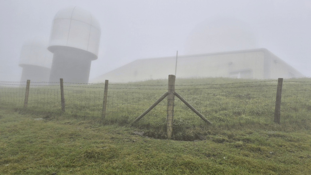
As we ascended the weather got worse. We had put our waterproof trousers on at Dufton and this seemed to have been the right call. Usually you get a view of the giant ‘golf ball’ on Great Dun Fell on the way up but not this time. I had seen signs warning of construction traffic on the road to the radar station but when I couldn’t see the ‘golf ball’ I assumed it must have been dismantled – hence the signs. I was so convinced I took a picture of the base of the structure. It was only much later when I was going through my photos I saw that the ball was just faintly visible but the rain and mist had completely obscured it from view to the naked eye!
The weather was the worst I’d ever had on Cross Fell. About four miles from Greg’s Hut Sharon turned to me a said ‘I think I’ve bitten off more than I can chew’ however we had no choice but to keep moving forward. Sometime later I looked at my watch and saw we were down to two miles from Greg’s Hut’. I told Sharon, ‘You’ve chewed two miles, just keep chewing and we’ll get there’.

Eventually we made it to Greg’s Hut and joined several other shell-shocked Spiners having a break after the horrors of Cross Fell.

Sharon said she was dropping out, apparently she had kept herself going by promising herself she would call it a day when she got to Greg’s Hut. I told her this wasn’t possible. ‘Why not?’ Well, if you phone Spine HQ and say you are dropping out, as soon as they know you are mobile and not alone, they will tell you to walk down to Garrigill to get picked up. Garrigill is only four fairly flat miles from the next checkpoint at Alston so you might as well get there. Besides, you’ve done the hard part, we are definitely not going back up onto the top and it’s a fairly easy, if somewhat boring, walk down to Garrigill. A couple of the other people in the hut backed up my assertion that the path wasn’t difficult and so we rested for a while and then started the walk down – which is actually slightly up for most of the first mile and a half, but then it really is downhill all the way.
There is another well-known Spine Angel in Garrigill called Annie, who opens her house to weary Spiners. I think every other time I’ve been through Garrigill it has been at an anti-social hour but this time we could have gone into Annie’s. However Sharon felt that if she stopped she might not want to start again so we passed on that opportunity and headed out of Garrigill.
The footbridge at Dryburn was still out of action so we would have to take the less nice route on the North East side of the river. Personally I will be surprised if the bridge is ever replaced. This is a shame as the North East path is not as nice as the original one, and has many challenging stiles on the way.
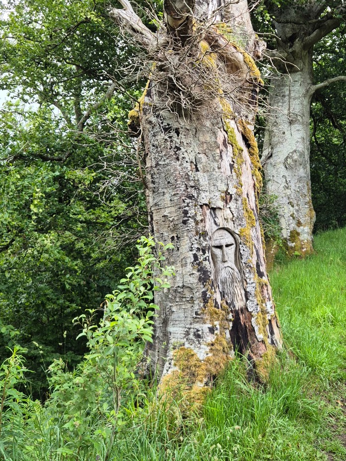
As we neared Alston we came across a carved tree. What was this about? Was there a secret Alston cult that worshipped Lindley Chambers?
In order to maximise our time at Alston, we took off our waterproofs before we arrived at the checkpoint. We had also decided that, although the usual routine was to eat first at a checkpoint, Sharon would sleep first. The rationale was that if she ate and it upset her stomach it might stop her sleeping. If she slept, ate and it upset her stomach at least she would have slept.
The medics had a look at Sharon’s feet and drew lines around two toes to indicate the extent of the infection in them. This concerned me quite a lot as when I had infected blisters there was some doubt as to whether I would be allowed to continue. Sharon had been pushed to her limit, she was sick, her blisters had blisters, some of which were infected, I wasn’t sure if this was where our Spine adventure would end…
