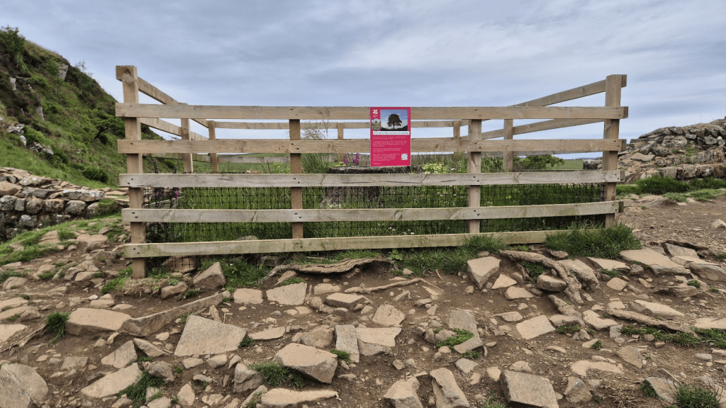
If you run, walk or stagger into a Spine checkpoint and say ‘Enough, I’m out’, the volunteers will politely not hear you and ask what you would like to eat and drink. They aren’t being rude, it’s just that the time you can spend in a checkpoint can change everything. When I DNFed in 2021, I expected my race to end at Alston. I didn’t want it to, I just couldn’t see how I was going to continue with my feet ripped to pieces with blisters. I was also fairly delirious and generally in a pretty poor state. I didn’t quite make it to the next checkpoint but I’m still amazed I managed to continue for another 35 miles to get beyond Hadrian’s Wall.
As I said in the first part of the blog, we had decided that sleep should be Sharon’s priority. Apparently a bed wasn’t immediately available so she took the opportunity to have a shower first and then lay down for a little less than two and a half hours. She thinks she probably got about two hours sleep. I had no idea as I was outside eating lasagne before going for a lie-down myself.
After her shower and sleep Sharon even managed some lasagne. The restorative powers of Alston lasagne are well documented so I was very happy to hear she’d been able to eat and keep it down. The medics rechecked her feet and were happy the infection wasn’t spreading. All blisters were retaped and our Spine journey could continue! Given the really quite concerning state Sharon had been in when we arrived in Alston, the transformation was remarkable. There was no more thoughts of dropping out, just of marching on to Bellingham and beyond to Kirk Yetholm.
Once again we would be going through the night. There would be an hour or two of daylight before it got dark, however the first part of this leg wasn’t the most interesting anyway and it would be light before we reached Hadrian’s Wall. It did mean I would have to concentrate on navigation though. It isn’t an inherently difficult section to navigate but it just requires a certain amount of awareness to avoid silly mistakes.
I remembered not to run into Harbut Law at the first A689 crossing. The Winter Spine GPX files had been slightly less detailed at this point and went diagonally through the aforesaid place (I think it’s mainly some holiday cottages). The new file made it clear the Pennine Way went along the road for a few metres before continuing cross-country but I remembered peering around there in the dark before anyway so I knew where I was going. I think there was a moments hesitation when we crossed back and went into a field further along the route but no real issue with navigation at this point.
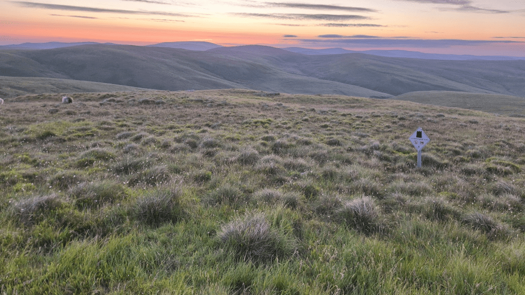
We passed through Slaggyford (still love that name) too late for any of the Angels that I’ve seen there in the past to be out but we did top up our water at Yew Tree Chapel.
The Burnstones viaduct can cause confusion as you go under it, turn left along the road, and then go under it again. This is to cross Thinhope Burn on the road and sort of makes sense on a map but when you are there you just have to trust the GPX and the signs.
Anyway the reason I’m going on about how great my navigation was is because we are fast approaching my biggest error of the race. Shortly after leaving the viaduct the path head towards a wall with a gap in in it with some gate type things on it. I chose not to go through the gap but follow a path along the wall – all the time thinking ‘I’m sure I should have gone through there’. After about 150 metres I was proved right when our path was blocked by a wire fence. Fortunately it contained no barbed wire so we were able to climb over it and get back onto the correct path but I do need to remember this for future excursions on the Pennine Way.
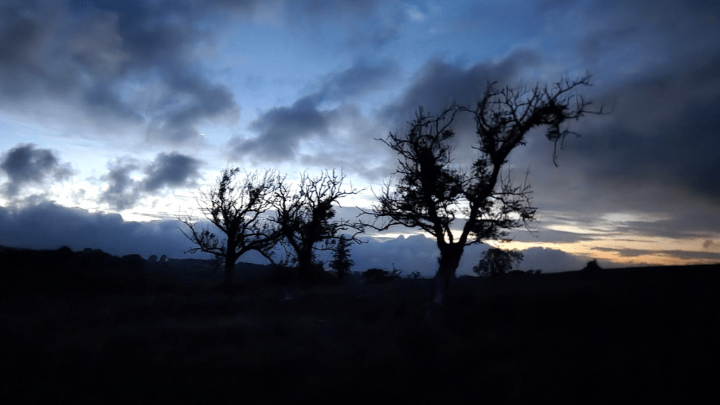
We were heading onto Hartleyburn Common (South side), soon to be followed by a short interlude before Hartleyburn Common (North side). These aren’t terribly exciting by day and by night there really was nothing to see. At this point we were sort of running with one of the Full Spine leaders, 152 – Dominic Gill (I think). I say ‘sort of’ because he was obviously much faster than us but he stopped for a couple of power naps so we overtook each other a couple of times. I followed him over the fence to the last part of Hartleyburn Common (South side) in the hope he might be able to find what I referred to as the ‘comedy footpath’. I call it that because there are three options from the fence crossing to the road – don’t bother, go straight to the road, do bother and follow the path to the road, come out a few metres up from the Pennine Way sign, or follow the GPX track through the heather to the Pennine Way sign whilst failing to find any sort of actual path at all. Sadly he had no more idea than I did and I think he followed the path to the road while I decided to just romp through the heather where the GPX file told me I should go. The section to Greenriggs was uneventful apart from a slightly atmospheric tree photo at two in the morning – oh, and Sharon kept finding frogs. Oh and there were some new steps at so we didn’t have to scramble up the bank at Foxhole Cleugh. Actually it was more eventful than I at first remembered.

At Greenriggs things became even more entertaining and I’m sure regular Spiners will know why – we passed through the garden of Rasta Man Ralph. I thought it was too late at night/early in the morning for him to be around but he came out for a chat and gave us some huge burgers. We did a short video with him which is on his Youtube channel. He did think we were third and fourth in the full Spine but unfortunately I had to tell him we were actually near the back of the Challenger North. The burgers were good, and I was very pleased that Sharon was able to eat at least some of it.

After Greenriggs it was finally on to Hartleyburn Common (North side) followed by the infamous Blenkinsopp Bog – sorry, Common. It was a bit boggy but nothing too bad. After that the path faffs around a bit before crossing the A69 and passing through the edge of the Haltwhistle Golf Club. There is a sign warning walkers to keep to the marked path – which, predictably, isn’t marked.
At Thirwell Castle we picked up the course of Hadrian’s Wall and after a short steep climb followed the road into the car park at Walltown, where we were met by a safety team.
As it was quarter past five in the morning the café was shut but the safety team had water and some biscuits.

Unfortunately the biscuits were too much for Sharon’s fragile digestive system but at least there were toilets.
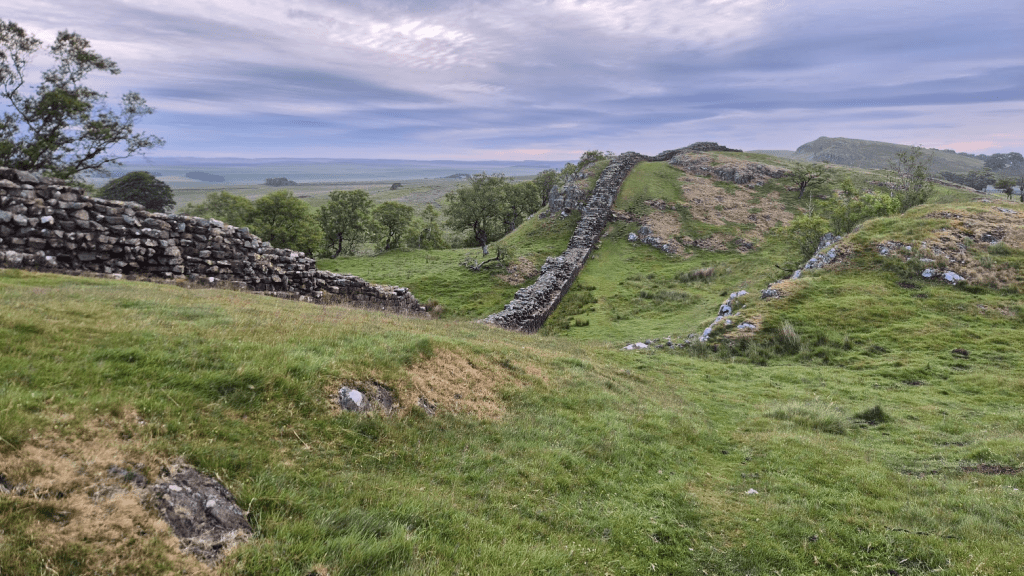
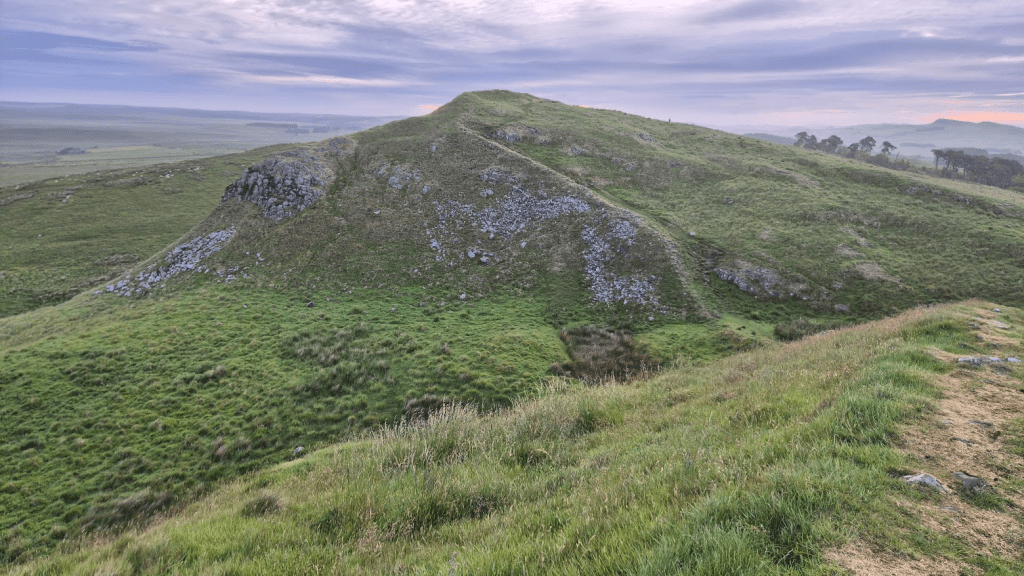
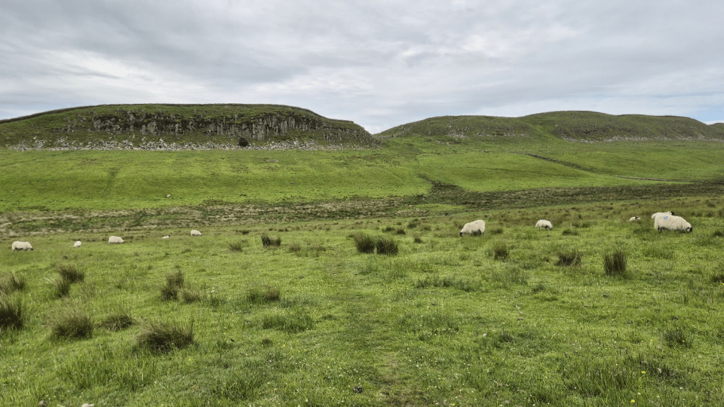
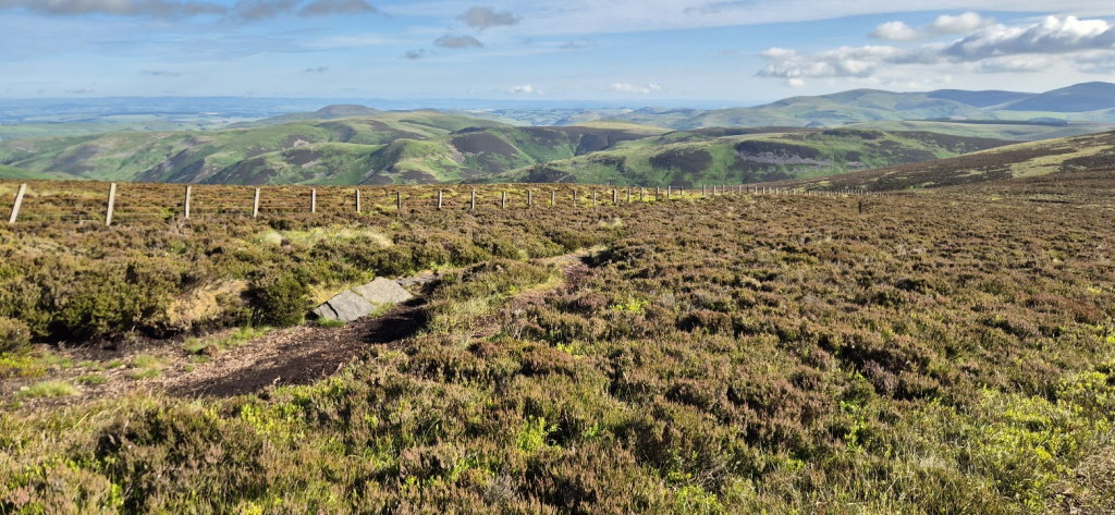
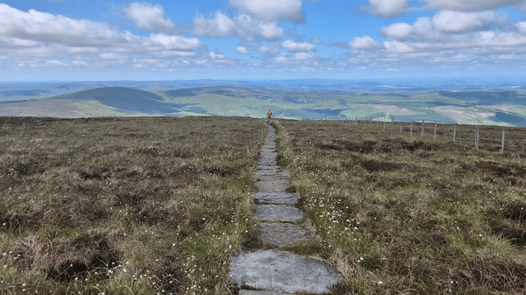
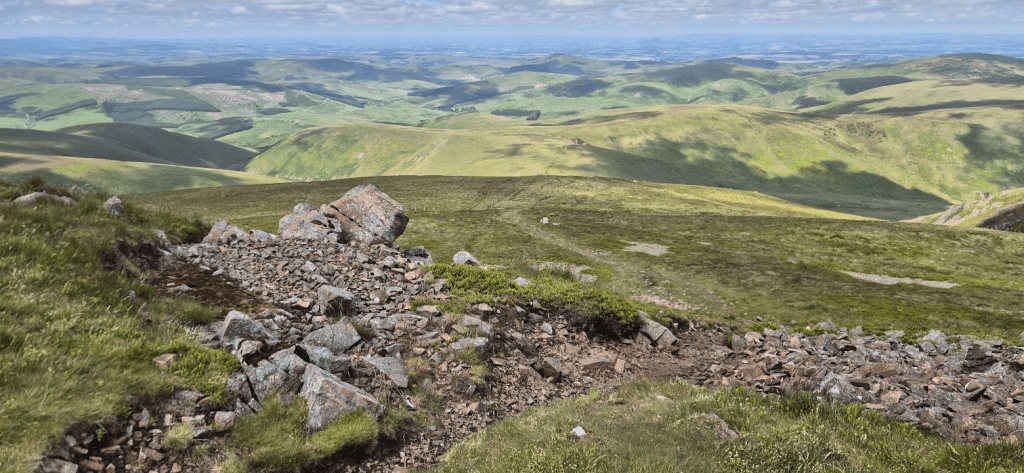
Now were were following the wall proper. Someone remarked that no-one really talks about Hadrian’s Wall on the Spine. Jacob’s Ladder, Cauldron Snout, Cross Fell, The Cheviots, some of us even have a lot to say about the Cam High Road, but not much is said about Hadrian’s Wall – although I guess Sycamore Gap has been mentioned a lot since September 2023. This is slightly surprising as it does represent a significant challenge. The Romans invented many things (as John Cleese was once told) but, if Hadrian’s Wall is anything to go by, the spirit level was not among them. The Pennine Way follows it for about eight miles of roller coaster like climbs and descents. I’ve written a lot so far so I’ll let some pictures do the talking for this bit.


There is a car park at Steel Riggs, which I had marked on my GPX track as there was usually a safety team to be found there. As it was early morning they were actually able to park on the road where the Pennine Way crossed it and gave us a very welcome cup of tea.


After we had passed Sycamore Gap we soon left Hadrian’s Wall and headed across Ridley Common (Bog) to Wark Forest.
I don’t like Wark Forest much. It’s a messy plantation that goes on for far too long. However it’s worth it for what follows, the unfailing hospitality of Helen at Horneystead Farm.

We had tea, sandwiches and cake. Sharon ate one and a half sandwiches with no real problem (predictably, I finished the odd half up). The cake was also delicious. We could have stayed all day but we did really have to get to Bellingham and also we were supposed to call in if we stopped for more than 30 minutes, so after 29 minutes and 59 seconds we left.
I did make another navigational error at Houxty Burn (on the OS Map) or Pundershaw Burn (on Open Streetmap). The main track crosses the burn via a ford but the Pennine Way bears left and crosses via a couple of bridges. I noticed we were slightly off track but we were nearly at the burn and following a decent track so I assumed we’d be OK. Fortunately we were, as the burn was very low and there were sufficient rocks to use as stepping stones across it. I think I may have got the wrong in Winter too, as a remember sliding across a frozen river somewhere around this area.
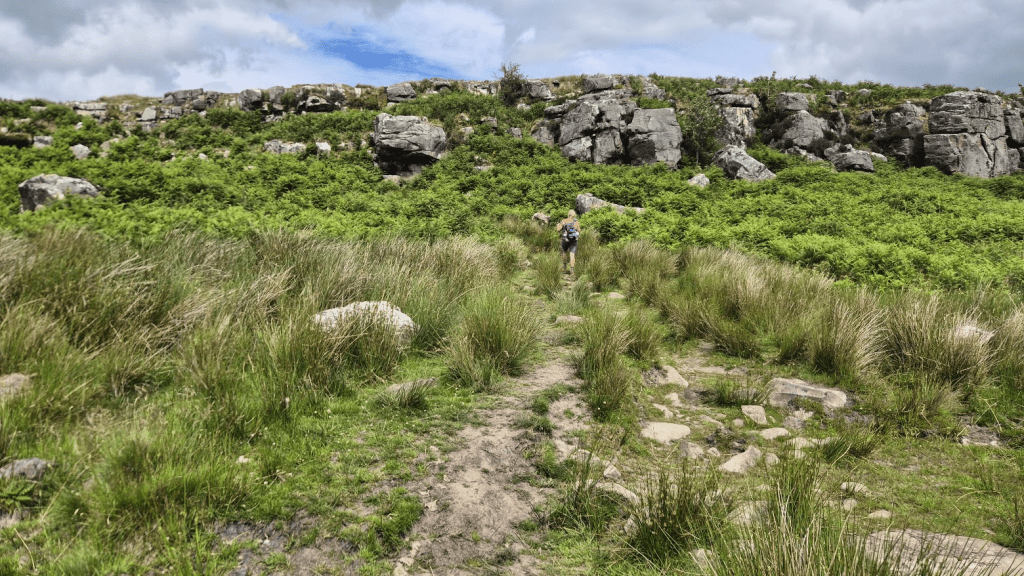
Shitlington Crags. Apart from the great name it was about here I realised my first spine dream had to die. They are a bit deceptive, if you look at the photo it looks like a boulder scramble up to the top but actually there is a very easy path that climbs gently to the left, which is fairly well hidden until you reach it.
After the crags its a bit more up to the relay tower.
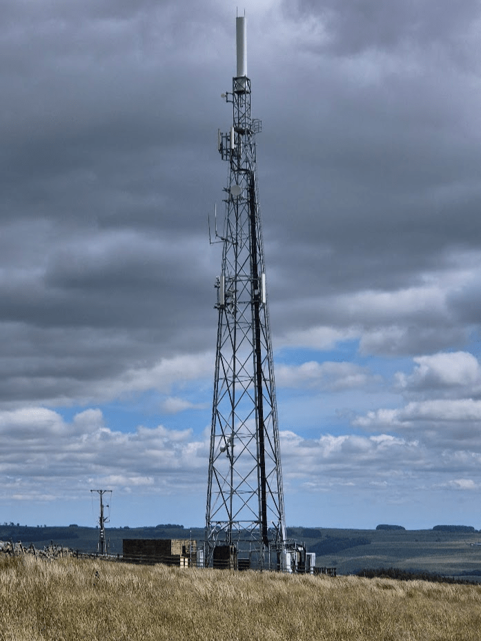
From the relay tower it was pretty much all downhill to the checkpoint. Flags started to appear to indicate where we should leave a small road – I suspect this was to ensure no-one simply ran down to the B6320 and followed the road to the checkpoint. I did almost try and turn into the Forestry Commission District Office instead of the campsite further down the road but the total lack of anything Spine related and the GPX track made me realise this would have been an error.

When I’d been to the Bellingham checkpoint before, sleeping had been indoors in a large hall. This time it was like the first checkpoint and consisted of tents. I did my normal thing of trying to eat my own bodyweight in food while Sharon found the sausage casserole much nicer than she expected. The tents were large and had big porches so we decided we could both fit into one. I think a lot of foot care and a very small amount of rest ensued. We forgot to tell the volunteers when we got up so I did find them in a slight panic, thinking we were still sleeping with less that 30 minutes of our allotted 6 hours remaining. I was able to reassure them that, not only were we up, we were ready for our kit check.
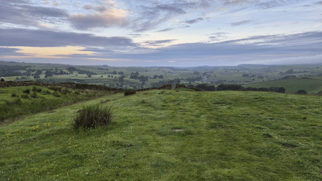
On both my previous Spine races that had got this far, I passed through Bellingham in the dark – at least that’s my excuse for never quite following the Pennine Way through the town. This time it was 8:30 in the evening, it would still have been dark if it had been winter but in June it was very definitely still daylight. I marked the occasion by carefully following the GPX route and passing through Bellingham on exactly the right path (I think). It also meant I was able to take a picture looking back towards Bellingham as we left the town.

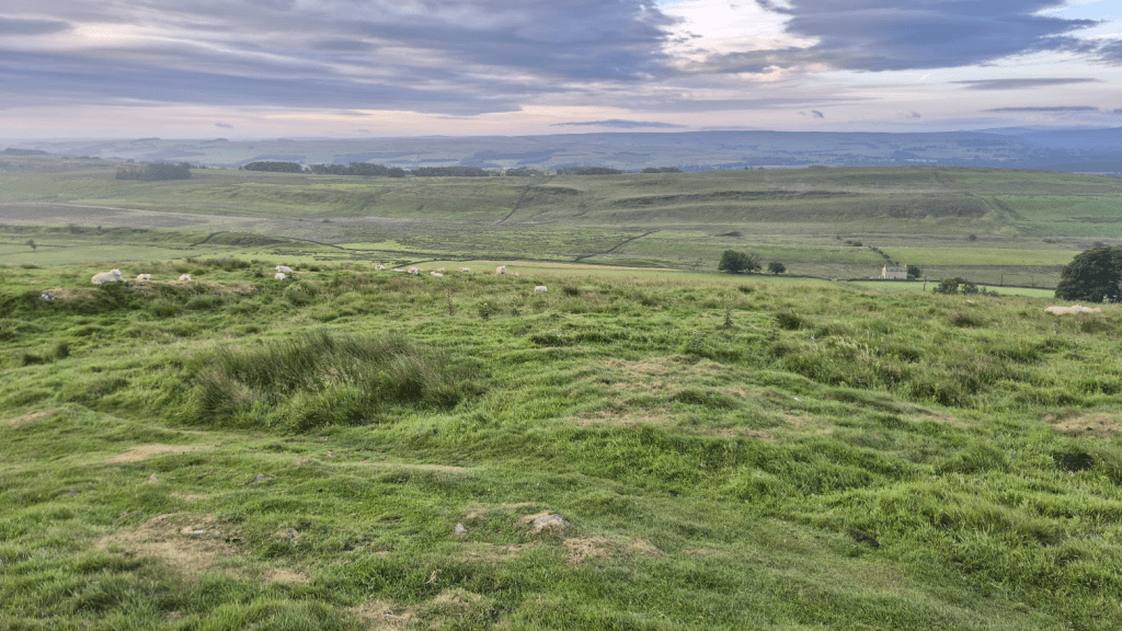
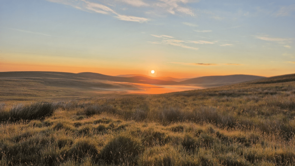
The next bit of the Pennine Way feels a bit like its just there to join some better bits up, it’s mainly farmland and heather. However this didn’t really matter as we would be doing quite a bit of it in the dark anyway. I did fail to capture sunset but did get a pretty sky.

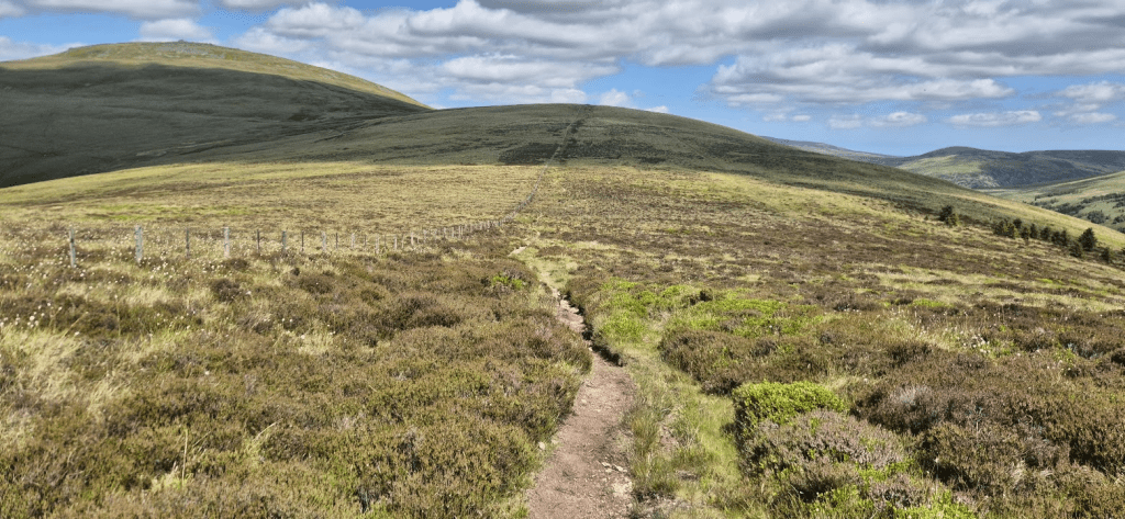
The path through quite a lot of this is just a narrow line through the heather. It wasn’t the easiest to see in the failing light but, if I say so myself, I absolutely nailed navigation through this stretch and we kept up a good pace. I had a chat with a safety team about the eternal question ‘is Summer or Winter harder?’ at a road crossing which broke up the tedium a bit. Eventually we reached the steep slippery uphill bit towards Brownrigg Head. After that the path improved, sometimes a lot, sometimes not so much until it became a fairly well made track and eventually the ‘grey road’ through the forest – either Kielder or Redesdale, or both, I’m not sure where one ends and the other starts.
We were making good time, we had run along quite a lot of the grey road as it wasn’t any less boring in the dark and it is at least a good surface to run over. We made such good time that when we got to Checkpoint 3.5 at Blakehope it appeared deserted. We had arrived half an hour ahead of our ETA, according to our trackers, and so, as it was 2am, John Bamber and his assistant (sorry, I didn’t get your name) had got their heads down for a short nap. We obviously didn’t arrive quietly as they soon appeared and made us tea and coffee, which was nice. What wasn’t so nice was the midges (I still have the bites over a week later) so we drank our tea through our head nets and set of to the church at Byrness.

The path from CP3.5 to the church follows the River Rede. It was a narrow path with high, wet vegetation. Although it is fairly straight, I always feel I’m walking in a circle and expect to emerge from it a 100m from where I went in.
The church was very busy with Spiners so we popped in to sort ourselves out ready for the Cheviots and then left after quite a short stay. I did joke with the safety team outside that the Spine occupancy of the church might be greater than the average Sunday congregation.
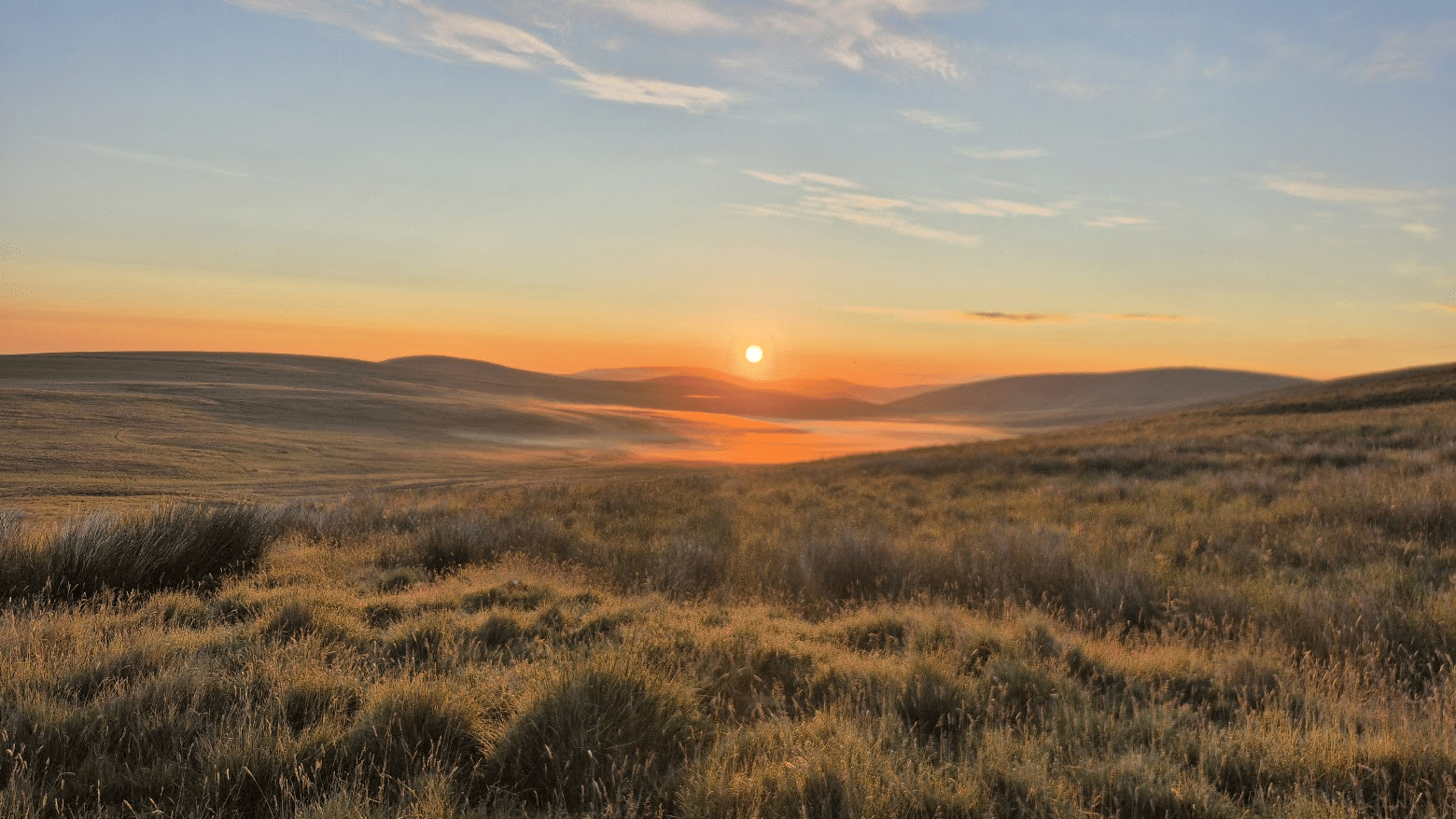
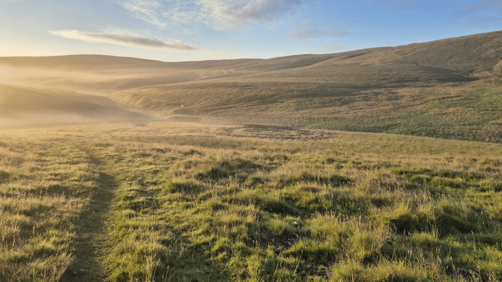
The climb up Byrness Hill is steep, can be slippery and does involve negotiating a few rocks but that was fine, it was getting light and we would be on the Cheviots for sunrise. And what a sunrise, and a cloud inversion over Chew Green. I took many photographs and for once I think it was justified, make your own mind up.


It was a truly magical 30 minutes. We forgot the horrors of Cross Fell, the pain, the fatigue and just enjoyed nature as we walked along. We only saw a couple of othe runners as we crossed the Cheviots so I don’t know if we were the only ones to experience the inversion but I know we did appreciate how lucky we had been to be there to see it. Of course it wasn’t quite so pleasant when we reached Chew Green and had to walk through a cold damp mist but hey ho.
We spent a very long time playing the ‘Is that Hut One?’ game. We were moving much more slowly than we would normally run an so were having problems adjusting to how long it took us to cover quite short distances. Finally we did arrive at the Hut.

The medic at Hut One felt that Sharon looked a little dehydrated and suggested she take one of the sachets of rehydration salts we had to carry as part of our mandatory kit. I asked for codeine as my feet, whilst not particularly blistered, felt absolutely battered and were painful to walk on. She kindly obliged and I let her have some of the charge from my power pack I was carrying for her phone so she could message HQ to record my prescription.
Sharon decided it had taken far too long to get to Hut One and, as it was nine miles to Hut Two, we should get a move on. As a result whilst we were travelling in single file along the trail, she was never very far behind me and I didn’t have to wait any time at all for her to catch up when I stopped. We did stop occasionally to take in the beauty of our surroundings. When I’ve been on the Cheviots before I’ve invariably been knackered and it has often been dark so it was great to have the energy and the light to appreciate where I was.
I always have it in my head that from Windy Gyle to the turn down Auchhope Ridge is a constant climb along a slabbed path, which it is – until it isn’t. The final climb to the ridge is steep and mostly lacking in slabs – I remembered this when I was looking up it, even though I’d only ever done it in the dark before. Anyway we got to the turn point and got our first view of Hut Two in the distance. I also always think its downhill all the way to the Hut – that isn’t strictly true either.
One piece of good news was that the rocky part of the path down was much shorter and easier than I’d been leading Sharon to believe, and also marked with flags. Again, I’d only done this in the dark and had probably not seen the route down and just blundered through.
I like Hut Two because it means you really are on the last leg of your Pennine journey. Equally I know that getting to Hut Two still doesn’t guarantee success but it was just before midday, apart from both having epically sore feet we were in quite good condition, and the weather was glorious, so I was confident. I also told everyone around that navigation of the Schil was a doddle as you just handrailed the fence. I even discussed it with the volunteers at the Hut. I don’t know if the followed our dots down but if they did they must have been amused when I took a random path that went off to the right. I’d successfully not gone down Red Cribs but hadn’t noticed a path split just after. My watch alerted me and, as it was only a bit of scrub between where I was and the path, I bashed my way through the undergrowth and got back to where I should have been in the first place.
Wishful thinking started taking over at this point. The fence lead up a small peak, so we didn’t go up the big peak on the left, right?
No, the fence unhelpfully turned left to give us this view…

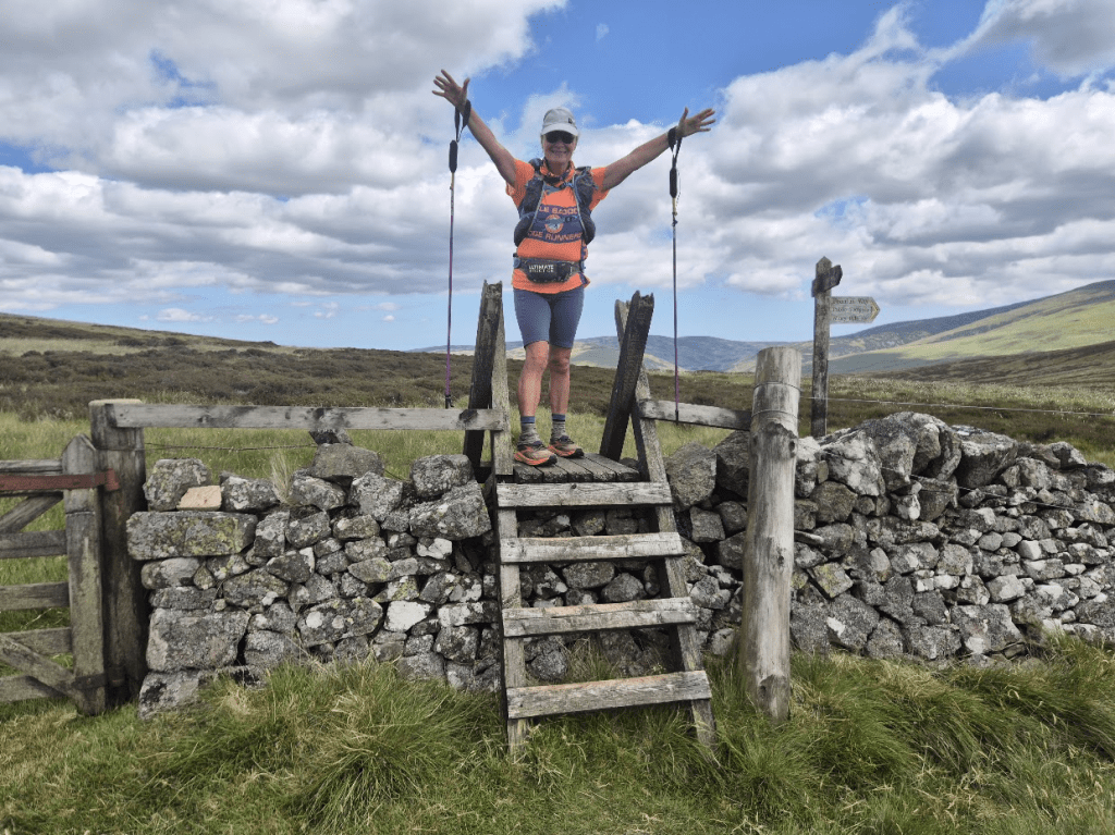
On top of the Schil I think the lack of sleep and the joy of almost being finished must have got to Sharon. spine Legend Gary Chapman organises a race called the Haworth Hobble in March, we had done it as part of our training for this event. There had been a bagpiper on the course and Sharon, as a true Scot and teacher of Highland Dance, had a little dance with him, which I videoed. Before the race Gary had commented that he wanted to see dancing on the Spine. This was the last real opportunity to do in on the course so, after 150+ miles with appallling blisters, Sharon obliged and I videoed. Sadly I don’t seem to be able to embed the video into my blog but here is a still I captured from it.

There is a particular Stile I always think of as the ‘Entrance to Scotland’. In practice I think the Pennine Way dips in and out of Scotland a few times but at this point you turn into Scotland and head away from the border. Sharon was excited to be there.
She also got very excited by the huge Tunnock’s sign, being a great lover of Tunnock’s products.

Once we were on the roads it was just a mental battle to keep going. As with so much of this race, it wasn’t far but it seemed to take so long. We ran as much as we could but our feet were on fire and so we had to walk quite a bit too – then of course there’s that hill right at the end…
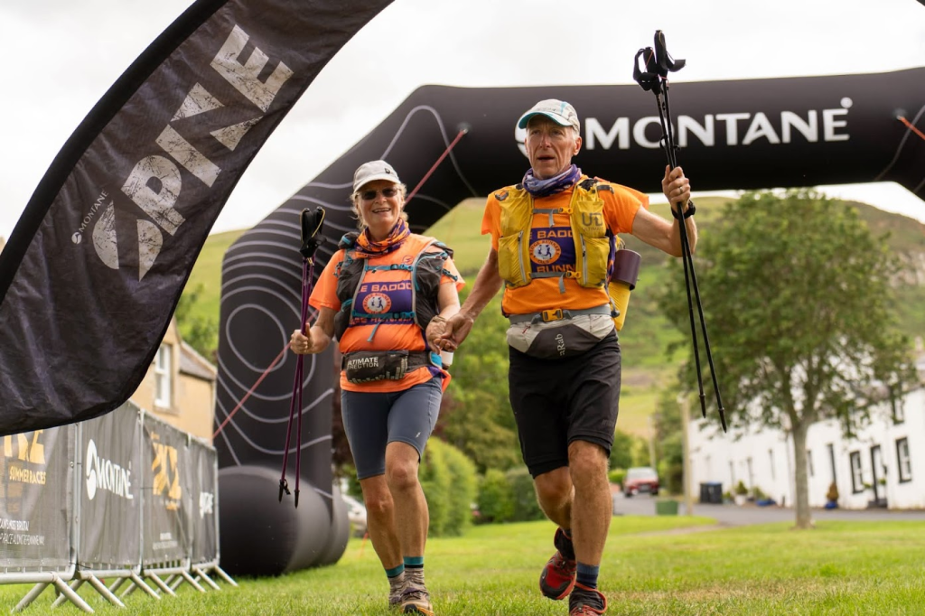
On Thursday the 19th of June at 15:02:09, Sharon finished the Spine Northern Challenger and completed the Pennine Way. Annoyingly I apparently finished 3 seconds later…
There are some that would say we hadn’t earned the right to kiss the Wall as we hadn’t done the full Spine. These people are entirely coincident with the group I don’t want to talk to.

I know this blog has gone on a bit, I had more time for photos and to take it all in than I have in the past, but there is a bit more I want to say – sorry, stop reading if you want.
The first and most important thing to say is how incredibly proud I am of Sharon. Yes there was a slight wobble on Cross Fell but nothing of any consequence. She battled stomach issues, infected blisters and massive sleep deprivation to not only complete the event but to do a surprisingly large amount of it with a smile on her face. How tough? Tough enough. She has now run the whole length of the Pennine Way and is in no rush to go back to it. We did discuss doing Northern Traverse together one day, but that was after much alcohol whilst recovering in Berwick.
As always there has to be a massive thank you to all the people that make the race happen, all the volunteers and the safety teams – and all the Spine Angels that gave us little treats along the way – Thank You to all of you.
I’d like to think it was because I wasn’t so much in my little bubble as I normally am but I suspect the reality is that it was Sharon that was being sociable, but I felt I talked to more people than usual, which was nice. If I did talk to you at any point, I probably won’t recognise you next time I see you but thank you for making our journey better anyway.
So would I recommend the spine Challenger North? Yes, in fact I would say this is the perfect Spine Race for most people. It will test you to the limit, with three checkpoints you get a very real Spine experience, you take on some of the hardest sections of the Pennine Way, but it is just about possible to complete it without going into the places in your soul that you would rather leave unvisited. Dancing on the Schil is optional.
I already have my place in the Winter spine next year and on Monday I will probably sign up for the Summer edition too. I’ve been on the start line of a Spine race every year since 2021, and completed them all since 2022. Will I complete the double in 2026? Watch this space…
