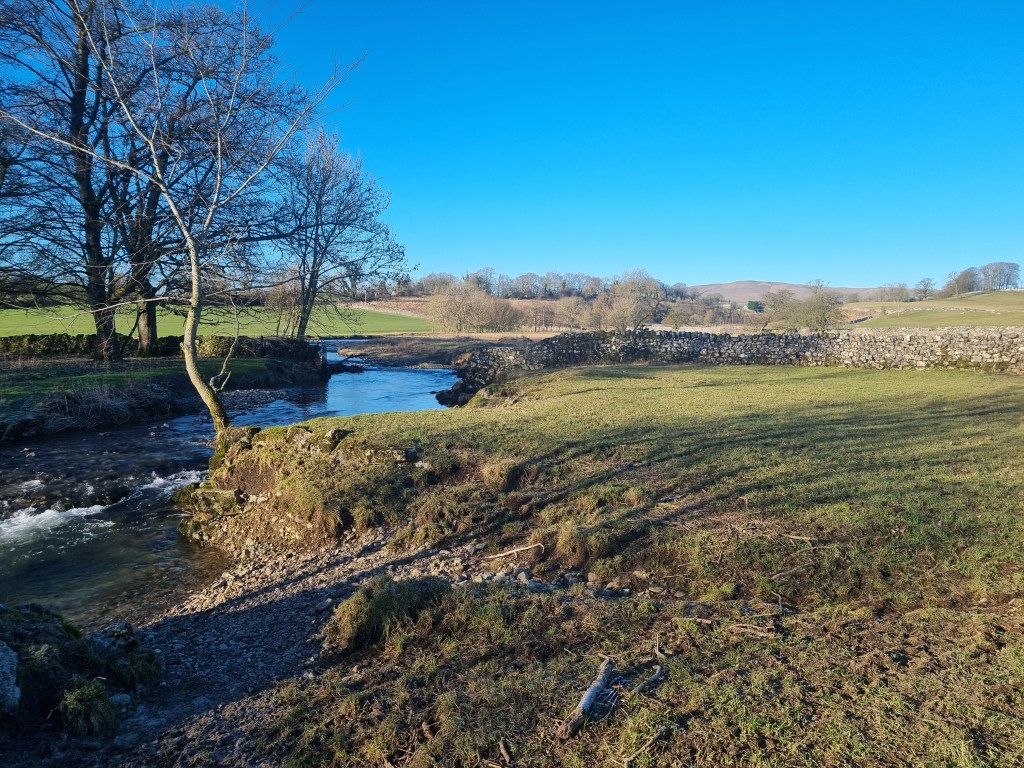
Sometimes I find myself running a very long way away from the Pennine Way. Not at all Spine related but as I was privileged enough to find myself running the first ever ultra race to be staged in Uzbekistan I thought it was worth a few words…however I don’t really do a few words so we are starting with an introduction to Uzbekistan…
When global Limits announced a race in Uzbekistan, it raised a lot of questions. The first one being, where is Uzbekistan? Central Asia, it was part of the Soviet Union until independence in 1991. It is also one of only two double-landlocked countries in the world (i.e. you have to pass through at least two other countries to reach the sea in any direction). For future pub quizzes, the other is Lichtenstein. Uzbekistan has a population of 36 million, of whom 96% are Muslim.
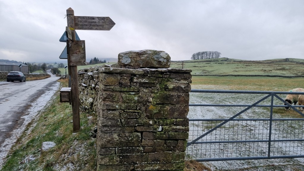
Location of Uzbekistan
In 327 BC, Macedonian ruler Alexander the Great conquered the Persian Empire provinces of Sogdiana and Bactria, which contained the territories of modern Uzbekistan. He built (well, had built, it’s unlikely he did all the work himself) the Fortress of Nur, located in Nurota, Uzbekistan, around 2300 years ago. The fortress was built to defend the settled lands from nomadic invaders to the north. This would be the finish line of the race.
Samarkand (our first destination in Uzbekistan) was on the Silk Road, a network of Asian trade routes active from the second century BCE until the mid-15th century, and grew rich from trade.
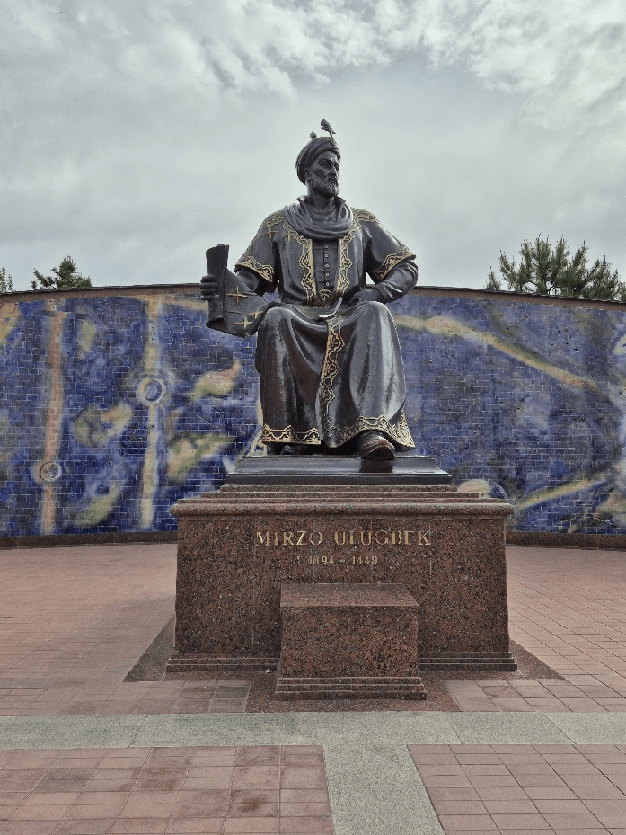
Timur, also known as Tamerlane ), was a Turco-Mongol conqueror who founded the Timurid Empire in the 14th Century. Its capital was Samarkand, which became a centre of science under the rule of Ulugh Beg, giving birth to the Timurid Renaissance.
As it says – Amir Temur
The first question everyone asked when I said I was going to Uzbekistan was, is it safe? There is a slight tendency to assume that any country that ends in -stan is a bit dodgy. We were assured it was by Global Limits, and as they had actually been there to plan the race, we took their word for it. How do we get there? Fly with Turkish airlines via Istanbul. Actually, getting there wasn’t too much of a problem, getting back was more challenging due to several flight cancellations and changes. There were other issues with leaving the country too but more on those much later. So anyway, we signed up. Then Sharon noticed one of the days was 40 miles and possibly wished she hadn’t. This race was slightly different to other Global Limits adventures in that there were about 100 people signed up for it, compared to the 50 or so the races usually had. This was due to the speed people were signing up, 100 places were booked in 100 hours!
As is usual with these kinds of adventures, I signed up first and then had a look to see what it was I’d actually signed up for. I knew the headlines, 230km over six days, but what about elevation, and how was the distance divided across the six days? It looked like it would be a race of two halves. The first three days were to be spent in the mountains, with some serious elevation gain on the first day, followed by two days that were predominantly downhill. The fourth day was the previously mentioned 40-mile stage, which would see us leave the mountains and move onto the hot and dusty plains of Uzbekistan. Day five looked similar but a bit shorter, and the last day was the traditional ‘short’ (~11 miles) leg to the finish – the previously mentioned fortress of Alexander the Great at Nur.
Getting to Uzbekistan was fairly straightforward, we flew from Gatwick and changed at Istanbul. We met Marilena – a multi-day legend from Venezuela – at Istanbul. For any future travellers do NOT simply ask for a glass of wine at the airport – unless you think the equivalent of £75 for three glasses of wine and a bottle of water is reasonable!
Immigration and customs went without a hitch, and we were met by Stefan, the race director, outside the airport and put on a coach to transfer to the hotel. Due to the time shift and flight times, we had kind of missed a night and arrived at the hotel at about 8:30am, too early to check in but in plenty of time for our 9 ‘o’ clock city tour. We met various people we knew and that were on the tour with us, having lost a night’s sleep at this point I find it hard to remember who was on the tour with us. One I definitely remember was Hannisze. She is the partner of Argy, a super-talented Greek runner I notionally raced against at the Way of Legends, and a brilliant photographer, so I knew we would have some great race photos.
I won’t go into details of the city tour, just to say it was really worth doing and Uzbekistan has some stunning architecture, I’ll let the pictures do the talking. Whilst the Mosques, Madrassas and Mausoleums were very impressive, possibly the most significant site for me, as an engineer was the observatory of Ulugh Beg, built in 1428.
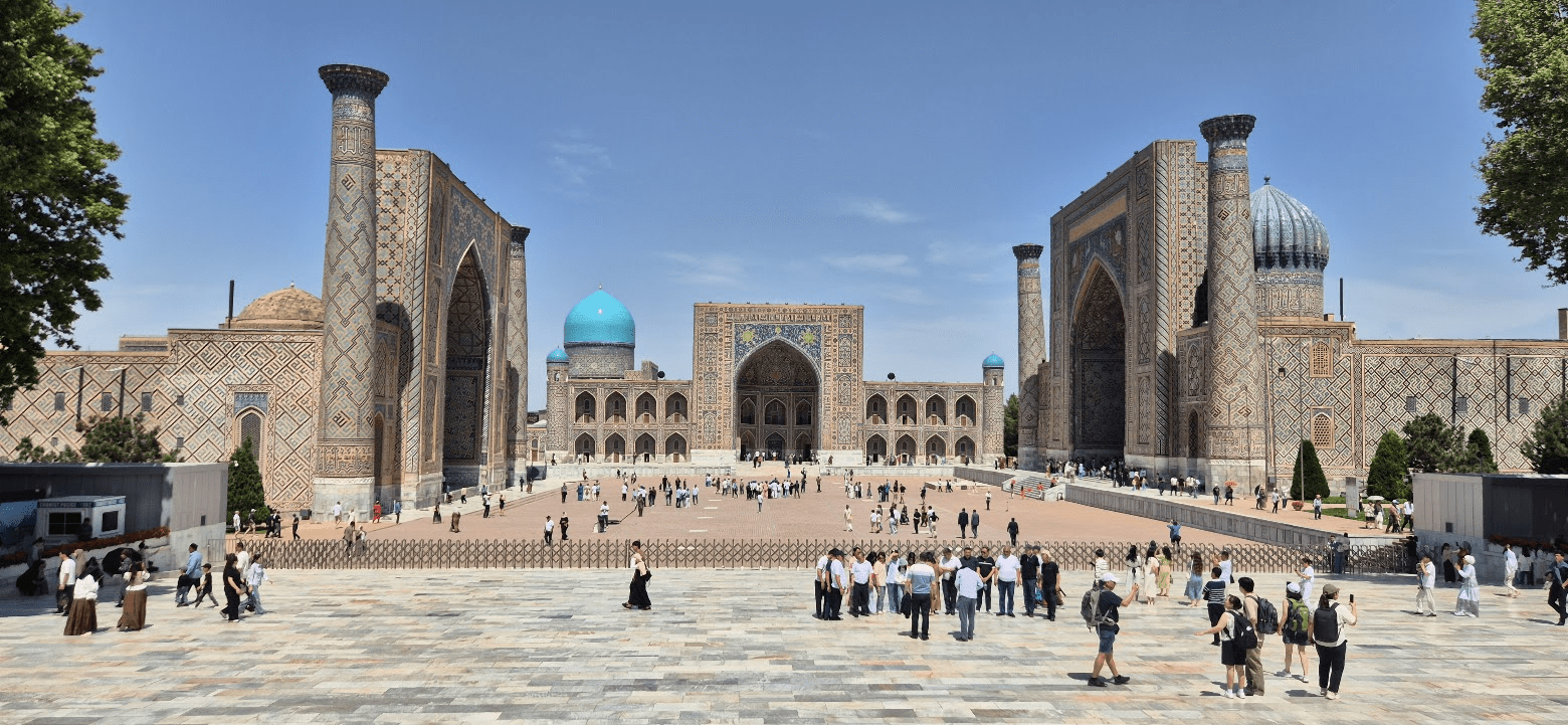
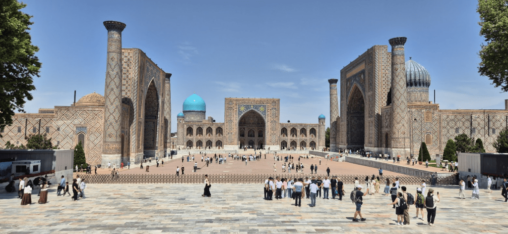
Registan Square
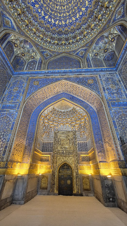
One of the ornate ceilings in a Mosque
Hard to photograph but the interiors are very ornate
Ulugh Beg Madrassa
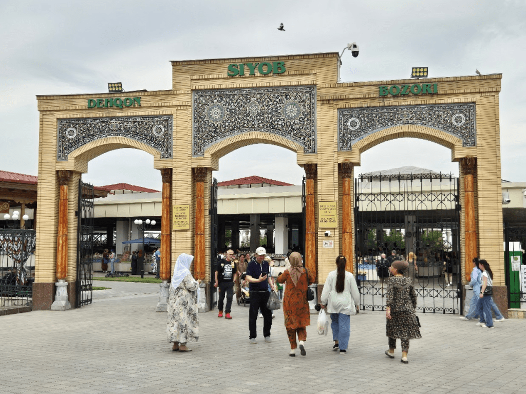
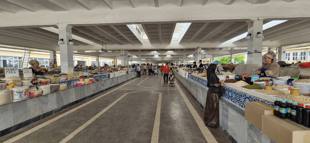
The entrance to the Bazaar
Inside the Bazaar
Water powered Paper Factory
Ulugh Beg
The remains of the Sextant
Lacking telescopes to work with, he built a huge sextant, the so-called Fakhri sextant. It had a radius of about 36 meters and the optical separability of 180″ (seconds of arc). The Fakhri sextant was the largest instrument at the observatory. There were many other astronomical instruments located at the observatory, but the Fakhri sextant is the most well-known instrument there. The purpose of the Fakhri sextant was to measure the transit altitudes of the stars. This was a measurement of the maximum altitude above the horizon of the stars. Unfortunately only the lower portion remains. The observatory was the most pervasive and well-known observatory throughout the Islamic world. With the instruments located in the observatory in Samarkand, Ulugh Beg composed a star catalogue consisting of 1018 stars. In 1437, Ulugh Beg determined the length of the sidereal year as 365.2570370 days or 365days 6hours 10minutes 8seconds (an error of +58 seconds).
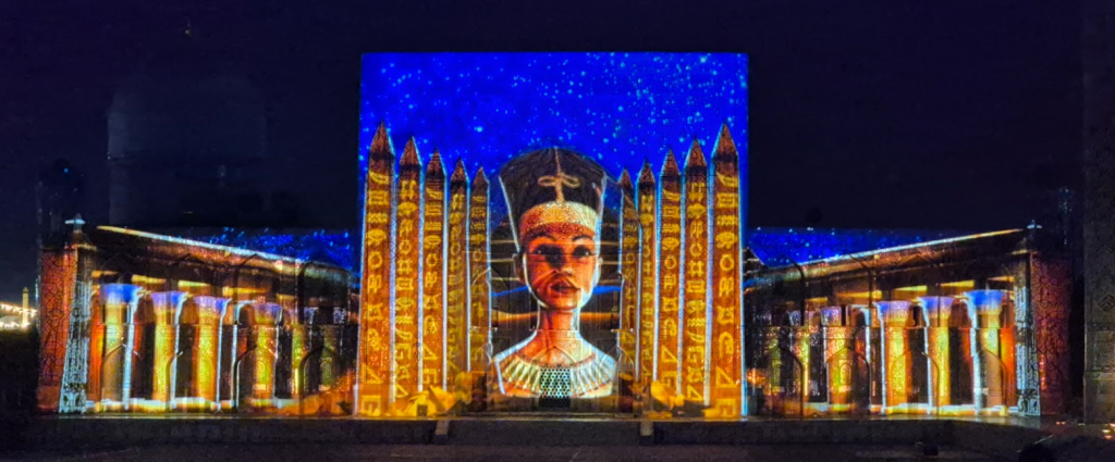
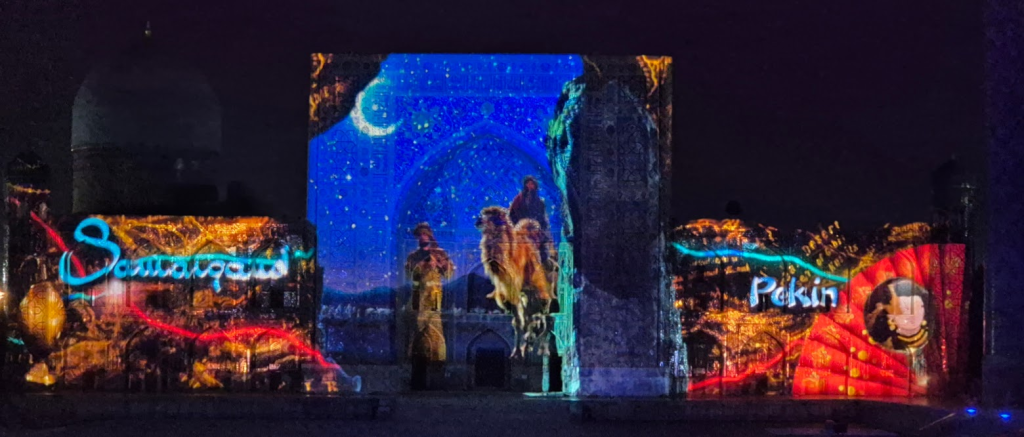
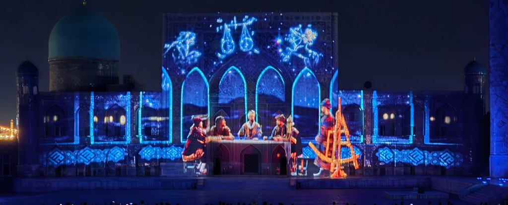
Later it had to offer ridiculously cheap food, and a stunning light show projected on the Mosque and Madrassas of Registan, which probably explained the history of Samarkand – the commentary was in Uzbek, so I wasn’t sure, I just recognised some of the pictures from the city tour. Anyway, we got to bed not to late considering we’d been up for nearly 36 hours.
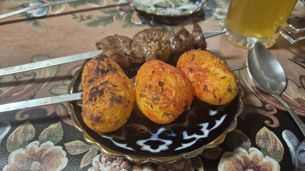
Kebabs!
A lot of kebabs!
The start of the light show
Not sure who this is
The Silk Road (probably)
Ulugh Beg (?)
Finally, we get to some race related stuff, almost, we did fail to visit a vineyard and drink a bottle of Uzbek wine, with some cheese, courtesy of a very nice man called Chocolate (not quite, but nearly) who had trained as a chef in London and hence loved English (and Scottish) people.
I hadn’t even started running and I already appeared to be lost..
I would have liked to have spent a lot longer here
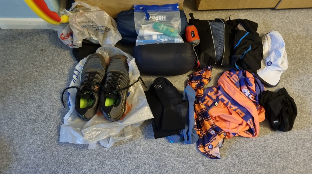
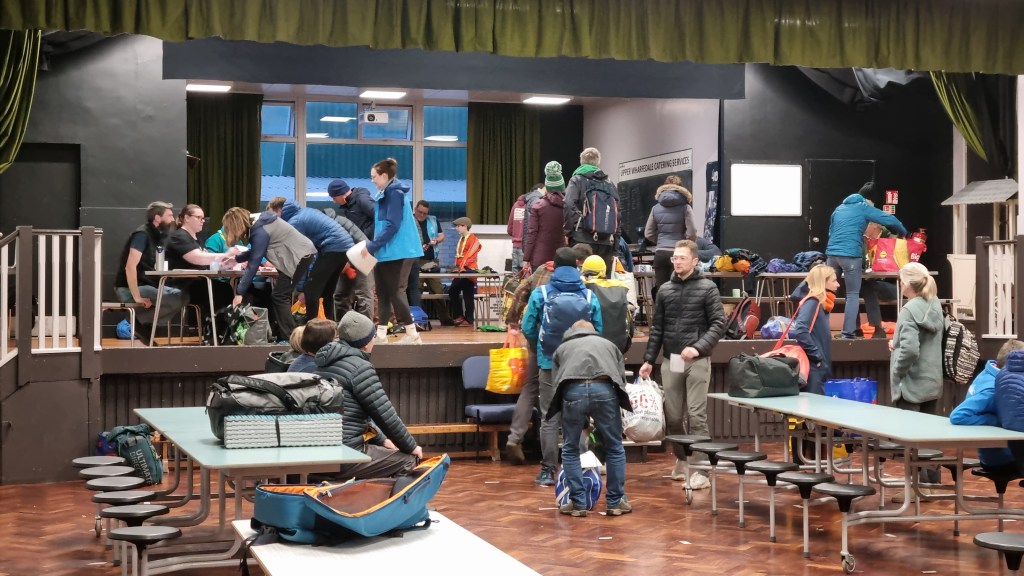
After that we had race check-in and kit check. We’ve gone through Spine Race kit check (several times) so no other kit check holds any fear. The kit list was fairly minimal and mostly sensible (although I’m not sure what use the compass would be, given we didn’t have a map) so there wasn’t much to trip up on. Geert did my kit check, a volunteer I knew from previous races. I think he knew that, contrary to appearances, I knew what I was doing and so kit check went very smoothly. My camp bag weighed in at 10kg so that was OK. My only slight issue was it was VERY tightly packed but I expected this to become less of a problem as the race went on and I ate the food, which filled at least half the bag. Sharon had sensibly opted for a slightly larger camp bag and had no such problems. We were slightly worried about the medical forms though. In the UK it has become very difficult to get a medical form signed to declare you fit to race without spending several hundred pounds. We had seen our doctors, had all the relevant jabs, and been counselled about the hazards of the country. However to get the form signed we had had to resort to an online medical service. Fortunately by the time we got to see the Doctors it appeared a few other Brits had been through and so they were aware of the difficulties of getting things signed and accepted our online declarations without comment. This just left us to pick up our bibs, caps and other goodies and then to do the most painful part of the whole process, pay for our trip and extra hotel night. Actually this wasn’t too bad considering, but not a cheap as the previous night’s dinner.
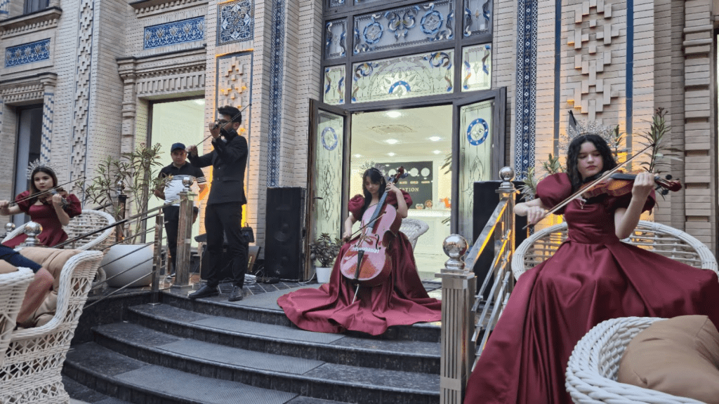
Tonight’s dinner was the welcome event for the race. It started with a drink on the hotel rooftop bar – which we eventually found, followed by an open air buffet complete with a string quartet.
Very sophisiticated
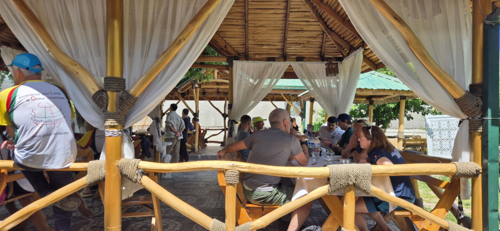
Sunday morning we had breakfast, checked out, left our bag of stuff we wouldn’t need on the race in the right pile, and boarded the coach for the three hour transfer to the first camp. The journey was fairly uneventful apart from an unscheduled toilet stop with free toilets (almost all toilets in Samarkand coat 3000 Soms to use – but as this was only about 18p it wasn’t a big deal). At midday we stopped for lunch, which was nice and invested 3000 Soms to make the remaining part of the coach journey more pleasant.
Lunch
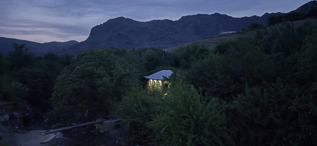
The first camp was in guest houses in the Sentob Valley, our group had taken over three of them. The last few kilometres of the journey were unsuitable for our coaches and so Stefan had arranged for a fleet of ten mini-buses to transport us. This seemed to have got lost in translation as there were only six or seven but after some shouting and organisation we were crammed into a very small vehicle and taken to our accommodation – the ‘New Building’. It certainly smelt very new although it looked much like the other buildings in style. There appeared to be some cosmetic work required to totally finish it off but everything worked and was functionally complete. From pictures I had looked at online, all the guest houses in the area appeared to have very similar rooms with four single beds in them, two on each side of the door. We were sharing with Mark and Frances, an English couple we had the very cheap dinner with on the first night so that was all good.
Our guest house at dusk
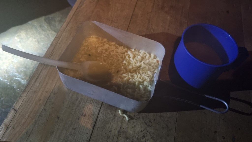
Stefan very generously provided Plov, a traditional Uzbek dish of rice, meat and vegetables. This was much better than the freeze dried meal we had planned – although it did mean my camp bag didn’t get any smaller that night.
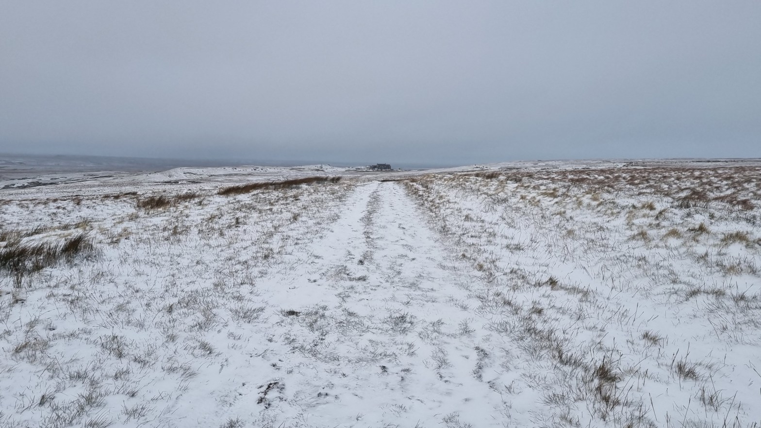
First proper look at Uzbek mountains
The first race briefing took place that evening. The highlight was Stefan assuring us there were no dogs in Uzbekistan – just as something that looked very much like a dog emerged from the undergrowth behind him. We were also told that the first stage was the hardest, as it included a significant amount of ‘up’.
Some of the team that would be looking after us
For the first time in Global Limits history, there were to be age group prizes. Presumably this was possible due to the larger than usual number of runners. With prizes for the top three overall plus the first three in each of three age groups, for male and female, the usual field of 40 to 50 would end up with as many people with prizes as without. I was slightly interested as this possibly gave me something to aim for. I’d looked through the entry list and there appeared to be too many young people in the race for me to realistically hope for a top three finish, indeed I wasn’t totally sure that top ten was possible. Even in my age group I knew that Peter Osterwalder at least had the potential to beat me, plus of course there could be some fast 60+ men I wasn’t aware of. From previous races I expected Peter to beat me on the first day as he is extremely good at ‘up’. However he had had knee surgery about a year ago and it apparently didn’t affect him going up but he had to be more careful on the ‘down’.
Anyway the time for speculation was over – tomorrow we would start running!
As those that have followed my Pennine journey from the start will know, I initially entered the Spine Race without any research or real knowledge of the race, started it in the same state and ended with a DNF and a desire to return with the knowledge I gained (plus a bit more) and complete the event. This I managed and in the process I became totally obsessed with the Spine Race. As Sharon had supported me so completely and unquestioningly I persuaded her to run the 2023 Summer Sprint with me so she could see what it was like to run a Spine race. She didn’t totally hate it and was somehow persuaded to take the next step up and run the 2024 Spine Summer Challenger South and this is where this story starts…
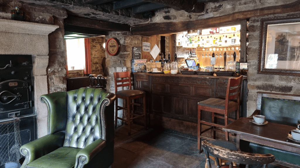
Well, sort of, this is me so nothing is every that simple if it can be a lot more complicated and long winded. We actually started at the finish of the Challenger South, in the Green Dragon pub in Hardraw, a lovely old pub with some fabulous rooms almost on the Challenger South finish line.
The bar at the Green Dragon – apparently used for the current series of ‘All Creatures Great and Small’
The plan was simple(ish). Spend Thursday night at the Green Dragon, leave the car there and take the train to Edale, do kit check and registration, get to Castleton, spend Friday night there, back to Edale on Saturday for the race and run back to the car – what could possibly go wrong?
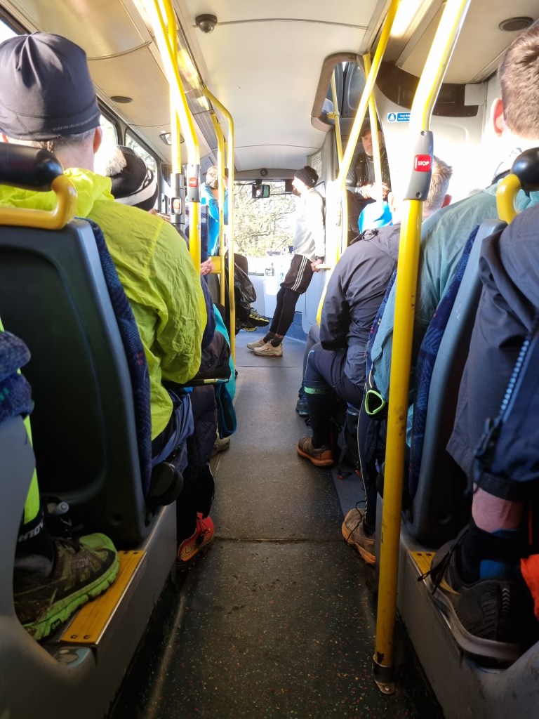
The first challenge was getting from Hardraw to Garsdale railway station – except that was easy. There is a wonderful community run ‘Little White Bus’ service which connected Hardraw to Garsdale in time for the (fairly infrequent) trains. I was slightly worried about the capacity of the bus in case any more Spiners were doing a similar thing but but Tasha was the only other Spine racer on the bus, along with a few locals.
The Little White Bus Stop – also almost the end point of the Challenger South
The journey was Garsdale to Leeds, Leeds to Sheffield, Sheffield to Edale. Trains from Sheffield to Edale run once an hour so there was a choice of train from Leeds to Sheffield. By taking a faster, later, train to Sheffield we had over an hour on Leeds station to improvise lunch from the various food outlets.
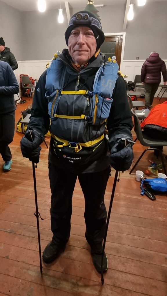
We were met at the station by a volunteer to make sure we didn’t get lost on our way to kit check. This was at the Village Hall for the Summer events, rather than the Peak Centre where I was kit checked in January.
Last year Sharon was chosen for a full kit check, this year as we both had the same items checked – I can’t quite remember what they were but we passed without any problem and got the all important stamp.
My kit was checked and it was pronounced satisfactory – I was given the mark of Lindley
The Mark of Lindley (and some ID) was enough to get us issued with numbers.
Still not smiling – Sharon does it for both of us
Sharon talked nicely to John, one of the shuttle drivers, and secured us a lift to Castleton. All that was left was to attend the briefing. This was organised particularly well as it was a ‘rolling brief’ – instead of waiting for the start you could join at any point and leave after it got back to where you came in.
We got our lift to Castleton but was warned there was no shuttle service in the morning. Living in a city, we take taxis for granted, however in rural Derbyshire… We eventually managed to secure a taxi for the following morning. it was a little on the expensive side as it was coming from Buxton but after all the hard work thus far we weren’t going to be listed as DNF because we couldn’t get to the start! (As I understand it we would have been a DNF (Did Not Finish) rather than DNS (Did Not Start) as we had registered). We sorted our kit, ate our last meal in the hotel restaurant and went to bed.
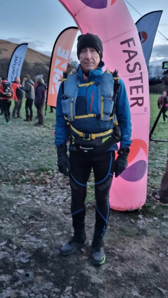
Although our taxi was expensive at least it was on time so we arrived at Edale in plenty of time for tracker fitting and last minute toilet visits. Gary and Gill from our running club came to see us off – their son, Dan, was doing the full Spine the next day so they were in the area. I was hoping Dan would do well, mainly for Gary and Gill, but also because I had given him much ‘advice’ and so I was hoping it would be helpful.
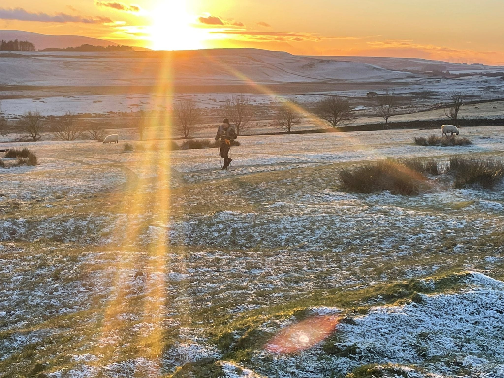
Last minute pep talk from Kevin McCann – ‘Be bothered!’
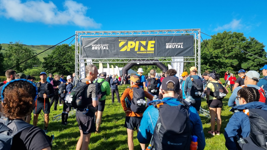
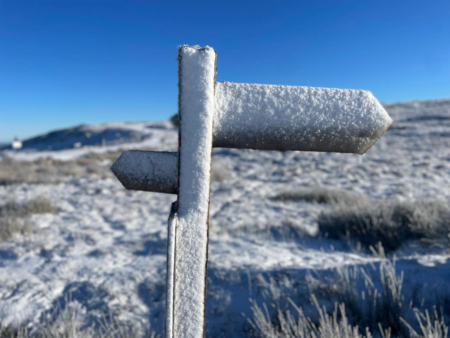
The weather was lovely on the start line but no-one was fooled – the forecast was for quite a lot of rain over the next few days. Kevin McCann (Deputy Race Director) told us as much before he set us off. He also told us to ‘be bothered’, a great piece of advice. What he meant was that we should sort problems out as soon as we notice them. If you’ve got a ‘hot spot’, be bothered and treat it before it becomes a blister. If you are cold, ‘be bothered’ and get an extra layer on before it becomes hypothermia. you get the idea. Anyway at exactly 8am we were sent on our way out onto Edale’s Mary’s Lane to join the Pennine Way.
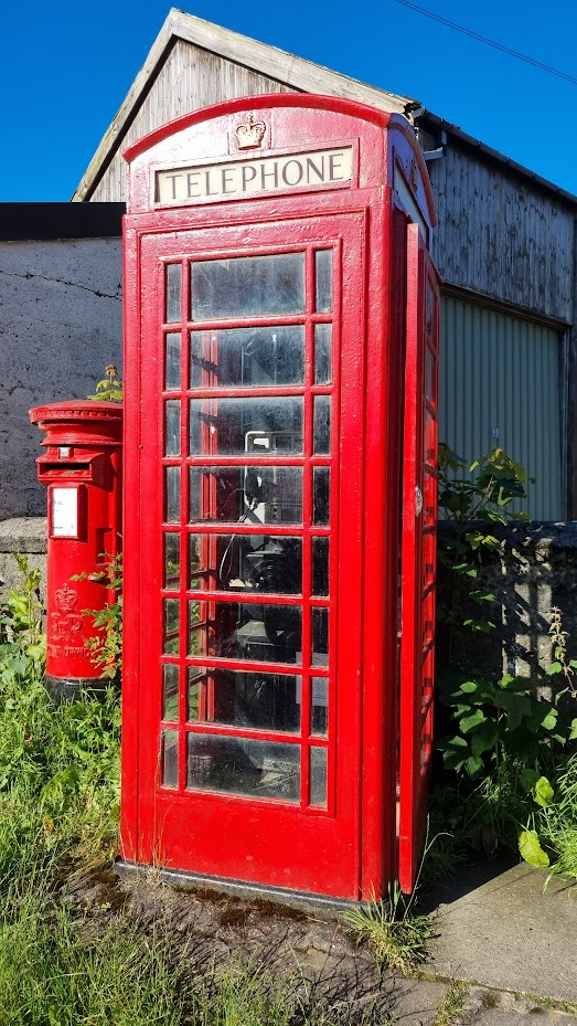
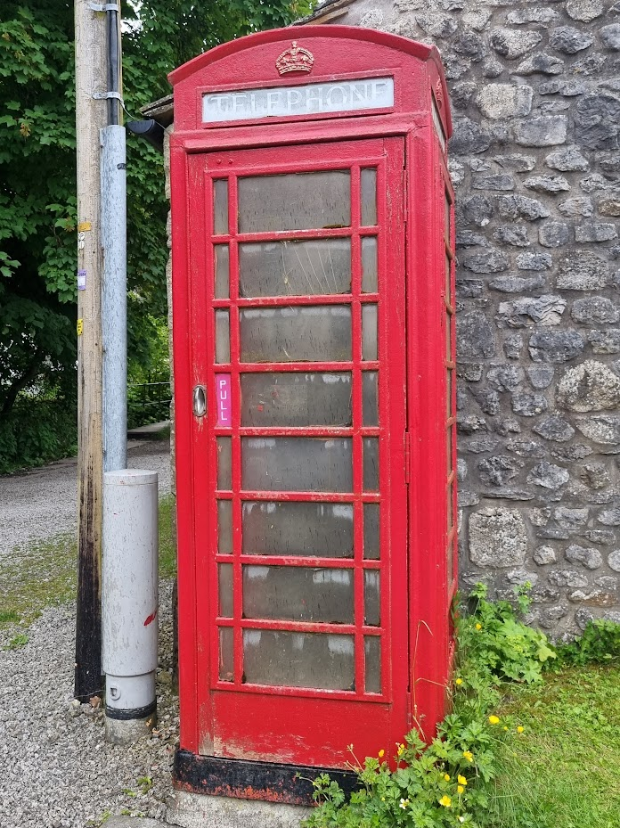
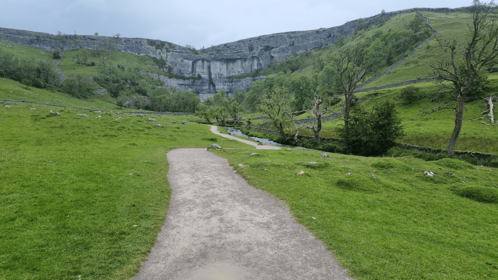
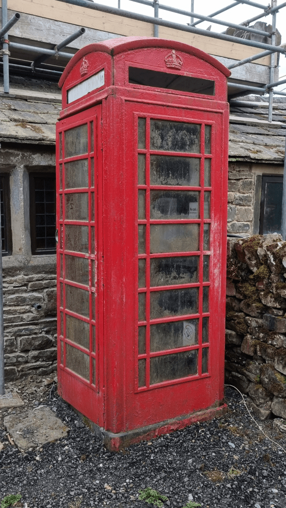
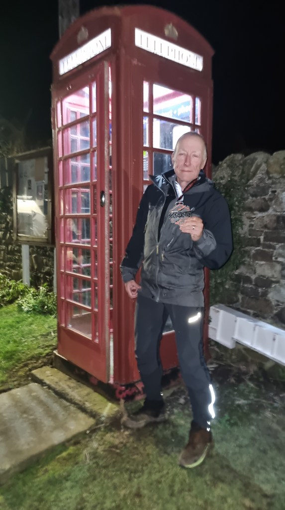
The first couple of miles are a fairly pleasant trot to Upper Booth. Gary and Gill had cycled round from the start to give us a wave. It is also the location of the second phone box on the Spine (the first is in Edale) and the first actually on the Pennine Way. I have photographed it before but, well, you know what’s coming…
…
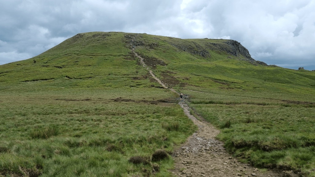
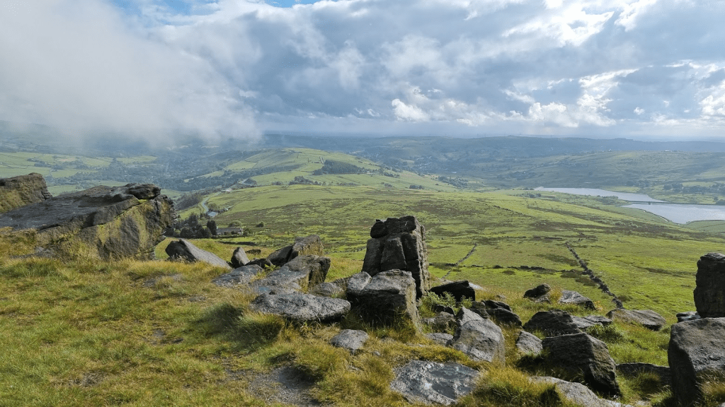
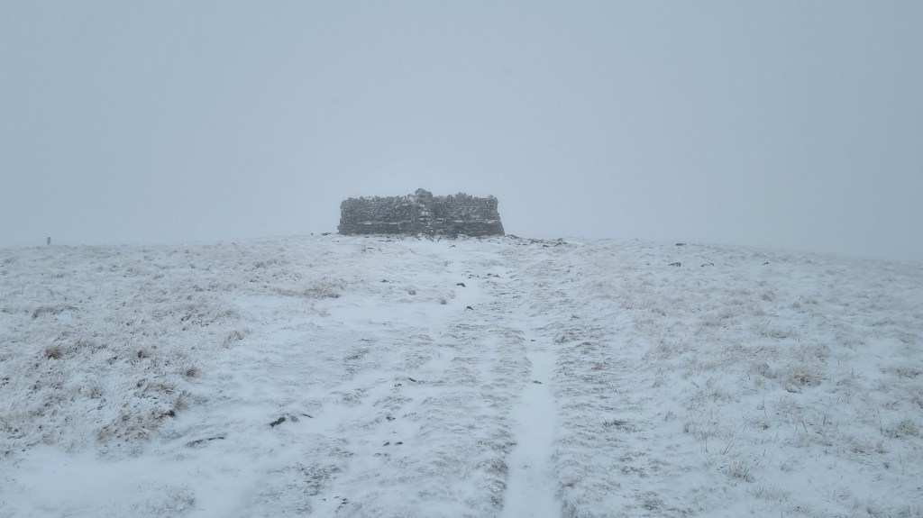
The next mile is the last ‘easy’ one for a while as it leads to the bottom of Jacob’s Ladder. After the second biggest climb on the Pennine Way we were at Kinder Low and our first trig point.
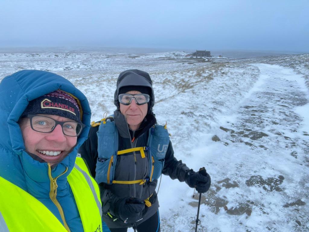
Reaching Kinder Low (Photo credit Nick Jones)
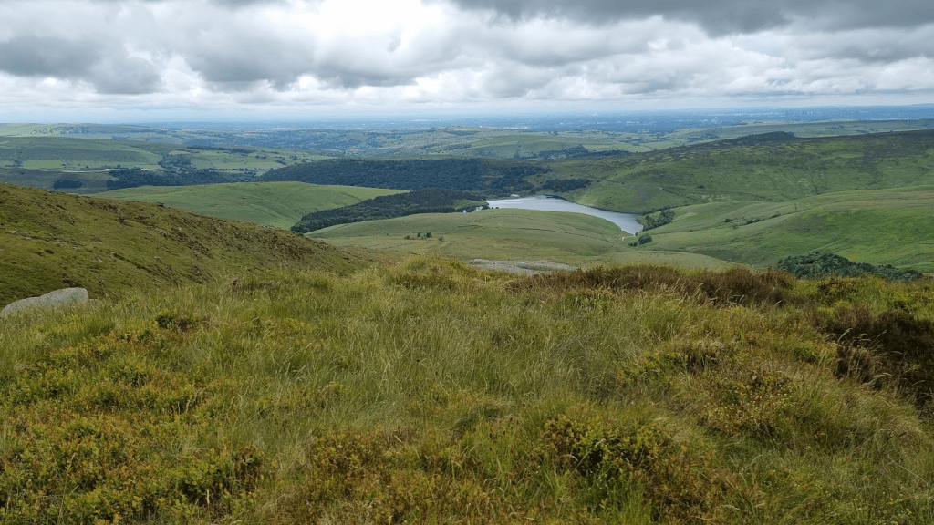
Clouds were gathering but there were still some good views from the plateau.
Kinder Reservoir
Passing Kinder Downfall
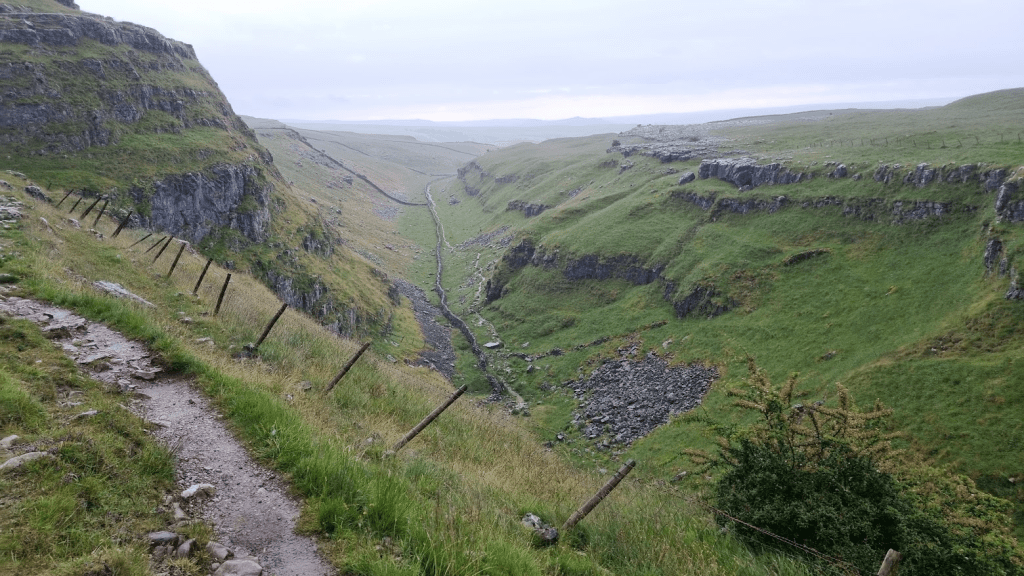
Just over a mile after the sharp turn at Kinder Downfall the Pennine Way drops sharply off the plateau.
Looking back to the plateau
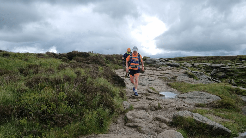
The sgn at the footpath junction gives a choice of a pub or Bleaklow. The pub sounds more appealing but the Pennine Way is towards Bleaklow. Neither Sharon nor I were looking forward to this bit. The ground so far had been quite wet and we knew from our original recce, after crossing the A57, Devils Dyke, Hearn Clough, Bleaklow were likely to be a muddy, messy mix of mud and rock. It also started raining. It was at this point I decided to twist my ankle. It was more a shock than a real injury but my yelp of pain caused the two guys that had just passed us to stop and ask if I was OK. I had noted from their numbers that they were part of the MRT (Mountain Rescue Team) race. They got me to rotate my ankle and point my toes to make sure I wasn’t seriously injured. I thanked them for stopping and commented they were off duty – I was told MRTs are never ‘off duty’.
I was able to run/walk the pain in my ankle off and we continued on our way to Torside. There is a point where the path splits and the signage is slightly ambiguous. If the ground is dry it doesn’t matter which path you take, if it isn’t you really want to be on the ‘correct’ path as the other one will be boggy. Fortunately I remembered sliding down the hillside from one path to the other in January and therefore knew that the ‘correct’ path was the lower one.
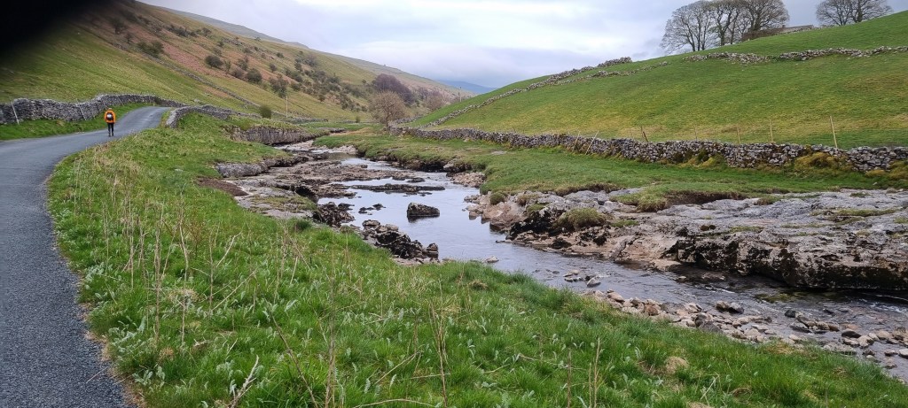
Even the correct path was rocky, wet and slippery. It was narrow and with a bit of a drop off the side. it wasn’t a nice place to be. Sharon had a bit of a ‘moment’ along here, we were less than 15 miles in and she was concerned about how she would cope if this was the standard of path she would have to negotiate for another 93 miles. Fortunately the path improved a little and we made our way down to the Torside reservoir.
It would be entirely incorrect to even suggest that the climb up to Laddow Rocks is the last climb before the first checkpoint of the Spine Race – not even close. however it is the last steep climb before the climb up from the Rochdale Canal in Hebden Bridge.
Looking back along Crowden Great Brook
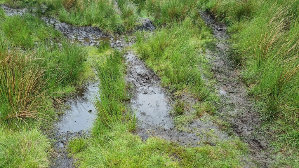
The path drops a little to follow Crowden Great Brook for about a mile, a very muddy mile as it turned out – worse I think than it had been in January.
Lovely!
The author Alfred Wainwright described Black Hill as ‘a brute in any weather’ and advised walkers to be prepared for a tough and gruelling trek. ‘Nothing can grow in this acid waste, There is no root-hold in this sea of ooze. In the flutings and ripplings of the surface of the dunes caused by the action of rain and wind, a certain strange beauty, a patterned sculpturing beyond the skill of man, must, however, be conceded. But it is a frightening place in bad weather, a dangerous place after heavy rain. It is not a place to visit unaccompanied.’ It was certainly not the greatest place to be after heavy rain and I was quite happy to have company but it’s fair to say it has been improved since Wainwright’s time. He also said ‘The broad top really is black. It is not the only fell with a summit of peat, but no other shows such a desolate and hopeless quagmire to the sky. This is peat naked and unashamed.’ However since he wrote that the Pennine Way has been (mostly) slabbed across it and regeneration projects have made it a little less black and bare.
After Black Hill it’s a mostly downhill slabbed path with Dean Clough being the last significant obstacle before the A635 road crossing at Wessenden Head. I think this was probably the most water I’d ever seen in Dean Clough but it was far from the raging torrent it can apparently become at times.
Dean Clough
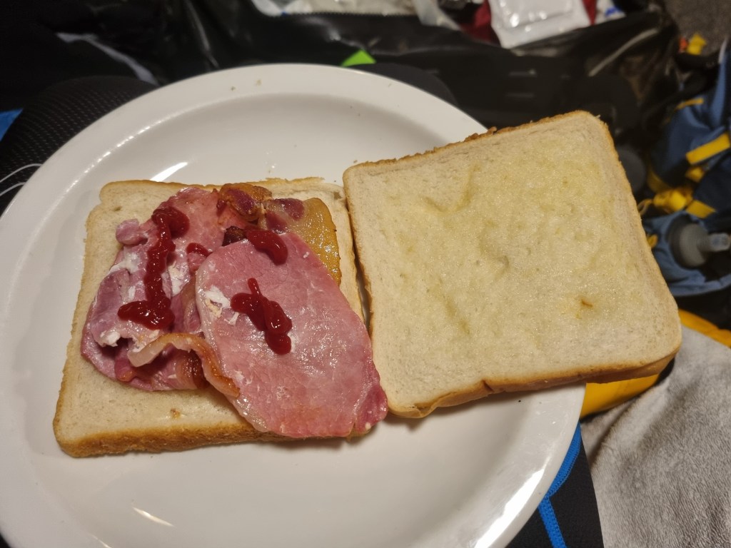
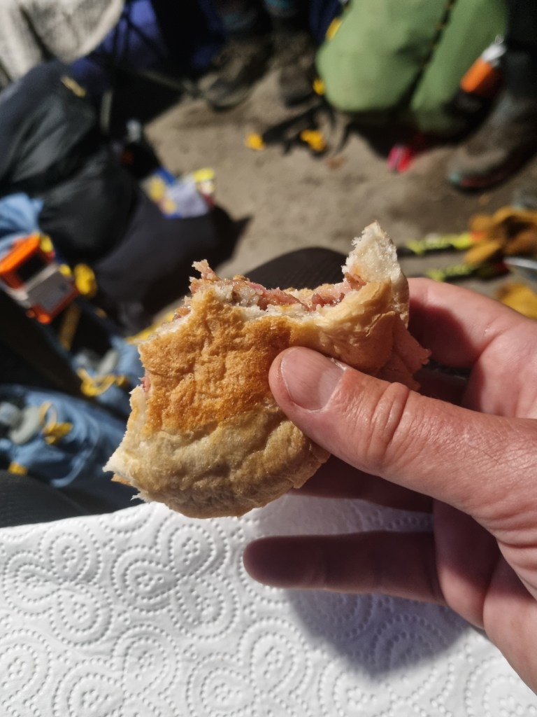
I was hopeful that the food van at Wessenden Head would be there and we were in luck. Coffee (tea for Sharon) and a bacon sandwich went down very well at this point, about half way through the first leg.
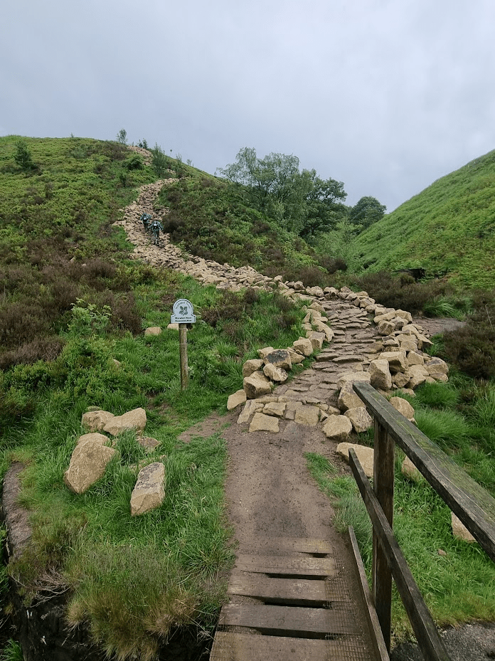
After crossing the A635 and turning off Wessenden Head Road, it was two miles of gentle downhill on a nice easy path. We took Kevin McCann’s advice and decided to ‘be bothered’ and sort Sharon’s hotspot before it became a blister. Soon I could see the new path which would take us up to Black Moss. In January this path was being built so we had a diversion. The path stood out quite starkly on the hillside, probably because it was so new.
The new path
Still quite daunting but not as slippery as before
Hopefully the stone will weather and stand out less, however I was grateful it had been done as this would have been a very muddy climb before – now it was just hard.
The only point of real note was a large wooden ‘road’ alongside the Black Moss reservoir. We weren’t sure if we were meant to take it or the original path. We chose the ‘road’ as it looked more inviting. In fact it was quite slippery, we would probably have been better off on the original path, but as we were only on it for less than 200m and it was parallel to the path I don’t think it could have been considered any sort of advantage anyway.
After crossing the A62 we were on Standedge. We did the obligatory selfie at the trig point but didn’t linger for long as the next significant point of interest was Nicky’s Food Bar!
Standedge trig point looking South-ish
Nicky’s Food Bar was a delight as always. Sharon was struggling a bit with eating (I wasn’t) but she sort of had some cuppa soup and a roll. I had the obligatory bacon sandwich and a cup of coffee, and some flat coke, and various sugary things.
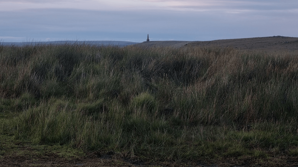
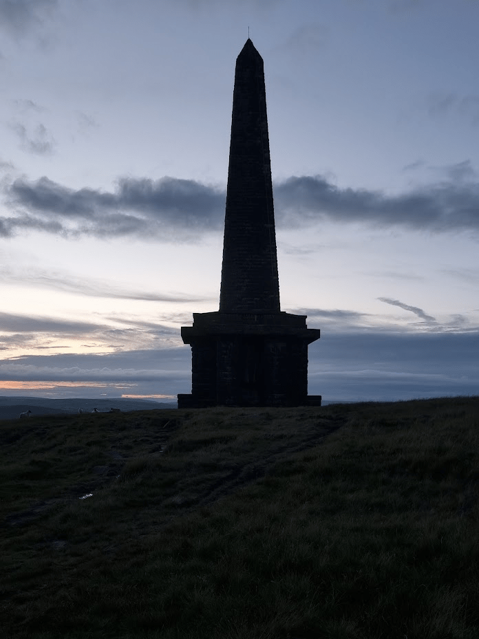
We have a friend from the running club from that part of the country and he always asks me if I’ve seen the red rose of Lancashire from the bridge over the M62. I always say no, because I haven’t. We had a really good look this time. The only thing we could see that might have been it was a small obelisk some way from the bridge – turns out this was it, not the huge monument I’d been lead to expect.
The other thing our friend has mentioned is a Roman Road called The Old Packhorse Road. This is a thing and I was slightly concerned about it as it’s cobbled in part and I thought it might be slippery. As it was it was fine and we followed it to the Broad Head Drain, which lead to the A58, our last major road crossing of the first leg.
The Old Packhorse Road
We passed the White House pub and a friendly (they all are) SST and started the relatively easy section through the reservoirs.
Random stonework
Soon we were rewarded with our first sight of Stoodley Pike.
Stoodley Pike
By the time we reached the Pike, the sun had set.
Stoodley Pike
Stoodley Pike to Hebden Bridge is fairly easy to navigate. This was the point where the Sprint route diverged from the Pennine Way. Sharon hadn’t been this way before but I had as recently as January so I should have no problem right?
Thank you so much to the runners that pointed out the bridge at Colden Water before I tried to wade across. Thank you again for calling us back before I took us to Heptonstall.
Eventually we were at Slack Top and all that remained was the slightly muddy and slippery path to the Scout centre. I almost made it, I was that close. I had warned Sharon about the slippery descent, it was actually far worse than it had been in January, I should have warned me, as about 5 metres from the courtyard my legs went from under me and I landed flat on my back. it jarred my knee a bit but on major damage was done. The amusing part was that my watch decided I’d had an accident and tried to phone Sharon. There is no phone signal at Hebden Hey (not on the 3 network anyway) and also Sharon had had a ringside view of my fall so didn’t need a phone call to tell her her husband was an idiot.
One of the reasons I wanted Sharon to do the Spine Challenger South was so she could experience a Spine checkpoint. I have been lucky enough to run in some amazingly well organised events but the spine really is another level. The trackers aren’t simply used to make sure we follow the correct route, they are an integral part of keeping the race moving smoothly. The volunteers at the checkpoints use the trackers to know who is coming in and when. That way they can have a space for you and your bag ready, even if a large number of people are arriving at the same time. From a competitors point of view it all looks very simple but that’s the clever part – no matter how stressed the volunteers might get at times, that stress is never transferred to the runners. Checkpoint One was quite busy so we were taken to a different room to the one I got sorted in in January. Actually it was better as it was in the same building as all the other facilities. We were sat down, given tea and set about sorting ourselves out. Feet, as ever, were the main priority. There is nothing better for feet during a race than being out of shoes and socks and getting some air.
In January I only changed my socks at CP1. As we only had one checkpoint we were both planning on showering and changing here. When I next do the full summer spine I may well still change at CP1 as CP2 and CP3 are camping fields in summer and don’t have showers. if I do, I’ll remember there are two showers in the shower room, not one, and not sit outside for 10 minutes waiting for the shower to become available…
Checkpoint One is different to all the other Spine checkpoints in that it has a separate dining room. I’ve got quite good at eating on the spine Race so when faced with a choice between vegan bolognaise or chicken and rice the answer was clear, a portion of each. I also accidentally ate a bowlful of Iced Ring biscuits for ‘dessert’, just because they were there.
As I mentioned before, the checkpoint volunteers are brilliant at adapting. The checkpoint had three dormitories, two for men and one for women. As there were a significant number of women wishing to get some rest, one of the ‘male’ dormitories was reallocated as ‘mixed’. Sharon and I took advantage of this to get some rest together. I should point out we had no energy for anything ‘untoward’, and a dormitory in a Spine checkpoint was hardly the place if we had, it just meant we could could keep an eye on each other and get up at the same time. We set our alarms to give us a full 2 hours rest. I slept for about an hour, Sharon apparently didn’t sleep at all.
After ‘sleeping’ we went back to the dining room. I had beans on toast with cheese on top, Sharon doesn’t like beans so she just had the cheese and the toast. I was surprised I was struggling to eat it all (obviously I did though) until Sharon pointed out I’d had basically two full meals and a packet of biscuits only two hours earlier!
We returned to our drop bags so Sharon could sort her feet and we could get ourselves ready for the next leg of the race. Before leaving the checkpoint there was a kit check to be done. This was standard for the full event so was also part of the Challenger. It happens at every checkpoint, a small selection (five?) of items are checked. We had to have our drop bags packed so that we weren’t tempted to put things in there after kit check (We wouldn’t be as I feel that all the kit is there for a reason and I wouldn’t be confident enough to be certain there was any item I might not need in the next 62 miles. However in the past some people have). We weren’t however expected to be ready to leave immediately, we would be allowed to repack properly before going out of the door. Personally I wouldn’t like to be right on the time limit and have to rush out straight away so I always try and be ready well before the six hours is up.
We retraced our steps (without me falling over this time) until we rejoined the Pennine Way.
Stoodley Pike just visible in the distance
After a few miles of moorland the scenery we passed along Graining Water and the path became familiar to Sharon again, we were on the route of the Haworth Hobble.
Bridge over Graining Water – which didn’t look at all troubled
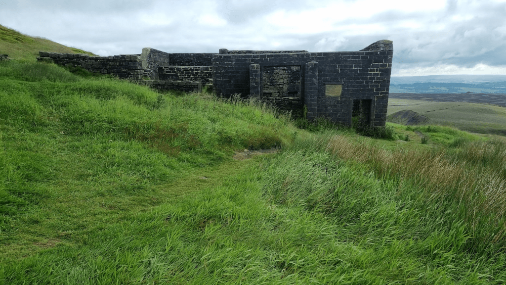
The Hobble runs in the opposite direction so although the section past Walshaw Dean reservoirs was easy enough, it was a bit of a shock to discover how much harder it was going up to Top Withens rather than running down from it!
Top Withens
Although I’ve passed by Top Withens several times I’d never actually had much of a look at it. As it was a nice morning (that would change) I thought I’d have a quick nosey ‘inside’ (can you go ‘inside’ a building that doesn’t have a roof?)
That’s cleared that up then
The ‘interior’ of Top Withens
Not long after leaving Top Withens, various motivational messages started appearing on gates…
True
Soon we found ourselves on Ickornshaw Moor. Yeuckornshaw Moor would have been a more appropriate name as it was a boggy slippery mess, which neither of us enjoyed. To make things worse I was soon being accused of leaving my wife behind. Actually this was a good thing (not leaving Sharon behind obviously. Anyway I wasn’t, not deliberately, I’d just crossed the bog, sorry moor, a little ahead of her) as the person making the accusation was Spine Legend Gary Chapman. He was also behind the Craven Energy Triathlon Club’s unofficial but most welcome checkpoint. Gary escorted us to the tent and helpfully pointed out the least boggy way to get there. I don’t know if its deliberate, but the location of the tent means it only becomes visible once you are almost on top of it – the complete opposite to Stoodley Pike, which is visible long before you reach it!
Happy Spiners at the Cowling Feed Station (Photo credit Gary Chapman)
I’m not sure when this unofficial oasis first appeared but up until 2021 (my Summer Spine DNF year) it was entirely unregulated and people would sleep at it. In Summer 2022 (my Summer Spine finish year) it didn’t happen as it was recognised it was being used as rather more than just a refreshment stop. However the following year (Summer Spine Sprint, didn’t come this far) it reappeared but with a 30 minute time limit, the same as the official ‘.5’ checkpoints.
We arrived just as it started to hail. 30 minutes, one bacon sandwich and a cuppa later the hail stopped, Perfect timing! Before we left Gary checked the weather forecast for us. As we expected, it was due to be raining heavily as we crossed Fountains Fell. Gary suggested we should spend a couple of hours in a pub in Malham to let it pass. When a Spine Legend gives you advice you are wise to at least think about it. We did, but decided against it as we weren’t entirely sure we would be able to get going again if we spent a couple of hours in a nice warm pub.
Trying to be artist and frame the landscape with the trees – I’ll stick to running…
After a few miles we were at Lothersdale, the location of the Craven Energy Triathlon Club checkpoint on the Winter Spine and where I’d enjoyed a bacon sandwich in January. Speaking of bacon sandwiches, although Sharon hadn’t been able to keep her breakfast down the bacon sarnie she had at the Tri Club CP went down and stayed down without too much effort, which was a good thing. As we were running towards Pinhaw Beacon, I could see two runners in the distance coming towards us. As they got nearer they resolved into my Spine Angel Rachel and her boyfriend, who I hadn’t met before, Clive.
The Spine Race has a rule that you should only be met by friends and family once in the event, and of course they can’t give you anything (unless they are willing to stand there and give the same to every other runner). Technically you could argue we had already had our support meeting as we saw Gill and Gary at Nether Booth. However given that, at that point, we were less than two miles into the race and we only stopped for long enough for Gary to take a picture of me by the phone box, I don’t feel we were violating the unsupported nature of the Spine by seeing a couple more friends.
It was great to see Rachel and finally meet Clive but we had to say goodbye and get on with it. The weather was currently OK so we were keen to make progress before it changed. There was also something else on my mind…
View from Pinhaw Beacon
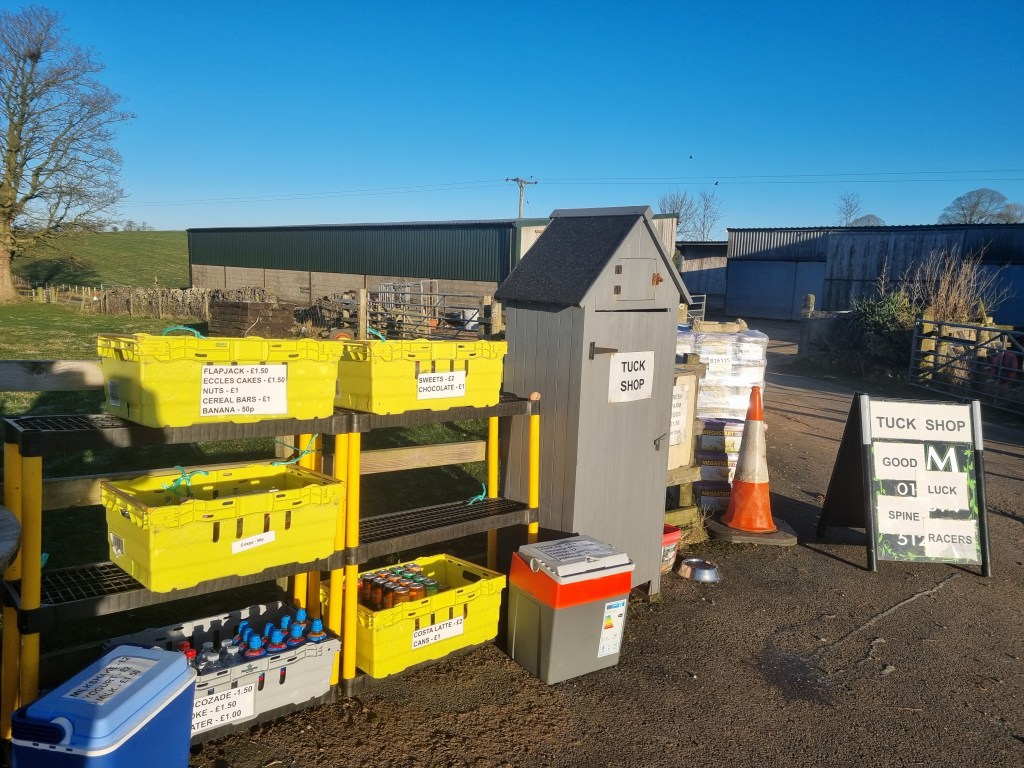
Less than a mile outside Thornton-in-Craven, we came to it – the Cam End Tuck Shop.
The new improved Cam End Tuck Shop
I had seen on Facebook that this had been significantly expanded from the small grey shed I had visited in the winter, which was great but…
Amazing!
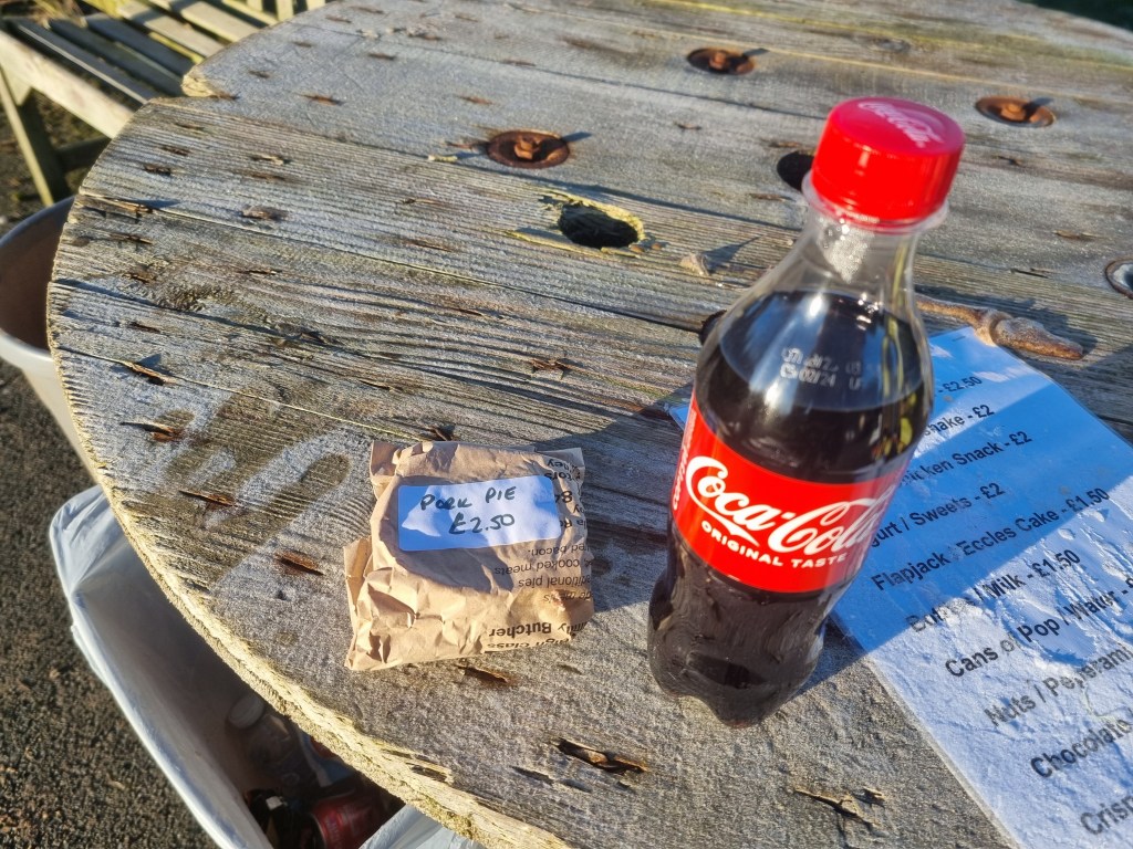
…would there be pork pies?
Possibly the best pork pies in the World
Oh yes! And milkshakes. Sharon was very happy with the crisps. I had a sausage roll to go with the pork pie. We chatted to an Australian couple who had come over to walk the Pennine Way and had also found the tuck shop. They were taking a far more sensible amount of time to walk the Pennine Way than us.
After crossing some fields we arrived at the Leeds and Liverpool Canal. Despite it being a water course it was still uphill from the last field to the canal – but then the general rule for the Spine Race is if you don’t know which way to go, it’s probably the uphill route you want. Anyway the canal at least was flat and a nice easy towpath to run on. At East Marton we passed under the double arch bridge. I took a picture despite having much better pictures from previous races.
Double arch bridge
On both my Spine finishes we had been diverted via Bank Newton between East Marton and Gargrave due to the Pennine Way being in a fairly bad state along that section. I was therefore a bit concerned as generally the underfoot conditions were worse than they had been in January (when we were diverted) so how bad would this be? As it turned out it was fine and we soon found ourselves in Gargrave and obviously, as I was trying to give Sharon the full Spine experience, we had to visit the legendary Co-op.
We bothy bought a drink and a packet of sandwiches. Well, we tried to. When we went to pay we were told if we added a snack it would be a meal deal and therefore cheaper than the drink and sandwiches alone. I’m not sure how that works economically but being paid to have a piece of Millionaire’s Shortbread sounded great so we didn’t argue.
We had recced Gargrave to Horton-in-Ribbledale in December so Sharon was back on part of the Pennine Way she had seen before. We left Gargrave and crossed a few fields until we met the River Aire, which we followed to Malham. I celebrated by photographing it’s phone box.
The phone box at Malham
By now the weather was getting decidedly grey and miserable. It was also about 7:30 in the evening. I had feared that we would be dodging through crowds at Malham Cove, but the time of day and the weather meant there were less people there than there had been in January.
Malham cove
There are a lot of steps from the bottom of the Cove to the limestone pavement at the top so we both set off at our own pace and would regroup at the top.
Am I at the top yet? Almost
The Pennine Way officially goes right through the limestone pavement. Looking at the trackers from January, the elite runners definitely don’t. Due to the rain the limestone was extremely slippery so I took us on a route that didn’t cut the corner quite as much as the elites but avoided most of the pavement as it was even more hazardous than usual.
Looking out over the pavement
It wasn’t possibly to avoid all the slippery limestone as there is over a mile of path and climb over limestone before the terrain opens out and becomes more grassy.
Looking back along the path from the pavement
We negotiated the limestone without incident and headed towards Malham Tarn and Checkpoint 1.5.
By now the promised rain had very much set in and so we were very pleased to get indoors at the checkpoint. I was surprised how many people were there. We had been fairly much on our own for some time and so it was surprising to see were weren’t that far behind several other runners.
As I expected the legendary John Bamber was in charge of CP1.5. Last time I saw John I got noodles. This time there were no noodles but there was tea and coffee. Officially there is only water at intermediate checkpoints but I was fairly confident that John would have tea and coffee as that’s the sort of person he is, one who will do his best to make sure people get what they need to carry on. I also had some water added to my freeze dried meal. A bit too much really so it was more like soup than spaghetti carbonara but extra liquid wasn’t a bad thing.
John was also strongly advising us to stay in groups or at least pairs to cross Fountains Fell and Pen-y-Ghent. Obviously this was the plan for Sharon and me anyway but most of the others at the CP seemed to be taking his advice too. We put on a warm layer and full waterproofs and headed out towards Fountains Fell.
Despite having run this section twice in the last 6 months, I still manage to get confused at a couple of points. The first is where the Pennine Way meets a small road. I know not to take the road but the correct route is up the farm track, not the barely discernible path on the grass. Shortly after the path goes through a group of farm buildings. You go right to the buildings before turning up toward Fountains Fell. I turned a bit early, although I didn’t feel there was any need for Sharon to tell the runner that caught us up we were lost.
Anyway we were soon on the path up to Fountains Fell. By now it was properly dark, miserable and quite misty. I kept stopping to ensure I didn’t leave Sharon behind. I had my mandatory red rear light so she could see me but it was raining and I had my hood up so if I got too far ahead I may not have heard her had she tried to call me back.
There wasn’t much opportunity for photos on Fountains Fell but I’m always pleased to see the ‘DANGER Mine Shafts’ sign as it means the climb is almost over.
Fortunately I have so far avoided the mine shafts
It’s not much over a mile from the top of Fountains Fell to the road that leads to the turn off for Pen-y-Ghent, but the dark, the rain and the mist combined with slippery underfoot conditions made it seem much further but eventually we were on the road and heading to the track up to Pen-y-Ghent. I think it was the runner that Sharon had told we were lost who asked if we would mind if he followed us up Pen-y-Ghent as he had never been over it before – obviously my failure to get lost again had reassured him that I might actually have some idea where I was going.
I guess I have always had the good fortune to go over Pen-y-Ghent in not too bad weather. This was about the worst I’d experienced on it but I was still fairly confident. There is actually only about half a mile of steep and tricky climbing to do. It is steep and tricky as a couple of places involve scrambling but that just takes my mind off how long it would take me to stop moving if I fell off.
As we approached the top there was a group of three runners in front of me. ‘Are you familiar with this mountain?’ I was asked. ‘Yes, just keep going up’ was my reply. I had learnt in January that if you just kept going up you would reach the top and all would be well. I diverted slightly right to avoid being right underneath them if something did go wrong and soon found myself on the slightly bizarre quarter of a mile long slabbed path that very gently climbs to the actual top pf Pen-y-Ghent. I looked behind me and Sharon and our new friend soon joined me.
The wet weather had brought the frogs out on Fountains Fell and Pen-y-Ghent so obviously I had to photograph one.
Pen-y-Ghent frog
I’m blaming the mist and the dark but initially I couldn’t find the marker for the top.
There it is
We were about to attempt our usual mountain to selfie when our fellow runner kindly offered to help.
At the top of Pen-y-Ghent in the mist
You can see in the photo that the left lens of Sharon’s glasses is completely covered in condensation. Unfortunately she didn’t realise this and assumed it was just the mist, which made getting down the mountain a little more challenging than it already was.
We went through the gate at the top and found the steps down followed by the track to Horton-in- Ribblesdale. Fortunately although the visibility was poor, it was good enough that when I followed a side path – presumably to a view point when it was light and not foggy – I could see ahead enough not to simply walk off the side of the mountain. It was soon clear that our mountain companion was much quicker than us so we told him to leave us and go at his own pace. He thanked us for our help and disappeared into the mist.
Horton-in-Ribblesdale was the last water refill point before Hardraw. This is probably not strictly true as I’m sure water is available in Hawes but there were no other water stops for the next 13 miles. We filled our bottles at the toilets. I had had a half a plan to have stop there but it was cold and wet outside and the toilets were quite busy with another group trying to warm up so we pressed on.
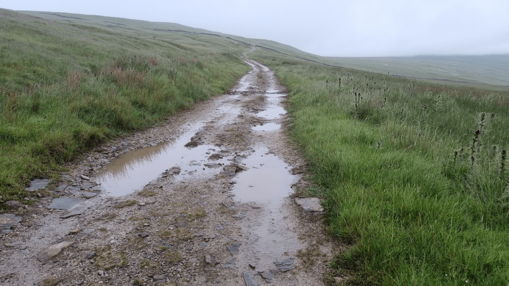
As we headed towards the dreaded Cam High Road the sun rose. Well, it got lighter anyway. The clouds were just a solid impenetrable grey which made it almost impossible to pick out which direction the sun was in, much less see it. I’d never been on the Cam High Road in daylight before but I wasn’t hopeful that this miserable version of daylight would make it any more pleasant.
And so it begins – The Cam High Road
After about twenty minutes, Sharon commented that she didn’t understand my intense dislike of the Cam High Road. Indeed it did have one or two points of interest I’d not seen in the dark.
Never noticed this in the dark
However most of the Cam High Road was exactly as I assumed it to look – only worse, I could see just how far it stretched in the daylight.
The Cam High Road, grey as far as the eye can see
After an hour or so Sharon commented that she completely understood my intense dislike of the Cam High Road! She now also agreed with my comment that, when she threw up on it earlier, that was the the best thing to do with the Cam High Road, vomit on it. The only highlight was being passed by the leader and eventual winner of the full Summer Spine, Chris Cope. Chris was very friendly and positive and commented on how bad the underfoot conditions were – at least the fast guys were finding it a challenge too!
I was really struggling to stay awake Sharon kept having to wait while I tried to ‘micro-nap’ hanging off my poles. After a while I remembered I was still carrying a sachet of caffeinated Tailwind – I’d just filled my bottles with water at Horton-in-Ribblesdale. I tipped it into my bottle and the effect was startlingly rapid. I had a good drink from the now caffeinated bottle and almost immediately perked up. The Cam High Road was still very boring but at least now I wasn’t falling asleep.
The only good thing was that I had overestimated how far along we went before we reached Ten End and so we turned off half a mile before I expected. Gaudy Lane was the final downhill section into Gayle and Hawes, from there is was a couple of fairly easy miles to Hardraw.
For most of its length Gaudy Lane is an extremely misleading name for a muddy moorland path. However it isn’t terribly hard to follow – keep going downhill and head for Hawes is the general gist of it – and after the Cam High Road it’s a nice downhill run. Apart form this time. It was the muddiest and slipperiest I have ever know it. Had we tried to run at any great speed we would undoubtedly arrived in Hawes caked in mud. As it was I had a few near misses but just about managed to stay upright until we reached the road.
Because this is the Pennine Way and nothing makes sense with regard to its route, it leaves the road and crosses a few more fields on the way to Gayle. The GPS route cut the corner between the road and the field a bit so it took a few seconds to find the gate into the fields. Fortunately these weren’t too muddy and overgrown as we had started running by now. My plan had been to get to Hawes and strip off our waterproofs there but we were getting quite hot so we stopped at the edge of a field and did it. As we were only a couple of miles from the finish and there were no more exposed or high sections, I wasn’t too bothered about how everything went into my pack as I wasn’t planning on opening it again before we finished.
We followed the GPS route through Hawes without incident until we reached the back of St. Margret’s Church. The footpath split and the Pennine Way marker appeared to be sending us to the left of the church so we went that way. I soon realised this wasn’t correct but we cut through the churchyard to get back onto our route with only a few bonus yards added. My (retrospective, having looked at the routes) excuse for getting it wrong is that in January, because the checkpoint is at Hawes Youth Hostel, the correct route was to the left of the church.
As this was the Summer Spine, we had another mile and a half to do to get to Hardraw. I remembered this bit correctly and we had no issues. There was much less sheep poo in fields to Hardraw than I remembered from my Summer Spine race too.
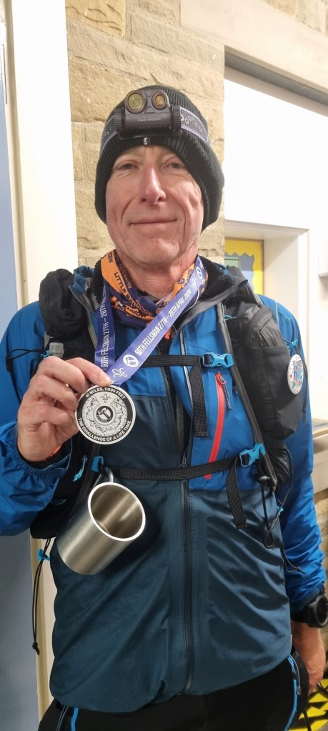
Our euphoria at being so close to the finish (and the fact I was full of sugar and caffeine) meant that we ran through the fields and over the bridge to cross the finish line had in hand. It had taken 49 hours and 22 minutes but we were 2024 Summer Spine Challenger South Finishers!
We were given medals, congratulations, t-shirts, certificates and food. The first thing we both wanted to do was get our shoes off though. Then we thought perhaps we should get a picture of us at the finish (there would be official photos but they take a while to come through). This is why we are wearing sandals in the photo!
Finishers!
As I’ve said earlier, Spine checkpoints are brilliantly organised. We had told the checkpoint manager we were in the Green Dragon pub so after we had recovered a bit she asked if we would mind going to the pub to free up space at the checkpoint if she found people to carry our bags for us – sounded like a great deal to us!
I’m sure that some of you are thinking that this must have been easy for me, given I did the full Winter event in January. Wrong. This was a tough event. The drop out rate was high, out of 157 starters , 59 did not finish. In the full Spine only 49 finished out of 109 starters, 47 of the 60 DNFs had pulled out by or at CP2, our finish line. I have no where near as much experience on the Pennine Way as many people but these were some of the worst underfoot conditions I’ve experienced on it. I’d be immensely proud of Sharon for having completed a 100+ mile race for the first time regardless but but to have completed that particular 100+ mile race is exceptional.
When I completed the Summer Spine my reward was a trip to the National Telephone Kiosk collection. This time we are in Wensleydale so really the only proper reward was a trip to the Wensleydale Creamery to see Wallace and Gromit.
More tea Gromit?
The obvious next step for Sharon is Challenger North. She hasn’t said no yet, we are just waiting to hear about the date of another event which may unfortunately clash before deciding. Hopefully we will be back on the Pennine Way next year but if not I’m toying with the idea of me doing a Winter-Summer double full Spine in 2026…
I ran the Way of Legends in 2018. I came second to someone much quicker than me and had a bit of a tussle for my place with a quick Frenchman. It was a brilliantly organised race and one I considered doing again but then Covid happened, the race didn’t and it looked like the Way of Legends would become a legend in its own right and vanish into history. Except…
The Way of Legends is the creation of Manu Pastor. He is supported by an amazing team, which is part of what makes the race so great. It was also certain members of that team (the medical section I believe) that harangued, pestered and probably bullied Manu until he agreed to run one last edition of the Way of Legends. As past entrants, Sharon and I received advanced notification of the race and immediately said yes. Later in the year we met Kim and Ali at Druids. They asked us about recommendations for overseas multiday events. ‘Well, there is this absolutely brilliant race in Spain…’
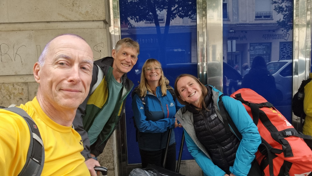
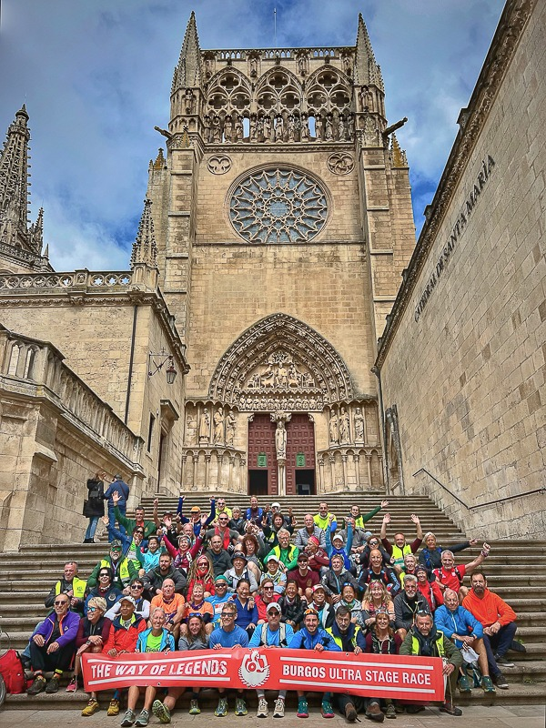
…And here we all are in Madrid!
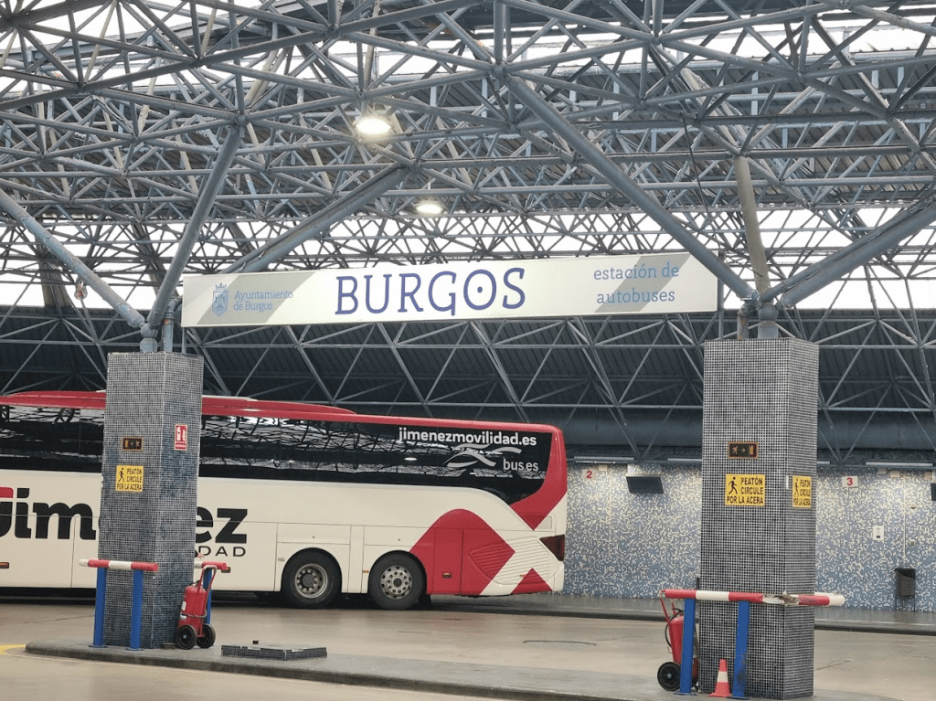
Getting from Madrid to Burgos is straightforward, just take the bus. We had learnt from our previous experience to book the bus in advance though. We did have a slight moment of confusion when we had the same seat numbers as Kim and Ali but it turns out there were two buses going to Burgos, both at the same time, and we were in the same seats, but on different buses.
BURGOS!!!
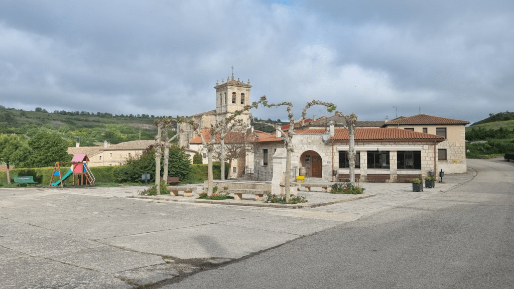
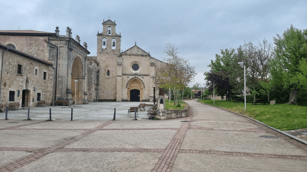
We were picked up from the coach station and taken to the new race HQ in the very pretty village of Ros.
Ros village centre
Once we arrived at Race HQ, it was just like one huge reunion party! The fact we hadn’t seen many of the people there for six years was irrelevant, we all remembered each other and spent the next quarter of an hour or so exchanging hugs and introducing ourselves to all the people we hadn’t met before (in Kim and Ali’s case that was everyone but they quickly had a lot of new friends).
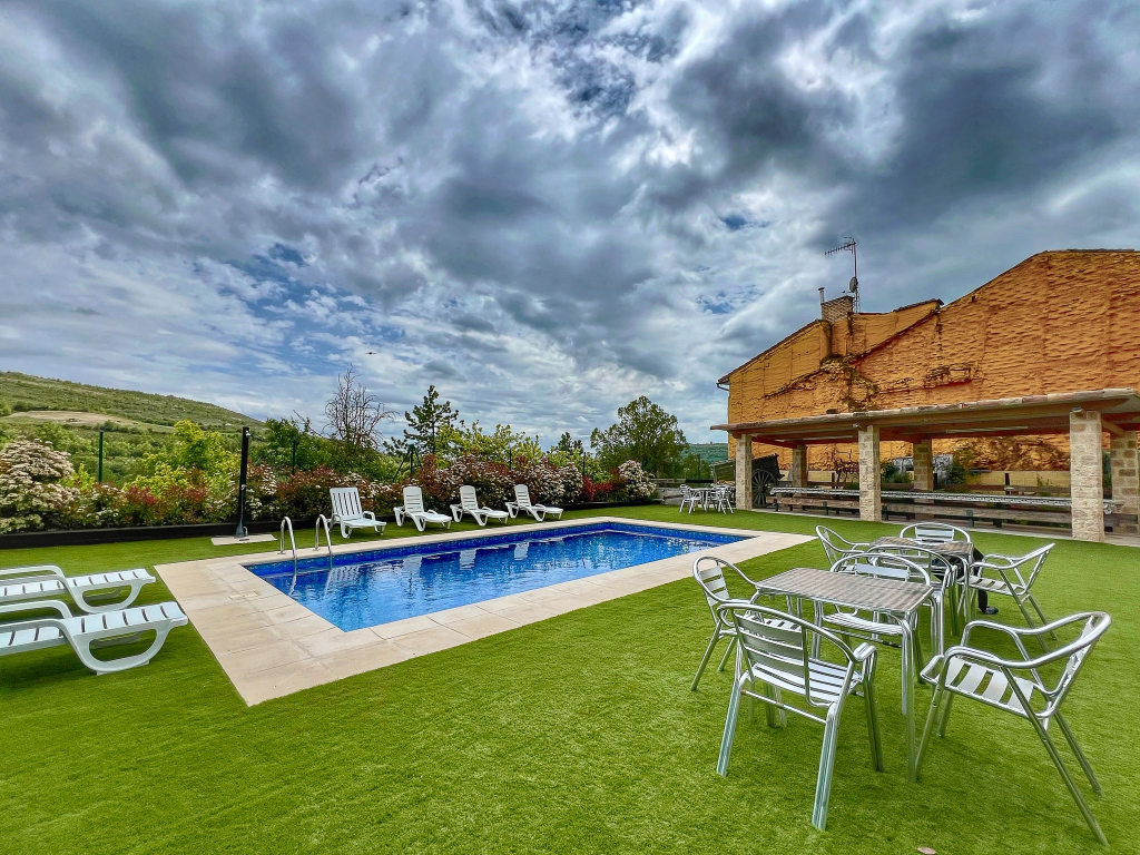
The new Race HQ had a pool but no-one (apart from Manu’s son) had been brave enough to get in it.
Lovely pool and outdoor area at Race HQ, just needed slightly warmer weather (Photo credit Run and Races)
I think it would be fair to describe our room as ‘cosy’ but it was perfectly fine for our three night stay.
Compact but comfortable enough
The following day was race check-in. This consisted of kit check and being issued with a race number and various Way of Legends goodies. The kit check was very short compared to what I’ve grown used to from ‘grim Northern’ races in the UK. The only items I had previously questioned with Manu were the head torch and red rear light – not because I didn’t have them, they were both mandatory for the Spine Race – but because it appeared there should be absolutely no chance of us having to run in the dark. The reply I got was that this was true, however if things did go horribly wrong and I did end up totally lost and it got dark, being able to see and be seen might be quite useful. This seemed fair enough so I didn’t question it further. Everything else was as you would expect for a mountain race. I suspect the absence of waterproof trousers from the kit list was an oversight. I’m so used to having them I packed them anyway.
I was tickled until I smiled
Kim and Ali both have the same birthday – although Kim does like to remind everyone she is three years younger. This was on the registration day. Just because they were new to the Way of Legends family, this doesn’t mean the occasion wasn’t going to be marked by the Way of Legends team and so they both got birthday cakes with candles.
Happy Birthday to You….
After everyone was registered we had our ‘Welcome to the Race’ and first race briefing. I hindsight should have paid more attention…
Introduction to WoL and the first race briefing (Photo credit Run and Races)
The race briefing wasn’t the last item on the agenda, we were all to go to the village church at 6pm – but why?…
At the church Manu talked about the passing of Hans Schmidt, a veteran ultra-runner and friend of Manu’s, who had celebrated his 80th birthday by climbing Aconcagua, the highest mountain in South America. Manu had created a one-off ‘Hans Schmidt Trophy’ to be voted on by competitors and volunteers. The winner would be the person most considered to personify the spirit of Hans, selflessness, determination and just generally being a good person.
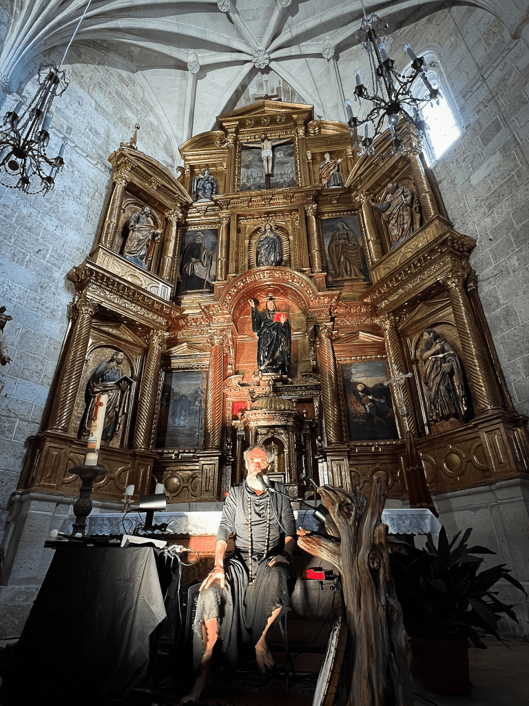
This was great but there was another reason we were in the church, and a reason for there being a number of local people there too. We were to have a quite brilliant performance from an incredibly talented individual. I later found out the name of the individual was Silberius de Ura and this was his neønymus project.
Silberius de Ura (Photo credit Run and Races)
I can’t really describe the performance so I will quote from his website:
A man alone, on stage, with his voice, some small unusual instruments and a loop station, constructing melodies that suggest scenes from prehistory and the current era. Different vocal lines created live, which weave and intertwine, sometimes raising chords, sometimes small phrases in counterpoint.
Sound landscapes that begin with the knocking of a bone inside a cave, a rhythm punctuated by the man’s breathing and the drops of water that fall from the stone vault. The shaman’s diphonic song invoking the spirits of the animals, while he hits the stalactites, comes from the depths of the grotto.
After the performance we were invited by the local people of Ros to join them at their community hall/bar for some meat and potato stew, which was delicious.
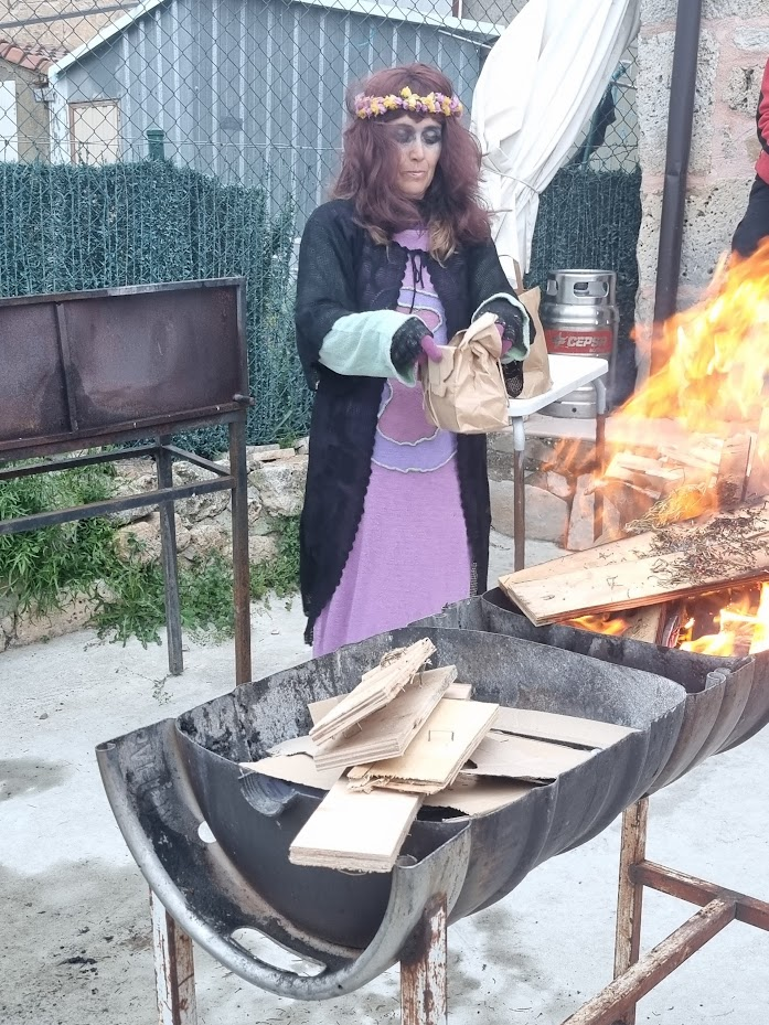
It was time to start running -however this is the Way of Legends so we needed an opening ceremony and blessing for the race. apparently the Shaman was busy but the Witch did a wonderful job of being mysterious and giving out our lucky laurel leaves.
All races should be blessed by a witch
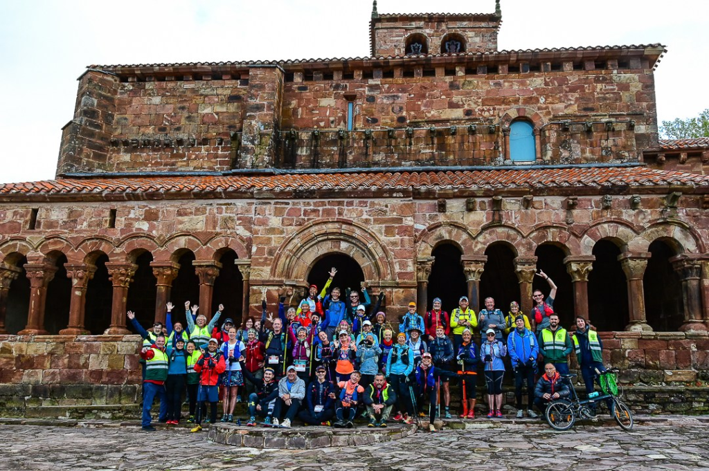
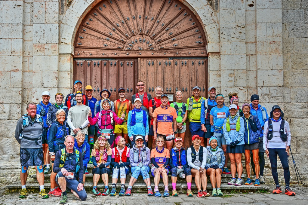
A quick team photo and it was time to start running!
The Class of 2024 (Photo credit Run and Races)
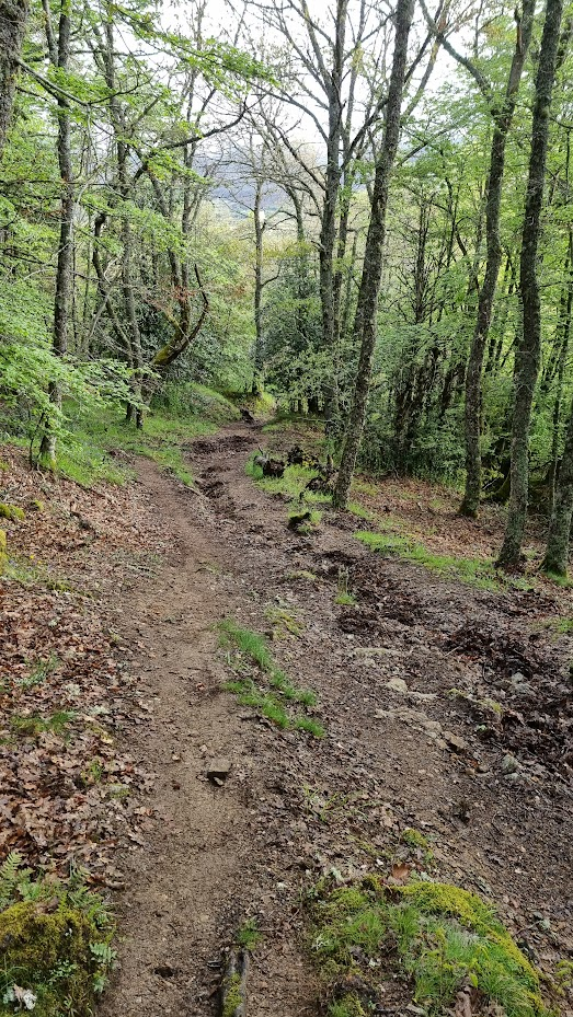
The first stage was a 42km loop through the countryside surrounding Ros with 1100m of climb. There’s no easy introductory stage on the Way of Legends! The stage had three checkpoints and two control points. Control points are generally at road crossings, points where one could go wrong or at the last bar of the day for those that wanted refreshment before they got to the finish. According to Manu, his Mother was usually responsible for any controls or checkpoints at a bar… Checkpoints supplied water but nothing else – apart from encouragement, which was welcome.
My aspiration was a top five finish. I had been told by Manu the hot favourite was a Greek runner called Argyrios Papathanasopoulos. I had never met or spoken to him but it sounded like I had no chance of winning. My hope for top five was based on the runners I knew or knew about – for all I knew there could be several international standard athletes on the roster I’d never heard of. My immediate concerns were Rob, a past Way of legends winner, Jean, the person I’d raced for second place last time, and Felix. I’d never met or raced against Felix but he was 24. Compared to me this made him a foetus but I suspected he’d be a fit and fast one. From the female side, I was certainly prepared to be racing Harri at least but as the male and female races are categorised separately on Way of Legends, I wasn’t going to be racing any women for podium spots.
As it turned out, Rob had some Achilles/bone spur problems and was planning on a relatively sedate run with his wife. This made a podium finish more possible but see previous comments about me not really having a clue. One of the things I quickly learned to accept about running is that there are a lot of people quicker than me. There is no point getting hung up about absolute finishing position, my ambition is to do the best I can. That performance could get me first or it could get me tenth place but if I’ve done my best, I’m happy. Anyway after all this pointless overthinking I decided to start in the pack and see who went for it and how things unfolded.
Great view of the race (Photo credit Run and Races)
I gradually moved up the pack until I was third. Argy had vanished into the distance and I found myself racing Felix, the 24 year old. I was generally quicker downhill but he would overtake me on the uphill. As there was more uphill than downhill in the first 10km, he soon built up a lead over me. Actually the first checkpoint was at a similar height to the start but the last descent was steep, technical and involved much faffing about on a log to avoid getting my feet wet crossing a small ditch. Felix seemed to tackle this much better than me as I could hear the cheers from the checkpoint staff announcing his arrival as I was slithering down the hill.
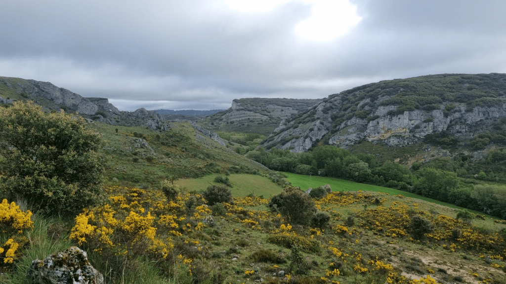
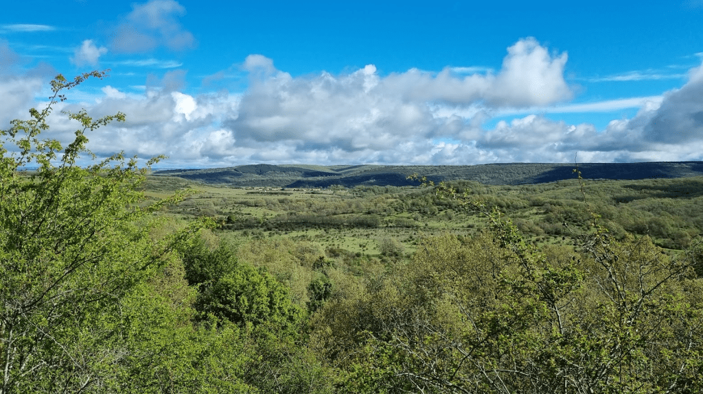
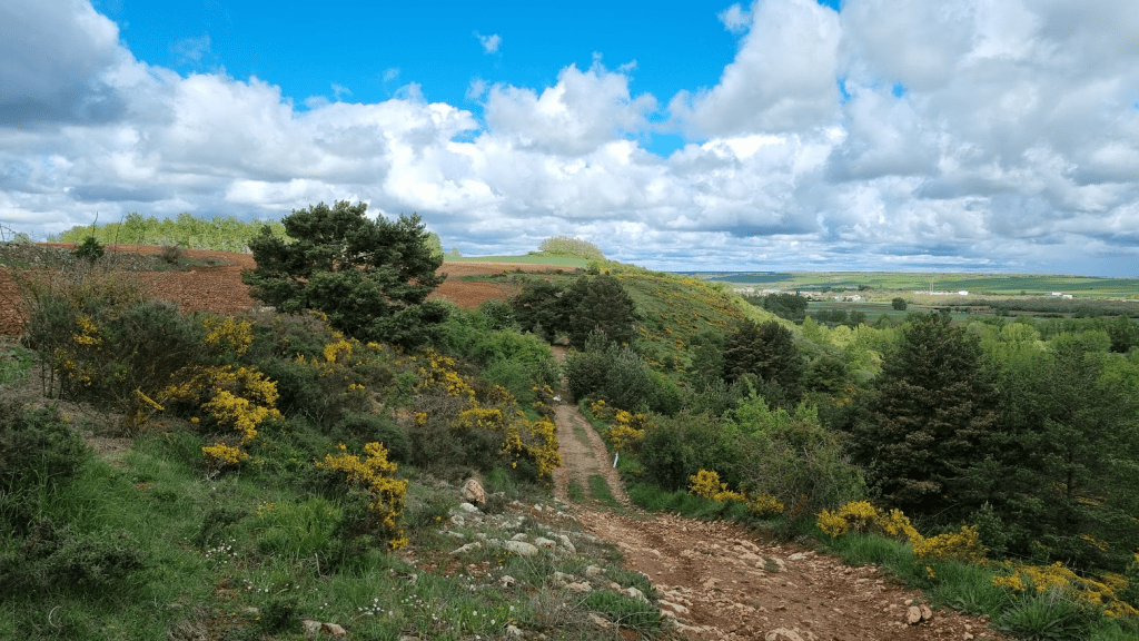
Although the weather wasn’t wonderful, there will still some good views
From Checkpoint One the overall theme was up. There was the odd bit of down but that was only so you could do a bit more up. At about 18km there was a sharp turn – with a marshal to make sure no-one missed it – and I caught a glimpse of Felix before he disappeared from view in some trees.
After the trees the path crossed a road before the final climb up to the day’s highest point. There was a volunteer at the crossing point, not because there was any traffic but simply to make sure we went the right way. I could see Felix on the climb and was exhorted to ‘Keep him in sight!’ by the marshal. As the climb steepened I could see I was gaining on him and eventually caught him up. He very sportingly stepped aside to let me pass. I asked how he was and he said he was struggling a bit with his knees, especially on the downhill. He lives in Berlin and hadn’t been able do much mountain training. I sympathised, I had similar problems on my first Way of Legends with some long downhill sections. Since then I’ve done quite bit of mountain running, including on my many trips to Fuerteventura and of course the ‘grim Northern’ races, but I know what a battering your knees and quads take the first time you run downhill for any length of time. I continued up the trail and reached Checkpoint Two.
The top was somewhat shrouded in mist so I didn’t hang around for too long.
Not the view I was hoping for!
After the peak there was a lot of fast downhill on easy tracks and roads. I pushed as hard as I could on these sections as I knew that Felix would struggle and so I wanted to try and open as much of a lead as I could. As I said, my aim is always to do as well as I can. I was in second place, I would have to work hard if I wanted to stay there.
I passed through the last checkpoint of the day fairly quickly. It was less than 11km to the finish and I had topped my bottles up at Checkpoint Two so I was confident I had enough water to get me to the finish.
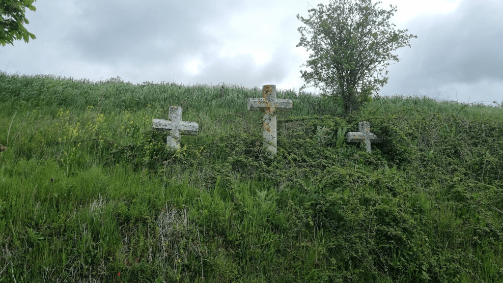
On the way to the last control point at Los Tremellos I passed some stone crosses. I assumed they were to mark the fall of brave competitors in previous races, but apparently they mark the Stations of the Cross on the path.
Not commemorating fallen runners
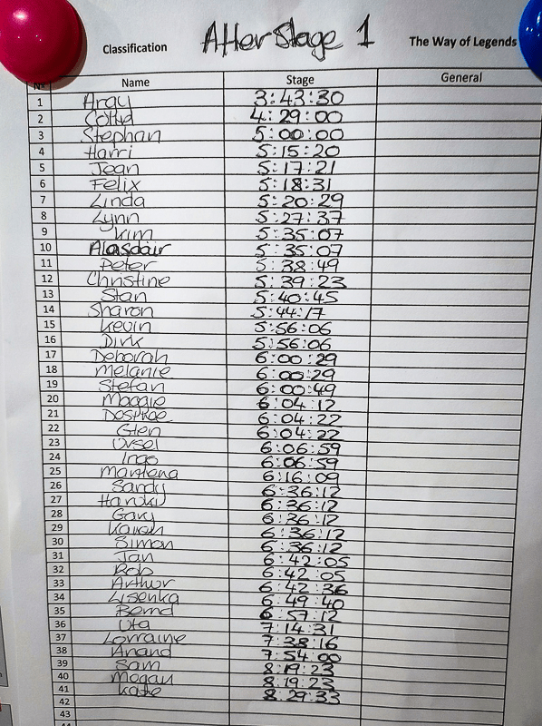
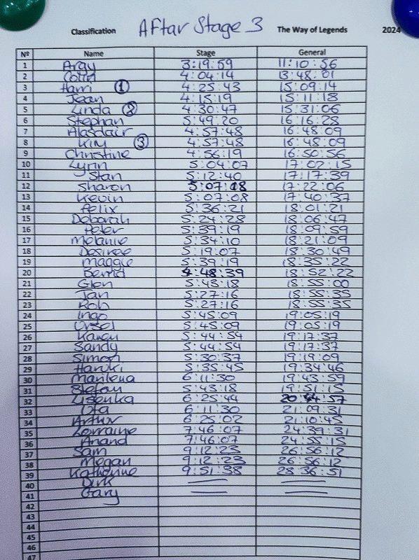
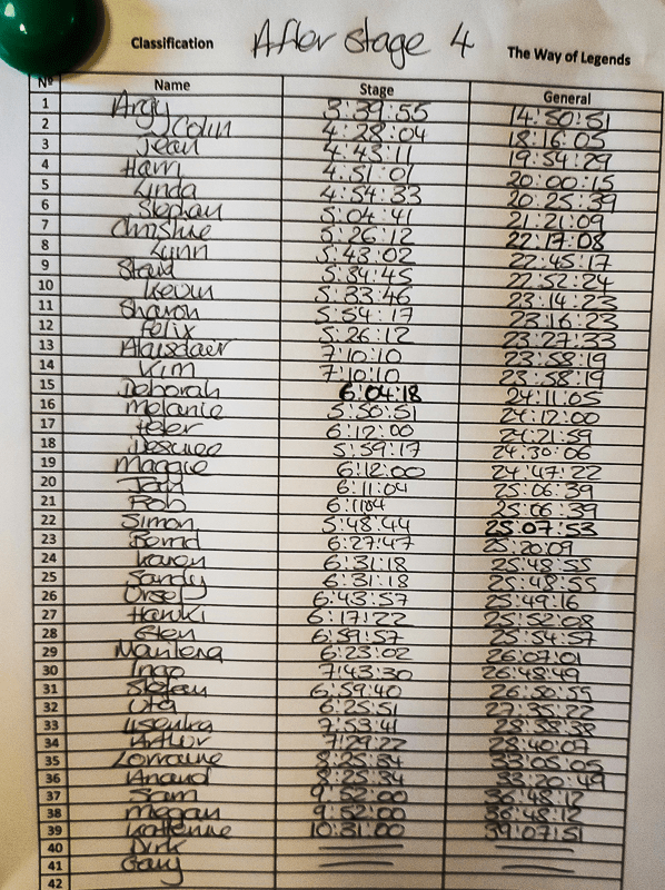
I was on a seemingly endless white path and was a little confused. As I said, I didn’t pay enough attention to the race briefing and remembered a big road crossing being mentioned. I was getting close to the end and I couldn’t see a big road. Thinking about it, the course was a loop and as I hadn’t crossed a big road previously, why would I be crossing one now? The big road crossing was on a later day and had been mentioned only in passing. However I was now slightly losing confidence and when I didn’t see a marker for what seemed like a while, I doubled back to make sure I hadn’t missed a turn. The next marker was about 20m beyond where I lost confidence… Anyway I continued along the endless track until it ended and I was back in Ros. I was a very long way behind Argy (45.5 minutes) but how far would I be ahead of Felix? 31 minutes later Stephan arrived. Felix had slowed quite a bit and was another 18.5 minutes behind Stephan – I had a new person to worry about!
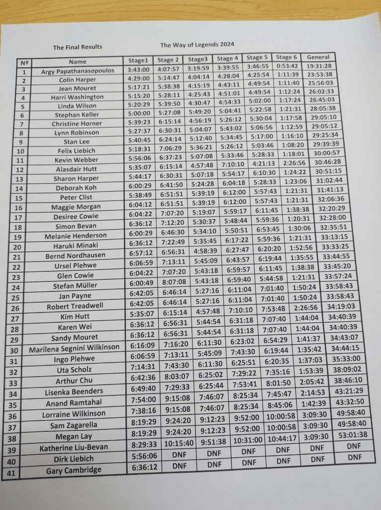
Stage 1 results
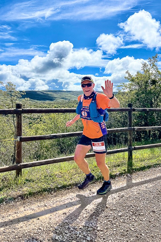
I chatted to Argy at the finish whilst we refuelled. He was very modest about his achievements but Leadville, Western States, Badwater, Spartathlon – he was clearly in a different league to me. Don’t get me wrong, I would put completing the Winter spine on a par with any of those races as an achievement but that’s only one race, Argy’s running CV is more like a list of the biggest and most iconic races in the World. I would love to be able to say he is a conceited, arrogant, pain in the backside but he is also one of the nicest and most supportive guys I’ve ever met.
Manu came and spoke to me after dinner and asked if I would be OK with starting Stage Two an hour later with Argy. It seemed a bit of a stretch to me to suggest we were in the same league but equally starting later should give me a chance to see a few more people as I (hopefully) caught the steadier runners.
Stage Two was slightly shorter at 38km but it had 1600m of climb. It was more or less a steady climb for about 22km, a steeper climb for 9km to the top of Trigaza Sur, then downhill to the finish. There were again three checkpoints but only one control, on the peak.
The start was at San Juan Ortega, about an hour from Ros. Everyone else got on a coach but the ‘elites’ were driven to the start by car an hour later.
The start – everyone else was long gone
I can only describe the start as a Formula One car lining up beside a tractor (I wasn’t the F1 car).
The ‘Elite’ start (Photo credit Run and Races)
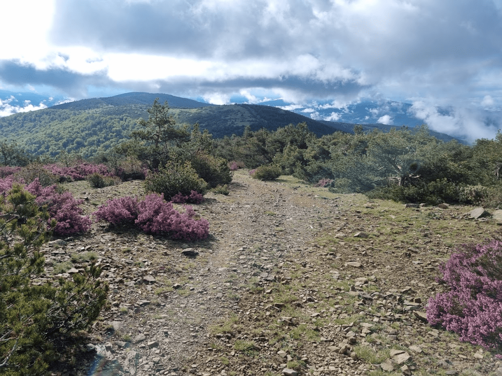
The first 5km was along the Camino de Santiago. I saw a few pilgrims but it wasn’t a great day for a pilgrimage, grey and drizzly. I struggled with the gradual uphill and was happy when I eventually started to catch a few people and could at least exchange a few words. I was happy to see Bluebells though.
Spanish Bluebells!
There was a kit check at the final checkpoint to ensure we had our foil blanket and fleece as we were heading into some fairly inhospitable conditions. I was actually quite happy to start ‘proper’ climbing, unfortunately the low cloud obscured most of the views, although the occasional break gave glimpses of what might have been.
Almost a view
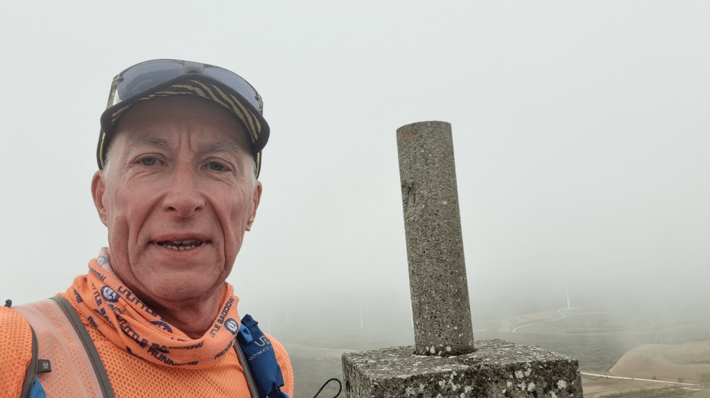
The peak is 2085m high and still had a little snow on it. I won’t post the selfie I took here – I just look miserable with a grey background.
Trigaza Sur
I don’t remember much about running down so I guess it was OK. We were spending one night at a mountain lodge in Pineda de la Sierra. It was cosy but the top three men were given the comparative luxury of a separate room with single beds rather than bunks and its own bathroom! It also had a two bed room off the main room which was given to Felix and his Dad, Dirk. Dirk had badly torn a muscle and was out of the race so Argy felt they might need a bit of comfort so we gave them the room. Gary had got wet and hypothermic and so was also out of the race, the second stage had taken its toll.
Stage 2 results
Stage Three was a kind of a loop. It returned to the village of Pineda de la Sierra but then went out of the village in an uphill kind of direction to what had been a ski lodge called Refugio Valle del Sol. The stage was ‘only’ 30km long but had 1700m of climb. Today’s high point was San Millan at 2130m. There were the usual three checkpoints as well as two controls.
Argy was to start an hour later than the main start again. I had been given a choice of start time and went for 8:30. I hoped this would mean I would get to see around 30 of the other runners during the course of the day. It also meant I could see how far I could get before Argy caught me. Despite starting later, both myself and Argy went out for the group photo at the very picturesque Church of Saint Juliana.
Happy runners!
It was slightly strange starting alone. I don’t remember exactly when I started to overtake people but by the first checkpoint I was working my way up. I passed Felix on the way into the first checkpoint and caught Sharon on the start of the climb up from the checkpoint to the mountain peak. On my way up I looked round and saw that Felix had passed Sharon and was hot on my tail. I pushed harder and managed to remain ahead but it was a reminder that I couldn’t take my second place for granted.
At the top – look at that….ah, sorry
The mountain top was again shrouded in mist but the run down was great fun, especially as the mist cleared a little.
Starting to get some views
I really enjoyed the run down.
Loved this track
Even the water crossing!
Trying not to make too much of a splash (Photo credit Run and Races)
All was good until I was back in Pineda de la Sierra and the final climb. As it was it wasn’t anywhere near as bad as it was for someone else but I did start to struggle. The climb was quite hard but the struggle was more of a mental one. The path steadily climbed through a forest. According to my watch I thought I should have only around 500m to go, however all I could see were apparently unending trees. Had I miscalculated? Was the road book wrong and the stage longer? To be fair the distances given each day were fairly spot on but these are the doubts that can creep in. Fortunately the trees started to thin out and I could just see the top of a roof – I was now desperately hoping that was the finish and not just a random building. Fortunately it was, Stage Three was complete!
I mentioned that someone else had a significantly tougher final section than me. That someone was Stefan. He didn’t realise you had to go through a wire gate, ran along another path instead, unfortunately eventually found tape left from another event two weeks previously and followed that, adding 11km to his day. This dropped him to fourth male and, in a repeat of 2018, moved Jean up to third.
Stage 3 results
The fourth stage was a loop from the lodge. It was similar to the previous stage in that it was 31km with 1700m of climb but today the climb came in the form of two ‘short sharp shocks’. The first was straight up, what had been the ski slope back to the lodge, to a ridge. This was a climb of 400m in a distance of 1.2km, quite a steep climb. The second was back up onto the ridge from the other side. We were warned this would seem never-ending. It was actually about a 600m climb over a distance of about 4.5km. In between we followed the ridge for a while before dropping down on the opposite side to the lodge – hence the climb back up. As before there we three checkpoints along with three controls.
As on the previous stage, I started at 8:30am. This seemed about right as on Stage Three I had caught most of the other runners but not all. It also meant I got to watch everyone as they set of up the ski slope.
Heading to the first climb of the day
I went out slightly early for my start so I could get a picture of the runners still on the slope – which was most of them. I went to take my phone out of my pack, ran back into the lodge to get it, quickly took a photo and set of in hot pursuit of the main pack.
Climbing the ski slope
The climb up was tough. Not only was it steep, the forest track gave way to loose rocks. It wasn’t dangerous but it did require care. I think it took me about 25 minutes to get to the top. I think I passed Megan and Sam just before the top and Kate as I reached the summit. I loved catching up with these wonderful people because they were always so positive and supportive as I passed them. Sam and Megan were from Australia. Megan had done these kind of event before but I think it was Sam’s first time. Whatever, they always had friendly encouraging words for me. Kate was at the Way of legends the last time I’d done it. She DNFed that time but was determined to succeed this time. She was also very supportive and had a hug and a kiss for me as I passed her each day. Ultra races are a different challenge for different people, some of us are looking to run as fast as we can, others take more time and probably see a lot more of the scenery.
Speaking of the scenery, I was hoping for less cloud than on the previous days and it looked like my wish was being granted, at the top of the ridge I could just see back down to the lodge.
Looking down to the lodge
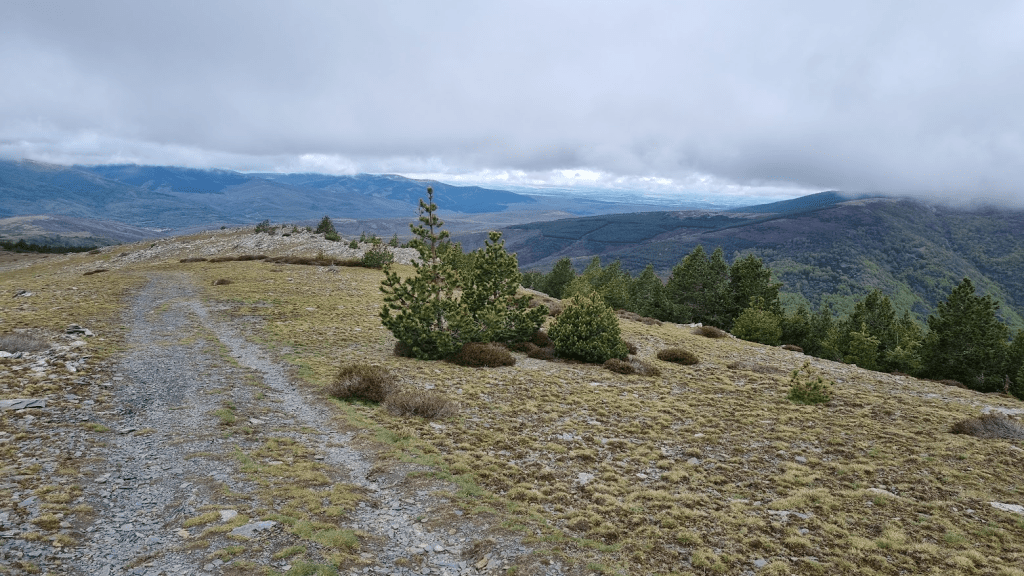
The mist soon cleared some more and I was starting to get views along and off the ridge. Running along the ridge was great, easy track and overall downhill. I should have enjoyed it, I am a Ridge Runner after all!
Looking along the ridge – nice path!
Today’s selfie at the top of somewhere – much less mist but still no smile
The path descended through some forests and was very easy to run.
Flying through the forest! (Photo credit Run and Races)
The path continued to descend and passed through what seemed to be farmland. At some point Argy cheerily passed me and ran off up a hill I had every intention walking up.
Weather definitely improving!
The track was still quite wet in places
The path seemed to be undulating with the odd climb and I was starting to wonder if Manu had been exaggerating when he claimed we’d have a ‘never ending’ climb to the ridge. Sadly he wasn’t. The climb was everything we had been lead to believe. Fortunately over the course of events such as the Spine Race, Lakeland 100 and the Cheviot Goat, I’ve had a lot of experience of endless climbs, however this one was definitely right up there with anything I’d done before.
Looking back from the top of the ‘endless climb’
I was slightly reminded of Cross Fell on the Pennine Way. Not only was it a very long climb up but once I’d got back onto the ridge I had a further undulating climb up until I reached the checkpoint. Fortunately from there I could leave the ridge at the final checkpoint of the day and drop back down towards the lodge. The path required some care as it was steep and rocky in places. After the steep and rocky bits it was just a case of carefully following the markers onto the road to the lodge. I started to rain a little but as I was within a mile of the finish and sheltered by trees I didn’t feel the need to put my waterproof on.
Stage 4 results
For me, the day had gone quite well, the weather had been better and I’d increased my lead over Jean by 15 minutes. However for others it hadn’t been quite as plain sailing.
When passed Kim and Ali I had seen they were walking but hadn’t notice Kim was limping quite badly. She had fallen and pulled her hamstring. Actually she had torn two of the three muscles that make up the hamstring off the bone and the third was hanging on by a thread. This was obviously not good news and meant that not only was her defence of third place female over, her entire race could be over.
While I was dozing after finishing, the rain got heavier and developed into a thunderstorm. Three people, Megan, Sam and Kate were still on the mountain. Obviously this was far too dangerous a place to leave them so Manu deployed some of the resources he had put in place, in the form of two four wheel drive buggies, to get them off the mountain and down to safety.
Safety buggies
Stage Five was much more like the ‘old’ Way of Legends. It was 43km with 600m of climb but also 1100m of descent so finally we were going downhill! It also finished at the monastery of San Pedro de Cardeña, a place I was familiar with from my previous Way of Legends experience. For the last time I would be starting 30 minutes after the main pack, with Argy starting 30 minutes later. As usual there were three checkpoints. This stage also had two control points.
The best news of the day was that Kim was going to continue. Ali would run on his own and she was going to walk a full marathon with a torn hamstring just to keep her Way of Legends alive – a true Legend if ever there was one.
The first tracks down from the lodge were through some woods and actually reminded me very much of the woods of Little Baddow, surely a good omen for the day?
Look a lot like Little Baddow!
This morning when I passed Megan and Sam they held their walking poles aloft to form an arch for me to run through and were singing ‘By the Rivers of Babylon’ for reasons which made sense at the time but which I won’t try and explain. I also passed Kim quite early on. She wasn’t exactly moving easily but she was smiling and being very positive.
A significant part of the stage was along a path built along the route of an old railway line. It was quite easy running and we finally had some nice weather.
Blue Skies!
Smiling! (Photo credit Run and Races)
After the disused railway, the underfoot conditions became slightly more challenging. The mud was mostly avoidable but there were a lot of large puddles and slippery sections to be negotiated.
Very pretty countryside
Some of the latter parts of the stage had some very slippery and very sticky mud which was impossible to avoid – once again I was reminded of Little Baddow, this time the fields in winter rather than the woods. This gave way to a solid track which I was able to run along until I reached the monastery and the finish of the stage.
The Monastery of San Pedro de Cardeña
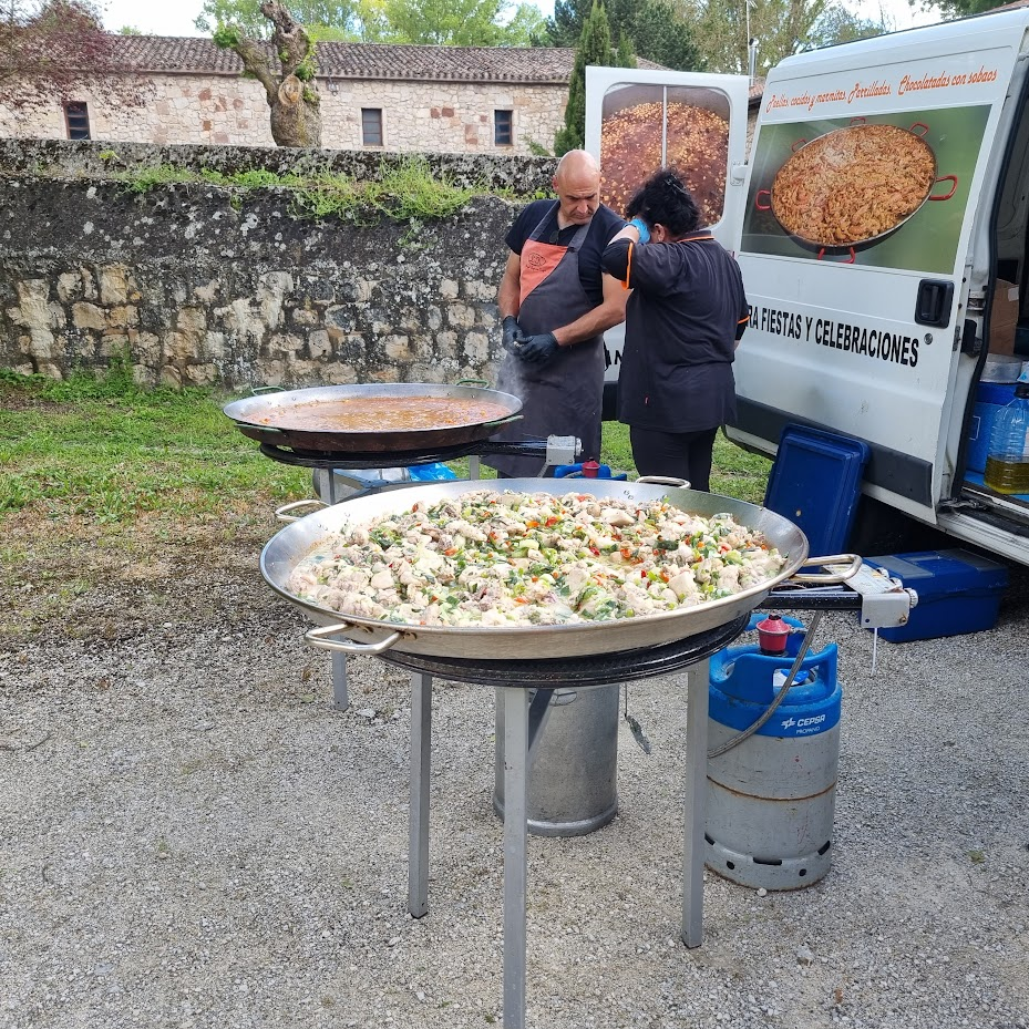
Unfortunately the amazing Way of Legends kitchen team aren’t allowed to use the kitchens at the monastery so Manu arranged for the delivery of a couple of small paellas for us…
Dinner!
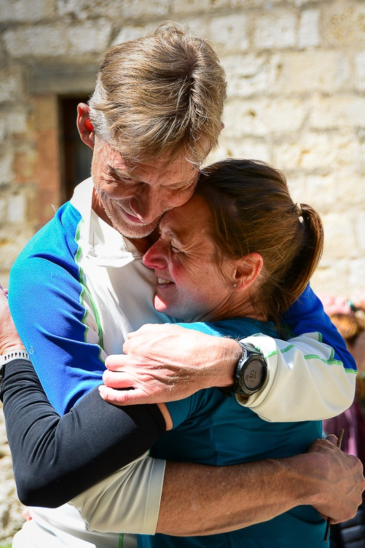
Ali had made the most of running on his own and finished second overall to Argy. Kim’s strength and determination saw her through to the finish a few hours later for a touching reunion on the finish line.
Well done Kim (Photo credit Run and Races)
One of the optional activities at the monastery is to go to evensong. I’m not even remotely religious but there is still something very uplifting about watching and listening to the monks so I went.
Evensong
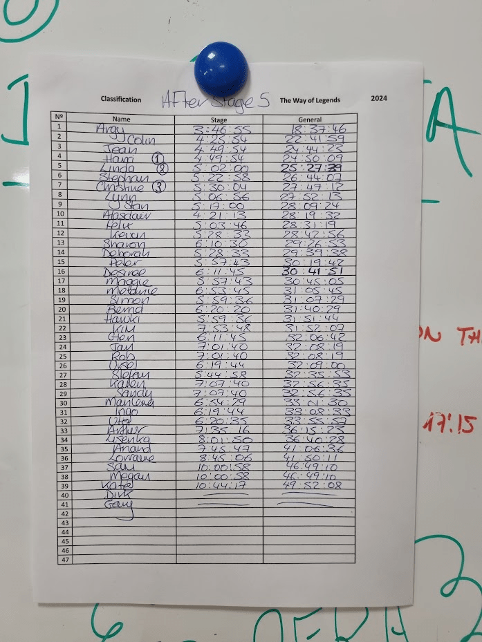
Stage 5 results
The final leg was exactly the same as the 2018 Way of Legends, in fact I believe every edition of the Way of Legends has finished with a 13km trot from the monastery to Burgos cathedral. There was to be 200m of climb and 300m of descent, trivial compared to what had come before.
13km to becoming Legends! (Photo credit Run and Races)
Unless something went badly wrong, the men’s podium was settled. I would need to beat Argy by four hours to get first, Jean would have to beat me by two to get second and Stefan would have to beat Jean by two hours to deprive him of third place.
Two, One, Three, Go!
The women’s race wasn’t quite so settled. First and second looked fairly decided but Lynn was only 5 minutes behind Christine, who was third. Lynn let it be known she was up to the challenge and would be racing for third place on the last leg.
On the last day everyone starts together and the volunteers can also run (or cycle). The photo sequence is courtesy of Run and Races – well the photos are, the silly captions are entirely my own work.
Surely this is cheating?
‘What do you mean someone’s on a bike?’
Blatant!
‘You can take your bike but you’ve got to push it’
Argy blazed of into the distance in pursuit of the course record. I started further back but soon found myself running alone in second place. As I didn’t need to race I took a few photos on the way.
Into the trees
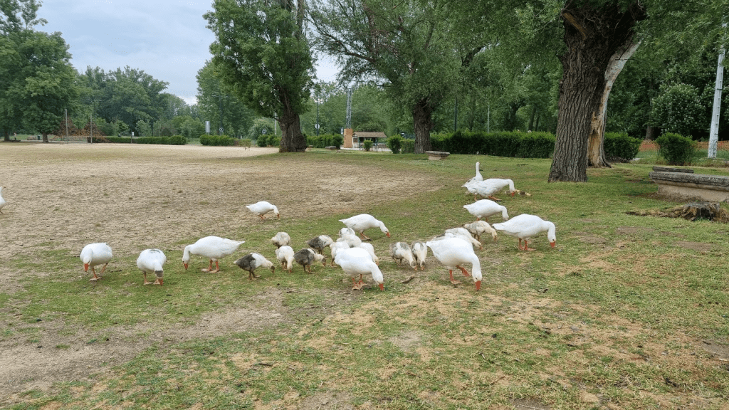
All the ducks are swimming in the water…
…but the geese aren’t
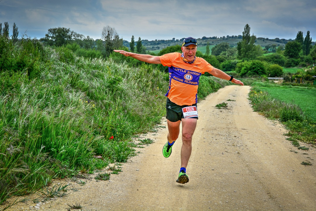
I also managed to pose and even smile for the camera on the way.
I’m flying! (and smiling, which is more strange) (Photo credit Run and Races)
As Burgos cathedral came into view, Jena and one of the volunteers, Matt, caught up with me. We ran together towards Burgos with the plan we would all cross the line together. However…
As we crossed the final bridge, Jean suddenly accelerated, I wasn’t having that so I accelerated (and nearly took out a mobility scooter apparently). The net result was I went flying straight through the finish barrier and completely ruined the finish photos.
Sprint finish (Photo credit Run and Races)
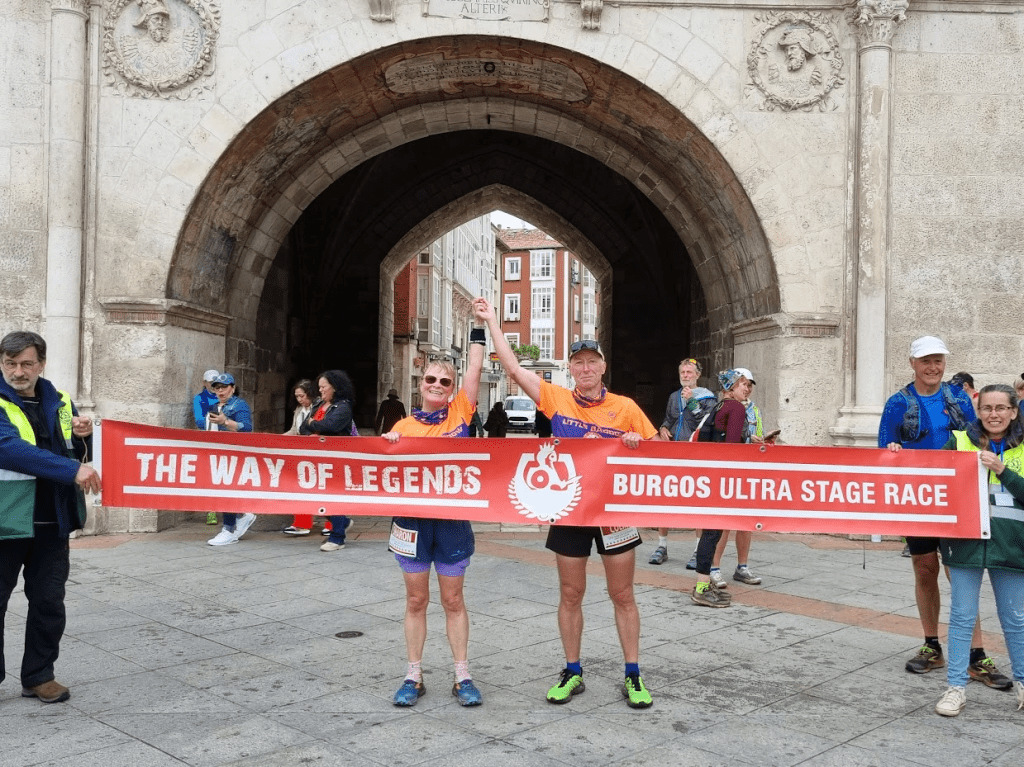
Sharon finished about ten minutes after me at a much more sensible pace. We posed for a finish line photo in our Ridge Runner shirts.
Ridge Runner Legends
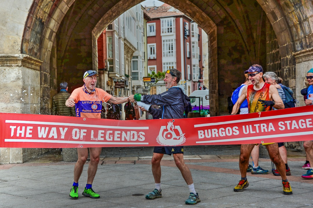
As is traditional everyone stayed at the finish until everyone had finished. One advantage of having a Frenchman on the podium is that champagne will appear from somewhere.
This is how you celebrate finishing an Ultra! (Photo credit Run and Races)
Lynn missed out on third place by an agonising two seconds. Despite only having one working leg, Kim completed the last stage to become a very definite Legend. Our last classified finisher was Kate, this was the first time she had managed to complete a multi-day ultra so it was a huge achievement, especially as she was out in some much worse weather than I had to deal with.
The Class of ’24
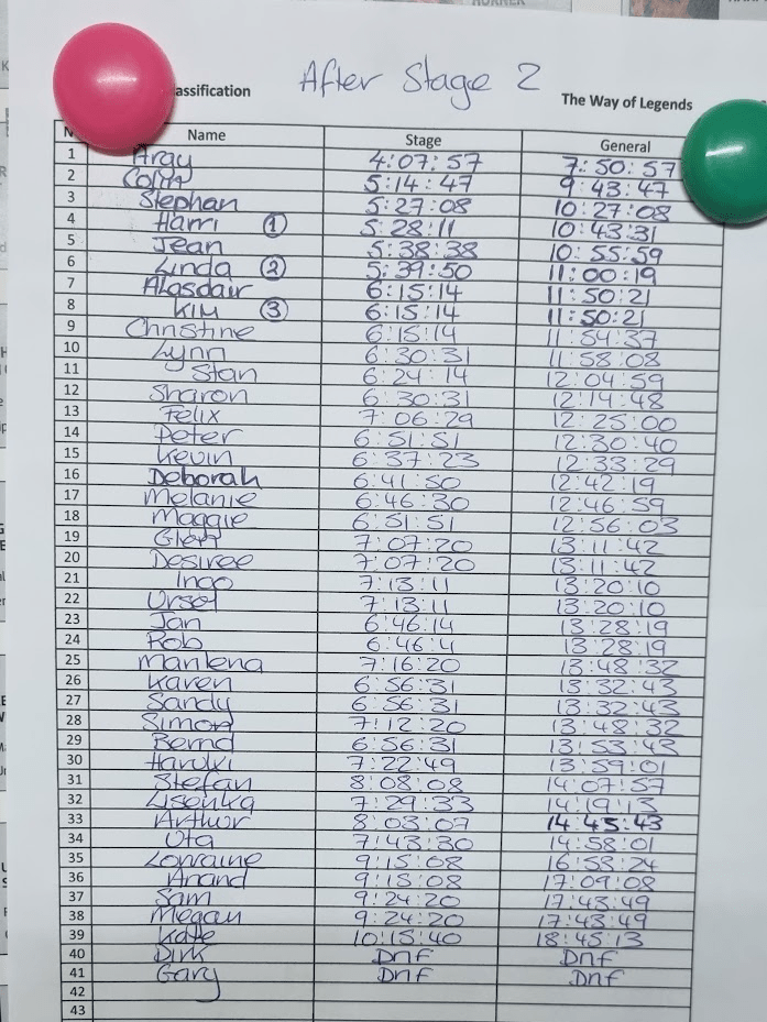
Final Results
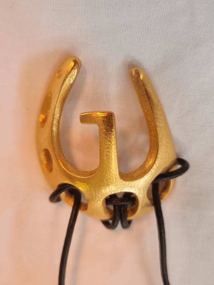
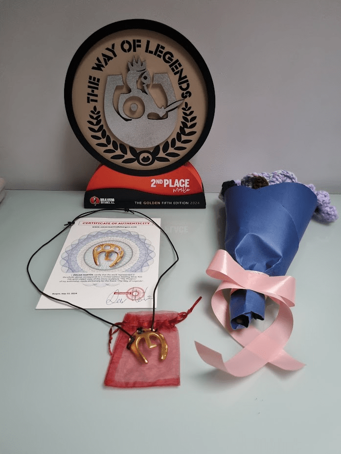
The penultimate ‘stage’ of the Way of Legends is the prize giving. This involved food, wine, and medals. The position of the Way of Legends as one of the best and most unique races I have ever done is cemented by the medal. It isn’t a medal, it is a micro-sculpture, totally unique and the only medal I wear as an item of jewellery.
The Fenix
It is made by a very talented local artist called Oscar Martin de Burgos. It’s called the Fenix and is solid silver. For the Golden Edition of the Way of Legends it was plated with gold. This made me very happy as I have a silver and a gold version. I was very honoured to receive mine from it’s creator.
Getting my medal (photo credit Run and Races)
As I had finished second I also got a trophy and some rather nice hand crocheted flowers from Manu’s daughter.
My winnings
I said the meal was the penultimate stage – the final stage was the party. What happens in Burgos stays in Burgos but there was some alcohol, a conga line, and some dancing on a shelf just to give you an idea…
Anyway….
Shelf dancing with only three working legs between us!
Everyone loves a Conga!
The evening finished with a rousing chorus of ‘We are the Champions’ and we all staggered off back to the hotel – which fortunately wasn’t very far away.
This is the bit where I get to all the thank yous – except that this time it’s easy, every single person involved either as a competitor or volunteer made my experience better, so thank you all. If I have to pick out anyone the Laura and Helen for bullying Manu into running the race; Maria, because she is lovely and never objected to my sweaty hugs at the end of each day; and of course Manu for doing as he was told and putting on just the best race. I would also like to thank Hannisze Xuanyi Yong for her wonderful photos (all the Run and Races credited photos in this blog are from her).
The last word as ever is saved for Sharon. I haven’t mentioned her much but she had a great race and finished fifth female. She also of course got me to the start and did all the logistics so I could just turn up and run. Our next adventure is back on the Pennine Way for the 2024 Summer spine Challenger South, 108 miles for which the only way will again be Pennine!
Sometimes I run a race and it’s so hard that at some point during the event I declare it a ‘one and done’ and vow that I will never do it again as long as I finish this time. My first Lakeland 100 was definitely a ‘one and done’ – I’m going back for my fourth this year and am intending to get my slate by doing number five next year.
I thought the Fellsman might have been in the ‘one and done’ category too – except that the 60th Fellsman was exactly four weeks after my 60th birthday and it was about 60 miles (hence the title of this blog, three 60(s)). As a result there was a certain inevitability to me heading up to Threshfield on Friday afternoon for the race on Saturday.
Carb loading on the way up – noodles and katsu curry
Anyway the Fellsman is a bit different to most races I’ve done. It’s old, very old, older than me even, it started in 1962. Due to Foot and Mouth causing 2001 to be postponed and the 2020 and 2021 events being cancelled due to Covid, 2024 would be, as previously mentioned, the 60th time it had happened. It’s also not run by a running club or an events company, it’s run by the Keighley Scout Service Network. I also doesn’t have a fixed route. As a result I had spent a certain amount of time looking at where I meant to go last year, where I actually went, and where I thought I might want to go this year. I also had a new running watch compared to last year, with a battery that, in theory, would last over twice as long as the race. I tweaked my route to try and ensure I could make a whole new set of errors this year rather than simply repeat last years, and uploaded it to my watch.
I don’t know if anyone involved with the Fellsman read my blog from last year but the kit list did have a few changes for the better. Five tops were still required. I was slightly concerned as to how a ‘fleece’ might be defined at kit check. I know from the Spine that the OMM Core Jacket provides incredible warmth but even I would admit the fact that you can see daylight through it doesn’t make it look that warm! Some races specify a minimum weight of fleece. I don’t agree with that either – a cheap fleece made of poor materials will almost certainly be quite heavy but not a lot of use on Buckden Pike in the middle of the night in a storm. There is no doubt the development of ever lighter, higher performing more technical materials makes it harder and harder for event organisers trying to ensure people have kit which meets the spirit of the kit requirement and not simply the letter.
All my compulsory kit – plus a few bits that weren’t
Last year I ran in Inov8 X-talons and whilst I loved the grip they did batter my feet somewhat. This year I had considered the new Inov8 Mud Talons but they had rubbed my ankle a bit on a trail marathon a couple of weeks previously. Although little of this was actually on the Pennine Way (those that know can guess which bit of the Pennine Way I did find myself on at one point…) it was classic Spine territory. As a result I took the sensible option of Roclite G320s, Hemy waterproof socks and Runderwear anti-blister socks as liners – exactly the set-up that had carried me through the winter Spine Race with relatively little damage to my feet.
Some other random stuff I thought might be useful – I didn’t take the hula hoops though
The food requirement was now an amount of calories rather than simply a weight, which I felt was far more sensible. I carried 80 grams of peanut butter buttons to meet the 500 calorie requirement – a vast improvement on the 300 grams of food I had to carry the previous year! There was also now a requirement to carry water.
Kit check – it got MUCH busier later!
Last year I used my 20l Fastpack and everything fitted easily. however I had noticed that many people were using significantly smaller and lighter packs so this year I was using my Adventure Vest. All my kit fitted, it was more of a squeeze but with a bit of thought I managed to arrange it all quite sensibly, with anything I might need in a hurry reasonably accessible. I then carefully unpacked it all into a black holdall ready for kit check. Last year I had arrived at kit check with my pack carefully prepared and then had to empty it all over the floor so the contents could be checked. This year I could empty the holdall and refill it as each item was checked. This seemed to work, my fleece and other long sleeved top collection wasn’t questioned. I got my kit check paper and went back to the hall I would be sleeping in to try and remember how I had packed my pack, and why it seemed to be only half the size it had been at home.
My bed for the night – no gym mats this year though
I got a little sleep but not as much as I would have liked. I don’t know if it was the lack of a gym mat under my mattress this year, or simply the fact that a screwed up down jacket makes a fairly lousy pillow, but sleep was slightly elusive.
The next morning I was up at 5:45 in time to hunt down a bacon roll before it was time to catch the 6:30 bus. Another lessoned learned was to make my toilet trip a bit earlier this year – I nearly missed the bus last year.
Bacon figures heavily in my ultra-running nutrition plan
Despite my improved scheduling, it was still standing room only on the bus. I sat on the floor at the back and gained an interesting perspective on life for the trip.
Standing room only – so I sat on the floor
Once I got to the start there was a bit of queue so I joined the back of it. Then someone told us this was the queue for kit check so a few of us tried to join the queue for registration. Turned out that the first queue was actually the queue for registration so I joined the back of it again. Apparently if anyone had entered a group of people it had given them all the same name and so much manual processing was having to be done to correct this – hence the long queue.
Eventually I was at the front and got given a number, a plastic disc, a fake wristwatch in orange and a GPS tracker. The plastic disc was my tally. Back in the day this would have been the only way my journey would have been recorded, the disc has 25 sections around the side and is clipped at each checkpoint. The 25 holes indicate that you have visited all 25 checkpoints. The clippers create different shaped holes at different checkpoints so you can’t cheat and make holes yourself. The ‘wristwatch’ is actually a transponder which is swiped over a box at each checkpoint to record your visit. The GPS tracker is a GPS tracker and allows people to occasionally see where you are on a web page. I say ‘occasionally’ as, probably due to poor phone coverage, I was told afterwards that tracking updates were a bit sporadic to say the least.
The issues with the entry system meant that the race started at 8:55 instead of 8:30. It is still the only race I’ve ever been part of where on the word ‘GO!’ everyone runs in different directions. Terry and I had positioned ourselves near the bank leading to the same gate as we’d used last year. It wasn’t that I felt I had to be near the front, it was simply to avoid any queue to get through the gate.
I appear to have a large flag attached to me…
Although the weather forecast wasn’t great, and it was a very cold morning, at least it was clear and I was rewarded with some great views as I made my way up Ingleborough.
Great views
Fairly sure that’s the Ribblehead Viaduct in the distance
Last year was my first ever trip over Ingleborough and I found if fairly terrifying, I caused a huge traffic jam with my nervous descent. This time it was better. I still wasn’t exactly fast off the top but at least I didn’t have quite such a steady stream of people overtaking me. For reasons I’m not totally sure of but that probably have a lot to do with incompetence on my part, I had marked Checkpoint Two (Hill Inn) in the wrong place on my route. Had I followed my route to the letter, I would have missed it altogether. However this was still near the start of the race and there were a lot of runners around me so I was really just following rather than looking too much at my route and so I did actually visit the checkpoint, get checked in at have some food and drink.
Heading towards Whernside
Still getting nice views but the cloud is building…
After Whernside it was all the way back down to the Kingsdale checkpoint for more drinks and biscuits in preparation for the climb up to Gragareth. Gragareth is by no means one of the highest points on the route and on paper the climb up doesn’t look so bad but I remembered it from the previous year as being particularly tough and it didn’t disappoint. I took a photo but it doesn’t really show just how hard work this climb is.
Climbing up to Gragareth
Gragareth is slightly ‘out and back’ so I did my good deed for the day by preventing a couple of runners from turning right at the stile and missing it altogether.
After Gragareth the route follows a wall towards Great Coum. It’s one of the boggier sections and last year I managed to fall in a bog. Just to prove it was no fluke, I fell in one this year as well. After Great Coum it’s on to Flinter’s Gill and ultimately the ‘Track of Doom’ into Dent. The ‘Track of Doom’ is a particularly unpleasant ankle twisting rocky downhill path which no-one enjoys. Terry apparently found a way to avoid it completely, which was nice. If I do this again next year I may have to ask how he did it.
At Dent, I got my tally clipped, swiped my Felltracker and waited. One of the marshals inquired what I was waiting for. ‘Where’s kit check?’, ‘Can’t tell you, it’s a secret, its not here though’, ‘Well it was last year’, ‘We wouldn’t put it in the same place two years in a row would we?’, ‘I don’t know, this is only my second time’. Anyway a nice man made me some coffee, I ate some beige food, stuffed a sausage roll in my pocket for later and left.
Phone box at Dent – somewhere between 1952 and 1955 vintage
After Dent it was a few miles along the Dales High Way and possibly the Craven Way too until I reached the ruin that marked the start of the first of what I had called last year, the ‘Brave and Bold’ sections – those parts with no marked path on the map. I mainly managed to follow a ‘trod’ – a path made simply by a general consensus of previous walkers that this was the route they would follow – and reached Blea Moor without incident. After Blea Moor I took a slightly more direct route back to the Bleamoor Tunnel footpath that I had the previous year. The ‘trod’ came and went but even where I lost the path it was still fairly easy to cross. The Bleamoor Tunnel path went through some fairly ugly plantations and dropped down around the tunnel entrance.
It was at this point that the highest point of the event occurred. Better than finishing, even better than a phone box. Well OK, perhaps not quite but I saw smoke and steam in the distance and decided the race could go on hold for a minute or two.
What a sight!
It was ‘Tangmere’, a ‘Battle of Britain’ class locomotive, hauling the ‘Northern Belle’, a train of luxurious Pullman carriages in which a fine dining experience was happening.
Quite pleased with this considering it was a ‘point and hope’ kind of photo
As I grew up with model railways and a Dad obsessed by steam trains it brought back a lot of memories. The ‘Battle of Britain’ class was designed by Oliver Bulleid for the Southern Railway and this particularly fine example was built by the Brighton Railway Works 1947. She was a long way from home but a magnificent sight nonetheless.
I continued on to Stonehouse, more food and drink, and, as it turned out, the location of this year’s kit check. I would like to take this opportunity to say that the lady that did my kit check was amazing. She was happy to simply see enough to convince herself that I had the kit and kept telling me not to completely unpack things. The result was a quick and efficient check and I wasn’t left with a pile of kit to try and squash back into my pack.
After Leaving Stonehouse I walked up the road, went back to the checkpoint, picked up my poles, walked back up the road and started the two and a half mile climb to Great Knoutberry Hill, which is roughly the halfway point of the Fellsman.
The climb involved going through the Arten Gill Viaduct. Last year I did this section in the sunshine, this year it started raining. I had been wearing my waterproof from the start so it didn’t make much difference to me but most of the runners around me stopped to put jackets on. I don’t know if it was simply an advantage conferred by using poles (not many of the people around me seemed to have poles) or whether I’ve got quite good at hills, but I overtook many people on the trek up (most of whom promptly overtook me on the next downhill section).
Arten gill Viaduct
After Great Knoutberry Hill, I was fairly convinced I would retrace my steps to the Pennine Bridleway rather than take a slightly more direct path to the checkpoint at Redshaw. Last year I’d tried the direct path and seemed to veer off course a bit and took quite long loop round. However everyone in front of me went straight onto the trod and so I just followed. I did have more idea of where I was heading this year so I did manage to follow a fairly reasonable line to the checkpoint. After more food and drink I carried on for a mile to the checkpoint at Snaizeholme and then on to Dodd Fell. Getting to Dodd Fell involved being on a short section of the Pennine Way. Sadly it was the Cam High Road, easily my least favourite path in the UK and possibly the world. However unlike the Spine Race, I only had to follow it for just under a mile, not about eight.
Coming down from Dodd Fell was another ‘Brave and Bold’ section. It was the last one I had a significant concern about as I knew that ideally I wanted to cross the wall I walked all the way round last year to save time. There were several of us on the fell and I quickly realised that few of them really had much more of an idea than I did as to the way to go. Fortunately I saw a group of three female runners (at least one of whom hated the Cam High Road as much as I did when I spoke to them earlier) heading purposefully to a point in the wall. The wall had slightly collapsed and it was fairly easy to duck through. I crossed the Cam High Road and continued to the Fleet Moss checkpoint and more food and drink.
Due to access issues, the next three miles were on tarmac and downhill. This isn’t great on legs that have already covered 36 miles of up and down, and it adds around a thousand feet to the overall climb on the event. It’s not all bad, it did mean I got to pass the rather sorry looking phone box at Oughtershaw.
This could do with being taken to a good home for some care and attention – my back garden would do.
The sun was starting to go down so it didn’t look like I’d get much of a sunset as I would be quite low down. However it was quite a pretty valley.
The River Wharfe
After leaving the Deepdale checkpoint the setting sun lit up the ground ahead of me quite beautifully.
Evening sunlight
I saw several runners on the way up to Chapel Moor. It was a very arduous climb and there didn’t seem to be much of a consensus on the best route. Looking back at my GPS trace, I appear to have taken a fairly direct route, possibly more by luck than judgement. The route to the next checkpoint at Hell Gap (not as awful as it sounds) was straightforward as it simply involved following a wall. From there it was a wide track downhill to Cray and yet more food and drink.
It was more or less dark by the time I got to Cray so I had my head torch out when I left. The next section was up to Buckden Pike, the penultimate big climb of the Fellsman. It involved passing Cray Gill, or Cow Close Gill, depending on which map you look at. Either way the choice was to go North or go South. Last year I meant to go South, went North, tried to go South and ended up in the Gill with a steep and tricky climb out. This year I’d decided to go South again, although I’d heard people discussing this on the bus and North seemed to have a lot of support.
As it was I kind of followed some people and ended up going North anyway. It was a fairly straightforward and direct route so if I go back next year I’ll probably go that way deliberately. At least this year I resisted the temptation to climb down into the gill. After you get to the end of the gill and hit the wall, there is absolutely no necessity to cross the wall, even if there is a gate (or it may have been a stile). As I was now the wrong side of the wall I ended up climbing it at the top of the slope. As I climbed the wrong wall I arrived at the checkpoint looking over the wall at the marshal – who kindly directed me to a nearby stile. I went back and got myself logged in at the top of Buckden Pike, the darkness mostly hiding my red face.
By now it was quite misty. I was using the Fenix head torch I had used on the Spine Race so I had no worries about how long the battery would last. The mist also gave me the opportunity to try a feature on my torch I’d never used before, the ‘warm white’ LED light. Mine was the latest version of the HM65R. The previous version had two conventional ‘white’ LEDs, one as a spotlight and one as a wider beam. I almost bought the older version as I couldn’t see the point of the ‘warm white’ LED. However I felt the if Fenix thought it was an upgrade I should give it a go – even if I didn’t know why. I was later told the ‘warm white’ was to give better visibility in mist and fog, well now I had a chance to find out. The visibility was only a few metres so I switched to the ‘warm’ light and yes, it was better than the ‘white’ light. It was a bit weird to start with but I soon got used to the different colour and appreciated the reduction in backscatter from the mist.
I’m blaming the mist for my failure to see the War Memorial again, I was entirely focussed on following the path. This was easy as it was a line of gritstone slabs – until it wasn’t. Despite this I found my way to Top Mere without any great drama (although I think I may have fallen in another bog – I definitely fell in bog somewhere in the dark but it may have been later on), although after my errors on the way up Buckden Pike I was constantly checking my route and questioning which side I should be on of every wall I came across.
After Top Mere I came into Park Rash, the penultimate ‘food’ checkpoint and the last one at which I intended to eat and drink. I had been slightly cold on the way and so, as the last major event was a climb up Great Whernside and hypothermia would be embarrassing at this stage of the event, I put on my woolly hat, warm gloves and OMM fleece.
I occasionally found the path up to Great Whernside but also spent quite a lot of time just trudging through grass and rocks, however so long as I was going up I felt I was kind of going the right way. I was also slightly regretting dressing so warmly as it wasn’t as cold as I’d expected it to be. Eventually I reached the Great Whernside checkpoint, which I believe was manned by a solitary marshal with a faulty radio. At Park Rash we had been asked to report that he was OK at the next checkpoint at Capplestone Gate, something I immediately forgot about.
From here it very much felt like the home straight, there was one more checkpoint and no more big climbs. Also some of the route was actually marked with flags and beacons. From the last checkpoint at Yarnbury it was only a couple of miles on a road to the finish.
I’d been checking my watch for a while and a sub-18 hour finish definitely looked to be a strong possibility. I ended up running the last couple of miles with another runner also looking for a sub-18 hour finish. I didn’t get his name (well, I might have done, but if so I was too knackered to remember) but from the results I would guess it was Ashley Ward. We dragged each other along and so this was one of very few ultras where one of my fastest miles was at the end. I can’t remember if I told him about my three 60 reasons for doing the race or if he noticed my badge but he asked me how I was still running like I was at the age of 60 as he was 44 and hoped to do the same at my age. I told him that the main thing is don’t stop. Also, anyone that says you are too old or you ought to slow down is not your friend. Unless someone can medically prove to me that I’m going to have a significantly poorer quality of life if I keep running then I’m going to keep going. Would I live longer if I stopped running? I’ve no idea but I do know it would feel one heck of a lot longer!
Anyway we made it to Threshfield without any incident. My official time was 17 hours 46 minutes and 52 seconds, over 90 minutes quicker than last year! Some of that was due to experience of the race and a slightly better choice of route in places. I don’t think any of it was due to the course conditions. It was just as wet as the pervious year, much colder and with poorer visibility after dark. I would like to think I’m getting better at ‘grim’ races as my friends call them.
Happy!
Terry had finished just over two hours before me but was awake when I went to find my bed. Sadly our other Ridge Runners had both retired, one at Dent and one at Stonehouse. It is a very tough race for those of us that live in Essex, there are simply no hills big enough and long enough to really subject your muscles to the load (both up and down) that they get running in the Yorkshire Dales. I’m lucky in that I spend several weeks a year running in Fuerteventura. Whilst the weather is quite different to the Yorkshire Dales, I do have the opportunity to run mountains of a comparable size and steepness. Obviously I have also gained a lot of experience of ‘grim’ races in the UK, two Summer Spines (one complete, one DNF), Summer Spine Sprint, Winter Spine, two Cheviot Goats, three Lakeland Hundreds and of course last years Fellsman. Considering I only started doing these kind of slower hillier races in 2021 I seem to have done a few!
Obviously I have to say thank you to the race organisers. A bit less queueing would have been nice but I do accept that at least some of it was due to circumstances outside the organisers control. The race is certainly friendly and has a great atmosphere. I do really feel for the marshals that are on the hilltops in a tent – especially those at Buckden Pike and Great Whernside as they are going to be out all night. However they were all still very upbeat and encouraging (and quite understanding when I was on the wrong side of the wall) so a big thanks to them for their dedication. Also all the ‘roadside’ (food) checkpoints are amazing. I mainly stuck to cake, biscuits and squash with the occasional coke and coffee thrown in but the variety of food available was unbelievable. While on the subject of coke, big thank you to the organisers, I mentioned it would be a good option in my blog last year and this year it appeared so thank you for that! I did even get a mention at the prize giving! Although the gentleman didn’t know my name or number he was aware I’d run with my 60th Birthday badge on and mentioned my three 60 rationale for running and I got a round of applause – which was nice.
Will I go back again, bearing in mind there is no ‘three 60’ justification next year? Probably. Why? I don’t in anyway feel I’ve ‘cracked’ this race yet. Yes, I have two finishes and yes, this year was quicker but I feel I’m still learning. This is why I started doing these races. I would never say an undulating 50km race on a marked route is easy but I know how they go now. I can still make mistakes but generally I know what I’m doing. The ‘grim’ races test me and they teach me. I still love Debbie Martin Consani’s comment about the Spine, you don’t train for it, you learn on the job. I’m still learning about these races and so I’m going to keep doing them, repeating them. I’m not expecting to ever ‘crack’ them but that’s part of the fascination. I’ve had real trouble accepting I’m 60, I’m now old and I can’t claim to be ‘in my 50s’ any more. However I’m not stopping, I don’t know what the age of the oldest Spine finisher is but one day I hope it will be me.
Anyway I need to stop writing and start packing. In a little over a weeks time I will be on a plane to Spain to take part in the Way of Legends, a 6 day stage race in the mountains of Spain! After that it will be the Summer Spine Challenger with Sharon, back to the only way being Pennine!
This is the post I probably shouldn’t publish as its really just me trying to organise my thoughts and make some notes before it all becomes a blur. However it might be useful or interesting to someone so I will.
Where to start? Lets start with kit – what worked and what didn’t. Overall my kit was good. The issues were more down to my inexperience and lack of relevant practice than the actual kit. What do I mean by ‘relevant practice’? Well, for instance, I’d practiced putting my Yaktrax on and off – mainly while sitting in a nice warm house, not tired and not wearing 5 layers. By the time I needed them I was well into the race, it was very cold, I had a lot of clothes on and generally at best I had a rock to sit on. Under these conditions it was a very different story, I could barely reach my feet, much less stretch bits of rubber over them! I think this was why my micro-crampons were destroyed – I didn’t position the wires correctly on the shoe and they got worn through by rocks.
Mangled!
Obviously running 200 miles to practice putting spikes on is a bit excessive but if I do it again I would certainly practice doing everything with all my kit on, probably outside, until I was absolutely confident I could do it without thinking.
Just to go on for longer than necessary about ice spikes, I’m not sure whether I would take more sets of Yaktrax and treat them as disposable, or whether I’d persevere with the micro-crampons (which did seem to offer better security) or go for the heavier micro-crampons with chains rather than wires. Winter spine 2025 has sold out so I’ve got at least nearly 2 years to decide.
Another item I hadn’t practiced with enough was ‘the big coat’. It was awesome, totally kept the wind out and was a great piece of kit. However one of the attractions was the pit zips for ventilation – which I discovered I had no idea how to open or close the first time I tried. The hood is very protective but fortunately I didn’t need to cinch it down too much as I had never tried to put it up while wearing a head torch.
The full 30l pack sat slightly lower than the 20l one I was more familiar with. This pushed the water bottles on the front higher which made getting a drink harder. The Lhotse jacket then got in the way making it even harder. As it was winter I wasn’t drinking that much so it was an annoyance but not too much. However this is another thing I really should have thought about and checked before the event.
When I first packed my drop bag it was about 15kg. My biggest fear before the race was that I would get cold. I don’t mean a bit chilly, I was worried about hypothermia. My nightmare scenario was this: My hands get really cold. When my hands get cold they don’t really work. I can’t operate the zips and clips on my jacket and pack. I can’t get my spare layers on and so I get really cold. Race ends wrapped like a turkey in foil blankets. Because of this fear I stuffed every warm layer I could find in my drop bag. I also bought an OMM Core fleece. My starting clothing was a Gore Thermal vest, LBRR long sleeve top, ME Switch gilet, NE Firefly jacket, OMM winter tights, Runderwear pants (too much information?), Runderwear socks and Hemy waterproof socks on top. I also had a LBRR buff and a Dexshell waterproof woolly hat. I had taken advice from Lindley Chambers about gloves and had a pair of waterproof Montane Prism gloves which I wore all race. I also had Buffalo Mitts and liners in case it got really cold but I never used them. Nathan Montague pointed out to me that if I wanted to keep my hands warm I needed to keep my core warm. He was, of course, absolutely right and I think my warm core was a significant contributor to my warm hands.
This saw me through the first leg. I think I might have added the OMM Core fleece for the second but the third leg was the one for which snow was predicted (and happened). I swapped the gilet for a Haglofs zip fleece which I’d bought about twenty years ago for skiing and put the OMM Core fleece over that. I swapped to the big coat (ME Lhotse jacket) a leg earlier than planned and that ensemble kept me plenty warm for the rest of the race. At CP4 I switched to Inov-8 winter tights as they were thicker. I wore my waterproof trousers (ME Zeno) when I needed more leg warmth. The full length zips were an absolute godsend when it came to getting them on and off.
Some of my kit worked absolutely perfectly – because I didn’t use it. My plan never included using my sleeping kit unless I was dropping out and waiting to be picked up. Now I know that the Pennine Way doesn’t really care what I planned but I went for the lightest sleeping bag (Nanga Minimarhythm Zero – no, I’d never heard of them either), The lightest mat (Thermarest NeoAir Uberlite short) and the second lightest bivvy bag (Mont Bell Breeze Dry-Tec – I couldn’t get the lightest, the Terra Nova Moonlite). These all sat in a dry bag long with my spare base layer top and bottoms at the bottom of my pack along with my poo kit – which I also didn’t use.
I didn’t use my stove either. I had practiced quite a lot with it but I never felt the need for something hot and as I was keeping warm by moving I felt stopping to make a drink or soup might be counter-productive. Anyway I had the Amicus stove (with built-in igniter) and a 650ml titanium cup, which held the stove and the gas canister. I also bought a titanium spork at the last minute which I added to the ensemble but I’ve no idea why as I also had a plastic one with each of my freeze dried meals (of which I ate one out of three at CP1.5)
My pack worked fairly well. I think going for 20l rather than 30l was a good call, but the 30l Fastpack does have some failings compared to the 20l version. The extra pockets are quite good but moving the access zip to be along the back panel is a retrograde step in my opinion – mainly because it is harder to close and (as I found) if you leave the zips in the wrong place they can come undone. However it was nice to not have to have everything perfectly placed just to get it done up – especially after checkpoint kit checks. The 1l waist pack worn backwards gave great access to my food, although sometimes getting my phone back in it was harder than it should have been. There may be better options than an old Montane Bite 1 pack but the two mesh pockets were great for short term storage, often my gloves but also litter. Whilst on this subject I would strongly recommend having an empty pocket or two that is easily accessible as you are likely to temporarily take stuff off, have empty cans or bottles etc. and its quite handy to be able to put them somewhere without having to take your pack off. My OMM winter tights had two decent thigh pockets, one of which was very useful when I bought a bottle of Coke from the Cam Lane tuck shop.
Starting kit
Big coat and more layers before leaving CP5
By the end, goggles, a balaclava and a bit of a lean had been added to the ensemble
One of the definitely not mandatory kit items (and possibly not allowed under a strict interpretation of the rules, although it remained sealed) was my hip flask. I took it on the Summer Spine full of Ballantine’s whisky in honour of my deceased Father-in-Law. I decided to do it again for the Winter Spine. I meant to drink it at the finish but forgot and drank it on Burn’s Night instead. I want to get the flask engraved with the Spine logo, just need to find a good engraver that can work on curved surfaces.
One of the interesting things I found was the difference between perception and reality. I’m not talking about hallucinations, I actually did fairly well at fending those of this time. I did see one or two people that turned out to be trees and bushes (I did also see a trig point that turned out to be a person) but generally I was remarkably hallucination free. What I’m talking about relates to my pace. I think its fairly usual that the first few miles of a run seem to pass quicker than the last ones. I think I did inevitably slow down towards the end of most legs but not as much as it felt like on some of them, along the river heading to CP3 I was shaking my watch to make sure it was still working as the miles seemed to pass so slowly. What was more surprising to me was the sections I thought I was ‘fast’ on. All things are relative so I knew I was unlikely to be doing more that 4 or 5 miles an hour but it was a bit of a surprise to find that my ‘dash’ down from Greg’s Hut was only about 3 miles an hour, average walking pace. Similarly, Gaudy Lane felt much quicker than the Cam High Road (it was downhill for a start) but looking at my GPS data there doesn’t seem to have been much in it. In reality it didn’t rally matter, the point was I hugely enjoyed my ‘fast’ bits and they seemed to pass quite quickly so ‘reality’ didn’t really matter. Personally I think reality is overrated anyway.
I’ve found it very hard to put into words why I went from ‘no, never, its pointless’ to entering the Winter Spine, its complicated and involves people, so lets skip to something more important – did I enjoy it? The answer is yes, definitely. It wasn’t even all Type 2 fun (the kind that isn’t fun at the time but is when you look back on it), much of it was genuinely fun at the time. Sunrises, sunsets, deep blue skies, being totally alone in the countryside, High Cup Nick, the Post Box Pantry, every Checkpoint, every marshal, friendly faces, reading peoples words of encouragement on my phone, I probably could go on but you get the idea. It wasn’t all great of course. I don’t need to mention the Cam High Road but the riverside from Middleton to Checkpoint Three was pretty awful. In many ways it was worse than the Cam High Road simply because in summer I love that bit and so to have it as an icy dark hell was doubly disappointing. I think also in my mind I’d decided I was almost at the CP at Middleton when in reality I still had 20% of the leg to go which didn’t help. The ‘grey road’ to Byrness wasn’t great but at least I had someone to talk to and it was light. However the euphoria of having crossed Cross Fell and eaten John Bamber’s legendary Chilliwack noodles meant I was in a very happy place going down to Garrigill. Garrigill to Alston wasn’t so good because of the diversion but equally I knew CP4, Rachel, Chris and lasagne were waiting, along with a bed and a shower and clean clothes so it was OK. One of the attractions for me of more ‘extreme’ races is the way you find out about yourself when things aren’t so much fun, you know these passages will pass but have you got what it takes to get through them?
So what does it take to do the Spine Race? Debbi Martin-Consani gave a brilliant interview on the Spine Facebook page before the full race started (if you watch it you can see me standing in the queue for kit check in the background). Apart from describing perfectly my feelings and activities in the lead up to the race she said ‘You can’t train for the Spine – you just learn on the job’ which I think is very true. On thing you don’t need to be is quick, from my Strava data my average moving pace was about 23 minutes per mile and I finished with over a day to spare so speed is not necessary. What is absolutely necessary is desire, I always tell people the main reason for not doing an ultra is because you don’t want to. In order to finish an ultra I believe that you really have to want to finish, it’s that desire that pulls you through the dark sections of the event. For the Spine Race you have to really, really want to finish it. In my view the answer to ‘what does it take to do the Spine Race?’ is the same things as to do any other ultra race, just with much more intensity. It is a really hard physical race but it’s your head that gets you to the finish line.
Will I be back? Well I’m already entered into the Southern Challenger with Sharon. I’ll probably have another go at the full Summer Spine. 2022 was redemption for 2021’s DNF but having now done the Winter one I feel I could improve on my Summer performance. This leads to another question which is always asked, which is harder, Summer or Winter? Generally the conditions will be better in Summer but it isn’t guaranteed, I would prefer a dry Winter event over a wet Summer one any day. However the one thing which is definitely different is the length of day and for that reason I’m going to say Winter is harder. Running in the dark can be a little harder than in daylight and seeing stiles across fields is harder but visibility can be reduced to zero by mist and rain in daylight so that isn’t the issue I have with less daylight. I left Checkpoint One at about twenty past one in the morning. If I’d done that in Summer I’d have had about two hours before it started to get light. In winter it was about six or seven hours of darkness. Daylight wakes me up and resets my body clock. By the time it was daylight I was flagging a bit, in Summer I don’t think that would have been the case. I think I did pretty well at making as much use of the daylight as I could but I do feel the lack of it adds an extra challenge to the Winter race, which is why I would say it is the harder of the two. When I first tried to do some pace calculations to come up with some sort of race plan, I allowed myself a fairly easy pace for the first leg. When I looked at my overall timing I seemed to be in checkpoints for most of the daylight hours. I rescheduled based on what I thought I should be able to achieve on the first leg if I pushed on a bit and all the subsequent timings improved greatly. How close were my predictions to reality? Well, I’m and engineer and stats geek so obviously I have a graph.
So Leg 1 was fairly spot on, Leg 2 I was quicker than predicted, Legs 3, 4 and 5 were about as predicted and Leg 5 was quicker, possibly spurred on by the impending bad weather.
Before I lose my audience by boring them with graphs and stats, I do need to say thank you. If you are reading this blog you may well have watched my dot, you may even has sent me a message before, during or after the race. Thank you, I said earlier you need more of everything for the Spine and one thing I’m very aware I have no lack of is support. The support I get doesn’t just mean a lot to me, it means everything. I think a lot about people watching my dot, I read messages when I can and I try and send out the odd update – thanks to Terry for taking and posting some videos of me too. At the end of the race I was handed a very long piece of paper, the man who gave it to ne said I appeared to be quite popular as it was a print out of my messages from the Open Tracking Trail Mail system.
My Trail Mail
Being an engineer and stats geek I’ve just measured it, its two and a half metres long! On top of that I had literally hundreds of comments on Facebook posts, WhatsApps, messages, texts, just simply huge and humbling support – thank you.
The very last word has to be saved for my biggest supporter, without Sharon I wouldn’t have even made it to the start line, and not just because she drove me there. She has put up with endless Spine talk (as have many others, sorry) and kit all over the house as I tried to go from panicked to packed. Kirk Yetholm had many things I wanted, the finish, the Wall even a phone box but as I said you have to really, really want to finish the Spine and I knew exactly what I really, really wanted.
More important than a medal
I think that’s the end of the blog for the 2024 Winter Spine Race. As I said I’m still doing Spine Races so, sadly, I expect the blog will continue. I may have finished the race but the Pennine Way is still there and as we all know, The Only Way is Pennine!
I attempted to get some sleep at the checkpoint but it didn’t work too well. Ironically the only place I was cold all week was in the sleeping area of CP5. I got up, got dressed and ate copious amounts of rice pudding with jam for breakfast. I was offered porridge but I felt rice pudding was easier to eat quickly and digest.
Before leaving every checkpoint there is a kit check. This is usually just a few items to ensure people are still carrying the kit and generally includes items which might be considered particularly necessary for the next leg. At Checkpoint Five the check is slightly more extensive as the final leg is the most remote and therefore things like sleeping kit, warm layers and GPS become even more important.
Soon I was ready to set off on the last leg of my epic journey. Strangely although this was probably the most challenging leg of the race – certainly after the previous 220+ miles – I was less worried about it than the previous ones. Why? Well firstly, on all the other legs I had to complete the leg I was on and try and finish in a state where I would be able to do the next leg. This was the last leg, it didn’t really matter if I couldn’t move for a month after I kissed the wall in Kirk Yetholm.
The second reason was that this was what I was there for. When we were all standing in the field in Edale I can’t imagine that anyone was thinking ‘I just want to get over Cross Fell’. If anyone was thinking ‘I just want to run along the Cam High Road’ then that person should get help, seriously, if that was you, get help. I would imagine that every person in that field had at some point visualised themselves kissing the wall of the border Hotel at the finish. There was still 42 miles between me and the wall, the last 26 of which were some of the toughest and most inhospitable on the entire Pennine Way but I hadn’t come this far to only come this far.
Ready to go – so tired I smiled
My plan for the day was to try and take it steady and look after my back. It would be nice to arrive in Kirk Yetholm upright for a change. I thought I could have a good stretch at Byrness and maybe at the huts and all would be well.
The first mile and a half involves navigating one’s way out of Bellingham. I got this mostly right and managed to leave Bellingham on the correct road until the turn off onto the farm track towards Blakelaw.
I mentioned previously that the GPS track was slightly approximated to a series of straight lines. This was one of those times when I perhaps should have looked at a map rather than just the GPS track but it was about twenty to seven in the morning, it was dark and I was tired. The Pennine Way simply follows the farm track. I’m fairly sure I knew that from the Summer race but the GPS track ‘cut the corner’ a bit and appeared to head into a field. It was unfortunate that at exactly the point it did this there was an open gate into a field. I did think I would have expected more evidence of a trail across the field than there seemed to be but I carried on anyway.
Fortunately at the opposite side of the field there was another open gate and I was able to make a left turn and re-join the track. Had there not been I could have had slightly frustrating return journey across the field. I don’t blame the GPS track, it was made very clear that these are a guide when we were given them. I blame me for only looking at my watch and not getting my Etrex GPS out. The watch does have a map on it and it almost certainly showed the track I should have followed but the handheld has a bigger screen and is easier to zoom in and out. If I’d looked at it when I headed off through the gate I would have seen the farm track re-join the GPS track and realised I didn’t need to turn off. As it was no harm was done but it was another wake-up call, as it were, regarding tired navigation.
The last sunrise I would see on the 2024 Winter Spine Race
After leaving Blakelaw I was fairly easily able to follow the rut that constituted the Pennine Way. I saw a safety team at one of the road crossing and they commented I looked strong. They didn’t mention a lean so I assumed I was still fairly upright.
As I was approaching Kielder Forest I was passed by Sauw-Yuh, a runner from the Netherlands I had spoken to a few times on the trail. My running pace is dictated entirely by how I feel at any given moment. I might run a 100 metres and the stop and walk or I might carry on running. As a result I tend to avoid running with people on big races. It’s not that I’m anti-social (much), it’s just that I have to do my own thing. I’m also quite comfortable being alone on the trail, I have imaginary conversations in my head with all kinds of random people about all kinds of random subjects, it passes the time anyway. Sauw-Yuh mentioned I was starting to lean. I wasn’t totally surprised, I’d had another ice induced fall and now one of my poles had a kind of s-bend in it, and whilst the trail wasn’t anywhere near as hard as it would become, it had its tricky moments.
Still in England but whoever lives here would appear to rather not be!
The last five miles or so to Byrness are along a very, very dull grey forestry road. Although Sauw-Yuh and I weren’t running together we stayed together for most of this section to alleviate the boredom and pull each other along to Byrness.
Byrness Church – I could have rested here but I wanted to get over the Cheviots ASAP
Byrness is Checkpoint 5.5. As an official ‘-.5’ checkpoint it has a maximum stay of 30 minutes. Unlike any other ‘-.5’ checkpoints it provides hot food. Mince and tatties were provided. I attempted two bowls but only had time for one and three quarters. I also had my obligatory coffee. I did manage a few back stretches and gained two important pieces of information. Oliver Hague – the proprietor of CP5.5 or ‘Forest view Inn’ as it is known the rest of the year – had just successfully completed the Spine Challenger North. He warned us there was a lot of sheet ice around Chew Green, a section of the Cheviots before Hut 1, and strongly recommended we used our ice spikes. The second piece of information was more worrying, 80 mile per hour winds and rain were forecast to hit the Cheviots. No one seemed to know exactly when but the suggestion was to get over them ASAP. This was part of the on the job training, what do you do when bad weather is forecast? Try and be somewhere else.
It may not look like anything special but it was much appreciated before I took on the Cheviots
I left CP5.5 and headed for Byrness Hill. As I was in a hurry, turning left and going the wrong way until my watch buzzed probably wasn’t a terribly smart move but I did it anyway. I was expecting the Hill to be slippery and hard to climb but it wasn’t, just a tiny amount of scrambling required on the rocky bits.
The wind was already fairly intense and I was now very sure I didn’t want to be up there when it got worse. As soon as I reached a sheltered spot I stopped to put my micro-crampons on. This took a while. It’s easy to ‘practice’ with kit at home and I could put my micro-crampons on quite easily when fresh and wearing indoor clothes. After 240+ miles and in my outdoor winter gear I don’t bend quite as easily!
At Chew Green there was, in the past, a Roman fort, a roman road and the medieval village of Kemylpethe. I did notice a sign telling me I was at an archaeological site and I did see some signs for the Roman road but my general feeling was that this wasn’t somewhere anyone would choose to live. I imagined the conversation between the Romans that had been stationed there and the Emperor: “Yes Caesar, I know conquest and occupation is our thing but have you tried living in the Cheviots? Even the sheep are too smart to stay up here.” I wasn’t hallucinating but my mind was definitely starting to go out to play on its own.
I achieved my aim of getting to Hut 1 in daylight and ate plenty of my snacks along with the provided coffee. I had 9 miles to go to Hut 2 and then 7 miles to Kirk Yetholm. However it was getting dark and, it seemed, windier.
Perception is a strange thing. Coming down from Greg’s Hut, I would say I was flying. My GPS log says something different. Similarly I would say I raced away from Hut 1 but Strava says I got up to about three miles an hour tops – and some of that was with quite a strong wind behind me (weather, not caused by the mince and tatties). Whatever the reality was I thought I was making fast progress. I was a little surprised by how easily some of the others that left Hut 1 just after me overtook me at the time but seeing how fast I was really going explains it I guess.
After a while I could no longer see the lights of anyone in front of me and started to flag a bit. The caffeine and sugar fix from Hut 1 was wearing off and I was climbing the last part of the ridge – the highest point on this leg – before the drop to Hut 2. I just gritted my teeth and put one foot in front of the other and slowly climbed upwards. I was looking forward to descending as the strength of some of the gusts of wind had been quite worrying. I hadn’t been knocked of my feet but I had been made to stagger a few times and at one point I was very relieved the wind was blowing me into the hill and not off it. Ironically Windy Gyle had been one of the calmer places on the route – although I still got the navigation wrong somewhere and had to climb the border fence back into England – fortunately that isn’t very hard to do.
Finally I reached the left turn off the ridge and before long started to descend. There were a few flags and tape marking the route down, I think to stop people falling down into the Hen Hole. It’s a small climb back up to Hut 2 but soon I was being welcomed inside and supplied with a hot beverage. I’d carried an extra cup on the outside of my pack as in Summer I had to use my own cup for a hot drink at any intermediate point. This was the first time I’d used my own cup since the first leg on the Winter race. At least it made carrying it 268 miles seem worthwhile.
By now I was definitely leaning. I didn’t care, the impending weather meant all bets were off as far as taking it easy and looking after my back was concerned. There was a medic at the hut. I carefully rehearsed a short justification as to why I would like some pain relief but was still fine to carry on. “Could I have some codeine?”. “Yes”. No need for the speech although I was able to reassure her that I had had codeine before and I would be OK with it. She gave me the tablet and suggested I take a couple of my paracetamol too. I could probably have made it to Kirk Yetholm without any pain relief but apart from my back, my feet were sore, my knees were sore and I was prepared to take any help I could get within the rules of the race at this point.
It wasn’t exactly a party atmosphere in the Hut but there were about six of us in there and I was given cashew nuts, chocolate and Jammy Dodgers as people emptied out some of the treats they’d been carrying with them.
Soon it was time to leave and a marshal escorted us out past Red Cribs and told us to keep the fence on our left all the way over the Schil and to make sure we turned left on the low path after going over it. Again I set off fairly quickly and pulled ahead of the others I’d left the hut with. There were three reasons for this, 1 – the impending weather, I was off the high ground but still didn’t want to get rained on if I could avoid it. 2 – I wanted ‘my’ moment at the finish. I wasn’t bothered about beating anyone else as such, that would be very petty after 268 miles, but I did want solo finish photos. 3 – I’d sent out a message at Hut 2 that I’d be finishing around midnight, to make the last seven miles a little more interesting I set myself the target of a Friday finish.
It was on my way up the Schil I realised I’d wrecked yet another set of spikes. I think this time it was to do with my difficulties fitting them. The wires securing them should have gone between the lugs of my shoes. As I couldn’t see what I was doing I think some of them ended up such that they were on the lugs and being abraded by rocks. I kept them on as the back spikes still seemed to be in place and I couldn’t be bothered to stop by now anyway, I just wanted to finish.
The route down from the Shil goes from path to track to road. I was having to be careful as there was still a lot of ice around and my spikes had gone from being crampons to some kind of strange jingling collections of wire and metal, a bit like part of a Steampunk Morris Dancing outfit.
I kept checking my watch, the Friday finish was on! About a mile from the finish I passed John Boothman. He had a really bad lean to the right, I was leaning to the left, we must have looked a very strange sight as I passed him. I felt for him as I had been pretty much the same (but a mirror image) on the Summer spine Race. however there was nothing I could do for him, apart from wish him well.
I climbed the last small hill and got my first glimpse of the finish line. Of course nothing is entirely straightforward on the Spine Race, the finish line then disappears out of sight until you’ve gone downhill and turn to run straight towards it.
On the Summer Spine I collapsed dramatically and in pain under the arch and had to get up and drag myself to the wall of the Border Hotel. This time I was focussed and had a little celebration as I went under the arch but kept moving and ran over to kiss the Wall. I’d finished the 2024 Winter Spine Race – on Friday!
A bit leany but much more comfortable that last time!
Finished
None of this would happen without Sharon
After the photos I was taken inside, fed, given a certificate and a t-shirt and reunited with my drop bag. After a short while I was ready to leave. A lovely marshal picked up my drop bag and carried out to the car for me. I was delighted with Sharon’s choice of parking spot as it was directly opposite ‘my’ finish line.
My Finish Line photo
So how does it feel to be a Winter spine Race finisher? Mostly amazing, I had a bit of a plan as to how I’d like the race to go and it more or less worked. I’m not sure I could have done much better with my finish time and apart from a lean on the last leg my body held up well. I only had one blister, on my left heel, which I kept taped up and never became a major source of discomfort.
So why only mostly amazing? I suffer quite a lot from Imposter Syndrome. I feel I kind of got away with it from a weather perspective. Yes, it was very, very cold at times but I didn’t have (much) water or bogginess to contend with and I only got exposed to precipitation for one day of the event. Jack Scott took ten hours of the course record so conditions must have been pretty good. However 164 people started and 91 finished, a success rate of 55.5%, which I think is around average for the Winter Spine. If conditions had been that easy I would have expected that figure to be higher so perhaps I did OK after all.
The last word of my race reports is always reserved for the thank yous. The Spine Race is an incredibly well organised and run operation. However this is not at the expense of compassion and friendliness. Obviously I felt particularly close to the marshals and volunteers I know and have name-checked throughout this report but every single person I interacted with was supportive, friendly and made me fee like I was the most important thing in their life at that moment. I never intended to do the Winter spine Race. Objectively I would say I couldn’t do the Winter Spine Race but here I am, with a medal, a t-shirt and a certificate. I entered because the Spine Family made me want to and I finished because they supported me and got me to Kirk Yetholm. Thanks everyone.
I also need to say thank you to everyone that messaged me during the race or followed my dot or gave me any advice or words of encouragement anywhere on my journey. I couldn’t reply too much during the race but it was great to read the messages, they really gave me a lift during the race. I felt a bit emotional in Hut 2 when I read some messages for the last time before heading to Kirk Yetholm.
The very last word has to be reserved for Sharon. She delivered me to the start, lost sleep watching my dot, had to be ready to collect me at a moments notice during the week and had to drive several hundred miles to be there when I got to Kirk Yetholm. She’s also put up with endless Spine talk and a house littered with Spine kit for months. I don’t know if I’m the luckiest man in the world because I don’t know every man in the world but I do know I couldn’t want for a more supportive, tolerant and caring wife than the one I’ve got. I love you Sharon.
So is this the end of the blog? Well the next Pennine adventure is The Southern Challenger with Sharon, her first 100+ mile race and over twice as far as she’s ever been before, I think that might warrant a bit of a write up. I might also compare my Summer and Winter experiences and talk a bit more about my kit and what worked and what didn’t. however until then, the only way is still Pennine!
After I’d showered and dressed I went looking for food. The overriding principle of the Spine Race is that everything must be done for everyone or for no-one. This means there can be no favouritism. This meant I couldn’t have a bacon sandwich because there wasn’t enough bacon for everyone to have one. This was fair enough so I settled for scrambled egg on toast with the by now inevitable sweet coffee.
I wasn’t exactly looking forward to today’s leg but I think few people do. Damian Hall describes the navigation as ‘fiddly’ and I think I would agree with him. I made numerous small errors in the first few miles. Most of them probably weren’t visible to anyone dot watching but I left CP4 at ten to seven in the morning and it took a while for my brain to wake up. I got away with my biggest error, where I inexplicably turned off the Pennine Way and followed another path and hence failed to cross a stream at the correct point. Fortunately there was another crossing a few hundred metres further on where I realised my mistake, and I was able to re-join the correct route without a lengthy backtrack. The issue with ‘small’ errors is that if you rely on your watch to tell you you are off course it can take a while before it does. It’s possible to be less than 20m away from the path but on the wrong side of a stream or wall. As far as your navigation device is concerned all is well as you are not significantly of the route – especially when you take into account the fact that the route is approximated to a series of straight lines in the GPX file. It’s possible to go quite some distance before being the wrong side of something suddenly becomes a big problem.
Anyway that’s enough excuses for my poor navigation. After a couple of hours the sun rose and whilst the ground was frequently an ankle twisting mass of frozen animal hoof imprints, at least it all started to look pretty.
Another sunrise
On my first ill-fated Summer spine attempt I met the Angel of Slaggyford, who gave me pizza, bourbon biscuits and coffee. On my successful Summer Spine attempt I went through Slaggyford at about 5am so not surprisingly she wasn’t there. This time I was in Slaggyford at about 9:15am so I was hopeful. As it was, Natasha (the original Angel) was nowhere to be seen but another lovely lady was slightly further up the road with a flask of coffee and a tin of home-made cake. Apparently the cake was pistachio and courgette, which sounded odd but tasted great!
I kept seeing a lot of this shadowy figure.
After sliding on ice and hitting a gate hard enough to set of the ‘incident alert’ on my watch I’d put my last set of ice spikes on, not Yaktrax but a set of micro-crampons. After several miles without ice, as these were my last pair, I stopped at a stile, sat down and took them off. I climbed the stile looked ahead and…. sheet ice, as far as the eye could see. Rather than put my crampons back on I ran alongside the sheet ice until it finally gave up. At some point I took off my waterproof trousers and OMM fleece. A short while later I saw the shadow of something flapping from my pack – the sleeve of my fleece. One of the differences (apart from the obvious one, 10 litres) between the Fastpack 20 and Fastpack 30 is the position of the full length zip to access the main compartment. In order (I think) to put an extra pocket on the Fastpack 30, the zip swaps sides and moves to the very back of the compartment. This is not an improvement. It means that the double ended zips can work open if left in certain positions – which is what had happened. Anyway I didn’t loose my fleece and from that point on I made sure I left the zips at one end of their travel and all was well.
Not my favourite bit but it did look quite pretty
I made my ‘traditional’ navigational error and had to double back to the stile at the northern end of Hartleyburn Common South Side. I’m not entirely sure why I bothered, its only a short run along the road if you just go straight and the path you cross onto only half exists but anyway it was the right way so I went that way – even if I did have to imagine the last 100m of path.
At the road crossing there was a large plastic box of chocolate bars and crisps for Spine racers. It was there at Summer too and I’ve never know if it is official or if its another example of the fabulous public support this race gets. Anyway I had two Kit-Kats and a pack of Mini-Cheddars.
I was hoping Rastaman Ralph would have his barbeque out at Greenriggs but there was no sign of either, just a lot of chickens, so I carried on across Hartleyburn Common North Side towards Blenkinsopp Common.
Boggy would have been worse but the frozen ground was very lumpy
I’ve said much about Blenkinsopp Common before, none of it good, so I won’t repeat it here. In its defence it was no worse than I expected, I didn’t get lost, and didn’t go on for too long. After Blenkinsopp it’s a careful crossing of the A69 and across the golf course towards Hadrian’s Wall, in my opinion the best part of this leg of the race (Horneystead Farm excepted) although I know many don’t like it.
Thirlwall Castle on the way to the Wall
Before starting on the Wall proper you pass through Walltown. In Summer I’d got ice cream there. Technically the café isn’t open in Winter but it was open for Spine racers and so I was able to get coffee and a biscuit before continuing.
Terry had messaged me to say he would be at Greenhead and he’d see me there. He then sent me various messages indicating he was being redeployed further along the route faster than I could catch up with him. I was expecting him to be in Kirk Yetholm by the end of the day at the rate he seemed to be moving.
As I said, a lot of people don’t like the section along Hadrian’s Wall. Given that I appear to hate most of the Pennine Way it might surprise you to know I do. It isn’t anything to do with the quality of the route or the ease or difficulty of running it. It’s because, well, it’s Hadrian’s Wall isn’t it? One of the most obvious, largest and significant bit of Roman Britain there is. I’m not going to pretend I felt anything spiritual or a connection with the ancient Centurions – and I certainly didn’t see any ghosts – but it is still something amazing to see.
By the time I finally caught up with Terry he had finished his shift, however he waited around for me to appear and took some photos and a short video so the watching world could see I wasn’t dead yet. Actually I was feeling OK but keen to get off the Wall and get the last bits over with.
Yours truly in the sunset
I’ll be honest, I didn’t really notice Sycamore Gap, I think it was dark and there’s a bit of a diversion away from it, possibly, or I’m just really unobservant. Anyway Terry had seen it earlier so the pictures are his.
Sycamore Gap
The stump
Finally I turned away from Hadrian’s Wall and downhill towards Wark Forest. Normal service is resumed as I don’t like this bit of the Pennine Way. However as it was dark I didn’t see much of it so it was kind of OK.
I was debating whether or not to stop at Horneystead Farm as its only 5 miles from the checkpoint. However the temperature was dropping and I needed to put my waterproof trousers and fleece back on. It was only a mile to the farm so I decided to hang on and do it there in relative comfort rather than on the trail.
Horneystead Farm!
I was glad I did stop. Helen is lovely and loves to chat to all the runners – she also makes very good soup!
Apart from having to slide across a frozen stream and occasionally selecting the ‘daylight’ setting on my head torch to find the path, nothing of real note occurred between Horneystead and Checkpoint Five.
At the checkpoint I was just in time to catch Mick Browne before he went off shift. He was very apologetic that he hadn’t been the one to meet me at the gate but apparently I was doing significantly better than the tracker had predicted in terms of my ETA at CP5. I was just happy that I had at least seen him and said hello.
Checkpoint Five is indoors but it is at a campsite which closes for winter. All the pipes to the main building were frozen so it was a trip across the yard to the toilet. Despite the problems I was still able to have a couple of portions of sausage casserole and banana and cake with custard. I asked the medics if I was leaning yet. The answer was that I was but barely noticeably and if I hadn’t asked they wouldn’t have noticed.
Only one more leg to go, I’m in reasonably good shape and feeling like I’m going to make it. The plan for tomorrow was go sensibly, look after my back and get to Kirk Yetholm…
Whilst the Spine Race presents a huge challenge for the runners, it is arguably even more of a challenge for the organisers. In both cases it is necessary to be prepared for all eventualities and try and have strategies in place to cope with them should they arise. In the case of the organisers this meant that there were several pre-planned diversions that could be put in place if necessary. Dean Clough had been a benign little stream, not he raging torrent it can be, so that diversion wasn’t used, the weather on Pen-y-Ghent was OK so we didn’t need to be diverted around that, and the banks of the Tees weren’t flooded around Bowlees so that diversion wasn’t used either. However the last pre-planned diversion was in use. Cauldron Snout was deemed to icy and dangerous to climb up so we would be diverted around it. I’m absolutely certain this was the correct decision as the Spine organisation doesn’t mollycoddle the runners and would only divert us if there was an unacceptable level of danger to life and limb, not just because it might be a bit difficult. I was quite looking forward to seeing Cauldron Snout in the snow so this was a little disappointing. However every cloud and all that – it did mean we would also miss the boulder field at Falcon Clints, which I have no love for whatsoever, and I suspect would also have been a nightmare if said boulders were covered in ice.
I didn’t have the diversion on the course on my watch as it would have meant I would need multiple versions of the course but I did have it on my handheld device. It wasn’t terribly difficult anyway, just across a few fields and then along a road until we rejoined the original course near the Cow Green reservoir. Also being a diversion it was marked.
I left Checkpoint Three just before 8am and more less caught the sunrise.
Sunrise on Leg 4
We had been told very firmly that we must close ALL gates on the diversion route. I was struggling with a chain and spring clip that was securing a gate I’d just gone through when the farmer came over on his quad bike and asked if I was a runner or an organiser. I told him I was a runner, which was just as well as he made it very clear he wasn’t too happy with the race organisers as his gates kept getting left open. I apologised on behalf of the Spine Race and chatted to him for a while until he had vented his feelings about every walker, runner and hiker that had caused him various problems in the past. He seemed a little calmer after that and we parted on good terms. A little further on I decided to pass this on to Spine HQ and ask if they could pass the message to CP3 to really, really emphasise how important it was to close the gates, even if some weren’t the easiest to secure. Of course no good deed goes unpunished, I took my glove off to make the call and by the time I’d finished my hand was more or less frozen to my phone and in all sorts of pain. Fortunately I didn’t do any permanent damage to my hand but it does demonstrate how easy it is to do something without thinking and pay the price afterwards.
By now I was nearly back on the Pennine Way. I took a couple of pictures of the reservoir simply because I’d never actually seen it before.
Cow Green Reservoir
Cow Green Dam
Even without Cauldron Snout, Leg Four of the Spine Race takes in a couple of the real icons of the Pennine Way. The first is High Cup Nick and I was soon back on the trail and headed High Cup-wards.
High Cup Nick
The Pennine Way goes along the North Eastern edge of High Cup Nick. As I’ve mentioned before, there were some fairly easy tracks to follow in the snow and here was no exception. The only thing was that, in my opinion, they all went the wrong way. They appeared to go up when the GPX file was telling me to go along. One of the things you are always told when navigating a race is not to blindly follow others – even if ‘others’ does appear to be every single person in front of you. I took the ‘correct’, slightly narrow unbroken path and was presented with an ‘interesting’ bit of water crossing at Strand’s Beck. After the event I think I do remember taking a higher path some time previously and finding that the water crossing was much easier. Anyway I didn’t get wet, I didn’t die and fairly soon everyone agreed where the path was again.
The path became a track which became a road into Dufton. Some caution was needed because of the ice but I didn’t care. Everyone has their own personal favourite parts of the race and I was approaching one of mine at Dufton, the Post Box Pantry! I’d had a full English breakfast there on the Summer spine in 2022 and ever since I’d entered the Winter Spine I had been praying that the running Gods would look upon me favourably and see me arrive in Dufton in time for another one. Quarter past one in the afternoon – perfect! I was a little confused as the sign outside the shop told me the shop was 100 yards down the road but I didn’t fall for that and went in anyway. After ‘breakfast’ I dropped in at CP3,5 in Dufton Village Hall and was helped into my waterproof trousers.
Quite possibly the finest full English breakfast available anywhere on the Pennine Way
I was going to need all the energy and help I could get for the next part of the race, the infamous, legendary Cross Fell. Cross Fell is the highest point in England outside the Lake District and apparently you have to travel 3000 miles East before you reach another point as high in the Urals, which goes some way to explaining why it can have such high winds, the wind gets a really good run up at it. However there are a few other fells involved. There is a 4 mile climb along Hurning Lane and over Green Fell before you reach Knock Fell. I had hoped to be there for sunrise but was a little late.
A bit after sunset
I’d love to be all blase and cool and say I breezed over Cross Fell without any worries but I can’t. I was scared. I live in Essex, two things we don’t have, mountains and snow (even if there is a list of 13 mountains in Essex). This was the furthest the race had yet pushed me out of my comfort zone. After Knock Fell there is a climb to the giant golf ball on Great Dun Fell followed by a drop and a climb up Little Dun Fell. It was windy, I had my googles on and I was mainly relying on following the tracks of others. Except where I couldn’t find any, then it was a case of trudging through snow, trusting the GPS and hoping to pick up some tracks.
The difference between me and a person that is experienced in these conditions was sharply illustrated when what I thought was a trig point on Little Dun Fell turned out to be a person. It was one of the safety team from Dufton, he’d trotted up to Cross Fell just to see the sunrise and was now confidently heading back. I was still a bit scared.
Keep walking into the night – actually it’s only about 6pm
The marshal had warned me that it was a bit of a drop down and a climb back up to finally reach Cross Fell. The head of the Tees river is in the dip between Little Dun and Cross Fell. I managed the down and up OK and then had a bit of a trek until I finally reached the highest point.
Cross Fell wind shelter
Another runner caught me up at the top, he had thoroughly enjoyed his crossing, I was just relieved I’d made it without getting into any sort of difficulty. I was so relieved that after a while I apparently decided to leave the path from Cross Fell to the track to Greg’s Hut and wade through snow on my own ‘path’.
Despite my ‘exuberance’ I soon arrived at Greg’s Hut ready for the next part of the culinary odyssey that was Leg 4 of the Winter Spine Race, John Bamber’s legendary Chilliwack noodles! These are not a feature of the Summer Spine Race and may have been one of the complicated and hard to describe reasons I entered the Winter Spine Race in the first place.
Magic happening
I was welcomed in sat down and my food and drink order taken. Sweet coffee for my drink and noodles with a little bit of chilli to eat. I had heard much about the Chilliwack and decided I would treat it with respect.
It may not look like much but after Cross Fell this was exactly what I needed
Sadly after my noodles and a couple of coffees I had to go back out into the cold to complete the last 10 miles to Alston.
As I left Greg’s Hut I did what I’d been doing for most of the day and followed some footprints. I don’t know where the guy whose footprints I followed was going, it may have involved a shovel, but I quickly realised he wasn’t going back onto the track and so I reverted to stumbling around in snow until I was back on course.
I was starting to notice that my best time of day seemed to be in the evening, especially after some carbs and caffeine. It would be a gross exaggeration to say I raced down from Greg’s Hut to Garrigill but I didn’t feel like I was hanging about either. The snow actually improved the path compared to Summer and so something almost like running occurred in places. The only moment of note involved an ATV coming up the track towards me. As it passed me the driver may have shouted ‘Well Done!’ but to me it sounded like ‘Knobhead!’ If it was the latter I can only assume I annoyed him by shining my head torch straight at him. Although I was moving well my brain wasn’t firing on all cylinders, if any, and it took me a while to process what was happening as the ATV approached me, during which time I was probably ruining the drivers night vision. Anyway if he was annoyed with me at least he was content with a passing insult and didn’t stop to discuss the matter further.
By the time I got the Garrigill I had completely trashed my Yaktrax. This was annoying as it meant I had to start being a bit careful and trying to make sure I avoided icy patches. I passed a Spine Safety Team in Garrigill and continued onwards.
There was a bit of a pre-planned diversion from Garrigill to Alston. The Pennine Way takes a pleasant if sometimes muddy path along the river to a bridge. Unfortunately said bridge was out of action and so we would take an alternative path on the North side of the river. I didn’t enjoy it. It felt to me very much like a path no one used, maintained or wanted. The detour didn’t add much to the overall distance and only lasted a couple of miles but it felt tedious and a bit energy draining.
Anyway I was eventually back onto bits I recognised and less than 2 miles from Checkpoint Four with its world famous lasagne and more importantly Chris and Rachel would be there so I knew I would get a very warm welcome (not that everyone doesn’t) and a bit of a lift by seeing some familiar faces.
Sure enough, Rachel was waiting for me just outside the checkpoint to walk in with me and get me sorted. Her shift had finished some hours before but she had promised she would be there when I arrived and she looked after me until I went off to try and sleep. Chris also came and gave me a hug so I felt quite loved.
Tea and lasagne! I had four portions apparently someone had fifteen!
Volunteer and Runner – both quite knackered!
Checkpoint Four was a huge milestone for me, not just because of the people but the point in represented in my head – halfway. In distance it was some way over half way but in terms of what it would need from me between Alston and Kirk Yetholm I judged it to be half way. I was going to take my full eight hours here and have a shower and a final change of kit. Most it was the same but I was going for some slightly warmer tights for the last two legs. I still had a huge amount to do but I felt my chances of getting to the finish were getting better all the time…
I don’t know how it works for other people but I find sleep at checkpoints slightly more elusive than I feel it should be. However I got some rest and a bit of dozing in so I did feel at least slightly refreshed when I got up. I showered, dressed and went looking for food. My food hunt was a great success and resulted in a bacon sandwich and more sweet coffee.
Just what I needed!
I checked my phone whilst eating and was delighted to see a message from my friend Terry. Terry was on SST3 and had messaged me to say he was on shift at the Tan Hill Inn until 6pm. I would be leaving the checkpoint at about 9am so unless things went badly wrong I expected to arrive at Tan Hill comfortably before 6pm. However there were a few obstacles in the way, Great Shunner Fell being the biggest of them…
The Spine Race doesn’t have any easy sections but on paper at least Leg Three is one of the easier ones, certainly when compared to the first two legs. My initial plan was to take things a bit easier today, as I told one of the photographers when I passed him just outside Hardraw. I’d never done the Hawes – Hardraw section in daylight before and was keen to see what I’d been missing, not a lot from what I saw but then today was a very grey cloudy day after the previous days of blue skies and sunshine so I wasn’t seeing anything in the best light.
Never seen this in daylight before
I reached Hardraw and the site of the Summer Spine checkpoint at the start of the track to Great Shunner Fell. It was on this track I stopped and put on my Yaktrax – a set of metal coils on a rubber ‘frame’ that went over my shoe to provide more grip on ice. It took a while to fit them, I had practiced at home but after 110 miles of the Pennine Way and dressed in cold weather gear my body didn’t bend quite as well as it had sitting indoors at home when I practiced.
Site of CP2 for the Summer Spine
Speaking of clothing, today was due to be a fairly miserable day so I’d broken out ‘Ma big coat’. I’d used the Mountain equipment Firefly for the first two legs and it had performed well. I’d put the Mountain Equipment Lhotse jacket in my drop bag as it was a heavier jacket, intending to use it from CP3 onwards. However the weather forecast meant that I brought the use of the heavier jacket forward. It wasn’t a move I regretted. If I could only have one jacket I would go for the Lhotse, it’s easy to ventilate a heavier jacket when the weather is good (especially as the Lhotse has pit zips). A lightweight jacket can keep the elements out in very bad weather but it is likely to flap more and have less structure to the hood and fewer draw cords to secure it to trap warm air.
Great Shunner Fell represented my first proper encounter with snow and ice. There had been a little the day before but this was proper ‘winter wonderland’ stuff. The way up was fairly straightforward if a bit slippery. I tried walking on some of the ice with my Yaktrax and wasn’t filled with confidence. I had used them briefly on my December recce and they had provided more grip but the ice here seemed too hard to gain any purchase on. It may have been that he coils were between the studs on my shoes and so not getting a good grip, or I wasn’t heavy enough to cut the ice or just that the ice was too hard but anyway I tried to avoid the icy bits, probably a good idea regardless of the expected level of traction if I think about it.
Great Shunner Fell wind shelter
The ‘down’ was a very different matter. In summer coming down off Great Shunner Fell can be enormous fun. The path is mostly slabbed, the gradient is not too steep and so it is quite runnable. This time I was taking every route down apart from any that involved the actual slabbed path as the slabs were mostly covered in solid ice. This was kind of fun but also a bit more tiring. At least in meant I was generating plenty of body heat though. I was wearing an old Haglofs zip top I’d bought for skiing 20+ years ago and my brand new OMM Core fleece. It was proving to be a winning combination with ‘the big coat’.
After leaving Great Shunner Fell I was in Thwaite. The café I’d stopped at on the summer race appeared to be closed but it wasn’t on my itinerary anyway so that wasn’t a problem. What was a problem was Thwaite to Keld, another bit of the Pennine Way I wasn’t keen on. It is possible that anyone reading this is starting to ask the question ‘If he hates so much of the Pennine Way, why is he doing this race?’ It’s a reasonable question and one I will attempt to answer. I love some of the Pennine Way, I hate some of the Pennine Way but the vast majority falls somewhere between liking and ambivalence. However it’s only the really the bits that I truly hate or truly love that make an impact, most of it is a relatively pleasant stroll and so doesn’t warrant too much comment. Some bits are really annoying though – like Thwaite to Keld. It crosses North Gang Scar, an area of rockfall that may be quite spectacular but I’ve never found that being in it is the best place to view it from. It just means that the path has a lot of rocks and things to fall over and hurt yourself on, a situation that didn’t seem to be improved by a covering of snow. It’s only a couple of miles but it seems longer. However I had it much better than the person I encountered that had slipped earlier and pulled a muscle in his back and was finding every step various forms of agony. As he was moving and had painkillers I couldn’t do much for him apart from reassure him that it was less than a mile to Keld so I pushed on.
North Gang Scar – or somewhere near it anyway
There was apparently a very good ‘pop-up’ checkpoint at Keld Public Hall. I had it marked on my route but decided not to take advantage of it. It was less than 4 miles to Tan Hill, I felt alright so I stuck to the food and drink I was carrying and carried on across Stonesdale Moor.
Stonesdale Moor and the Tan Hill Inn in the distance
The Tan Hill Inn came into sight! A bit further up the path a figure came into sight, waving at me – it was Terry! He took some photos and invited me to mumble incoherently in a video. More importantly he escorted me into a nice warm pub.
I’ve met my mate and we are about to go to the pub – you would have thought I could look happy about it
Just in case anyone was wondering how high it is
I ordered mini fish and chips. I don’t know how big ordinary fish and chips are but this seemed fairly substantial to me.
Will smile for food
I met Terry through our running club, Little Baddow Ridge Runners. I get a huge amount of support for my slightly unusual adventures from members of the club and so whenever possible I run in club colours. On this occasion no-one would really see them but I was using my LBRR top as part of my base layering and my compulsory neck gaiter was also in club colours.
Little Baddow Ridge Runner
Eventually I had to leave the warmth of the Tan Hill Inn and stagger out onto Sleightholme Moor. Terry came with me to make sure I at least started off in the right direction. The Moor has a bit of a reputation as a boggy hell that is easy to get lost on but I didn’t have any trouble as the path was well trodden and frozen. It’s also slightly downhill so as I was refreshed and rested I crossed fairly briskly.
Off across Sleightholme Moor
After Sleightholme Moor I struggled a bit across Wytham Moor to God’s Bridge. The path seemed indistinct and I was heavily relying on my GPS as I kept getting disorientated – it was also starting to snow. However I kept going in roughly the right direction until I crossed God’s Bridge and went through the tunnel under the A66 onto Bowes Moor. I’d been across Bowes Moor on both the race and a recce so I knew that, despite appearances, it didn’t go on for ever. Getting across it turned into an exercise in tracking. I was desperately hoping the snowfall didn’t get any heavier as my main method of keeping on the path was to follow the footprints of previous runners. Fortunately the Moor was frozen fairly solid so when I did go wrong I didn’t sink too much and could cut across to try and find the path again.
Eventually I hit the road up to Clove Lodge. Here there was very welcome surprise, the barn was another pop-up honesty box style checkpoint! I removed a surprisingly large amount of snow from myself and stopped for coffee and a biscuit.
A wonderful surprise (the gloves are mine, the Adventure Food belonged to another runner in the barn)
Shortly after leaving the barn I came to a gate. Nothing unusual about that, there are a very large number of gates on the Pennine Way (some of which will be discussed in more detail later). however this was the third time I’d been led to this gate and the third time I found it completely impossible to open – as did the two other runners that had been at the barn. According to my GPS I was in the right place. Is there another way through I’ve always missed or is the only way through this gate to go over it? It seems unlikely that an unopenable gate would be allowed to stand on the Pennine Way for (at least) three and a half years but that is my experience, I’d love to know if this is the case or if I’m missing something (probably).
The people that live, work and run businesses along the Pennine Way have varying attitudes to Spine racers. Many embrace the race and support it enthusiastically. Sadly some have less than positive experiences and want nothing to do with it. Obviously Clove Lodge had decided to embrace the race by opening up its barn but this was nothing compare to the couple at East Nettlepot (I think, I didn’t make a note at the time) who opened their field gate so we didn’t have to climb the stile, and stood in the cold and dark handing out sweets and homemade flapjack (delicious) to passing runners. A little further up the road I passed through a farm where the farmer was letting his dogs out for their nightly ablutions and he also wished me well and checked I was OK for water. By now I was only a couple of miles outside Middleton and was mentally preparing to arrive at Checkpoint Three.
Unfortunately there was still the small matter of eight miles along the Tees to the checkpoint. I started along the path, which was a mixture of ice and rock, thinking I would be a the checkpoint fairly soon. I’d snapped part on one of my Yaktrax and as it was a bit rocky I took them off. This was a huge mistake, the further I went along the path the more ice there was. I should put them back on. I can’t be bothered, it’ll be alright. I also made a few stupid navigational errors, some due to detouring to avoid ice. I almost got away with it until I slipped heavily on a bridge and landed on my pole, bending it a bit. I wasn’t at my happiest when I arrived at Checkpoint Three. Today was supposed to be a relaxing stroll but had actually been one of the most challenging days yet in terms of dealing with underfoot conditions. However I’d got away with it and my spirits were soon lifted by the food on offer at the checkpoint – chicken korma curry, rice and naan bread! I had two bowls, ate the naan bread far too fast and had to drink some milk to try and make it soften and go down my digestive tract properly.
Julian Wareham was volunteering at Checkpoint Three. I knew him through a chance meeting when he was doing some training for the Summer Spine Race and I was randomly running along the same piece of footpath. The Spine Race creates a lot of friendships, I knew I would see friends volunteering at the last two checkpoints, and its these friendships that make the race enjoyable.
Checkpoint Three was a short stay for me, about four hours, so I got my shoes and socks off, I think someone had to thaw my gaiters out for me, got everything charging, had some food and then tried to get some rest. If the first couple of days hadn’t felt particularly ‘Spiney’ Day Three had certainly made up for it. Also it was only likely to get worse as the next leg included the notoriously inhospitable Cross Fell…
I can’t remember if I had any more food before leaving Checkpoint One but I’m fairly sure I had a couple of cups of coffee. I don’t normally take sugar in coffee but on the Spine Race I wasn’t interested in the taste of the drink, it was just a means to obtain caffeine and calories. I started taking two sugars but by the end of the race it was a case of how much sugar will dissolve in one cup.
I had arrived at CP1 at around 10pm and was intending to stay for around four hours so this would mean I would leave about 2am. As it was I managed minimal faffing and was out of the door by about 1:20am. I was expecting the next leg to take around 24 hours. Ideally I would have been an hour ahead of this to get the optimum timing for the next leg but all things considered I felt I was doing OK.
I successfully negotiated the slippery steps and started on the mile long trek mostly along the road back to the Pennine Way.
It was dark and so I don’t remember anything hugely significant before Lothersdale. I do remember some reservoirs and passing Top Withens, mainly from the Haworth Hobble, which took in some of this section of the Pennine Way in the other direction. Looking at my GPS track, I appear to have had a little wander about in an area marked ‘The Sea’ on the OS map. It may have been a call of nature, I may have lost the track for a short while or it may have been the shock of finding I was in ‘The Sea’, I don’t know, I can’t remember. I would have thought I would have remembered suddenly being in the sea though.
The next thing I very much do remember was the ‘pop up’ checkpoint in Lothersdale being run by the Craven Energy Triathlon Club. This was an unofficial feed station but it did have a 30 minute cut-off. This was more than enough time for a bacon roll, some coffee and a few bits of chocolate on the way out. Thanks very much to everyone involved, it was a great addition to the official feed stations. By the time I left it was light, I’d had bacon and all was well with the world.
So good I almost forgot to photograph it
As it turned out, life would just get better. I had various points marked on my GPS course and my watch would count down to the next one. The thing was, the next one was simply described as ‘Hut’ but with a symbol indicating food. I really couldn’t remember what this was or what food I had been expecting when I put it on the map.
Sunrise
It was the Cam Lane Tuck Shop of course! I used this on the Summer Spine but for winter the proprietors appeared to have gone massively ‘above and beyond’ expectations. A bottle of Coke was good as I was mostly powered by caffeine but there was a cool box and I the cool box (amongst other things) PORK PIES!!! Not only a pork pie but one of the best pork pies I’ve ever tasted, bearing absolutely no relationship to the slightly dodgy supermarket fare often tagged with the same label. Thank you so much to whoever runs that little ‘hut’.
Absolutely brilliant!
Possibly the best pork pie ever
The next part of the Pennine Way takes you down to the Leeds and Liverpool Canal and through the double arched bridge at East Marton. After all the upping and downing, three quarters of a mile of flat is quite nice!
The double arched bridge (obviously)
After leaving the canal, at a place marked as Trenet Laithe on the OS map, the Spine Race diverted from the official Pennine Way. I understand this is because the next section is very boggy and muddy. I really want to go back and check this out, just because – given some of the bits of the Pennine Way we do run on – I’m having trouble visualising just how muddy and boggy a path has to be for it to be too muddy and boggy for the Spine Race! Anyway the net result was a detour through Bank Newton, still quite flat and following the canal until the road into Gargrave, which roughly followed the river.
In some ways I was quite looking forward to the next twenty miles as it was the bit I had recce’d most recently. However it did also include Fountains Fell and Pen-y-Ghent. I wasn’t too worried about the climbs but it was bitterly cold. I wouldn’t really consider myself a cold weather runner – Fuerteventura is my location of choice for running – and the possibility of hypothermia was something which had been preying on my mind for some time. However before then I made a slightly controversial decision – I wouldn’t go to the Co-Op! I’d already had a bacon roll and a pork pie and I had my bottle of coke to drink. I’d been ‘de-gassing’ it since I bought it at Cam Lane so I chatted with the Safety Team at the bus shelter, drank my bottle of Coke, and carried on.
The next section wasn’t too taxing and it was a beautiful day.
The River Aire and a stunning blue sky
Eventually I could see Malham Cove in the distance.
First sighting of Malham Cove
This was a great boost as, whilst a bit of a climb was involved, CP1.5 was at Malham Tarn. I had my freeze dried meal to eat there to prepare me for the nightmares ahead.
As I walked up the path towards the Cove I met Allan from the B&B. he seemed a little tired but we chatted for a while and I think it gave us both a bit of a lift to see that the other was still going strong.
Malham Cove – and Allan in his pink hat
It’s a bit of a lung busting ascent to the top of Malham Cove but I made it without incident. Damian Hall recommends staying North of the limestone pavement and this was my intended route. However the official GPX file does take you right through the pavement so was going North strictly allowed? My answer was given to me by the presence of the media team on the North edge of the pavement, who reassured me that all the front runners had gone this way. I still didn’t find the best way across I think but soon I could see Malham Tarn.
Malham Tarn
I had my freeze dried meal and some coffee at the checkpoint and pressed on. So far the day had gone well but it was now getting dark and was bitterly cold. Could I survive Fountains Fell and Pen-y-Ghent, and if I did, would I wish I hadn’t when I reached the Cam High Road?
Fountains Fell
Approaching the top
As I was climbing Fountains Fell my mind started being silly. I’d changed my Facebook cover picture to Fountains Fell after my recent recce, had I jinxed myself to fail at that point? No, don’t be stupid, things don’t happen that way, only if you convince yourself they will. I got over Fountains Fell and marched purposefully on towards Pen-y-Ghent. I was slightly surprised not to see a marshal on the Silverdale Road but I was feeling OK, I wasn’t at all cold and Pen-y-Ghent beckoned. Fortunately the wind was coming from somewhere North and so I would be sheltered from it as I climbed. It might be a bit chilly coming down but that was better than being battered and frozen on the way up – battered and frozen is great for Birds Eye haddock, not so good for me.
The climb up Pen-y-Ghent was absolutely fine until I got to the scramble at the top. A few weeks ago in daylight the route had been incredibly easy to find. In the dark and with slightly fewer brain cells functioning at full capacity I couldn’t make a decision. I appeared to have two options, dither and freeze to death or fall of the mountain. Fortunately a third option presented itself, man up and just climb upwards until you run out of rocks, that should be somewhere near the top. I say near the top because once you get over the rocks there is still a few hundred metres to go on a slabbed path until you reach the trig point.
The top of Pen-y-Ghent
Despite the cold, the descent from Pen-y-Ghent to Horton-in-Ribblesdale was nowhere near as icy as it had been on my recce. There was still a large patch of ice at the point where I fell over but this time I managed to remain upright.
I could have popped into the Crown where we stayed for the recce but I was planning a long stay at CP2 and the later I arrived the less daylight I would have when I left so I pushed on towards the most miserable right of way in the UK, the Cam High Road.
I should say that every time I’ve been on the Cam High Road it has been dark and I’ve been 50 odd miles into Leg 2 of the spine Race. If I was fresh and it was daylight I might like it more but at this point I was dreading it. Parts of the road are quite good, one section is even tarmacked but some of it really batters my feet. Again to be fair the previous 50 miles don’t help but I don’t think I will ever be persuaded to love the Cam High Road.
The start of the Cam High Road – no cars or motorbikes, it really should include cyclists, walkers and especially runners
I even attempted to leave the Cam high road prematurely but the fact I started going down gave away my navigational error and I reluctantly returned to the road.
Eventually I reached Ten End and could start to feel the end (as well as the Ten End) was in sight. Apparently the whole track from Ten End down to Hawes is Gaudy Lane but its a while until it resolves into much of a ‘lane’. I ran down with far more confidence than my navigational abilities warranted but I’ve always been of the opinion that so long as you are going down and heading towards the lights of Hawes, everything will be alright. It was possibly luck but I arrived at the gate onto the tarmac road and ran down it – and then turned round and just went across it to run through Gayle to Hawes and finally a short search revealed CP3. Checkpoint Three is in Hawes Youth Hostel, in the Summer it is in a field in Hardraw.
I was planning on taking my full 8 hours at Hawes including a full change of clothes and a shower. I also needed to charge my torch, phone and watch. At CP1 I’d done this with a power bank. I’d packed a few power banks in case I couldn’t access a mains socket at any checkpoint. I came up with a charging strategy which I would successfully use for the rest of the race. I put the power bank and head torch on charge from the mains and connected my phone and watch to another power bank. This way I could have my phone and watch with me when I slept and would have a full power bank to use at the next checkpoint.
When I went to bed I did some calculations, redid some calculations and did them again. The reason for the checking and re-checking was that I’d really not faffed and only taken an hour to be ready for bed. I could have 5 hours sleep and still have 2 hours the next ‘morning’ to shower, eat, pack, sort my feet etc.
108 miles done and things are still going surprisingly well. How would I get on with Leg Three?…