So several recces later we reach the start of the race – I did warn you this was complicated. It would also be our earliest start as we had a bit of a drive after to a hotel for some R&R after this recce, also an earlier train would take half an hour less to get from Hadfield to Edale which would obviously give us more time.
Anyway it all seemed to work out OK and the most important thing was that we arrived at Edale just after 8:30 in the morning in bright sunshine.
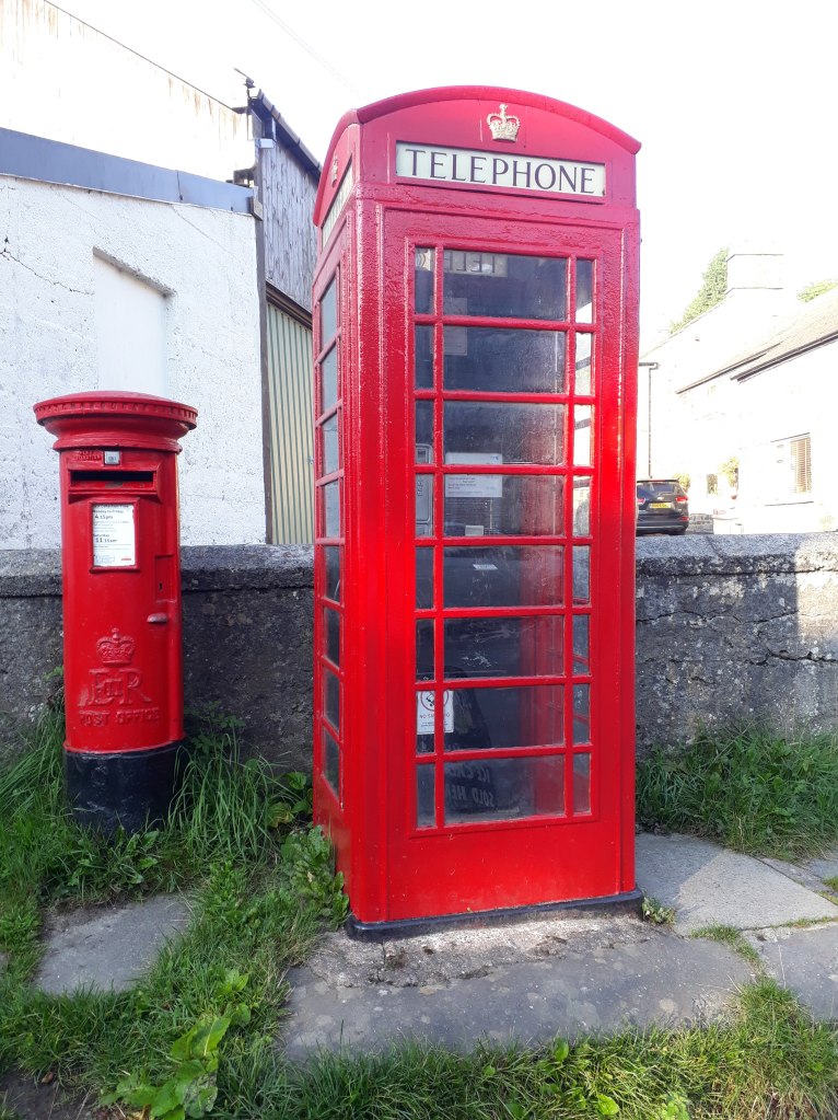
Edale Village Hall – where it all started
We started from the Village Hall, almost like the real race, although we decided we could risk not recceing the run across the car park. However I soon had to stop for my first photo. As many of you will know, I have a strange interest, almost an obsession, with phone boxes. I had heard that up until recently when Edale got mobile phone coverage, the Edale phone box was the most profitable in the UK. I have no idea if that is true or not but anyway it had to be photographed.
The most profitable phone box in Britain?
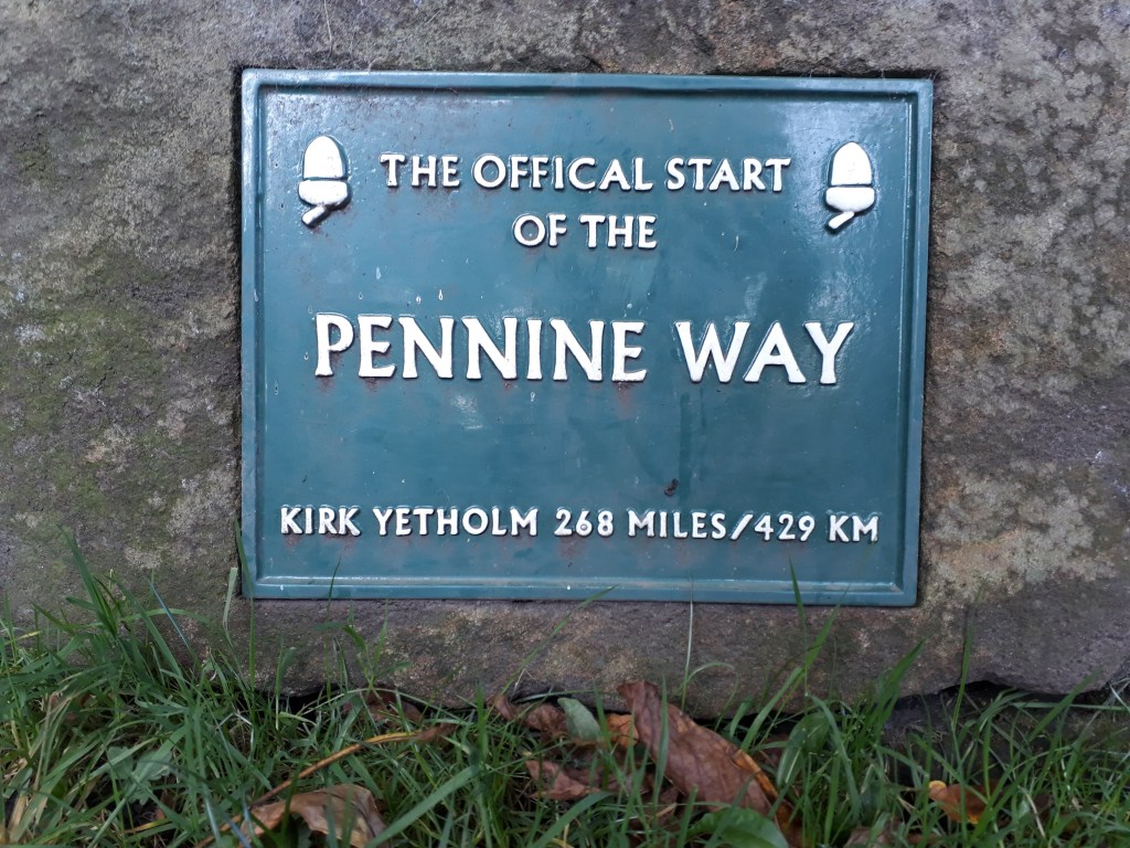
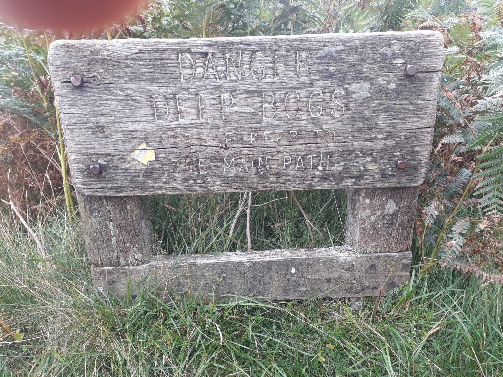
After about half a mile we reached the official start of the Pennine Way, opposite the Old Nag’s Head pub. There was a sign – it didn’t mention how much of the 268 miles is bog though.
As it says!
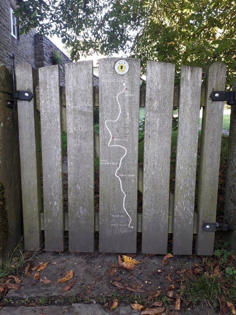
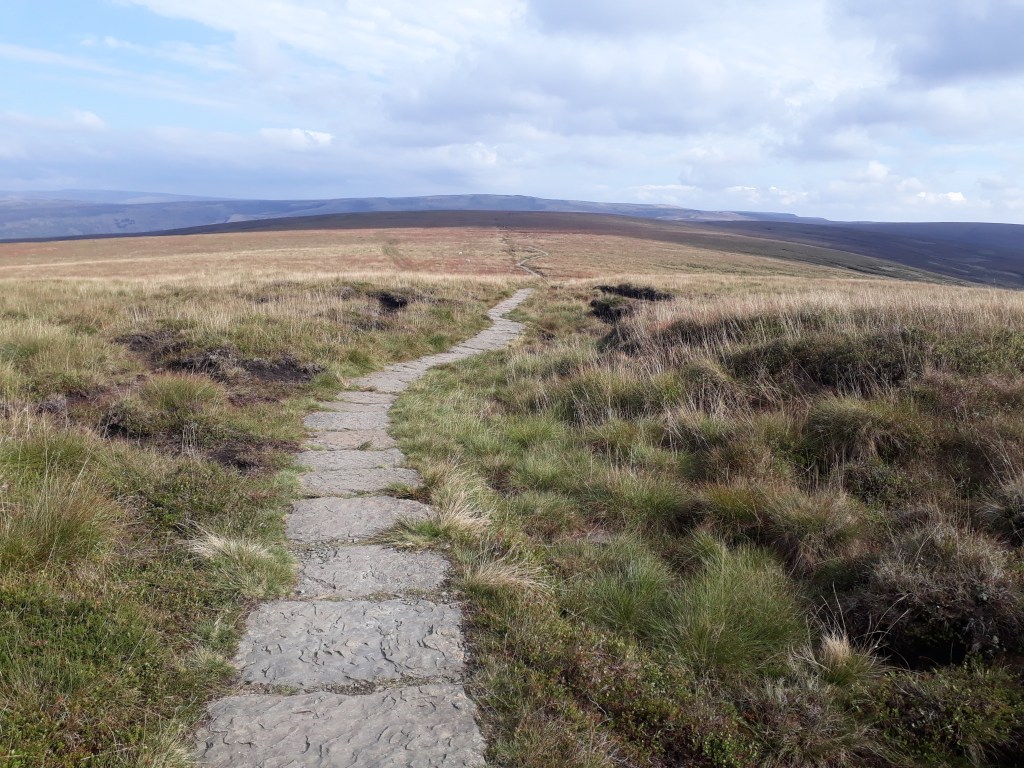
There was even a map. I’m not sure it would pass kit check but it seemed to cover the main points, go North, past some places. It doesn’t mention Blenkinsopp Common but then if you were trying to push the Pennine Way as a tourist attraction you wouldn’t either.
Map of the Pennine Way – looks quite straightforward
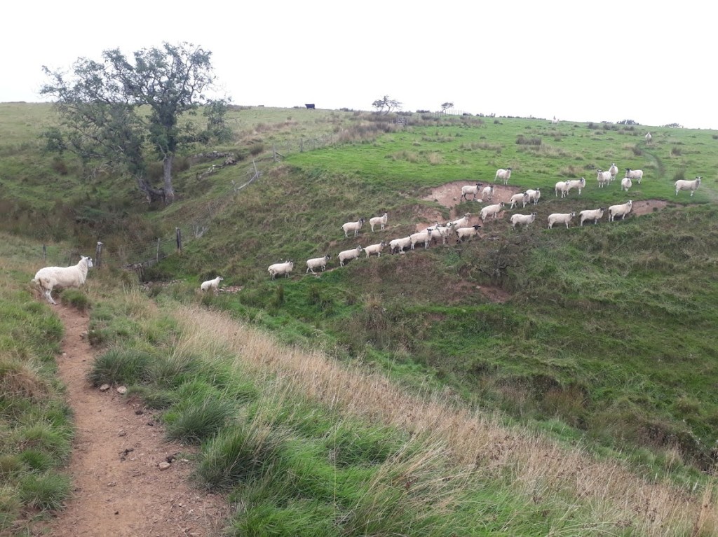
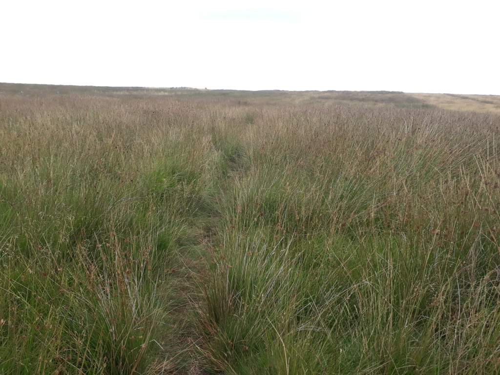
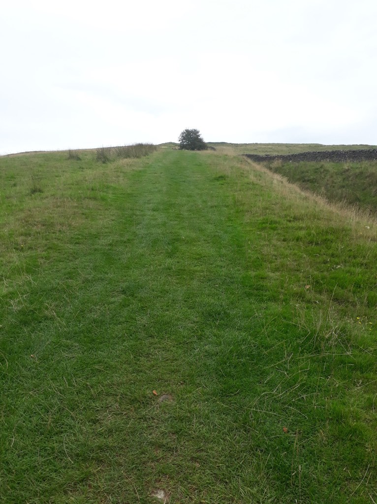
We went through the gate and started running through idyllic English countryside under blue skies.
Beautiful
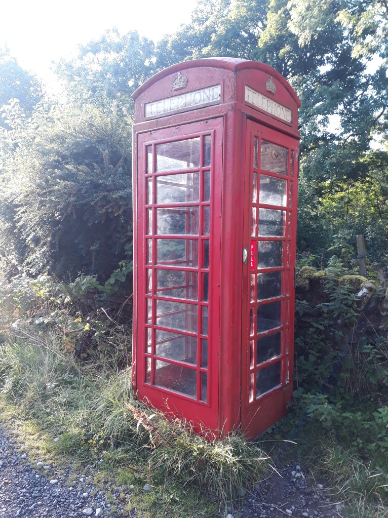
As we ran through Upper Booth, things got even better – another phone box! OK, I understand, no-one else is terribly interested in phone boxes so I’ll make that the last picture or reference in this blog entry. I still thought it was a great start to the day though.
Even more beautiful – well maybe not, but I like it
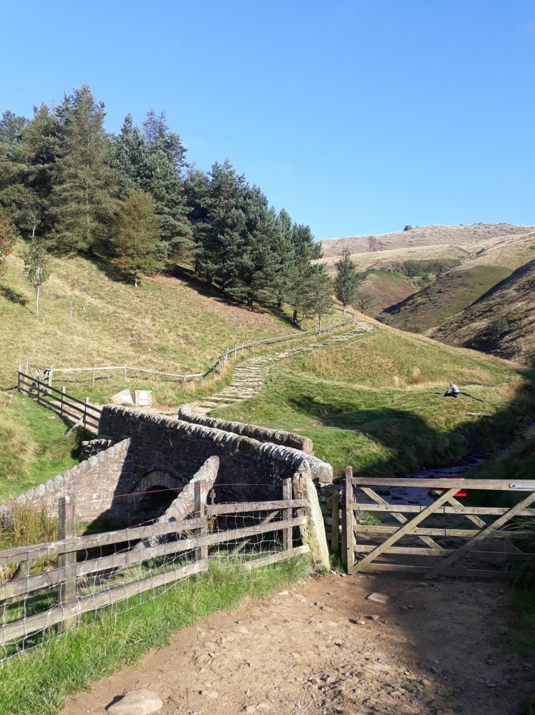
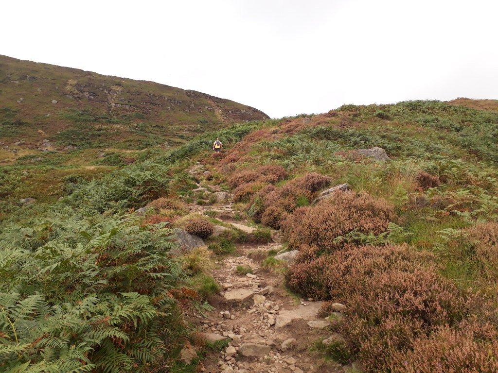
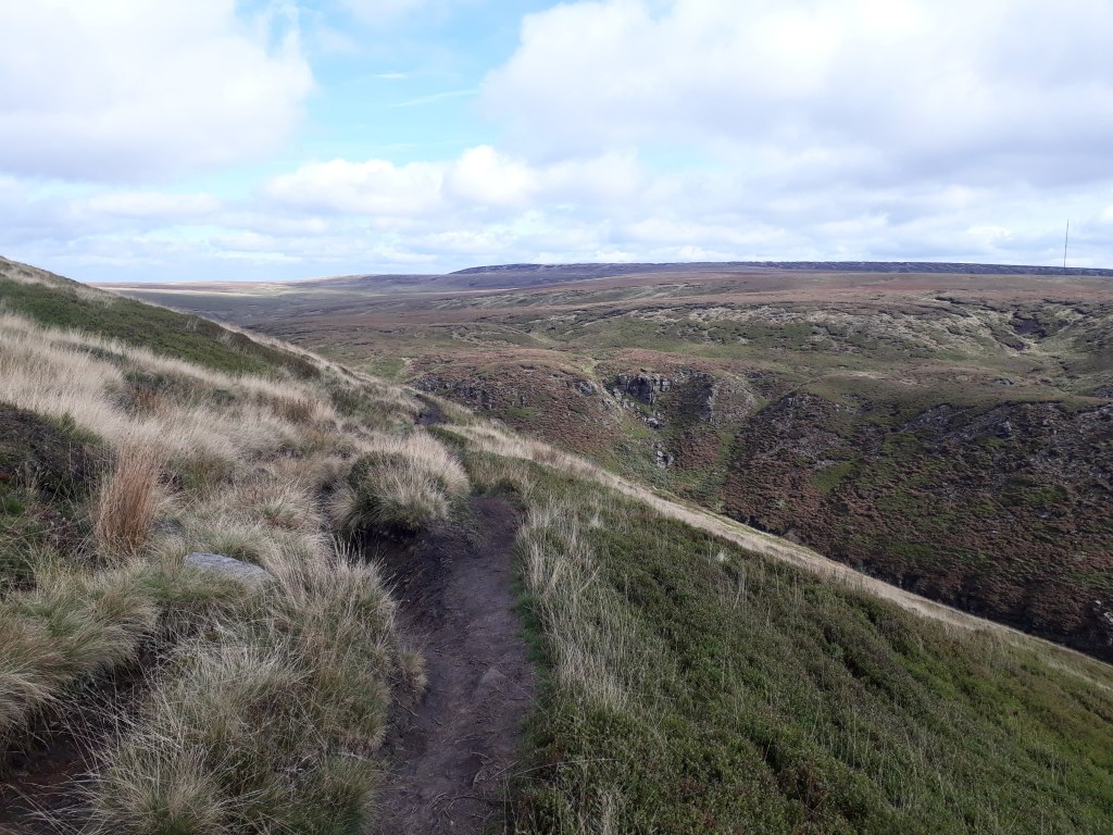
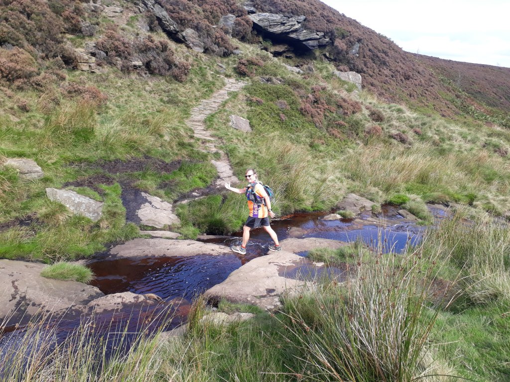
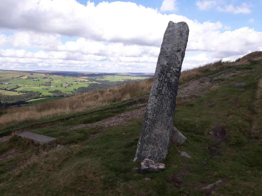
As we left Nether Booth the track started gradually climbing until we reached the bottom of Jacobs Ladder and the start of the second biggest climb on the Pennine Way.
Doesn’t look too bad…
Jacob’s Ladder is reached by a very narrow and picturesque 17th Century stone packhorse bridge over the River Noe. The bridge is apparently a designated Grade II listed structure, located on what was once an important packhorse route over the Pennine moorland between Hayfield and Edale, used from medieval times into the 18th Century. At its narrowest point the parapet walls of the bridge are only 27 inches apart.
Quietly confident….Ahhh….
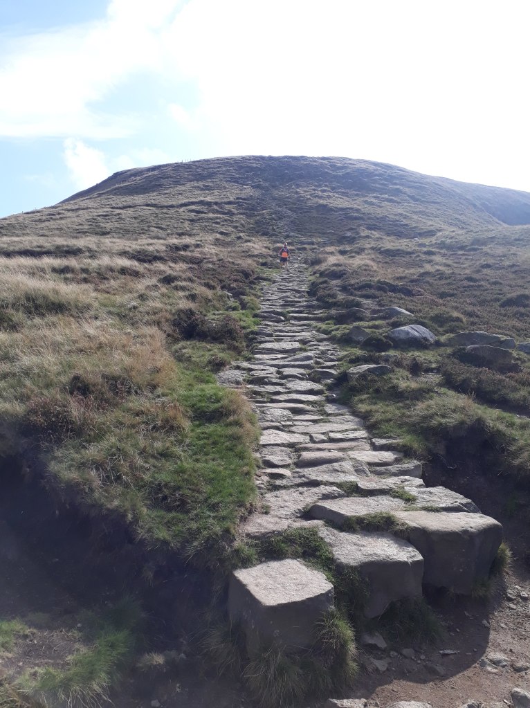
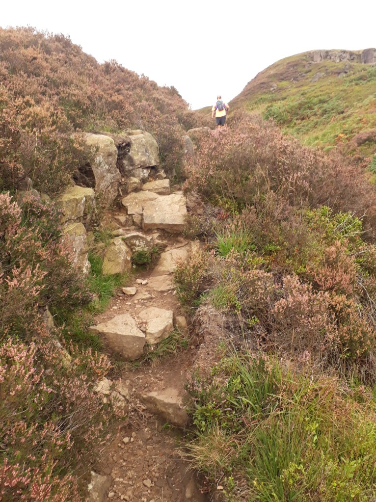
After the steps the climb continued until we reached Kinder Low. ‘Low’ is an old dialect word meaning hilltop and has nothing to do with the fact its 3 metres lower than Kinder Scout.
The path to Kinder LowAt the top!
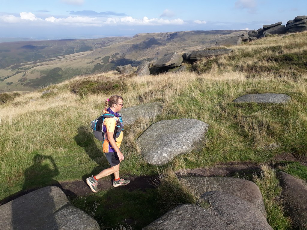
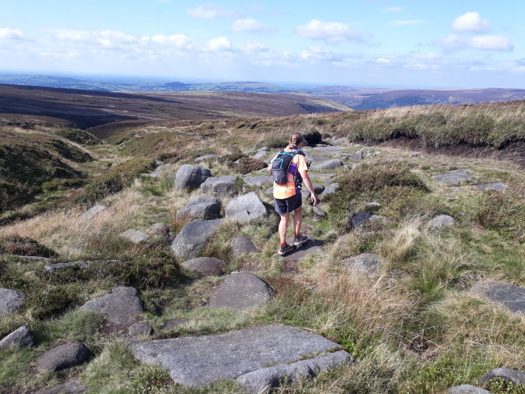
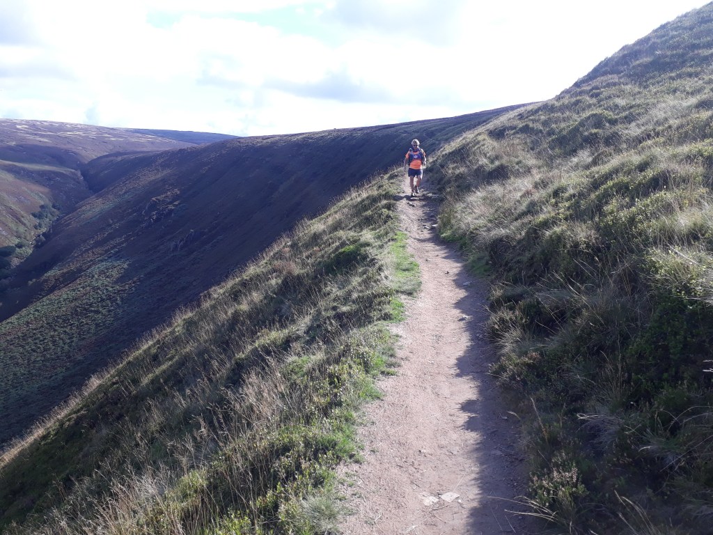
My memory of this section of the route was that once you’d reached Kinder Low it was a fairly straightforward jog along the top. This wasn’t strictly true and I really should have known that , given that this was heading to the area where I fell over and dislocated my finger!
Path looks fairly easy….Then it gets a bit rougherSharon neatly picks her way between the boulders
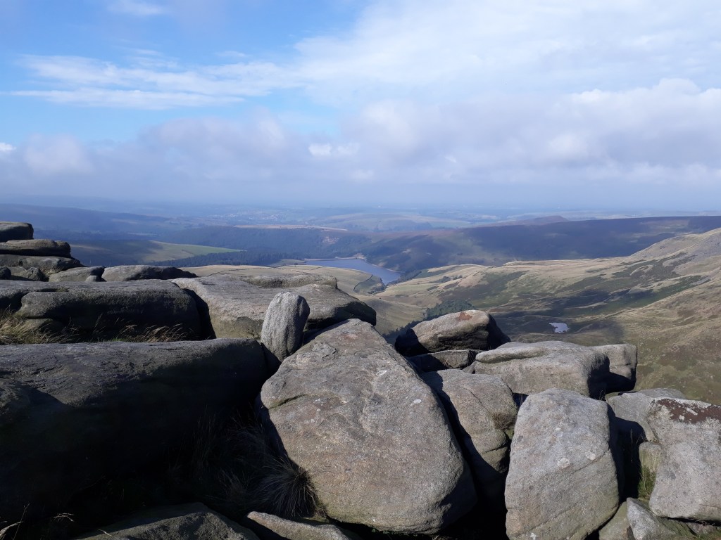
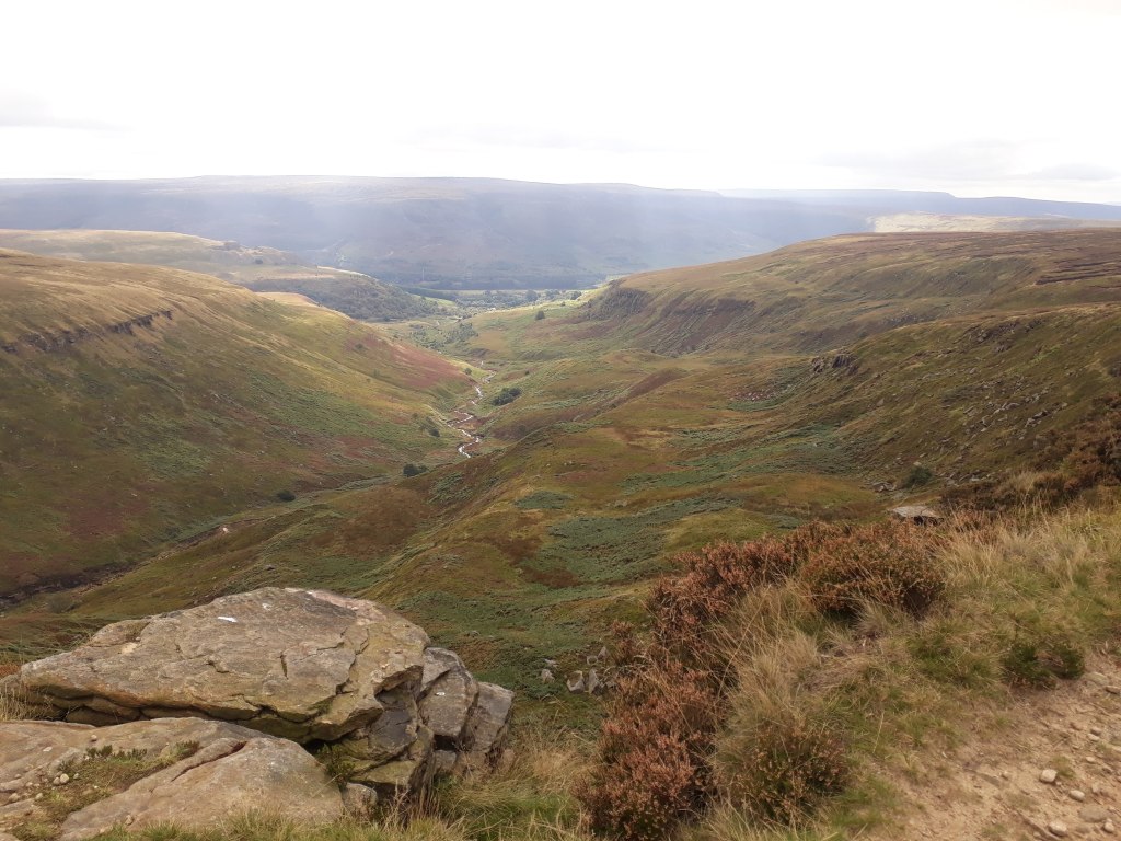
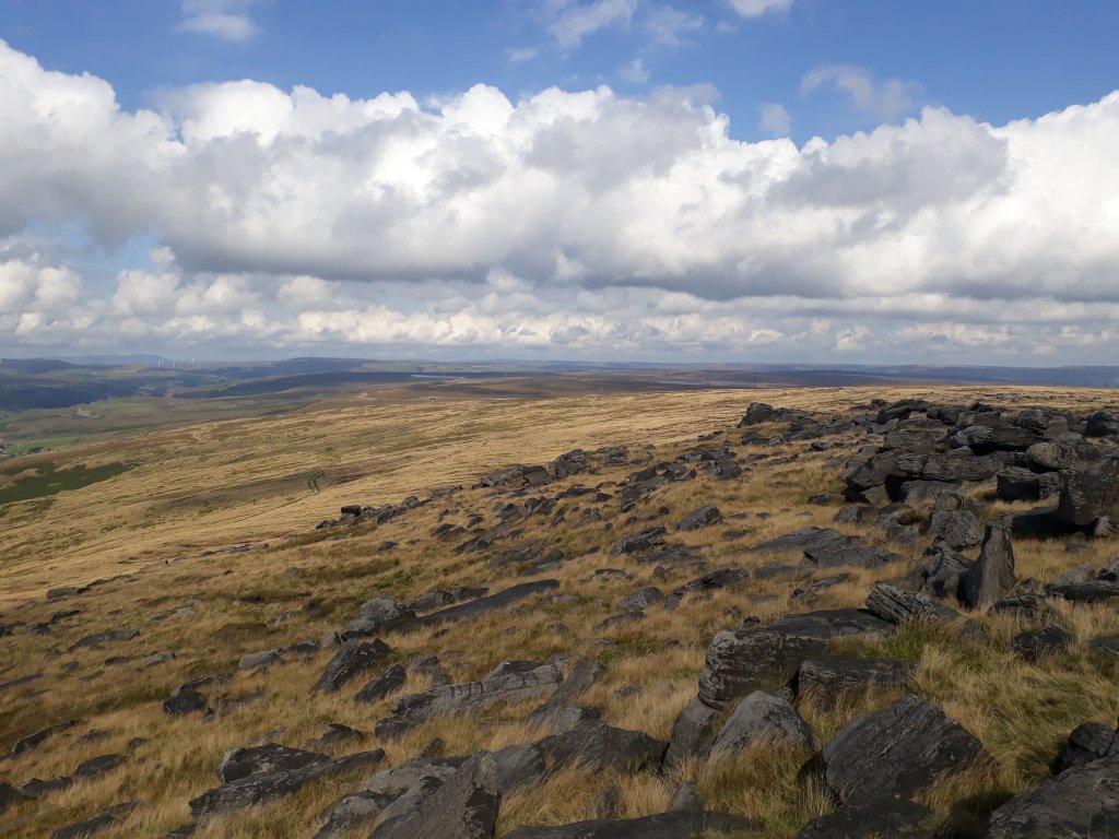
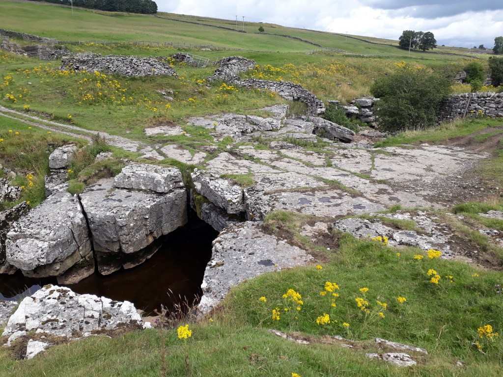
As we picked our way along the path I soon realised why I had fallen, it was a lot trickier than I remembered it. The path wove between numerous rocks and boulders. however it did provide us with great views down to Kinder Reservoir.
Looking over the rocks near Kinder Downfall to Kinder Reservoir. The Mermaids pool can be seen towards the right of the picture.
The path descended down an irregular line of not-quite-steps, not-quite-slabs.
Coming down
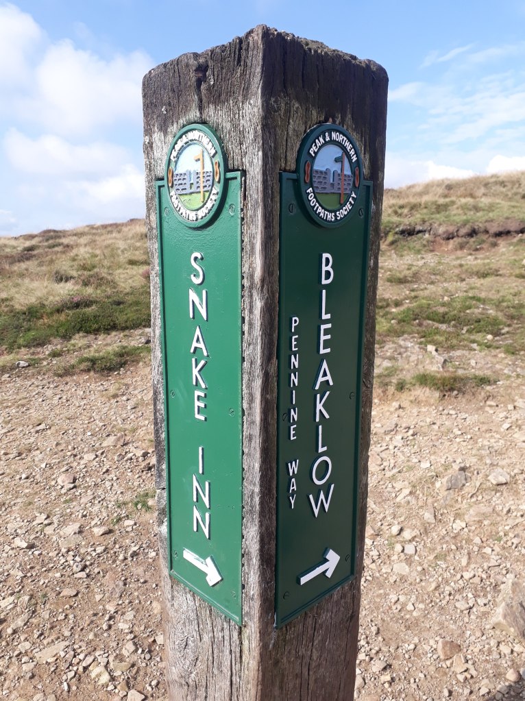
This brought us to what was by far the most challenging part of the day. In my opinion signposts on footpaths should stick to telling you which way the path goes and possibly what the next place of note it is and how far away it is. They should NOT tell you that the path perpendicular to the one you should be following will take you to a pub!
Entirely unnecessary information!
Had it not been a nice sunny day, the lure of a hostelry may have been more difficult to turn down, however we gritted our teeth and continued on to a seemingly endless slabbed path across Featherbed Moss.
At least it’s hard to get lost on this bit!
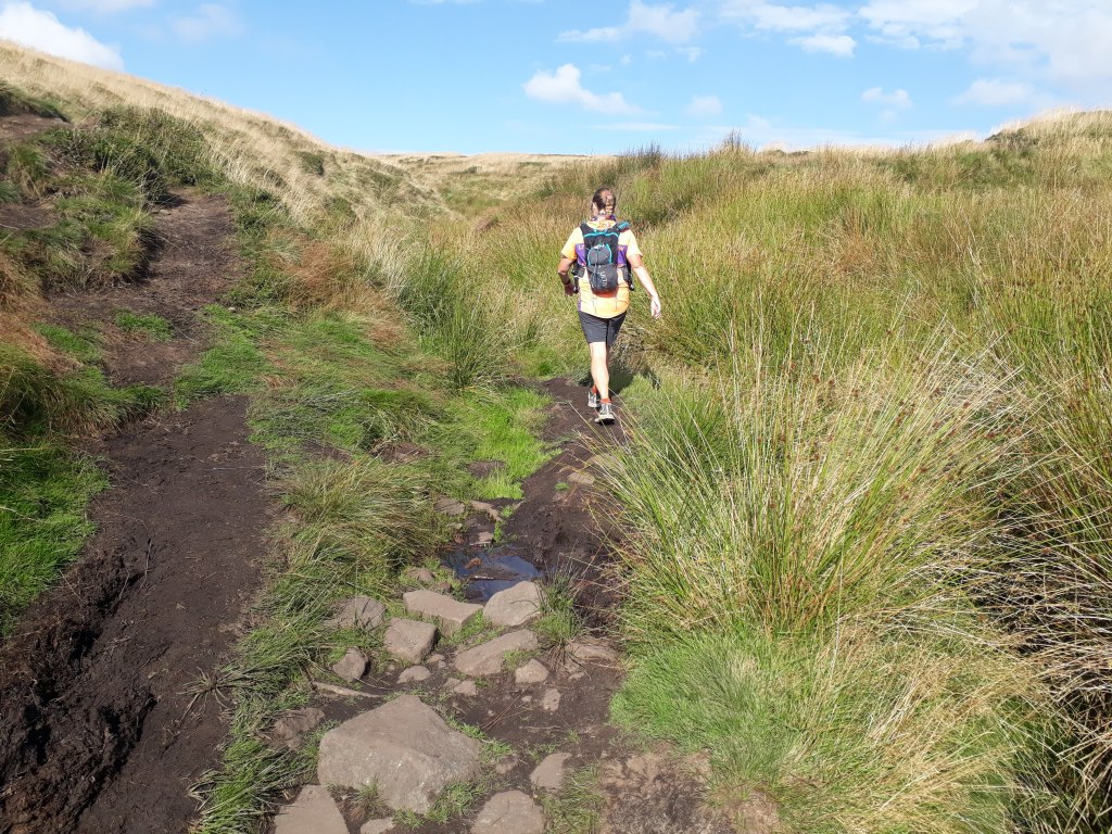
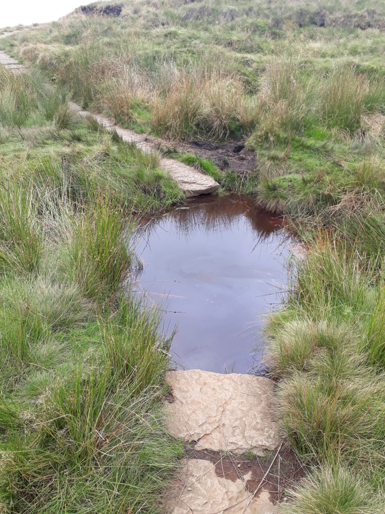
The path was very easy to follow with only the occasional loose slab threatening to put you in a bog and, after stopping to chat to a very nice man with two very nice dogs, we arrived at the A57, Snake Pass. Fortunately the previously signposted Snake Inn was some miles away down the road so temptation didn’t have to be resisted again.
After crossing the A57 we followed the path along Devil’s Dike. This is not the same Devil’s Dike as the numerous other Devil’s Dikes that seem to be scattered across England but an entirely different Devil’s Dike. The path became more challenging as we followed it, going from boggy, to rocky, to boggy and rocky, followed by some more rockiness with a bit of bogginess thrown in because, well, this is the Pennine Way after all.
A bit muddyRocky, but definitely the right wayMuddy, verging on boggyAnd back to rocky
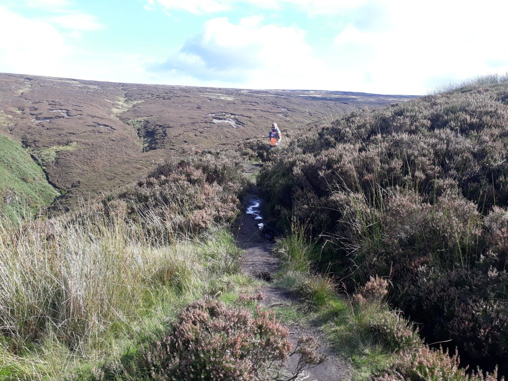
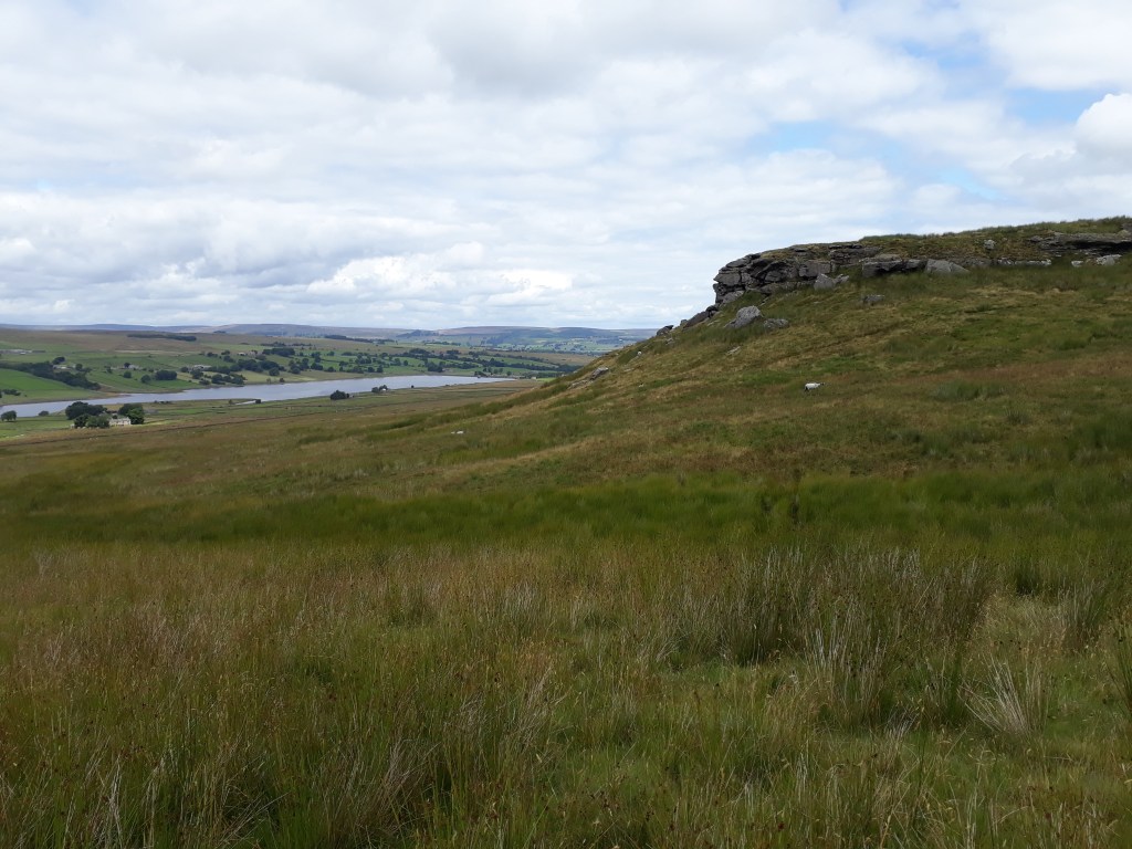
After reaching Bleaklow Head, the path started to descend and run through the heather (I think it was heather) along Torside Clough.
Sharon and Heather (probably)
There were a few paths through the heather. In places one path was as good as any other but in others it was definitely best to be on the ‘official’ path. This was mainly at points where the path crossed water courses. The proper path had easy crossing points, the improper path crossing points were sufficiently not easy to make us turn back and find the right path.
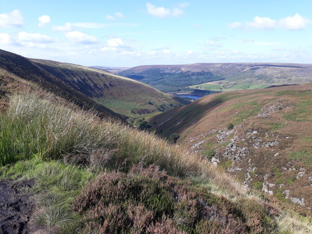
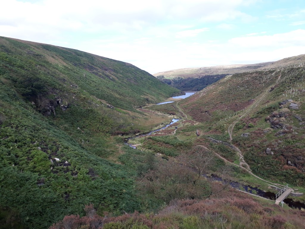
The first glimpse of Torside ReservoirTorside ReservoirAlmost there -sort of…
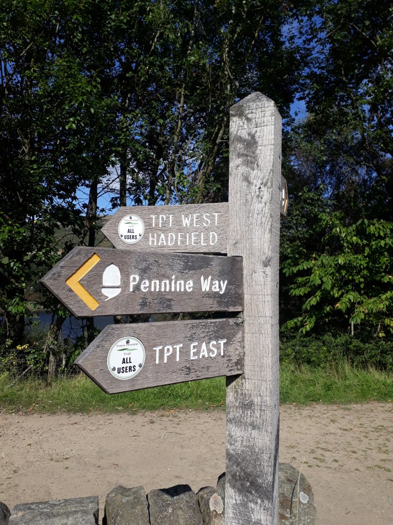
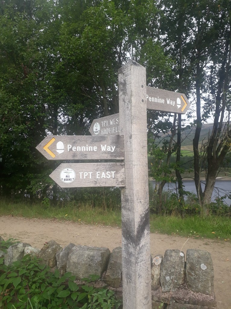
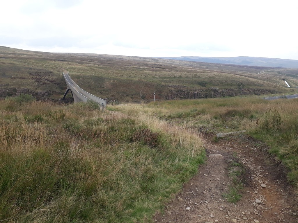
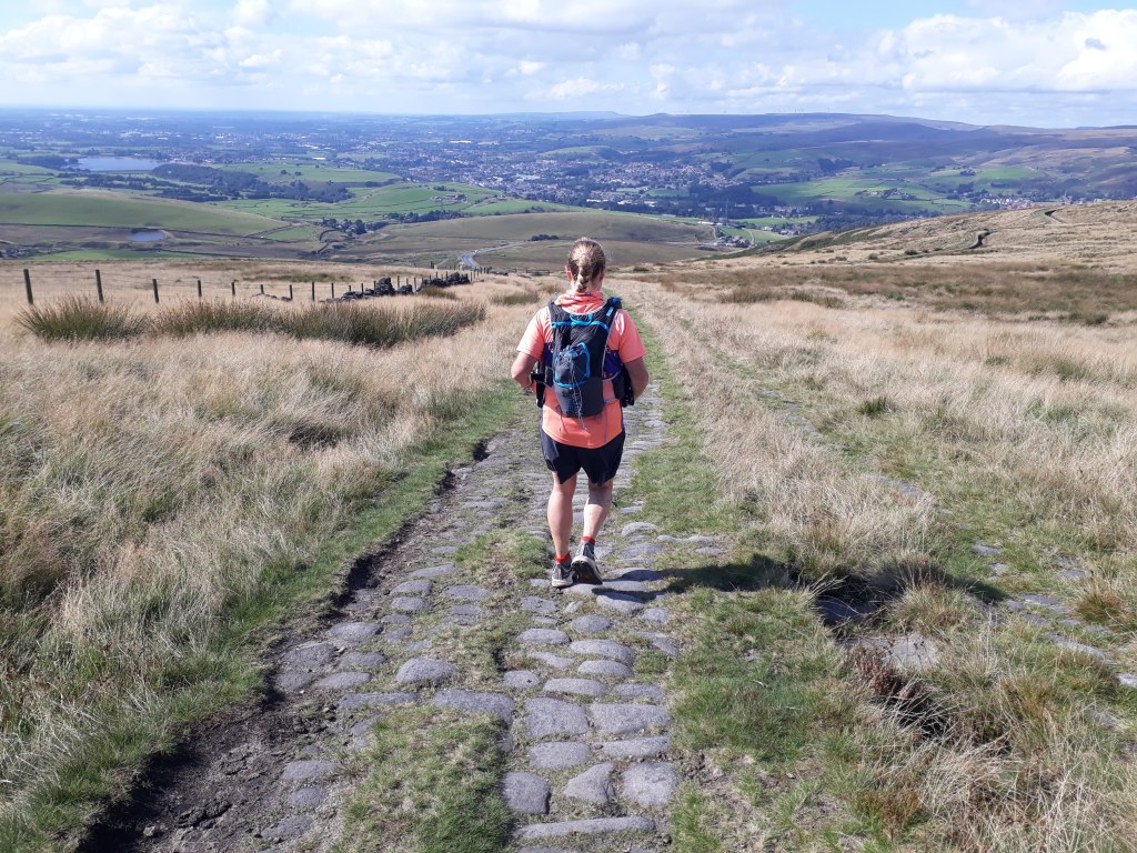
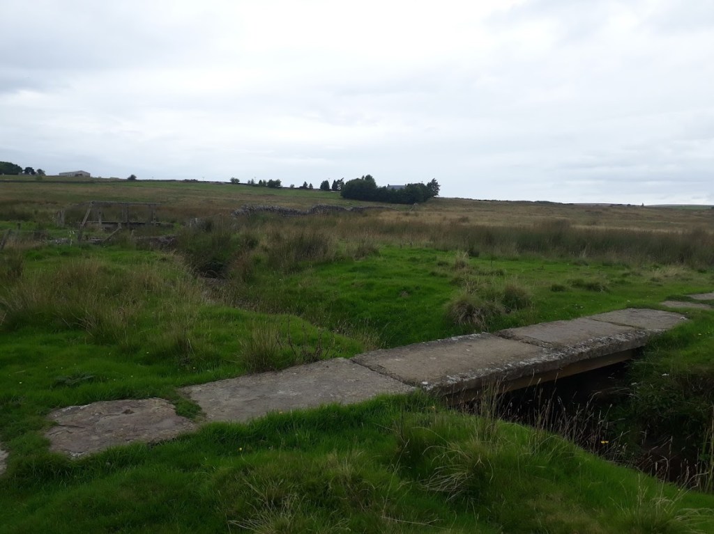
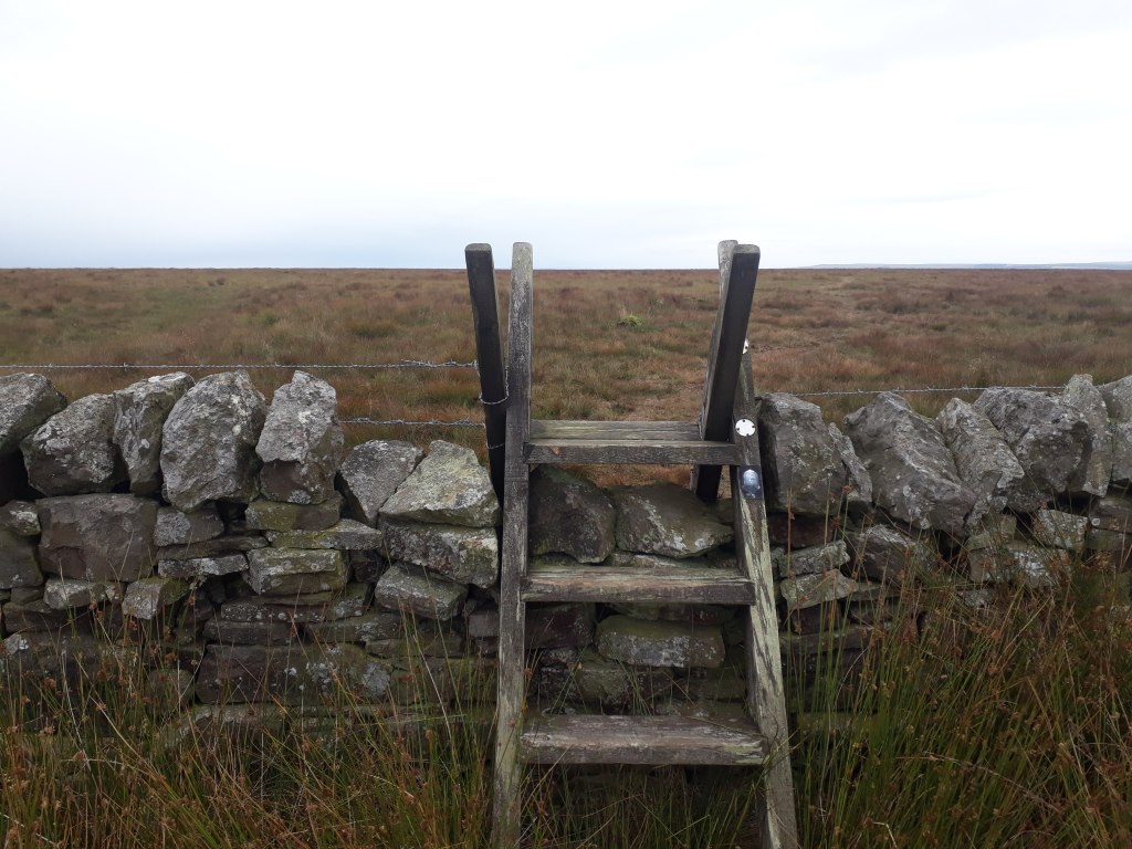
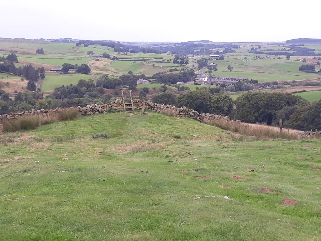
Our section of the Pennine Way finished with a sharp descent to the Trans-Pennine Trail, which crosses the Pennine Way near Torside reservoir. This was the end of our Pennine Way recce as we turned left along the Trans-Pennine Trail to Hadfield, back to the railway station and our car.
Where we joined the Pennine Way yesterday
So that concludes our three day recce of the first leg of the Spine Race. What have I learned from it? Well, there was an awful lot of it I just didn’t remember. It was harder than my my memory allowed me to remember it to be. I think it has helped me enormously to see it all again and be more prepared for next year. Sharon decided she would wait a year to try the Spine Sprint so we could do it together.
Assuming all goes to plan my next blog post will be a race report! Next weekend I am off to the Cheviots to run round near the Pennine Way and get cold and wet and miserable. Why? Well I didn’t make it to the Cheviots on the Spine Race and I reckon if I can negotiate 55 miles around them mostly in the dark in December it should stand me in good stead when I reach them next June!
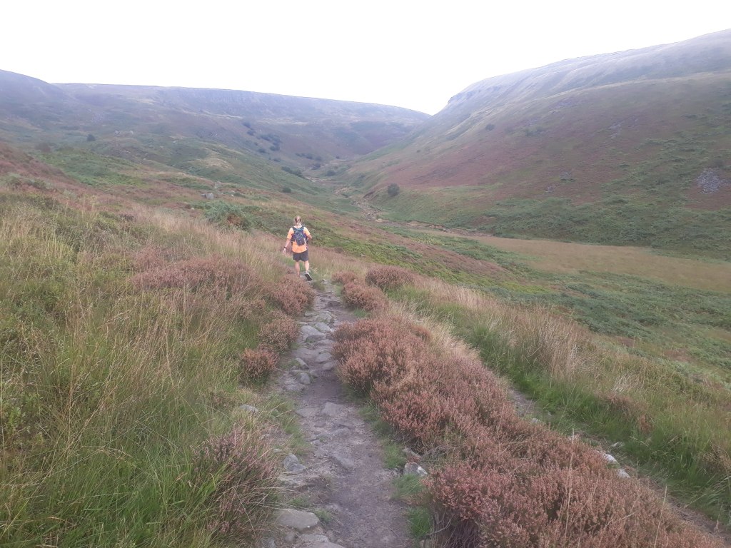
So after the success of the recce of the last bit of the first bit of the Spine Race, the next day’s mission was to recce the middle bit of the first bit. I wasn’t really expecting much from today as I couldn’t really remember much about it. As it turned out this was probably due to the fact it was around this part that I became extremely unsure that I would even complete the first leg of the race, never mind the five after! As I soon found, it wasn’t because this bit was boring…
Today’s train journey was via Manchester Piccadilly, which meant it was very expensive but there was an opportunity to get coffee and a breakfast roll. Today’s leg was the shortest in distance but had the most ascent (only just). It also had a nice easy start with a reasonably flat three mile jog along the Longdendale Trail, part of the Transpennine Trail, before we joined the Pennine Way.
Definitely on the Pennine Way – just have to pick a direction
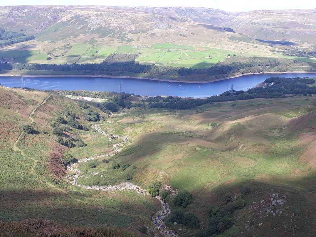
For some reason I remembered the run across the dam between the Rhodeswood and Torside reservoir and the following gradual incline along Torside Reservoir, however after the left turn at Crowden everything was worryingly unfamiliar.
Not too bad so far…
This was disappointing as I discovered that had I seen the sign on the way to Laddow Rocks, I would have had a lot more idea what I was letting myself in for…
This basically applies to the whole of the Pennine Way
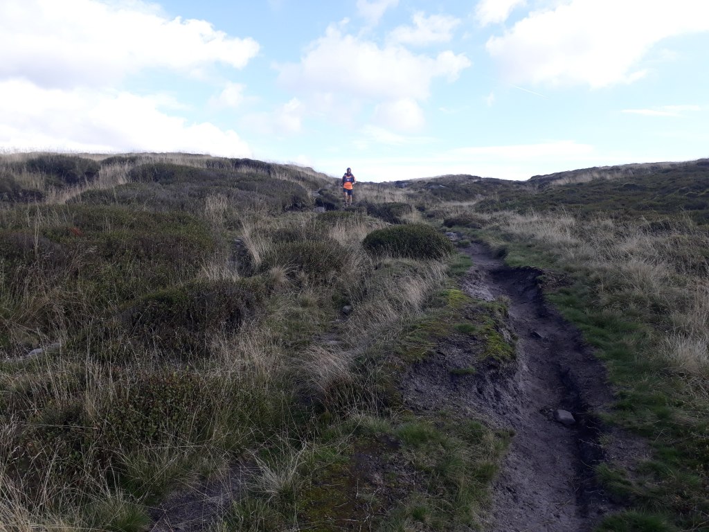
Fortunately the main path was fairly obvious. Steep, rocky and hard but obvious.
Upwards…More upwards…And a bit more up.
Eventually we ran out of up an moved on to ‘horizontal but on a bit of a cliff’ however the view back down the valley was spectacular.
A bit grey but still a great view
After we reached Laddow Rocks, the path became flatter with a steep slope down to the right. These kind of paths are quite safe and runnable but my fear of falling means that I’m always a little nervous – perhaps that’s why I had apparently blanked this section from my memory.
Blue skies ahead
The Pennine Way drops into the valley of Crowden Great Brook – which obviously leads to a return to boginess. In actual fact the path wasn’t too bad and was paved along much of its length. The bigger challenge was fording all the small streams feeding into the brook, especially when this happened…
Now what do I do?
For my future refence, go to the left and it is possible to jump across. It may even be possible to jump across from the path but the margin for error was no where near big enough to tempt me to try.
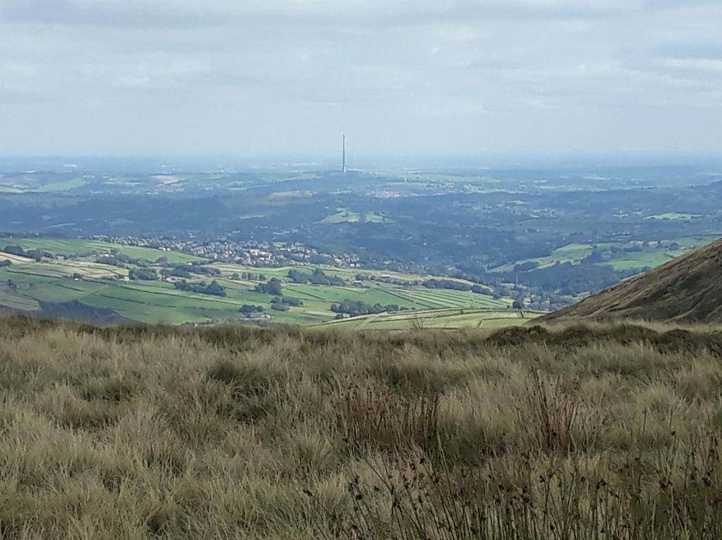
The path gradually climbed back up to Black Hill, or Soldier’s Lump – it appears to have both names on the map. The view from the top of the hill is largely urban but I was particularly intrigued by a large tower/chimney/other sticky-up thing almost on the horizon. I have no idea what it is so if anyone could enlighten me I’d be very grateful.
What is the tall thing?
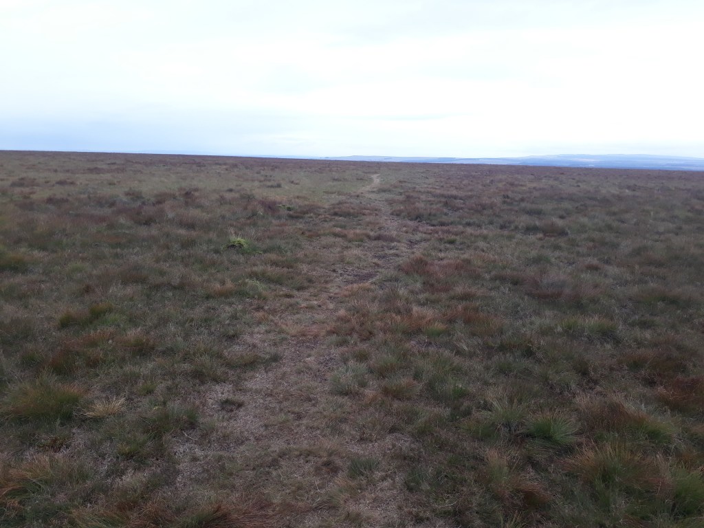
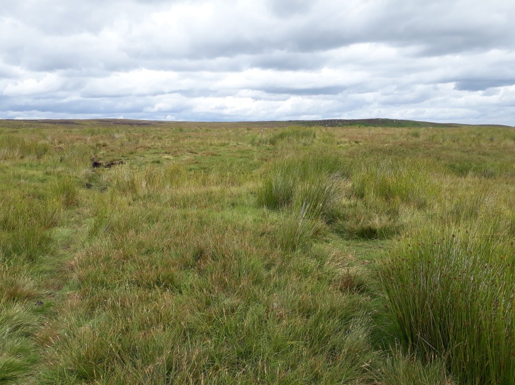
The run across Wessenden Head Moor was a bit dull if I’m honest. the path is slabbed and so at least it was easy running. A stop for a chat with a man with two Tibetan Path Finder dogs provided some respite from the tedium (I may have the dog breed not quite correct but there was something about path finding – or possibly following).
Wessenden Head Moor
One last stream crossing at Dean Clough followed by a short climb up took us off Wessenden Head Moor to the A635.
By now stream crossing was doodle
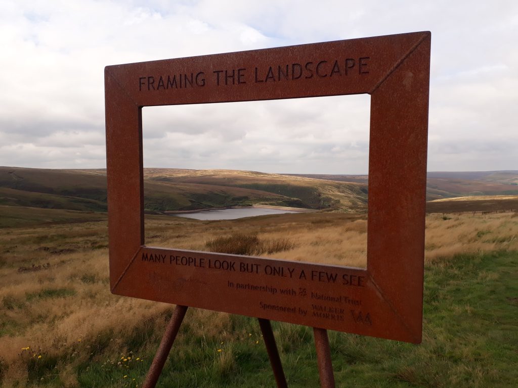
A short road section took us towards Wessenden Head Reservoir. Someone had left a picture frame by the side of the path so naturally I had to try and get artistic with it.
MoorlandReservoir
The path took us past Wessenden Reservoir and a short sharp descent to the end of Blakely Reservoir followed by the inevitable short sharp ascent to Blakeley Clough.
Wessenden ReservoirBlakely Reservoir
The path across Black Moss was variable in quality, a few random sections were paved but much was just a bit annoying. Finally we passed the last reservoir of the day (Black Moss Reservoir) and joined the Standedge Trail at the point we joined the Pennine Way yesterday.
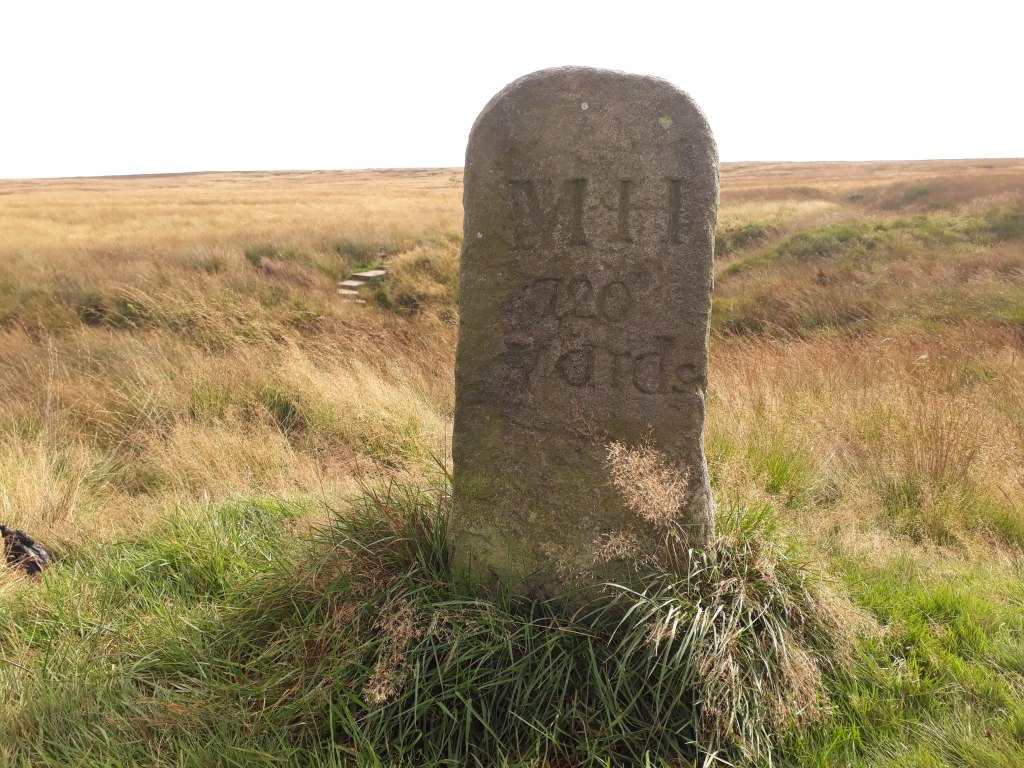
Anyone know what M.H. refers to?Yesterday’s starting point
Having run this section again I can kind of see why I didn’t recollect much about the second half – once you start the climb to Black Hill the remaining section was reasonably pleasant but not especially memorable. However how I had forgotten the climb to Laddow Rocks and the subsequent ridge edge run I have no idea.
So, two days of recceing successfully completed – what would tomorrow bring?
The next three recces I had planned were so complicated I ended up with a spreadsheet detailing where we were staying, where we were running from and to, where we were then going and what times the trains ran. Overall we wanted to head South as that was (is) where home was (is). However I also wanted to run the Pennine Way South to North as that was (is) the way the Spine Race goes.
I had the first stage divided into three sections which (with some small extra bits at the start and/or finish) could be done by train. The plan was to stay in accommodation at the North end of the recce section, leave the car there for the day, take the train to the South end, run back and then drive down to our next accommodation at the North end of the next day’s run, which is where this days started – simple eh?
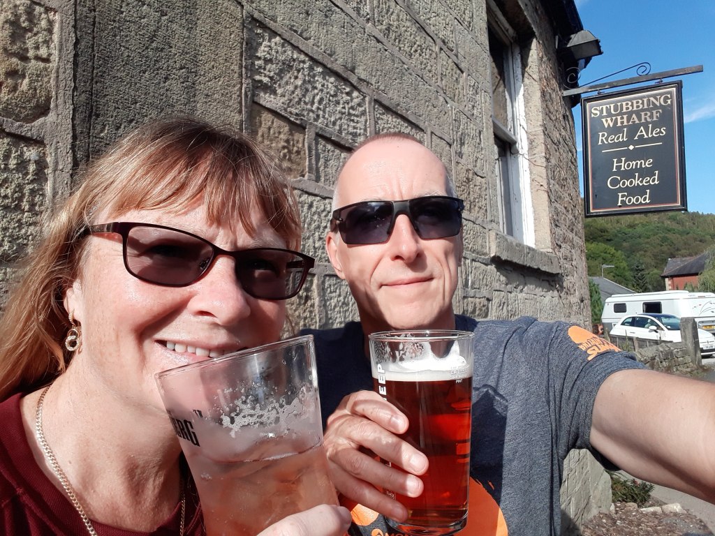
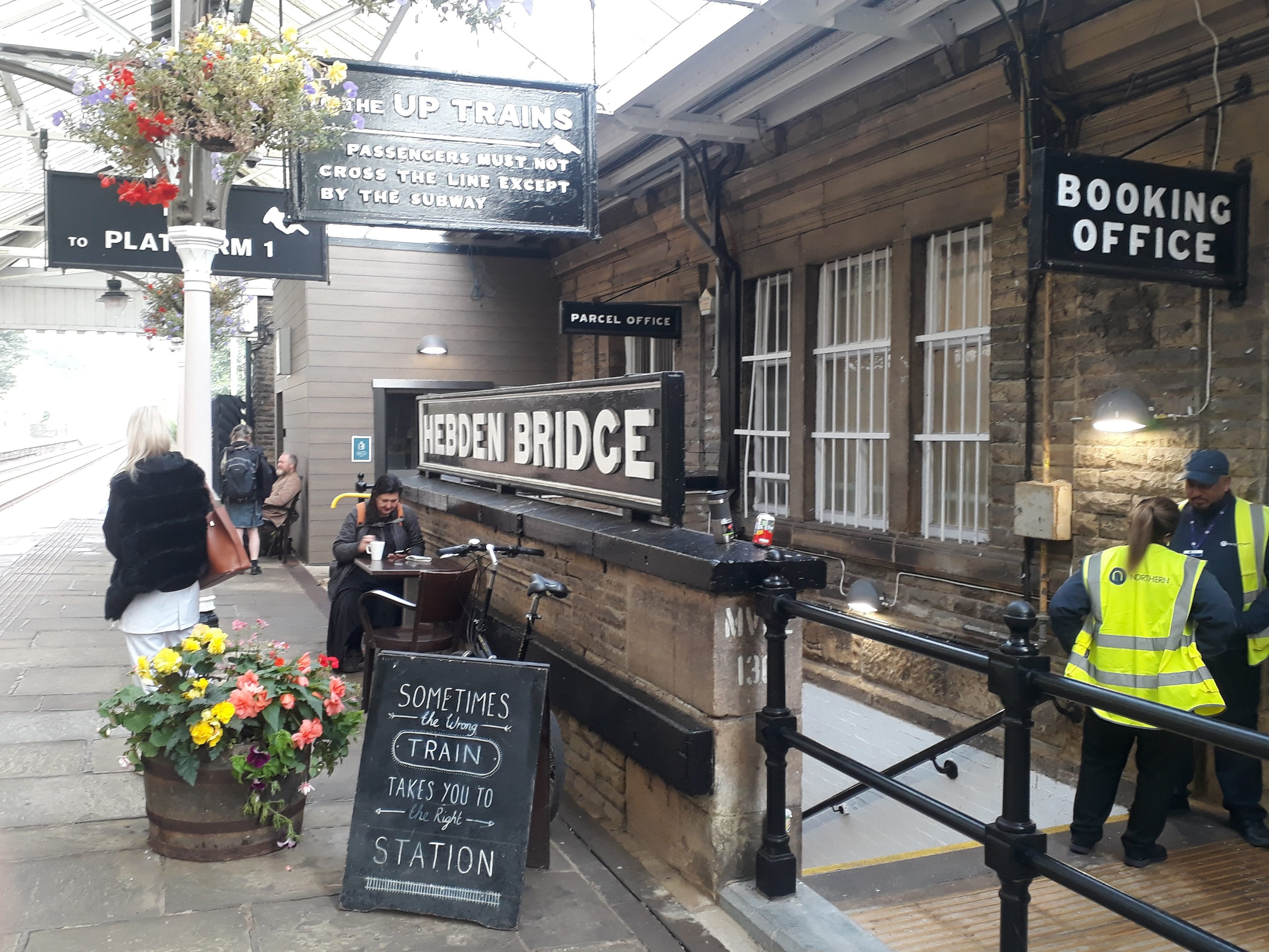
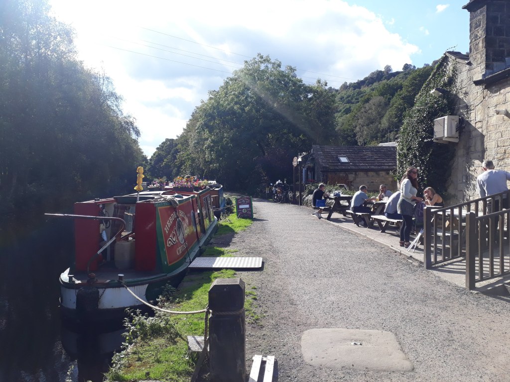
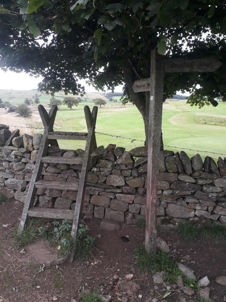
Anyway the net result of all the planning was that our first recce would be from Mardsen, we would pick up the Pennine Way at Standedge and run to Hebden Bridge. I had booked us, what fortunately turned out to be, a lovely B&B in Hebden Bridge on the canal (I didn’t know at the time but I ran past it at the start of the second leg of the Spine Race) it also had a very nice pub a stone’s throw away so we took advantage of a nice sunny afternoon when we arrived and sat outside the pub with some rehydration fluids until it was time to check into our B&B.
Cheers!
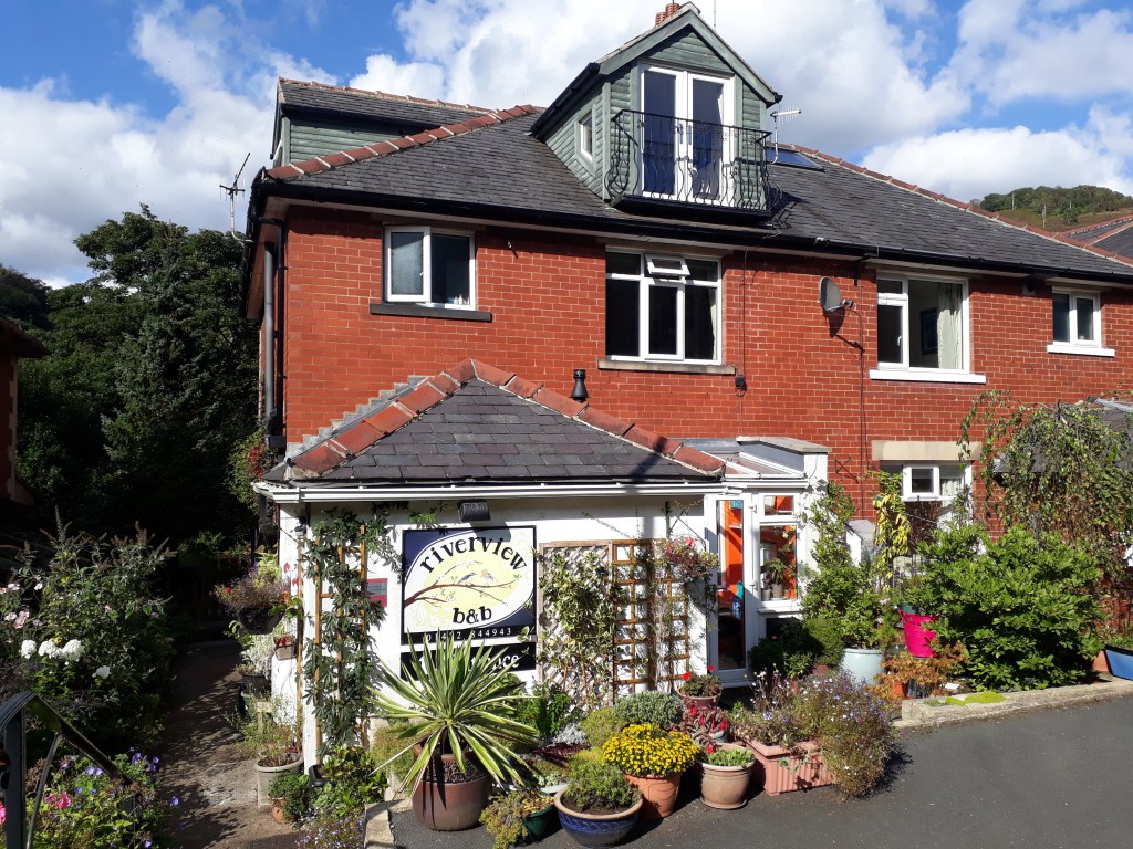
The B&B was lovely and came with a scone on arrival, wine in the room and a very friendly little dog – and a very obliging landlady called Susy who was prepared to get up to make us breakfast at 7am as we were intending to get the 8:33am train from Hebden Bridge station, about three quarters of a mile away.
Our B&B – We were in the room at the top with the bacony
We ate in the pub that night, had breakfast the next morning and arrived at the station in plenty of time to purchase tickets. We even managed the train changes correctly and even, even managed to get a cup of tea at Huddersfield station – so far my meticulous planning was paying off!
Hebden Bridge station appears to have resisted modernisation and retains some real character
So what do I remember of this section from the Spine Race? Well, it was dark when I did it but a few things stand out. The Bog – that definitely stands out. Nicki’s Food Bar is a more pleasant memory – shortly before the Bog. The M62 crossing – shortly after the Bog. Reservoirs and Stoodley Pike Monument, and it was unpleasantly steep downhill on tarmac into Hebden Bridge.
From Marsden station we took roads and a barely existent footpath up to the Standedge Trail, which joins the Pennine Way.
Slightly misty views from Standedge but still better than the one I had in the dark
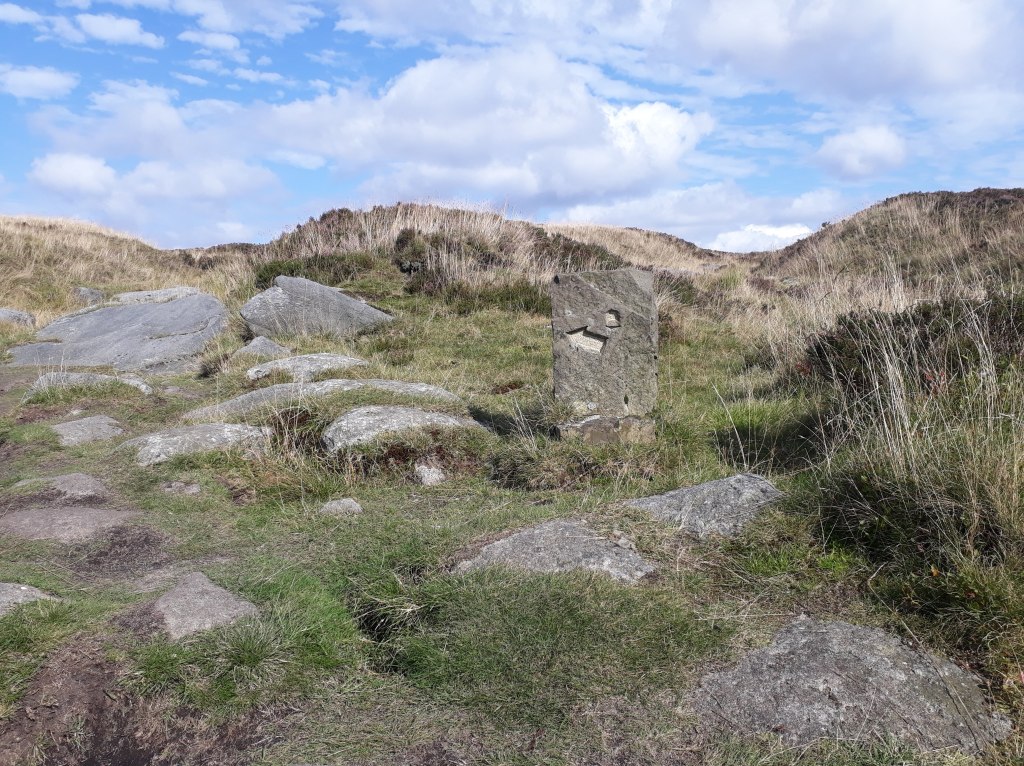
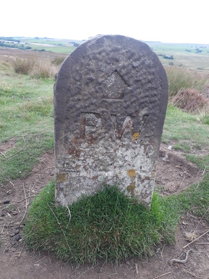
Standedge provided some good views and was negotiated fairly uneventfully. Shortly afterwards we found one of those stones which tells you exactly where you are in a way which is almost entirely unhelpful from a navigational perspective. fortunately the path was obvious and with occasional reference to the GPS we weren’t in need of any additional directional assistance.
That’s fairly definite
Soon we reached Nicki’s Food Bar. As we were less than half way into our run we resisted the temptation to stop, instead I turned my attention to more important matters – where was the Bog? My impression was that the van was at a different place in the layby to where it was that fateful night but I’m fairly sure I found the Bog. To be honest I was slightly reassured to find it was basically on the path as it made me feel a little less stupid to have stumbled into it!
The Bog!
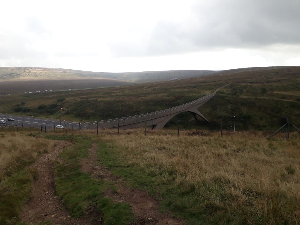
Shortly after the Bog we crossed the very impressive footbridge over the M62.
Looking North to the bridgeYou get a better view of the bridge looking back from the North side
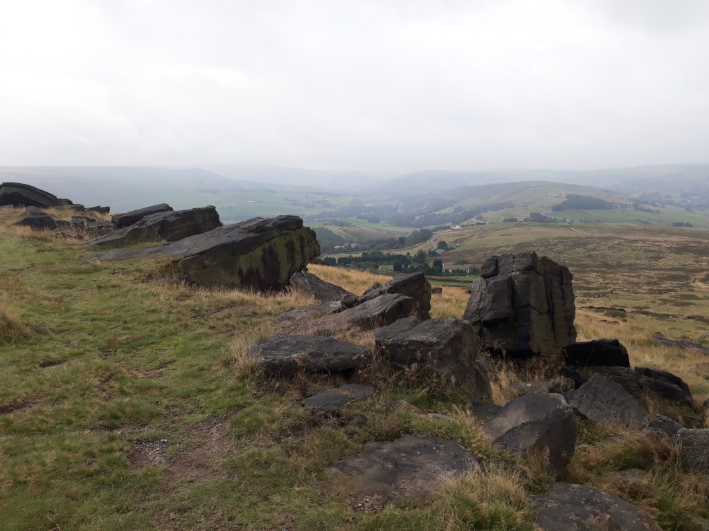
I was fairly certain I was going to enjoy the next section along Blackstone Edge much more than I did on the race itself. This was partly due to the fact it was daylight this time but mainly because I wasn’t coated in bog up to just below my dangly bits. Things were further improved as the cloud lifted a bit and we had some lovely blue skies to run under.
There are many unusual sights on the Pennine Way. I noticed a stone windbreak on Blackstone Edge, much like those favoured by German naturists in Fuerteventura. What I didn’t expect was that it too would be occupied by naked men…
Anyway, as the sun was shining and the sky was blue, here are a few pictures on Blackstone Edge (none feature naked men of any nationality).
Top of the World!In some directions you can see towns……but turn 90 degrees and an altogether wilder picture appears
A short section of the Old Packhorse Road took us to the Broad Head Drain, which we followed to the A58, where crossed, reluctantly passing the White House Pub to Blackstone Edge reservoir.
The Old Packhorse Road – no, that is definitely not an old packhorse!
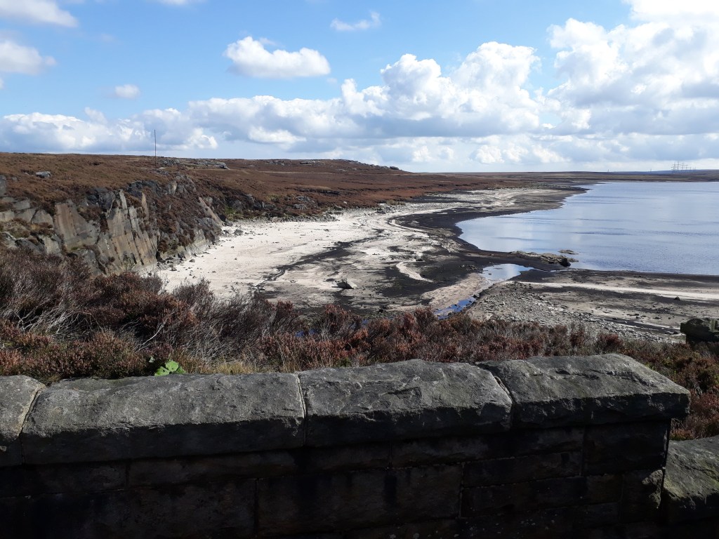
I remembered the reservoirs quite well. They are slightly interesting to run past on a sunny day but in the dark they were very dull,especially as – due to earlier over-exertions – I couldn’t manage much more than a fast walk by this point.
Warland Reservoir looking a bit low on water!
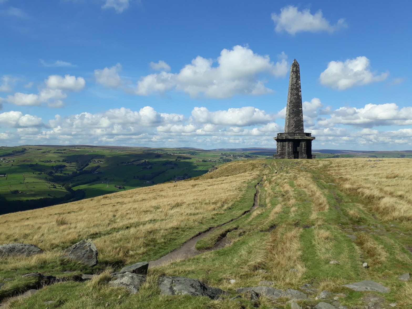
We were now heading towards the last significant landmark on this leg of the journey, Stoodley Pike Monument. Rather than pretend to know stuff I will quote the ‘Visit Calderdale’ website:
The 121 foot (37 m) high Stoodley Pike Monument dominates the skyline above Todmorden, sitting atop Stoodley Pike, a 1,300-foot (400 m) hill The monument was designed in 1854 by local architect James Green, and completed in 1856 at the end of the Crimean War. The monument replaced an earlier structure, commemorating the defeat of Napoleon and the surrender of Paris. It was completed in 1815, after the Battle of Waterloo, but collapsed in 1854 after decades of weathering and a lightning strike.
Our first view of Stoodley Pike
Last time I was here it was dark. That was possibly a good thing as Stoodley Pike Monument is one of those structures that never seems to get closer. The path was also a lot more undulating than I remembered…
The monument looked a lot more impressive from a distance……only joking, its still a long way away…
Eventually we arrived at the monument and climbed the 39 steps in pitch darkness to its viewing balcony. Sharon complained about me using my phone torch to negotiate the steps and abandoning her to the darkness but to be honest it provided enough light to see about six inches in front of my face and didn’t illuminate the steps at all. fortunately I remembered I was carrying a 900 Lumen head torch for the way out.
Stoodley Pike MonumentA view from the Monument
From here it was a fairly straightforward run into Hebden Bridge – although it is necessary to be aware that, as is often the case, the Pennine Way doesn’t follow the biggest or most obvious path. The Way turns off Dick’s Lane across some fields, past a disused quarry, through a small bog (obviously) before finally reaching a farm track. If anyone is wondering, I have no idea if the earlier naturists hang out in Dick’s Lane.
Once on the track the only other potential navigational embarrassment is missing the small path where the Spine Race route diverts from the Pennine Way into Hebden Bridge. This leads to a path, which becomes a cobbled road and finally a steep downhill tarmac road. On the race, at the canal you go into Hebden Bridge to the checkpoint. We turned left and followed the canal on the route the Spine Race leaves Hebden Bridge as it took us towards the pub and our car.
Back at the pub!
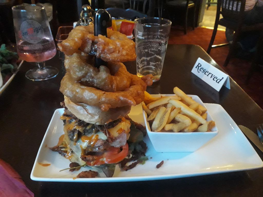
So the first of our three recce runs on the first leg of the Spine had gone well. We didn’t get lost and no bogs were fallen in – which is about as good as it gets on the Pennine Way for much of its length. We drove to Marsden to our next accommodation in the New Inn. As I was hungry I ordered a New Inn burger. It was just as well I was hungry…
Possibly the biggest burger I have ever eaten
The next section of our recce would take us from Torside to Standedge. I could remember nothing about this section so assumed it would be fairly dull and uneventful…
I do have a bit of a reputation for repeating races but, even by my standards, I’ve done a lot of Great North Runs, twenty-two now. It was the first ever ‘proper’ event I entered in 1998. I missed ’99 but have done everyone since.
This year was slightly different in that we were driving up rather than taking the train and we had much additional running planned. York parkrun was first on the list, an incredibly fast course with some incredibly fast runners, Jonathan Brownlee is only the second fastest ever and no, his brother isn’t the fastest. Anyway it was friendly, well organised, I managed 25th place in exactly 20 minutes and hopefully persuaded one of the volunteers (Linda) to take up ultra running. Not a bad mornings work!
I know the changes to the Great North Run for this year weren’t to everyones liking but I thought the event was really good. The ‘out and back’ course was a little more challenging but still had good support and for the first time ever I got to see the elite athletes running. The race village had a good atmosphere – although it was strange to finish and then chat to people that hadn’t started! Anyway I had a decent run and exceeded the targets I had set myself, finishing in 1 hour 33 minutes and 9 seconds officially.
We had decided to visit Sharon’s Dad after the run as Newcastle is nearer Glasgow than Chelmsford. The route would take us very near to Hadrian’s Wall and would cross the Pennine Way – very near to my least favourite place on Earth, Blenkinsopp Common. Sharon had no desire to visit Blenkinsopp Common. However she hadn’t ever seen Hadrian’s Wall either so we had come up with a plan where she would visit the wall and I would visit a bog.
My starting point was on the A689 near Lambley. Sharon wisely dropped me off and drove away before she became embroiled in anything bog-like. Although I had almost developed a ‘Blenkinsopp Twitch’ in response to any mention of the area, I was very keen to revisit it as I made a number of bad decisions between this point and Hadrian’s Wall. I made a lot of bad decisions throughout the race but whilst this was only around 25 miles from my final demise, I thought I was OK at this point. The Angels of CP4 and Slaggyford had allowed me to get this far in not terrible condition and I wasn’t hallucinating despite it being dark.
The first ‘error’ I thought I needed to investigate was a slightly deliberate act on my part. The Pennine Way follows the route of a Roman road between Hartleyburn Common (South Side) and Lambley Common. Shortly before it reaches the A689 crossing point the Pennine Way diverts left across Hartleyburn Common to the road crossing point. I had continued straight on to the road as it was a clear path and also a public right of way. So the plan was to run back up the straight bit to the point where the Pennine Way turned off and come back on the correct path. I had forgotten I was going downhill to the road on the race…
Navigation would be a lot easier if these had been placed every 100 metres!
Having finally got back to more or less where I started and crossed the A689, it was a very short distance to my first major ‘bad decision’. I had to cross the Black Burn. In my defence it was dark and what I saw was a less well lit version of this:
Not a bridge on the Pennine Way
Of course Britain’s oldest national trail would go through a barbed wire fence and over a derelict bridge – was what I obviously thought on the night of the race. This time, it being light and me being a bit more with it, I looked around a bit more…
This is a bridge on the Pennine Way – the thing in the background still isn’t
So if I was being very kind to myself I could argue that the actual bridge is entirely level with the ground and so not so visible in the dark. However the reality is I wanted a bridge, I saw a bridge, and so I crossed a bridge. Had I been in a better mental state I would have looked for another bridge or checked my GPS more carefully or basically done anything apart from climb through barbed wire, cross a rickety bridge and then later climb a dry stone to wall to get back on my path.
You could be forgiven for wondering why I found route finding so hard…
The thing about path markers is just that – they mark the path, the don’t mark ‘not the path’. As a result following the path is straightforward until it isn’t. fortunately it was light and I was reasonably alert (really) and so I didn’t have any real problems. This might be High House according to the OS map, I investigated it as potential shelter should I require it next year. It didn’t have a roof but would be a good wind break.
High House – probably…
I was having no problem following the path, although I did have some issues with high levels of ‘commuter traffic’…
The locals were less than impressed by me using their path…
I recognised the buildings at Batey Shield and didn’t walk round in a large circle this time, although I did upset a small and very noisy dog.
Batey Shield – I think
After I crossed the road and entered Greenriggs, I met its resident, Stu. I remembered when I came through before it looked like there had been a barbeque and I learned I was right, had I been earlier Stu would have given me a burger. As it was we had a nice a chat and he promised to look out for me next summer and make good on the burger front.
All this lack of drama on the route finding front did mean that the boggy horrors of Blenkinsopp Common were getting ever nearer. Hartleyburn Common (North Side) was soft but not very boggy and was traversed with relatively dry feet with some careful observation and avoidance of the odd lurking bog.
Hartleyburn Common (North Side) leading to…
…Blenkinsopp Common!
Assuming I knew where Blenkinsopp common started, it seemed quite benign and even had a wooden walkway to save me from the bog. However the path became less obvious and, whilst I had no real problem following it, I began to understand why I had found it so challenging before.
The path across Blenkinsopp Common
Blenkinsopp Common has grouse butts according to the OS map. Whilst it wasn’t quite a terrible as I remembered, I did still wonder if any grouse had to be hunted or if they just gave themselves up and begged to be put out of their misery.
I soon reached the wall across the common and the scene of one of my other ‘bad decisions’ – this was not a sensible place to change my socks.
A stile, not somewhere to change socks
So far I had avoided anything really boggy but I could tell that the section after the stile felt very spongy underfoot and had the potential to be the boggiest bog so far, which made the sock changing idea even more of a bad one. The path was very faint and not hugely necessary as the vegetation was quite low growing. I struggled quite badly with navigation across this section before, next time I will be more inclined to just head off in the right direction rather than obsess over finding a barely there path.
The path across Blenkinsopp Bog
After Blenkinsopp Common the route was easy to follow if a little tedious. The only excitement was having to cross the A69, which was helpfully three lanes at the crossing point. Then it was downhill alongside the golf course until the next stile and the scene of yet another bad decision – does this look like a comfortable place to try and sleep?
A stile, not a bed
The path across the golf course was at least as vague and overgrown as last time but I soon passed Thirwell Castle and found myself at the bottom of a very big slope I had completely forgotten about.
Completely forgot about this……nice view back down though
I arrived at the car park I was to meet Sharon at and… no car! Fortunately she called before my imagination went too wild and it turned out there were two ‘quarry’ car parks – she was at one three miles away. I didn’t really fancy another three miles at this point and happily agreed with her suggestion she came and got me.
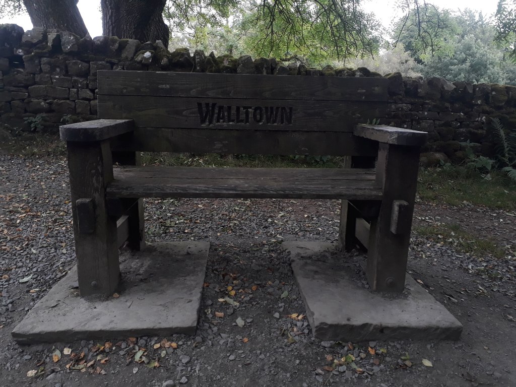
My recce finished at Walltown, which was where a member of the Spine Safety Team first met me and suggested I might like to quit. At the time I was disappointed at what I perceived to be a lack of support or encouragement. However I now realise I was so ‘out of it’ that it was clear to the safety teams I wouldn’t make it and so they simply wanted to stop me damaging myself further. Although I did damage myself and to a certain extent possibly even endangered myself, I don’t regret carrying on. I have some hazy knowledge of virtually all the route bar the last stage which gives me a foundation to build on for next year’s attempt.
Not the most imaginative name for a town on a wall
Another 7.5 miles recced and a very important 7.5 miles in terms of my understanding of where I went wrong and what was happening to me towards the end of my race. There is still much to do, however I have spent three days recceing the whole of the first leg, which will inevitably lead to three more blog posts I guess. It really does seem that the only way – for me – is Pennine!
Just a quick update for anyone interested as I haven’t posted anything for a few weeks.
Am I bored with the Spine Race by now? Far from it! The last few weeks have been spent testing a new pack and planning some recce runs which will doubtless become the subject of future blog entries (you have been warned…)
For the 2021 Spine Race I chose the Ultimate Direction Adventure Vest 5.0. It didn’t rub, held all my kit and would have been perfect if I had been anywhere near as good as I thought I was going to be.
So why am I planning on using a different pack – especially a bigger and heavier one – surely if I failed before the last thing I want to do is to carry more stuff? Well, its not that simple…
Along with the pack I used a UD Ultra belt with the Adventure Pocket to hold all my food and some additional water, so although the pack I’m planning on using is heavier, I will save some weight as I won’t need the extra belt as all my food and water will fit easily (I hope) into the one pack.
The other issue with the Ultra Vest is access. It has very stretchy fabric and not overly generous access zips. This keeps the pack light and everything secure but isn’t so good if you need to get stuff in and out of it. For a properly sorted racer this would be less of an issue but I would like easier access and a bit more room. More room is important because if I’m honest I wasn’t really carrying enough clothing. A couple of mornings it was chilly with a cool breeze as the sun came up and I was a bit cold. Next time I will pack an extra fleece in my pack. Obviously we will then have the hottest Spine Race on record and I will wish I’d packed swimming trunks instead of a fleece…
Anyway the net result of all this excessive thinking is that I’ve bought a UD Fastpack 20l and so far am loving it! I holds two bottles at the front and a couple of 750ml bottles securely in side pockets so easily allows me to meet the requirement to be able to carry two litres of water. It will also take a bladder if I decide that is preferable. I won’t detail all of the pack’s features – this isn’t a review and all that can be found on the website anyway – but I will mention a very positive aspect of the pack in that all the front pockets can be fully utilised at the same time. Quite often you find that if you fill one pocket on a race vest another one becomes less usable, but not with this pack.
An attempt at being artistic with my new pack…
Anyway I’ve been increasing the load in the pack and gradually adding more kit. I’m currently running with it loaded up to about five kilos and its all going very well.
Next week we are going up to Newcastle for the Great North Run. It will be my 22nd time running the race, it was the first event I ever entered in 1998. I missed 1999 due to food poisoning from an unwise fish barbeque in Zanzibar but have run every year from 2000 onwards – apart from last year of course when it was cancelled.
We are going up to Glasgow to see Sharon’s Dad afterwards. This will take us perilously close to the bog that is Blenkinsopp Common and so I will use the opportunity to remind myself just what a wet and god-forsaken mess it truly is – or it might be really nice, although somehow I doubt it.
Sharon is seriously considering entering the Spine Sprint Race, which is the first leg of the full Spine Race. In order to help her decide and also so I can try and complete it without dislocating anything or falling in a bog, we are going to spend three days recceing it. The planning for this is so complicated I had to write it all down on a spreadsheet (true story – I really do have a spreadsheet). We are running each section from South to North like the event but doing the Northernmost section first. Each section will involve taking a train from the North end to the South, running back to the North end, and then driving to the next B&B in the place we started that day’s run at. If you have read that more than once and are still thinking ‘no, don’t get it’ then you will understand why I had to put it into a spreadsheet.
Will I lose the will to live on Blenkinsopp Common? Will we actually have B&Bs booked in the right towns on the right days? Will I suddenly realise what as terrible idea entering the Spine Race again was? All these questions and even more you aren’t really interested in the answers to will almost certainly be answered in my future blog entries…
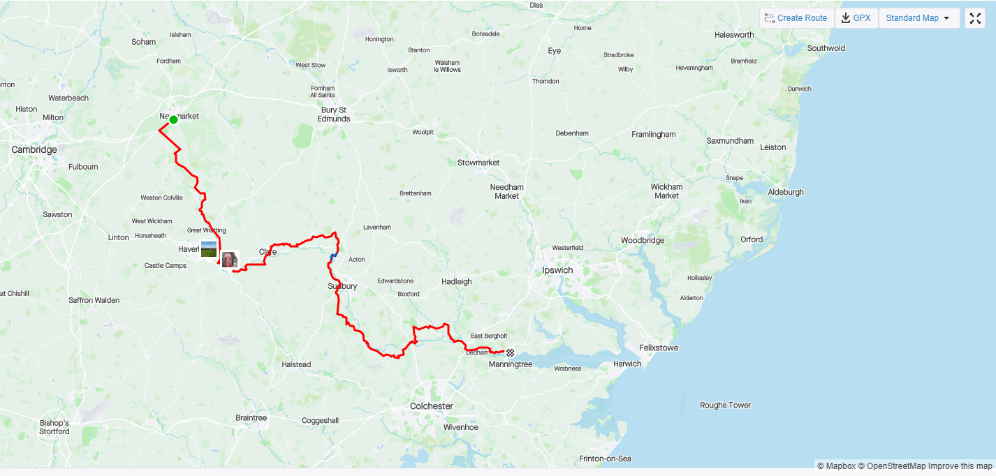
So as I said right at the beginning, this blog will detail my journey to the 2022 Summer Spine Race. It could be argued that a 100km trail race along the Suffolk/Essex border has nothing to do with the Pennine Way but I’m going to disagree.
It is hard to express how consumed by the 2022 Summer Spine Race my life is. Any trail race is an opportunity to try something new or different. In this case it was shoes. I ran the Spine and Lakeland in Inov8 Roclite 275G. many people have completed both events very successfully in them but my lack of running technique (especially downhill) meant that I ended up with very battered feet. I’m quite a fan of Hoka shoes, particularly the Torrent. I finished the Spine in Torrents, but my feet were already damaged when I switched to them. However the uppers do seem to hold a bit of water and I do remember finding the heel stability a bit lacking for some of the more technical downhill bits so I don’t think either the Roclites or the Torrents will be my shoe of choice for Summer Spine 2022.
I liked the look of the Inov8 Terra Ultra 270G – however I was less taken by the price. Fortunately I could buy them at a considerable discount from a website in France. Unfortunately due to ‘restocking issues’ they have been delayed – I don’t know by how much as I still haven’t received them. I did manage to find them with almost as big a discount on a UK site and they arrived on Friday – I had a full afternoon to try them out before SVP100 on the Saturday…
After four or five miles (I forgot to start my watch at the beginning of the run) I came to the conclusion they weren’t horrible and I’d use them for the race. I did this once before with a pair of ON trail shoes and finished the race with small pools of blood in the shoes – it is also my best time to date, maybe pain makes me run faster.
Anyway shoes and kit were decided on and so we set off at 5am on Saturday to pick up our friend Adam who was also running SVP100. It’s at this point I have to once again mention how great Sharon is. She does the SVP50, which follows the second half of the SVP100 course and doesn’t start until 5 hours later. However she gets up at 4:30 to take me to Newmarket for the SVP100 start, drives to the finish at Brantham, has breakfast and gets the train to Sudbury for the SVP50 start – I never stop telling myself how lucky I am to have such incredible support!
The SVP100 still had some social distancing rules in place and so there was a rolling start from 6:30 to 7am, and there was only a bag drop, no briefing at the start. I met my friend Peter at the start, sadly I didn’t see him at the finish as he had to drop out with cramp.
I did ask what the SVP100 has to do with the Spine race earlier, well at the bag drop Chris came over and spoke to me – he had last seen me shortly after CP4 on his way to successfully complete the 2021 Summer spine Race. I had forgotten that I had a conversation with another Essex runner at CP4, I had given myself away by wearing my Little Baddow Ridge Runners t-shirt. I was wearing a similar t-shirt for the SVP100 so I was easy to spot. When Felix was fixing my feet I was fairly blissfully ignorant of how bad they were as I couldn’t see the soles and they looked OK from above. Chris also had some medical attention at the checkpoint and apparently could see how bad they were – he was amazed that I managed to continue at all!
Anyway onto the race, obviously I’ve done many races before and so wouldn’t be making any schoolboy errors like forgetting to take my fleece off before dropping my bag, getting half way to the start and having to run back to put it in my bag, would I…?
Adam was determined to start at the last minute, I started a minute or two before the last minute and, for the seventh consecutive year, I set off down Barbara Stradbroke Avenue to the left turn onto Devils Dyke (or ‘Ditch’ according to the OS map). The Dyke (or Ditch) was dry underfoot and my progress was good. It’s largely chalk and can be quite slippery if there has been recent rain. I was very aware of the underfoot conditions as I was trying to assess how good or bad my new shoes were. They performed well, grip was excellent, they protected my feet from the odd tree root and rock that tried to trip me up, and they felt a little more forgiving than the Roclites. By the end my feet would be quite sore but I think that had more to do with inadequate recovery time from the Lakeland 100 (and the Spine Race) than any issue with the shoes themselves.
I set out quite quickly, knowing that I would slow up a lot as the race went on. I’d already started to slow a little by the time I got to CP1 at Great Thurlow but that was fine, I had no time in mind and was just interested to see how I would do and how my new shoes were.
Not a bad day for a little run
Actually things were all going rather pleasantly, I spotted my first phone box at Baythorne End, less than 20 miles into the race, and took an unwise and slightly disturbing selfie – I do have bottom teeth…
Slightly strange phone box selfie!
I would photograph four more phone boxes before the end of the race – however as I am aware that very few people find the mas interesting as I do, I won’t include any more pictures of them in this blog.
Checkpoint Two was at Clare Castle Country Park. Rather than try and take huge quantities of Tailwind I had one for each checkpoint and supplemented it with Coke and Baby Bel cheeses at checkpoints. This allowed me to carry all my compulsory kit in a waist belt with two water bottles and have the Tailwind in pockets in my shorts. I did end up with a few rubs doing this but it meant I didn’t have to use my race vest. I like my race vest but I do like to run with a little kit as possible from time to time. Today that was a particularly good move as it was very hot in the sun and the lack of a vest meant the air could flow more freely around me. I filled one bottle with Tailwind and one with squash and carried on.
I’m sure Checkpoint Three used to be at the Long Melford cricket ground – which is why I nearly ran past it. It’s on the main road before the turn to where I thought it was going to be. fortunately the volunteers were very alert and called me over before I did anything too embarrassing.
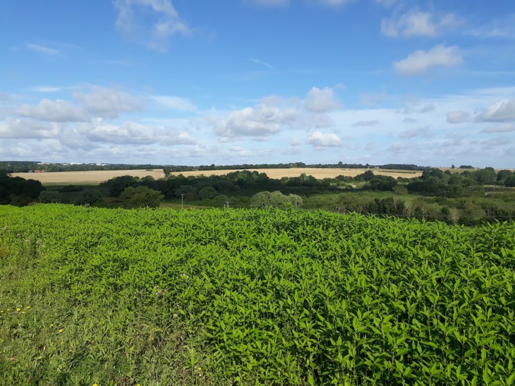
A few miles further on the SVP50 joins the 100km route at the Valley Trail, an old railway line route just outside Sudbury. There are a few climbs on the way to Checkpoint Four and the difference between those just starting out on the 50km race and me – who had already run around 60km – was very obvious! Although the route of the Stour Valley Path does follow the valley, it also likes to wander up and down the sides of the valley and has many short sharp climbs and matching downs.
I ran for a while with Mark and his friend Matt. I met Mark on my very first SVP100 and bought him an ice cream. Six years later on I still remind him he owes me an ice-cream. To be fair we were out in the middle of nowhere and there wasn’t an ice-cream to be seen.
One of the many short, sharp ‘ups’ on the route
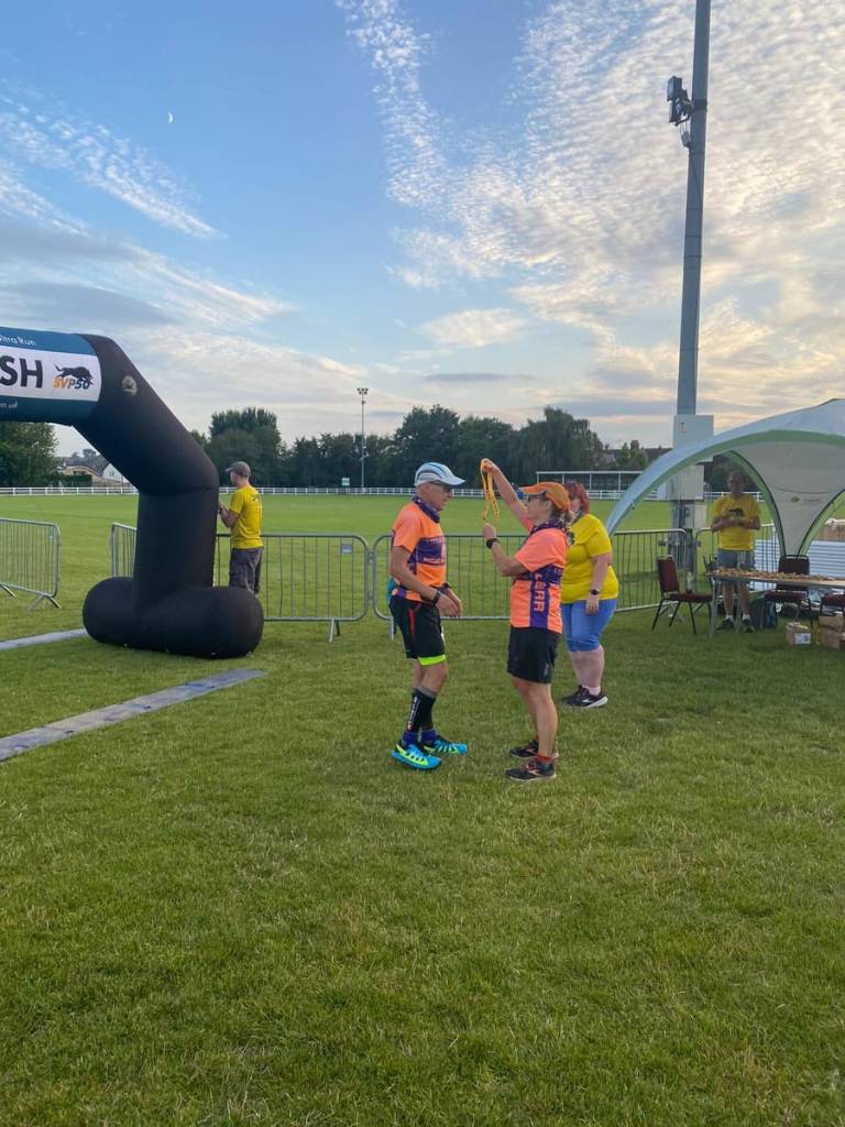
At Checkpoint Five a very nice lady informed me that ‘Mrs. Colin’ had gone through 15-20 minutes earlier. I was quite happy with this, last year I finished first and gave Sharon her medal, this year she would be able to return the favour.
By Checkpoint Six there is only one climb left and that is only because it has take a year and counting for anyone to repair the Fen Bridge. If the bridge was usable it would be more or less flat from the checkpoint to the end, instead there is another short sharp climb.
The reward for the climb is a nice run down to Flatford, inspiration to John Constable. I didn’t take any pictures and I can’t find any from previous trips, so I’ll use a somewhat better image than I could ever create to illustrate this part of the route…
File:Flatford Mill (Scene on a Navigable River) by John Constable, Tate Britain
Two miles from the end I met Lakeland Jackie. She was in a yellow volunteers t-shirt with her dog Jake, and was putting out the glow sticks to guide home those that would finish after sunset. She told me she had run with Sharon and that if really went for it I might catch her. I was fairly sure I wouldn’t although I did speed up. That had nothing to do with catching anyone but everything to do with my watch telling me it only had 5% battery left and I’d better get a move on if I wanted all of this run recorded!
The very last section of just under a mile is not usually my favourite, it is along the road and always seems longer than it really is. However this year it was made significantly more pleasant when I met Esther marshalling the last road crossing before the finish. We have a ‘in’ joke about USB cables that probably confused the other chap that crossed the road with me.
The very last bit involves passing a pub with very supportive patrons cheering you on outside, running round the corner, trying to remember the turn to the footpath, meeting a lady who described herself as ‘Your last marshal’ and triumphantly running across the field to the finish arch.
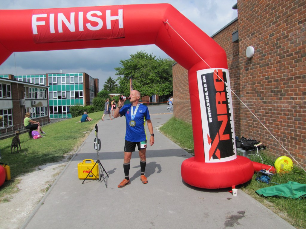
The finish of the SVP100 is always great. This year we are back to hugging and so I was able to have my traditional hug with Nicola-Anne after Sharon had given me my medal.
Getting my medal!
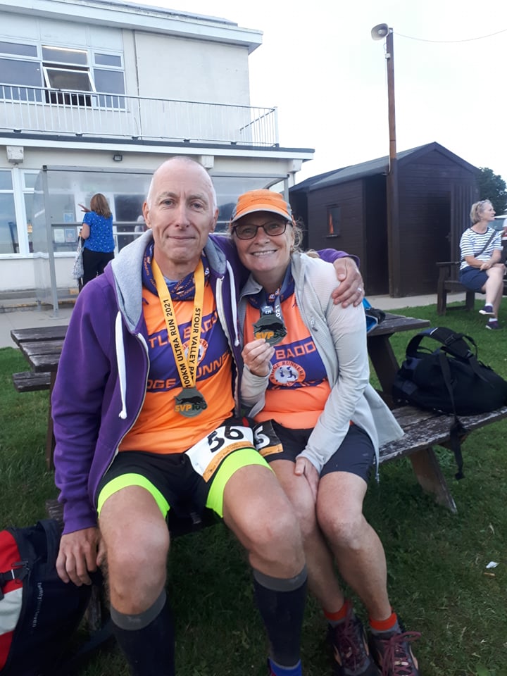
The other welcome tradition is that Steve always has my bag immediately ready for me so I can change, collapse or do whatever I want to do as soon as I finish. This year it was take my shoes off… followed by beer.
Tired but happy to have finished!
So how was it? Hard. I’ve done this race seven times now and only two or three times have I been in peak condition but this was probably the most wrecked I’ve felt at the end. That’s not terribly surprising given only three weeks ago I ran 105 miles around the Lake District and a little over four weeks before that I was pulling out of the Spine Race, having covered 220 miles in five and a half days, but it does remind me I do need to take it easy for a while longer. Of course my performance wasn’t helped by the fact I’ve put on around five to seven pounds compared to my pre-Spine weight – I did need to eat a lot after that but I then forgot to stop… however the positives are I finished in daylight and with no serious foot issues or blisters – and I had fun and saw some people and generally enjoyed myself.
My preparation for Summer spine 2022 continues! Next month is the Great North Run. This is in no way very relevant to the Spine Race except that its much nearer to its route than Essex is. I’ve planned a few days recceing after the race – including a trek across the infamous Blenkinsop Common. I’ve also entered the Cheviot Goat Race in December. The race is 55 miles of which 10 are on the Pennine Way and more importantly 10 miles of the Pennine Way I didn’t get as far as. It’s likely to be cold, wet and probably dark so I’m kind of hoping that when I run it on the Spine Race then at the very least it will be no worse!
On leaving the Lake District after the Lakeland 100, we went to Glasgow to see Sharon’s Dad. As Sharon does all the driving we decided to split up the journey back. The first part of the plan was to spend Saturday night in Penrith and finish the journey on Sunday. Our journey from Penrith would take us along the A66 and past God’s Bridge. Sharon was quite keen on the idea of stopping and having a look at God’s Bridge. I also wanted to see God’s Bridge as it was on the small list – along with Snowdon and Pen-y-ghent – of ‘Thing’s I’ve only seen in the dark’. I crossed it on the Spine Race, I only knew that because I was with a couple of other runners at the time, one of whom told me I was crossing God’s Bridge. I can honestly say that otherwise I would have crossed it and been none the wiser.
Anyway this appeared to be a perfect opportunity to recce a bit of the Pennine Way and see the bridge. A further night was booked in a hotel in Grantham to allow us a bit more time to run, at the expense of an early start on Monday to get to work before 9:30.
I had my GPS with me from Lakeland but I’d deleted the Spine routes from it so I’d have to do a bit of route finding on the fly. Fortunately there is a ‘Bowes Loop’ at that point on the Pennine Way so I came up with something that almost looked like a plan if you didn’t look to closely. We would start in Bowes, run to God’s Bridge, recce the bit of the Pennine Way from there to Blackton Reservoir and return to Bowes on the ‘Bowes Loop’ – what could possibly go wrong?
Usually the phrase ‘What could possibly go wrong?’ is followed by a litany of disasters, indicating that the correct answer was ‘Pretty much everything’. Well not this time! Despite the lack of planning and minimal navigational aids, we executed our plan very well. We parked at the perfect location in Bowes (although this was a bit of a fluke as I wasn’t quite sure where we came back into the town) and headed west to God’s Bridge.
To be fair the first bit of navigation was hard to get wrong. God’s Bridge is over the river Greta (which had nothing to say on the subject of the environment) which flows past Bowes, it’s also near the A66 underpass so I would have had to really work at it to go massively off course – although from Spine experience, a few days of sleep deprivation might have done it. My navigation wasn’t perfect, I followed a path along Sleightholme Beck instead of the Pennine Way for about 500m, and just before God’s Bridge I took us along a farm track instead of the footpath but no one shot us or shouted at us and we arrived at said bridge so I’m taking that as a win.
God’s Bridge!
So what is so special about God’s Bridge? Why is it considered the property of a deity? I’ll let Wikipedia explain:
‘God’s Bridge is a Site of Special Scientific Interest in the Teesdale district of south-west County Durham, England. It is a natural limestone bridge over the River Greta, just over 3 km upstream from the village of Bowes. The bridge was formed by a process of cave development in the limestone beneath the river bed and is the best example in Britain of a natural bridge formed in this way. The SSSI covers a portion of the river above and below the bridge where shallow cave development by solutional activity is still taking place.’
Standing on the bridge looking East
When I crossed it previously it was dark. As you can see it is an excellent bridge, with no real approach or exit ramps or steps so I think I can be forgiven for crossing it without noticing.
Looking back to the Greta Valley – Sleightholme Moor is in the distance and way off to the right is the Tan Hill Inn
The A66 underpass was a lot more rural than I remembered from the impression I got in the dark. I thought it was graffitied and that the road was more visible (not sure why I thought that, given it was dark) but the path goes along the side of a field and into an arched corrugated iron tunnel under the road before emerging on the North side of the A66.
When I got to this point on the Spine Race the obvious path from the gate after the underpass very slightly cut the corner compared to the ‘official’ route. I took the obvious path again. Technically that could be construed as cheating I suppose but it would be quite harsh to be penalised for cutting maybe 20 yards off 268 miles, I feel.
The start of Cotherstone Moor
Once I was on Cotherstone Moor, things felt reassuringly familiar. I found the same rock to cross Rove Gill without getting my feet wet – however I did also find a very small peat bog I didn’t step into last time…
So which foot went in the bog then?
The path continued on to a shelter at Deepdale (which I’m fairly sure was locked when I did the Spine but was open on this occasion). We then passed ‘The Great Allotment’ – which was disappointingly devoid of people growing potatoes or sitting in sheds or doing any of the things one associates with allotments.
Looking towards the shelter – The Great allotment is on the far right of the picture
For the last half a mile of Cotherstone Moor I followed a path which was almost but not quite the Pennine Way as shown on an OS map. Interestingly I followed exactly the same route on the actual race. This time I probably added 20 yards to my distance and came out on a road not more than 10 yards from the official exit from Cotherstone Moor.
Just to prove we actually were on the Pennine Way!
We were escorted by a goose and some goslings to Clove Lodge and shortly after left the Pennine Way proper to turn onto the Bowes Loop for the return journey.
Mum keeping her babies away from the strange people
The Bowes Loop started well with some nice views back to the reservoir. The path was fairly clear apart from across one boggy field. it looked as if people had taken several different routes, presumably to try and avoid the boggiest bits. I tried to just keep heading in the right direction rather than keep trying ot find the exact path. I think this was one of my mistakes on the Spine Race, I spent a lot of time going sideways trying to find the path as indicated on the GPS, rather than making forward progress.
Looking across Baldersdale
We started to climb away from the reservoirs and farmland, and back onto the moor. We passed under the shadow of Robin Hood’s hole according to the map, although it didn’t look much like a hole to me.
Robin Hood’s Hole apparently
Shortly after this it seemed to become quite important that we stayed on the path…
You have been warned
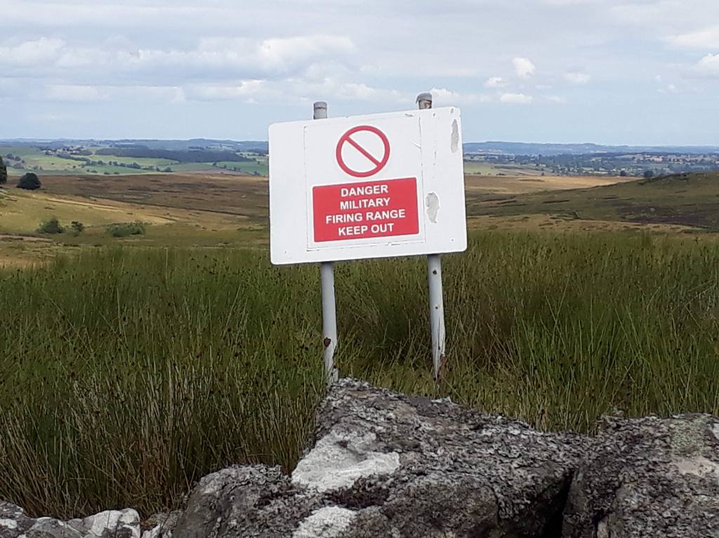
Fortunately the path was quite obvious and, more importantly, so was the boundary of the firing range.
Looks very clam a peaceful -presumably they don’t do any firing on Sundays…
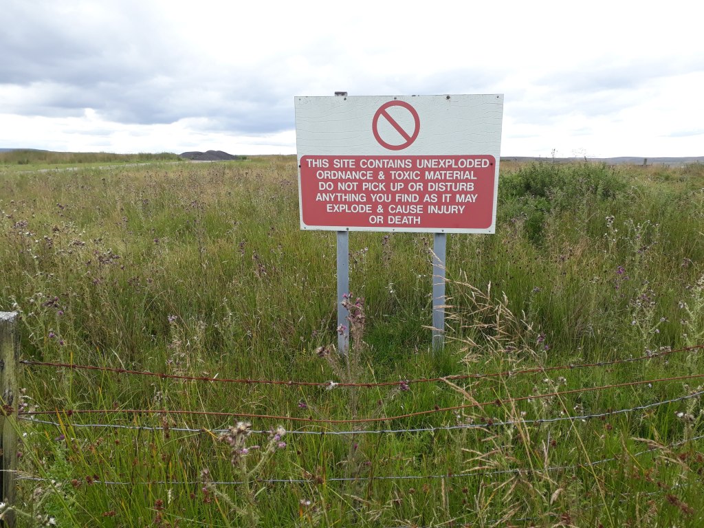
As we got nearer to Bowes and came to Stoney Keld, we drifted a little off the path as marked on the GPS. At the time I wasn’t too bothered as we still appeared to be on a path and it would ultimately take us to the same place. Had I known more about the history of RAF Bowes Moor, the site of which we were now walking across, I might have been a little more careful about our exact route. As we rejoined the road a sign gave us a hint…
Fortunately we didn’t find or disturb anything
RAF Bowes Moor was a storage site for chemical weapons during the Second World War. Wikipedia can provide more details but I’ll just quote one small part: ‘Originally, the weapons were left piled up in the open with tarpaulins on them, however, sheep ate the covers which dislodged the weapons and so hardstandings were built to house the weapons. Most weapons were then stored inside buildings, except the 250 lb (110 kg) bombs which were left outside, however, sheep-proof fencing was erected around the whole site.’
Having avoided being shot, blown up or poisoned (and, even more surprisingly, getting lost), the last part of our journey took us on a country road towards Bowes. By now my feet were suffering on the hard surface and Sharon was delighted to find that she was having to wait for me rather than vice-versa. As we came into Bowes we got a nice view of the castle and the even more welcome sight of the car, which, it turned out, was parked perfectly on our loop so no running back into Bowes to find it.
Bowes with the castle in the background
So what did I learn and did the recce achieve anything? Well ignoring anything else the ‘Bowes Loop’ is quite a nice little run and can be recommended to anyone that finds themselves in that part of the world. I was very pleased at how much of the Pennine Way I remembered. I was however particularly interested in how my perception of the A66 underpass deviated from reality. On the race I was there on my third night and had had maybe 3 hours sleep in total since the start of the race. This would seem to suggest that apart from obvious hallucinations, sleep deprivation (and possibly inadequate fuelling) can cause more subtle changes in perception. These are perhaps more concerning as they have the potential to be more disorientating than full blown ‘obvious’ hallucinations.
On a map or on a GPS track, there is THE Pennine Way. On the ground this can be less of a certainty. Also GPS positioning is only accurate to within a few metres so some common sense is needed – simply moving such that your location on the GPS is exactly on the track you are trying to follow does not mean you will be on a path! Add to this the fact that if the ground is boggy people may well take a different path (or several different paths as conditions change) and it becomes more important to be going the right way than trying to be on a path which exactly matches the GPS track – it may not exist. I think on the Spine I spent way too long looking for non-existent paths and not long enough making progress in the right direction. On this recce, especially once we were on the Bowes Loop and I had no previous experience of the route, I tried to take us the right way rather than be constantly looking for an exact path. OK I took us through a ex-chemical weapons dump in doing so and so maybe that isn’t always the right approach but there should be some middle ground there somewhere.
The recce also served two more linked purposes. At the moment I am very focussed on Spine 2022. It’s going to be hard to keep that focus for almost 11 more months so anything directly linked to the race will help. I also said I would update this blog on a regular basis but it might be hard to think of vaguely interesting things to write without the odd recce to report on!
So 4 miles recced, 264 more to do! It really does feel that the only way is Pennine…
This story starts, as so many do at the moment, with a tale of Covid induced disruption. Many races went virtual in 2020 – Lakeland became Fakeland..
My good friend Jackie is a Lakeland legend, with five finishes she is a huge part of the Lakeland family and so was definitely going to get involved in the 2020 Virtual Lakeland 100. The suggested format was to run the distance between two checkpoints every day for a week to complete 105 miles (for those that don’t know, for reasons which seem to have been lost in the mists of time, the Lakeland 100 is 105 miles).
I felt this lacked ambition, plotted a 105 mile loop around Essex and so Fakeland was born…
The finish of Fakeland 100 2020
With support from Jackie’s partner Adam, we completed the loop and had great fun. So when Jackie said I should enter the real one I kind of agreed, anyway it’s a ballot to get in so I had no chance…
Twelve months later, four weeks after DNFing at the Spine Race, I’m heading to the Lake District.
I won’t lie, I wasn’t entirely looking forward to the race. Firstly, I knew the terrain, climbs and descents were harder than the Spine Race. Secondly, I had no idea if I was physically recovered sufficiently to even run 105 miles. Thirdly, I really didn’t want two DNFs in a row and my firstly and secondly made my thirdly a strong possibility.
The theme for 2021 was The Blues Brothers, getting the band back together and everybody needs somebody. This was extremely appropriate given the number of people I knew that were doing the event. There were eight of us with Essex connections, including, of course, Jackie and Adam. My 2016 MDS tent mate Darren lives in Kendal and had promised to come and support me. As it would turn out he wasn’t the only member of Tent 137 I would see over the weekend, all the bands were getting back together!
The weather was fantastic and the Lake District was heaving. Our guest house was lovely and not far from Coniston – except that Lake Windermere was in the way… Fortunately I had a tent to set up at the campsite as driving back to the guest house after registration and then back for the start could have been challenging. My tent is so easy to.put up – it basically puts itself up. I haven’t used it for ages and really should have practised putting it away…
My tent and my flamingos, Coni and Dale
Kit check was painless – the kit was mainly a subset of my Spine kit and all passed without any problems. Then it was the official photo for the tracking page and I was done, all that was left to do was eat, drink and wait for the briefing.
There is no doubt the organisers of the Lakeland 100 go out of their way to create a great atmosphere around the race. The briefing was a mix of humour and the usual race type stuff, shut gates, don’t drop litter, try not to die etc. After the briefing I disguised myself as a runner and joined the hordes at the start.
The atmosphere as we ran through Coniston was electric, probably the best I’ve ever experienced at the start of a race. However 500+ people starting together and heading for single track paths and gates did mean there was a lot of delays after we left Coniston. Its a tricky one as a rolling start would allow smoother running but the mass start had the best atmosphere. From my perspective it didn’t matter too much as I wasn’t going to be racing but I guess if you are you just have to make sure you start far enough forward.
I was looking forward to seeing this on my way to the finish
I wasn’t really taking notes as I ran so you will be relieved to know I’m not going to go through a checkpoint to checkpoint breakdown of my race. To summarise the Lakeland 100 course: Scenery – stunning; Climbs – long, hard; Descents – sometimes nice but usually too steep for someone with my lack of mountain experience to be comfortable on; Underfoot – occasional tarmac or grass but mostly rocks and stones. So what did this mean for me? Well the stunning scenery helped, although less so in the dark. I actually did OK on the climbs I felt, I was usually keeping up with whatever little group I was in. Many of the climbs were single track and so small groups tended to develop as it wasn’t really worth trying to overtake unless you were planning on going much more quickly. The descents were a real problem for me. I would arrive at the top of a climb in a group and suddenly find myself all alone as everyone else descended and I tried not to do anything embarrassing out of sheer terror.
Beautiful but hard work
The combination of steep descents and rocky paths started to give me another problem – blisters. Those who read my Spine Race report will know that blisters figured significantly on that event. I had added anti-blister plasters to my shoes for the Lakeland 100 and they worked very well – I didn’t get any blisters in the same place as I did on the Spine Race. However, probably due to poor technique, the steep descents put a lot of pressure on my heels and I could feel them starting to blister on the bottoms. By Checkpoint Two I decided to put into practice the lessons of the Spine Race and stopped and taped them up. It wasn’t a perfect repair but they were no where near as bad or as painful as the ones on the Spine Race so I gave myself a tick for learning my lesson and doing something sensible. The only time they really hurt was when I missed my footing and slipped to a halt on my heel.
Anyway enough about blisters and back to the event. I’ll be honest, by the time I’d completed marathon distance and had got to Buttermere, I wasn’t feeling too much love for the race. This was nothing to do with the race itself but all down to my failings. I had really struggled with the steep descents in the dark, I’d rolled my ankle several times on a narrow track on the hillside and I was seriously wondering if I hadn’t taken on way too much so soon after the Spine Race. However it wasn’t all doom and gloom (there was a very spectacular orange full moon so definitely not so gloomy). Someone asked if they had done the MDS with me – it was Tony, another of the Tent 137 occupants in 2016! We had a quick chat and passed each other a few times during the race until Tony pulled away from me as the race went on.
By Braithwaite it was getting light. Braithwaite was also a source of rice pudding which improved my mood no end. I padded my heels a little more and set off up the road. This was good as it was easy underfoot and I had a little chat with another runner on the way. By the time I got to the old railway line I decided some running was in order as it was a good path with only the slightest of gradients. I didn’t even see the shortcut that we weren’t to take and so passed the virtual checkpoint without any worries.
Before Dockray I would have to negotiate the Old Coach Road, a fairly universally hated trek along a wide stony path. I chatted with a few more runners along it which at least passed some of the time.
Dockray to Dalemain was the longest leg but by now I was running in loose group which included my friend Matthew, race director for the Stour Valley path 100, a race I had enjoyed many times. The weather was good, the views even better and the paths less challenging. Also at Dalemain would be my drop bag. Whist I had some first aid stuff with me (it was part of the kit list as well as being useful), in my drop bag I had a lot of tape and padding so my plan was to really sort my heels out. I did have a full change of kit but as the weather was good I only changed my socks.
How to ruin a perfectly good view
I was shocked to see Jackie at Dalemain as I had expected her to be several hours ahead of me by now. She had been having stomach issues and had a little sleep and some food at Dalemain. Fortunately she recovered and I didn’t see her again until the finish. Less good news was that Adam had had to pull out. I had seen him at an earlier checkpoint where he had told me his ITB was giving him problems and he would probably have to retire so it wasn’t a surprise but disappointing nonetheless.
After Dalemain it was Howtown. Apparently some people had a long wait at Howtown as it’s the first checkpoint after the Lakeland 50 runners join at Dalemain. I don’t remember much about it and was behind most of the LL50 runners so I assume it was OK. However the next leg was the second longest at 9.4 miles and had the most climb, 2205 feet according to the road book. I was still with Matt and a couple of others and we picked up someone that knew the course and was able to give us an idea of what was to come. The climb was hard with many false summits but not terribly technical. We were very fortunate that it was dry as much of the descent is on grassy boggy ground which can be very slippery – for us it was OK but I can imagine slipping and sliding down to the lake wouldn’t be a lot of fun. By the time we reached the lakeside it was just me and Matt and I tried to push us on at a reasonable pace as, although it was a bit rocky and technical in places, the course was no where near as difficult as some of the earlier stages.
At Mardale Head I experienced something I don’t normally have a problem with – the fact that checkpoints can run out of stuff for later runners. Due to the heat of the day, Coke and squash had proved extremely popular and so we only had a choice of tea, coffee or water to drink. You might think this would cause me to think badly of Mardale Head but as it happened it was where things started to really come together for me.
I should point out that the fact that this was where I stopped running with Matt is NOT the reason things changed for me from here. Matt had a few issues with plantar fasciitis and I had my own issues I’ve mentioned previously. The net result was that it was becoming obvious that we had very different strengths and weaknesses. I was still fairly OK on the climbs but was suffering a little on the downhill. As the route out of Mardale Head is up the Gatescarth Pass I pulled ahead. As I was heading upwards I had the most welcome sight of Sharon and Darren coming down to cheer me on. This was also where I first met Mary. At this point we weren’t deliberately running together but she was running at a similar speed to me, and obviously Sharon and Darren were running with me . As Mary was Scottish, Sharon immediately liked her.
After we came over the pass, Sharon and Darren went off to the car park back to Darren’s car. Darren said they would see us at the Garburn Pass, obviously assuming I had any idea where that was…
Mary and I both had a few issues but were of quite similar pace and so we ran together chatting about subjects as diverse as camel fairs and GPS. We actually made quite a good team, Mary’s husband has done LL100 before and was way ahead of us but Mary had recced most of the course and knew her way round 99% of it. The reason I say we made a good team is because I has my handheld GPS and so could quickly fill in the 1% Mary didn’t know. This was great for me as, whilst I absolutely love my handheld GPS, it isn’t very convenient to refer to continuously whilst using poles.
At Kentmere we were too late for smoothies but they did have a lot of apple juice which went down very well with me as it was a nice change from the sugary synthetic tastes of Coke and Tailwind. I started chatting to the volunteer handing it out and he asked me about hallucinations. Although I was into my second night things were still behaving fairly well. I think this was down to a regular supply of sugar to my brain and the fact that having someone to chat to gave the aforementioned brain something to do instead of go off on its own and make things up. I mentioned the extreme hallucinations I experienced on the Spine Race. It turned out this particular volunteer knew exactly what effect they had had on me as he had been the member of the Spine Safety Team that tracked me from Cross Fell to Alston and so was aware of all my random delirious wanderings! He told me he was delighted to see me as he had been sent a photo of me on the course and said that he was concerned I may have been seriously ill – the fact I was at Kentmere in plenty of time to finish (he said) proved that I wasn’t and that it was just sleep deprivation and probably a lack of sugar. After my less than heroic performance at the Spine and the fact that I obviously caused the Safety Teams some concern, I wasn’t sure that they would be over pleased to see me back next year. However my previously unknown guardian angel said that everyone would be really excited to see me back and to see me finish.
So it may be dark, there may be no chance of me finishing without going all the way through the second night and well into Sunday but I don’t care, life is good. I’m still running and chatting with Mary, I found out more about my Spine Race and, as promised, Sharon and Darren were at the Garburn Pass.
After the Garburn Pass and Ambleside I could dare to dream I was going to finish. I knew there was some technical stuff at the end but at least it would be light and there was less than 15 miles to go and three checkpoints in that distance.
As we left Chapel Stile it was starting to get light. Bleamoss wasn’t at all boggy and we followed the line of flags a nice man puts in to guide runners through the potentially boggy exit and passed the second and final virtual checkpoint. Personally if anyone wants to take a shortcut through a bog I would let them and watch them deal with the consequences but presumably people have done in the past.
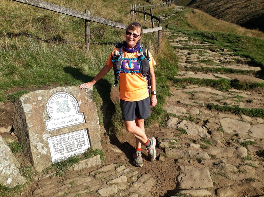
Tilberthwaite, the final checkpoint and only three and a half miles to go. On one of my ‘comfort zone’ races I would barely stop at a checkpoint that close to the finish. However I could see the steep climb up Jacob’s Ladder and I was aware that the other side involved a technical descent into Coniston so I made sure I was well fuelled, and that I wouldn’t need any ‘nature stops’ at an inconvenient moment.
I threw my pound in the bucket and started the climb up the steps of Jacobs Ladder. Jacob was a little boy that sadly died of cancer. He had a strong association with the race and so no one minds making a small donation to charity as they start the last part of the race. I certainly didn’t, I’ve rarely been happier to have been somewhere than I was at this point. The climb up was tricky in places but not too bad. The section across was fairly straightforward but then there was the descent. Everybody needs somebody right? With Mary’s words of advice, encouragement and demonstration of where to put my feet I got down without too much drama, just the last run into Coniston to go.
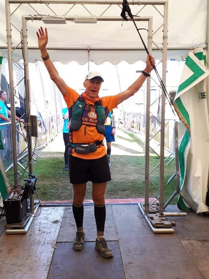
And it was a run. Someone pointed out that we could finish in less than 39 hours as we came off the final descent so we ran through Coniston. It was amazing, the marshals were cheering us on and directing us home, people cheering, Sharon and Darren cheering loudest, round the corner under the arch and we’ve finished!
No words for how I felt here
Everyone gets their moment at the Lakeland 100. A marshal took charge of me, made me pose under the finish arch so Sharon could get a photo and then made me wait until it was my turn to be announced and enter the marquee to even more noise and applause (quite a lot of it from Jackie). I was the last of the ‘Essex Legends’ to finish but Jackie, Adam, Steve and Matt were all there along with Sharon and Darren. After getting my medal and my finishers photo I was given food, drink and beer.
I’m a bit happy!
Mary came over with her husband so I thanked him for lending her to me and he thanked me for looking after her (I didn’t much, only a little bit when she was getting tired). I wanted to stay for all the presentations but I was knackered so we went and failed to dismantle the tent properly – I knew I should have practised taking it down. however it was folded up enough to get it into the car and after saying goodbye to Darren and thanking him for his support and for looking after my wife, we went to our guesthouse.
So for those that have looked at this and said ‘Too Long: Didn’t Read’, I made it, four weeks after my traumatic exit from the Spine Race I found redemption in the form of the Lakeland 100. I do feel redeemed because it was an incredibly tough race and totally out of my comfort zone and I struggled, and I suffered, and I went thorough a whole heap of emotions on the first night but I have a big medal and a t-shirt I’m not taking off.
I did learn from my Spine failure. I looked after myself better, I took more responsibility for myself. I didn’t get it all right but I’ve made progress. I found out more about the Spine Race, I didn’t realise I was causing quite so much concern or that I would be welcomed back (presumably provided I do actually learn from the last one). I spent time with people, lots of different people. Realistically I should never have been able to finish that race but I did, because of people. Everybody needs somebody – and with enough somebodies on your side you can do anything.
Oh yeah!
Anyway I think I’ve gone on quite enough. For anyone that skipped straight to the end – summary: I am a Lakeland Legend!
I intended to try and answer the question ‘What’s the difference between stage and non-stop racing?’ in my last post. However it turned into something slightly autobiographical. However it still didn’t really make the point that is relevant to the answer to the question. That point is that I am a stage racer. All my experience is of stage races. The two non-stop races I’ve done are the 100 and 184 mile events along the Thames. In both cases I did them without sleep or rest and so essentially turned them into single stage races.
So what is a stage race? to answer this I will describe the format of stage races I’ve done, others may be different but all mine have followed a broadly similar format. A stage race could be two days or it could be a week. The distance and start time of each stage is defined. Typically the stage might start between 6 and 9 in the morning and be around 50km in distance. The clock stops when you reach the finish of the stage until the start of the next stage. The Marathon Des Sables has always had a stage of 50 miles and many other stage races have copied the idea of having one ‘long’ stage somewhere in the event. In reality the long day of the MDS is followed by a rest day and the total time permitted for the stage does allow competitors to split it into two parts and sleep overnight at a checkpoint if they so wish. Generally there will be a number of checkpoints along the stage. Dependent on the race the spacing will generally be between 5 and 10 miles, although some might be closer and some further apart depending on safety requirements and the availability of suitable locations for a checkpoint. Water will always be available at a checkpoint. On the MDS only water is available, other races might have sweets, snacks, cola – an ultra-race has been described as jog between picnics!
Suddenly the reason I’ve done so many Extreme Energy events becomes obvious…
Anyway the point of all this is to explain why part of the reason for my failure to complete the Spine Race was due to not appreciating the difference between a stage race and a non-stop race, and, more relevantly, not being smart enough to modify my behaviour accordingly.
So I am used to starting a stage at a particular time, running to the end, the clock stops and I then have until the next stage starts to recover – usually at least the evening and overnight. As a result I try and minimise the time spent in checkpoints and don’t worry too much if I reach the end of the stage perhaps a little dehydrated and under-fuelled as I usually have in excess of 12 hours to sort myself out before I have to run again. Checkpoints are places to spend as little time at as possible (even the ones with Freddo Frogs at them) as it adds to my total time, whereas once I finish the stage I can spend as much time as like eating and drinking without affecting my race time.
The Spine Race is a non-stop race. That doesn’t mean you can’t stop. The Safety Teams do not come out with whips if they notice anyone’s dot has stopped moving. If a dot stops moving for any length of time they will investigate but that is for safety reasons, not to satisfy any sadistic urges to make runners move. What doesn’t stop is the clock, it starts when the starter says go and it stops when you reach the Border Hotel, that is your race time.
If we try and map the Spine Race onto the format of a typical stage race then a Spine Race checkpoint is most like the overnight halt of a stage race. It has food, sleeping facilities and access to your drop bag, much like a typical stage race halt. The Spine Race equivalent to a stage race checkpoint is slightly more ad-hoc. Water may be obtained on the Spine Race potentially from Safety Teams or from taps or – if you are feeling brave and have a filter – from any natural water sources on the route. Shops, cafes, and pubs can also be used to buy provisions.
So much for the similarities, now we come to the huge difference and one of the reasons I ended up in such a delirious, sleep deprived state. On the Spine Race you can stop for a maximum of 6 hours at a checkpoint or until it closes, whichever comes first. This compares with anything up to 18 hours on a stage race – and that 18 hours doesn’t go onto your race time. Conceptually I knew that I would have to stop and sleep, unfortunately there was still a part of my mentality which kept telling me that resting was adding unnecessarily to my race time. Sometimes my brain is not my friend. Some people sleep out on the course. This was never my plan and I didn’t. Whilst planning the race I couldn’t understand why anyone would. However having run the race (most of it) I can now see why that might be attractive.
I arrived at all the checkpoints during the day. Ironically if I had made it to Checkpoint Five it would have been at night. However as it closed at 2am I would still have had to leave in the dark. The only checkpoint I spent anywhere near 6 hours at was Checkpoint Four. I think the transformation I underwent there indicates that if I had spent more time resting earlier on I could have been in a much better state later in the race and may even have been able to finish (although possibly not with the cellulitis).
As I’ve been writing this I’ve come to realise the reason I DNF’ed wasn’t because it was a non-stop race but because I didn’t take enough responsibility for me. As I’ve mentioned before, I’ve run a lot of Extreme Energy races. Their philosophy is that they will do all the organisation, you just turn up and run. The MDS is the most ‘self sufficient’ stage race I’ve run because I had to carry all my food and kit for the week. However you have tent mates who will keep an eye on you and make sure you eat and look after yourself. The Spine Race actually says ‘There is very little hand holding on this race. We expect you to travel with a degree of self-sufficiency and skill which sets this race apart from others.’ Either approach is perfectly fine as the competitor knows what is expected of them and what they can expect from the race.
My first error was even before I started. The event supplied GPX files for each stage, which was excellent. I did briefly think that waypoints at each checkpoint would help. There is no reason I couldn’t have added them, If I had I could have used my GPS unit’s ‘go to’ function to keep me pointing in the right direction when I was tired and couldn’t find Checkpoint Four for instance – but I didn’t. When my left foot developed its first small blister I got the medic to check the right one. He said it was battered but not blistered. This didn’t stop me from taking responsibility for my own foot and padding it – but I didn’t. On Blenkinsop Common another runner changed his socks. So did I but it really wasn’t a sensible idea for me. I could have thought for myself – but I didn’t. Later in the race when it was cold at night I didn’t eat or drink during the hours of darkness because I didn’t want to be fumbling around in the dark with my gloves on. I could have (for instance) made sure I had some concentrated Tailwind to drink, which could have provided energy, caffeine and liquid with no fumbling – but I didn’t. I could have tracked my time in checkpoints better and got more rest, in fact I could have thought about my total amount of sleep altogether more – but I didn’t.
The more I think about the event, the more ‘but I didn’t’ moments I find. It wasn’t one big thing that made me DNF, it was a whole sequence of events to which I failed to respond to correctly. The net result was a rapid decline in my mental and physical state. The more bad decisions I made, the more tired I became and the more bad decisions I made. The positive I can take from this is that I now know, deeply know, what will happen if I don’t take responsibility and look after myself. I only got as far as I did because Rachel and Felix effectively took charge of me at Checkpoint Four and repaired some of the damage I had done. Unfortunately by then it was only postponing the inevitable. If I am to succeed in 2022 I will have to channel my inner Felix and Rachel and look after myself right from the beginning, eat enough, drink enough, sleep enough, look after my feet enough. I’m not beating myself up about it, I just need to make sure I understand all the points I got wrong and work on my mental preparation so that by the 19th of June 2022 my mental attitude has adjusted enough to make taking responsibility for myself second nature. Two immediate changes are waypoints for the checkpoints and an instant, easily accessible energy source for times when I need a quick boost. I’m sure many more things will be added to the list over the next 11 months.
Anyway my recovery is going well. The blisters have pretty much healed although skin is still being shed. The cellulitis has gone, there is just a slight swelling form the original sting/bite. I’ve been for a few runs and I haven’t died yet. This is all good as in less than two weeks time I’ll be on the start line of the Lakeland 100. The Only Way is Pennine – but we are taking the scenic route!
I have been fortunate enough to take part in some amazing races around the world. For those that don’t know me I will digress a little and explain how I came to be at the Spine Race in the first place.
OK so for those that have never heard my story, I have been a runner of sorts for around 25 years. I started when I unwisely took up karate. I needed to get fit in order to be able to avoid getting hit too much so I started running as a cheap and easy way to build stamina. After a while I was much fitter but still getting hit a lot so I dropped karate and kept running. In 1998 I did my first half marathon (The Great North Run) and in 2007 I did my first marathon (London, like a lot of people). I kept doing the Great North Run, did London again, Edinburgh Marathon a couple of times, but I was exclusively a road runner and mainly stuck to 10km to half-marathon type distances.
London 2007 – losing my marathon virginity
Things changed dramatically in 2013. At the end of March 2014 I would be 50. This event had to be marked with a ridiculous, over-the-top, grand gesture. There was this race I’d heard about years before and had always kind of interested me. some of you may have heard of it, The Marathon Des Sables. I wasn’t interested in it’s billing as the toughest foot race in the World (it isn’t – controversial among some people I know but it just isn’t) it was the idea of running in the Sahara Desert that appealed to me. Bear in mind at this point in my life I’d done four road marathons and never run off road since school cross-country (my school cross-country is now almost certainly banned as a ‘cruel and unusual punishment’). However after spending six weeks in New Zealand doing a whole load of stuff I had no prior experience of (canyoning, white-water sledging, mountaineering (well, we had a rope anyway)) I went for my normal approach of sign-up first and ask questions later.
I asked a lot of questions. I got a lot of answers. Most were either, wrong, contradictory or wrong and contradictory. However it became clear I needed to do some ultra races. When I was advised to do ‘Druids’ and ‘Pilgrims’ I did start to wonder whether I was going to become an ultra-runner or a Wiccan but it turned out these are multi-day events run by Extreme Energy and are a staple of many peoples Marathon Des Sables training.
One of the best things to come from my running was my wife, Sharon. We both worked on the same site and had access to a gym. In 2007 the spring was lovely and I (and a few others) used to run from the gym at lunchtimes. Sharon was very jealous as she was stuck in the gym on the machines so I offered to take her running after I had done my marathon. To cut a long story short she went from barely being able to run half a mile in May, to 10km in October, the Great North Run the following year and her first marathon in 2010 – by which time we were married.
In 2013 there were still a lot of people at work running. I’d slightly changed my employer and now actually worked with the same people as Sharon. There is a local 5 (and a bit) km race held every year in Chelmsford called the Race For Business, which, as the name suggests, is open to runners from local businesses. I arranged a team for my business and yes, this does have some relevance to my story, it’s just taking a while to get to it.
At said race there was a small A5 flyer advertising the first running of the Saltmarsh 75, a two day event of 75 miles duration (it was 76, it’s always (at least) 76) around the coast of Essex. This looked like an ideal event to start my ultra career with and so it proved. I had another blog at the time of my MDS training, which includes much rambling and race reports so I won’t go into to much detail here (I can hear the sighs of relief). Go to http://colinsmds.blogspot.com/ if you really want to read about my early adventures in ultra running but as you’ve got this far I would recommend wading through the rest of this blog post first (or going for a nice cup of tea, probably the best option of all).
The net result of all this was that I was hooked on ultra-running. That was never the plan, the MDS was supposed to be – as it is for many – a once in a lifetime thing. I’ve done it twice. I’ve run in Hungary, Bhutan, Spain, Cambodia, and Sao Tome. I’ve also done the previously mentioned Pilgrims and Druids many times and even occasionally won trophies for being old. I’ve done numerous trail marathons, 50km races and a few 100km races. I’ve done one 100 mile race and a 184 mile race (of which, more later). In 2019 I completed my 100th ‘marathon’ (I was actually averaging 38 miles per marathon at this point) and joined the 100 Marathon Club.
T’shirt, medal and beer – what more do I need?
Anyway I’m supposed to be explaining how I ended up in Edale on the start line of the 2021 Summer Spine Race, so lets go back to my 100 mile race…
There was some banter on Facebook about a race I wasn’t even slightly interested in doing which resulted in me being told I couldn’t enter it anyway because I’d never done a 100 mile race. True – I’d never wanted to, sounded horrible. However it became a bit of an itch that needed scratching. I had a few good results on my ultra races, on my 100th marathon I was third overall and first place male over 50, but the lack of a 100 miler on my running CV was bit of a gap that I was starting to think should be filled.
OK so find a 100 mile race and get it over with. Most were sold out but I found one that ran from the Thames Barrier to Streatley along the Thames Path called the T100. I entered and, to my utter amazement both enjoyed it and won. There is an account of the race here https://colinrunning.blogspot.com/2017/08/the-t100-or-how-i-learned-to-stop.html.
The T100 has a big brother, the T184. This goes all the way to the source of the Thames (or at least, to a stone that probably isn’t really at the source but claims to be). when I finished the T100 another itch started, I hadn’t really finished had I? 100 miles was OK but I really needed to do the full thing. So a couple of years later I did – and that also went very well. Race report here https://colinrunning.blogspot.com/2019/09/the-t184-from-barrier-to-source.html
Looking quite smug…
So I’m on a roll, loving this longer running and looking for my next challenge and this is where I should have calmed down and had a bit of a think and not done what I did next…
I’ve never fancied the Spine Race. I mainly run for location and scenery (hence the MDS). 6 hours of daylight and blizzards don’t appeal. However a summer version with 6 hours of darkness and (hopefully) no blizzards, that sounds nice. So I signed up, again with about as much idea of what I was letting myself in for as when I signed up for my first MDS. But I was feeling confident – however to quote Dilbert ‘It’s too bad being smart doesn’t come with some sort of good feeling like that’. Covid put paid to the 2020 Summer Spine Race so I was transferred to the 2021 edition – by which time the feeling of confidence was wearing off. The T184 is quite hard but it’s 184 miles, has two small hills and is basically flat. The Spine Race is 268 miles, has nothing but hills and has one or two flat bits just to remind you how hard the hills are.
I should explain I didn’t enter the Summer spine Race because I thought it would be easy, or that I was likely to do well in it, quite the opposite. As I’ve said, I’ve had some good results in some of my races and it’s easy and fun to keep doing those races, and I do. I’ve done about 30 events with Extreme Energy and I still love them. However I needed to get out of my comfort zone, stop being a largish fish in a medium size pond. In the pond that is the Spine Race I wasn’t even a minnow, I think I was a stickleback at best. In many ways not finishing was the best result for me, it’s made me think again and realise just how unprepared I was and how different the challenge is to what I was expecting. This blog post was going to be about one of those differences but veered of into some sort of autobiographical ramble. Hopefully it was a bit interesting to some of you but the next post will be back on topic and attempt to explain one of the key things that I didn’t really fully get until I ran the Spine Race, the difference between stage racing and non-stop racing. Until then, the only way is Pennine!