
Fuerteventura is a very special place for me. I first went there in 2013 after I entered the Marathon Des Sables. The guy I sat next to at work at he time was a regular visitor there and told me there were some dunes at Corralejo that might be good for me to practice on. Over the years I’ve spent many a happy hour in the UK plotting out routes round dunes, volcanoes and mountains, loading them onto my GPS and going over to run them. Surprisingly this generally works out OK. I don’t really know what sort of ‘right to roam’ exists in Fuerteventura but people’s private roads tend to be well marked and usually are dead ends so are of little interest to me. In the times I have been I’ve only twice come across roads marked ‘no entry’ on routes I’ve plotted. In both cases I’ve carried on, trying to be as unobtrusive as possible, and marked them as routes not to be used again.
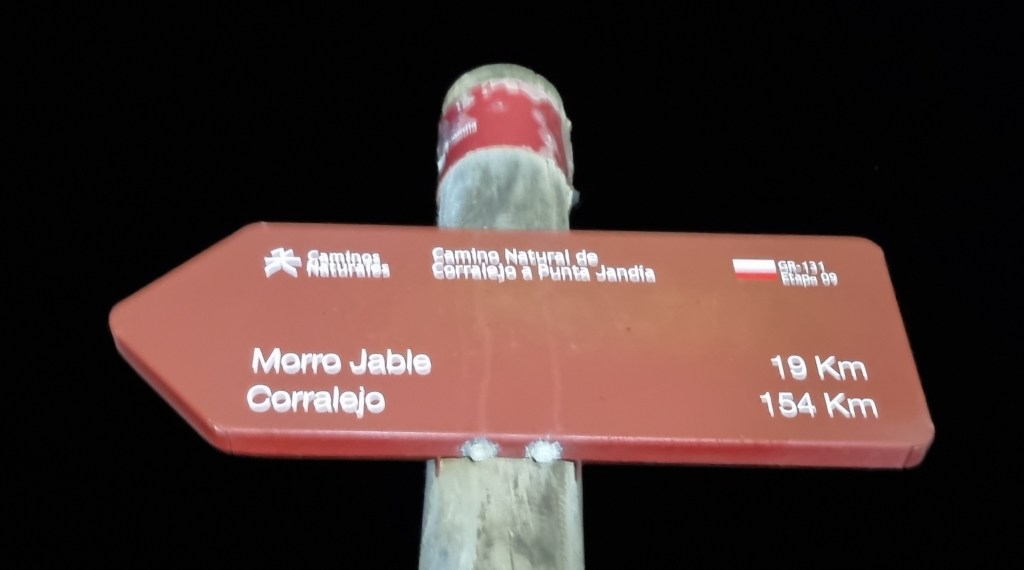
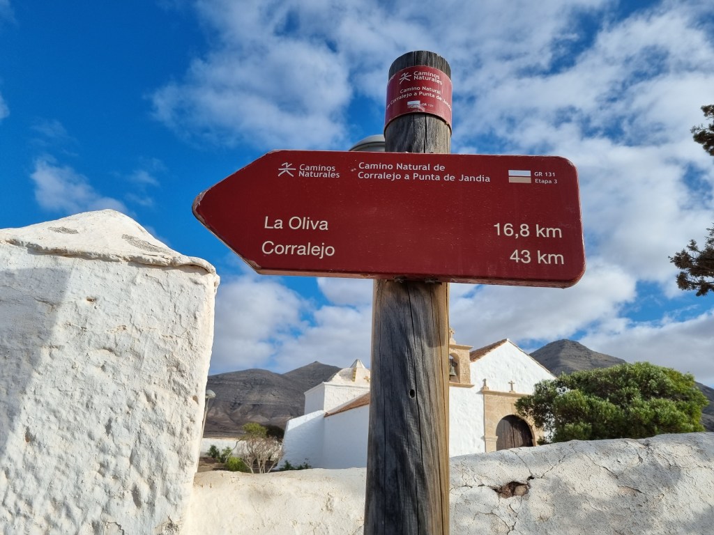
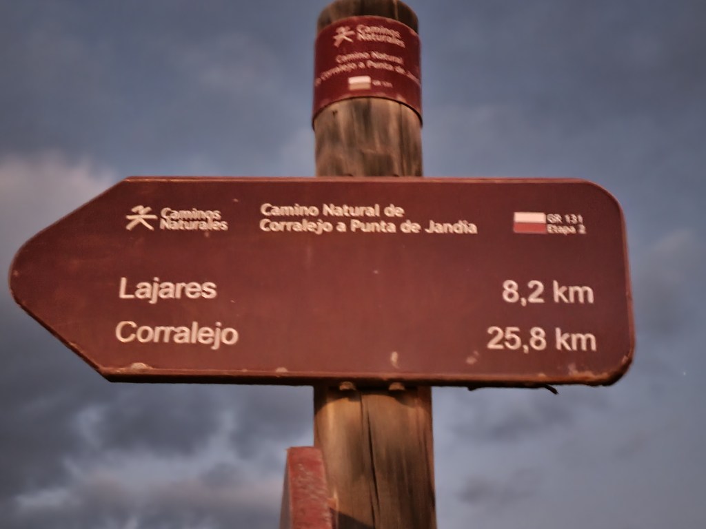
There are also several marked paths on the island. The network appears to be expanding, which is a good thing, although I haven’t ever found much in the way of maps to help find them, I just tend to happen across them when they are on my plotted routes. One path which captured my imagination from my very first visit was the GR131. This is a path of 154km (the sign says) from Corralejo in the north, to Punta de Jandia, almost as far south as you can get. On my first visit I ran part of it with no GPS using a road map I got from the airport, following the signs and trying to remember the route I had seen on the web when I got lost. It was kind of important I found it again as Sharon was waiting on the route in Tefia to pick me up.
Anyway it will probably surprise no-one to know that I’ve always wanted to run the GR131 in one go. I’d covered all of it (the northern part many times) over the course of several holidays but never all in a single run.
For obvious reasons we haven’t been to Fuerteventura for a couple of years so we decided this trip should be a big one. We would have Christmas, New Year and Sharon’s birthday out there. Add on the annual leave we had to take before the end of 2021 and it came to 25 days. As it was such a long trip Sharon suggested it might be the time to finally see if I could run the length of Fuerteventura in one go! Just in case it was feasible I packed my Fastpack backpack, a survival bivvy, several head torches and some Tailwind.
We had hired a car from our arrival until Christmas Eve. I had naively assumed we could simply hire one when we needed it after then – wrong! There are a lot fewer hire cars available than there used to be and absolutely nothing available between Christmas and New Year, the period in which I first thought I might try my little run. After a few false dawns we finally managed to secure a car from the 3rd of January until we left at a not too extortionate rate. Even then I wouldn’t believe it until we were actually sitting in it. However we could only get it by picking it up from the airport. This didn’t seem too much of an issue as we could take the bus to Puerto Del Rosario and run the last few miles to the airport. Unfortunately whilst the airport is so large even I couldn’t miss it (not with the aid of GPS anyway) it isn’t exactly designed to be approached on foot…
After blatantly ignoring the ‘No Pedestrians’ sign we ran into the airport and were very glad we were hiring from Top Car rather than Cicar, who we normally use, as the Cicar queue stretched right across the airport and out of the door whereas there were only four or five people in the Top Car queue.
Anyway I suspect most people are reading this to hear about the run so I should get on with it…
I had always assumed I would run from Corralejo to Punta de Jandia, however as our hotel was in Corralejo and it’s a 12 mile drive down an unpaved road to Punta de Jandia – which we obviously didn’t do as hire cars aren’t generally insured for unpaved roads – it made more sense logistically to run from South to North. I guessed the run would take about 24 hours so I decided I would start at around 9pm as that would avoid having to run through all the hours of darkness in one go, and it would allow Sharon to get back to Corralejo at a reasonable hour after she definitely hadn’t done the drive along the unpaved road to drop me at Punta de Jandia.
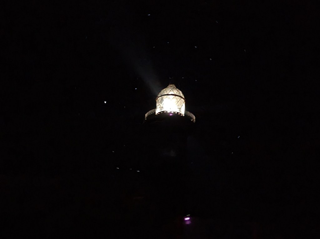
A stop in Morro Jable for food plus a ‘road’ that would have been significantly more challenging than we expected had we driven on it, which obviously we didn’t, meant I started a little later than intended at twenty to ten. Actually my start was also delayed by watching the patterns of light from the Faro de Jandia lighthouse, and the fact the wind had got up and was unhelpfully blowing from North to South…
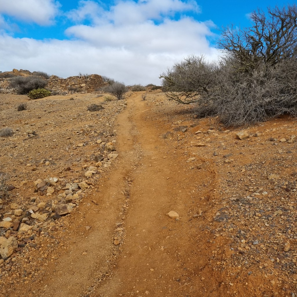
Anyway I finally set out on my long awaited mission to run the GR131! I was fairly confident about the first 13 miles or so to Morro Jable as we had run exactly that section earlier in our holiday. However it was challenging to remain on the path during the day so at night I was having to keep a close eye on the GPS. I was also having to keep a close eye on the ground as the path was a typical Fuerteventuran coastal path consisting of loose rocks and very fixed rocks. One thing you are rarely short of when running in Fuerteventura is underfoot grip. This is generally a good thing but it does also mean that if you catch a toe or heel on a rock it tends to ‘stick’ and you are likely to fall – which I did, six and three quarter miles in. The damage was minimal, a grazed arm, hand and leg but at that rate I could look forward to another twelve or thirteen trips into the dirt, a thought that didn’t fill me with joy.

Fortunately I made it to Morro Jable with a few stumbles but no more outright falls. As I came into Morro Jable I had a little difficulty following the GR131. At first this was due to complete incompetence and things looking different in the dark, as I’d run the last section down to the road twice before two weeks ago. However the section from the road to the seafront was rendered a little confusing due to a lack of data points on my GPS track, leading to a series of straight lines passing through buildings but I soon got onto the seafront path.
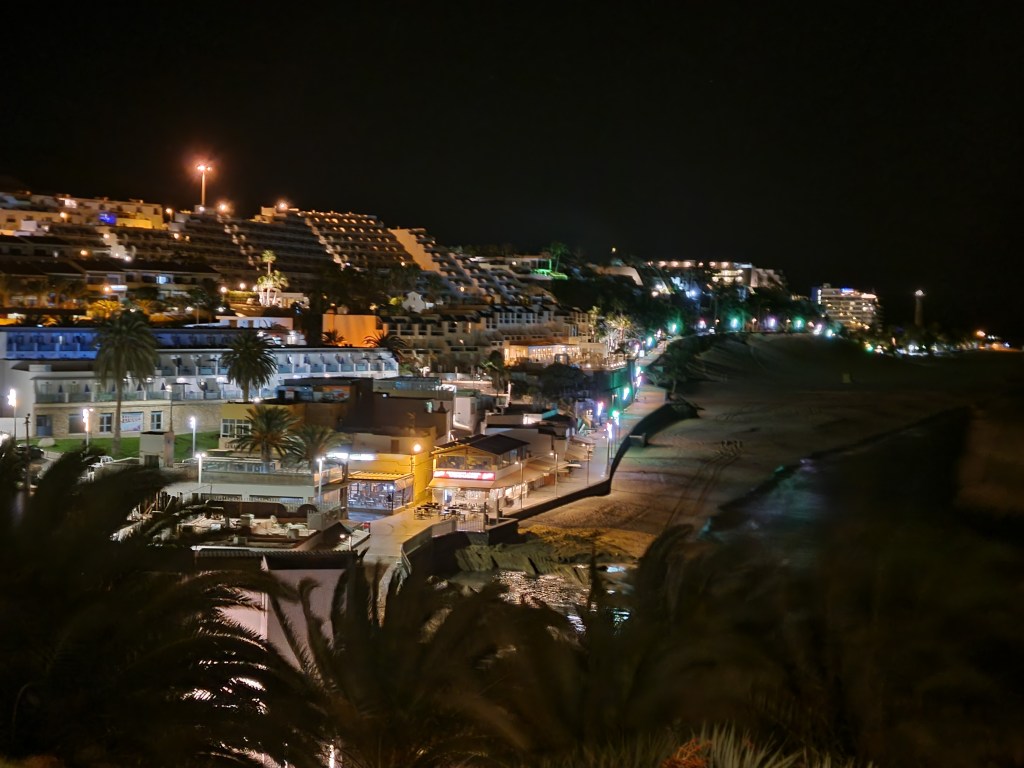

The path was smooth and well lit so I took the opportunity to conserve the battery in my head torch and to give my head a rest from the band by taking my torch off. I had three torches and several spare batteries so battery life was unlikely to be a problem but it was nice to take off the elasticated head band that holds the torch. I also stopped at a street lamp to set up Garmin Livetrack so Sharon could track me. I would have done this at Punta de Jandia but I had no mobile signal. I shared the Livetrack link on Facebook as I know some people like a dot to watch and if I’m honest I like the idea that someone might be interested enough to track my progress. Just before leaving the smooth well lit path I refilled my front bottles from a bottle of Tailwind I had been carrying. My pack was quite heavy as I was carrying three and a half litres of fluid – two half litre soft bottles of Tailwind, a litre bottle of Tailwind and a litre bottle of water, plus another half litre soft bottle of water for emergencies. In addition I had a blister kit, a first aid kit, a thin fleece, a waterproof jacket, three torches and batteries and a charger for my phone and one for my watch. I also had my SOL Escape bivvy. Fuerteventura isn’t very big but it isn’t over endowed with paved roads either, especially at the southern end. If things did go wrong I could potentially have to wait some time for help so I wanted to be adequately prepared. Although Fuerteventura never gets really cold, with the wind I could chill quite quickly if I had to stop running, hence the bivvy. It may all seem a little over the top but I’d sooner carry a pack full of stuff I don’t use than find myself wishing I had the equipment when things go pear shaped.

After leaving the seafront of Morro Jable the next mile and a half was fairly straightforward along the beach. The only slight complication was that the tide appeared to be in so I had to scramble over rocks in a couple of places where there was a slight lack of sand. However I was about to embark on what was to be the least enjoyable section of the whole run for me. To start off with it was OK, the path leaves the beach and follows some paths in front of some hotels. However the paths and my GPS track didn’t always seem to align so I had to extrapolate my route (guess) a bit to avoid running into hotels – or, on one occasion, over a cliff.
After finding my way out of Esquinzo and possibly Butihondo as well, the route became a cliff path. In the daylight with some nice views that might be OK. Although Fuerteventura doesn’t have a lot of rain these days, in the past it was home to some very big rivers. Said rivers have literally left their mark in the form of dried up river mouths along the coast. Of course if you are on the cliffs the only way to cross these is to go right down one side to sea level – and back up the other to the cliff top. This is invariably done on loose steep slopes and, as I previously mentioned, I wasn’t even getting to enjoy any views from the cliffs.
Eventually after many dark thoughts about the architect of the GR131. I reached Barranco De Penescecal. This was another riverbed but was significant as it was where I would leave the coast and head inland. A short way up the riverbed the GR131 goes under the FV-2, the main road on the island south of Puerto Del Rosario, the capital. It was here that Sharon had left me two litres of water (and a chocolate!). I replaced the bottle I’d used in Morro Jable, topped up my soft flasks and stuck the bottle with a small amount of water in it into the back pocket of my pack. I didn’t want to leave litter and anyway it was 3 ‘o’ clock in the morning and several hours before I would be able to get any more water so I wasn’t prepared to leave any behind at this point.

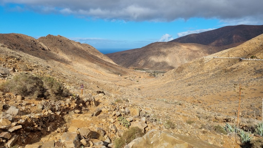
I can’t say I was sorry to leave the coast. don’t get me wrong, I love Fuerteventura’s coastal paths, they just aren’t the best place to be in the wind and the dark. I knew the next section would be challenging, I was going to enter the area of sand leading from Jandia to Maxorata known as El Jable. If you look at a satellite photo the area of sand is very clear. As I understand it, the Jandia peninsula was originally separated from the northern part (Maxorata). This area of sand is where the sea silted up eventually joining the two parts. It would also be the first significant climb of the trail – even if some of the cliff ascents previously felt a little tough. Although the going would undoubtedly be tougher, I felt that at least the sand would be a little more forgiving should I fall again.

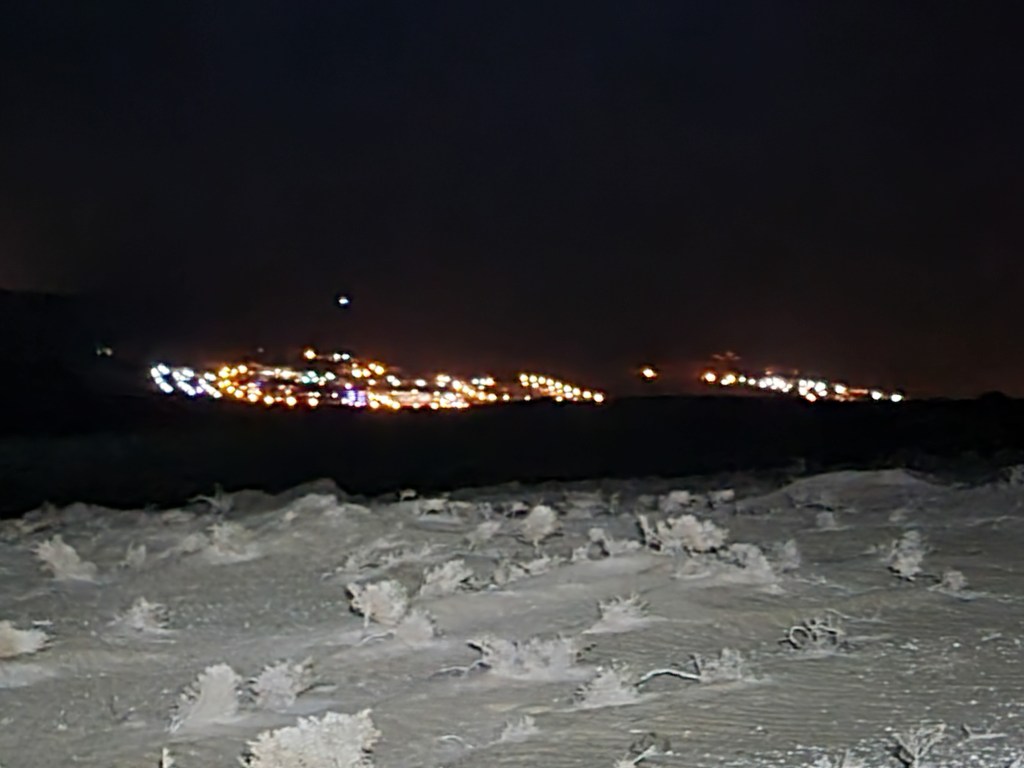
There was practically no moon, skies were clear and the wind had dropped. I turned my torch off, looked up and was treated to the most incredible display of stars. As I continued I saw a regular pattern of brightly coloured lights to the south-east. It took me some time to realise I was looking at Costa Calma – I guess on an island with many wind turbines and a lot of wind it isn’t necessary to turn the lights off, even at 4:30 in the morning!
Eventually I reached La Pared. La Pared means The Wall in Spanish and is named after the wall that used to divide the kingdoms of Jandia and Maxorata (according to some historians, some say the border was further north). The street lights were also on in La Pared so I took the opportunity to empty most of El Jable out of my shoes.
The path from La Pared to Cardon wasn’t terribly interesting for the next five miles or so, having several pointless and fussy ‘detours’ to avoid simply following the FV-617, which was basically going the same way. It was at this point I suspect I became the least popular person on the island. There are a lot of dogs on Fuerteventura, a lot of dogs. They all bark if they can see or smell you no matter how far away you are. I’d been running for over eight hours by now so was probably quite pungent. It was around 6 ‘o’clock in the morning and whilst there is no settlement named on a map in the area, I had about twenty dogs barking at me for fifteen to thirty minutes (about – I didn’t time it) as I passed by some farms.
Eventually I parted company with the FV-617 and was back in the countryside and a mystery. Ahead there were five (or possibly six) big red lights in the sky, all flashing in perfect unison. I don’t believe in UFOs (although a little green man could pick a worse place than Fuerteventura to go on holiday) but I couldn’t figure out what they were. Shortly after I passed under the line of lights, dawn’s first rays broke through and I was able to see that my mysterious lights were nothing more than some of the many wind turbines on the island – not sure why the lights flash in perfect unison though.
Last time I arrived in Cardon it was from the opposite direction, I was hot and thirsty and very pleased to find it had a bar I didn’t know about. This time it was quarter past seven in the morning so the bar was shut but as I left the village and started the climb towards Pajara I got a call from Sharon to see how I was doing and where I wanted her to meet me. We agreed to meet in Pajara as there was nowhere between Cardon and there and I had more than enough water to see me through.
I’d only ever run the section between Pajara and Cardon once before and only in the other direction. I had a vague idea that it was slightly technical in places but was expecting to go up and over a pass and on to Pajara.
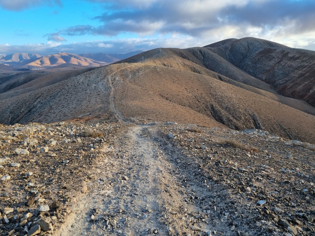
Not quite! The route involved climbing up over two hundred metres from Cardon to Morro de Moralito (411m), a brief respite and on to Pasos (482m). The path opened out onto a wide ridge which provided spectacular running along a rollercoaster route until Pajara was in sight.

Pajara is a lovely little town, even if the GR131 does take you past its municipal tip. As I entered the town I could hear a cacophony of car horns. The biggest day of the Christmas period for the Spanish is Three Kings Day, which is either on the 5th or 6th of January, no-one seems quite sure. We’ve seen the parade in Corralejo and it is a big carnival pageant. Obviously with Covid big parades were not really allowed so Pajara’s Three Kings were racing through the area in three open topped sports cars with a police escort!
I met with Sharon, she refilled my bottles, gave me a biscuit or two and made sure I was OK. Actually I was feeling great, Pajara was just over half way, I’d made it through the night and I’d met up with my wife, how could life be better? As I was going so well we agreed we would meet again in about fourteen miles time at Valle de Santa Ines.
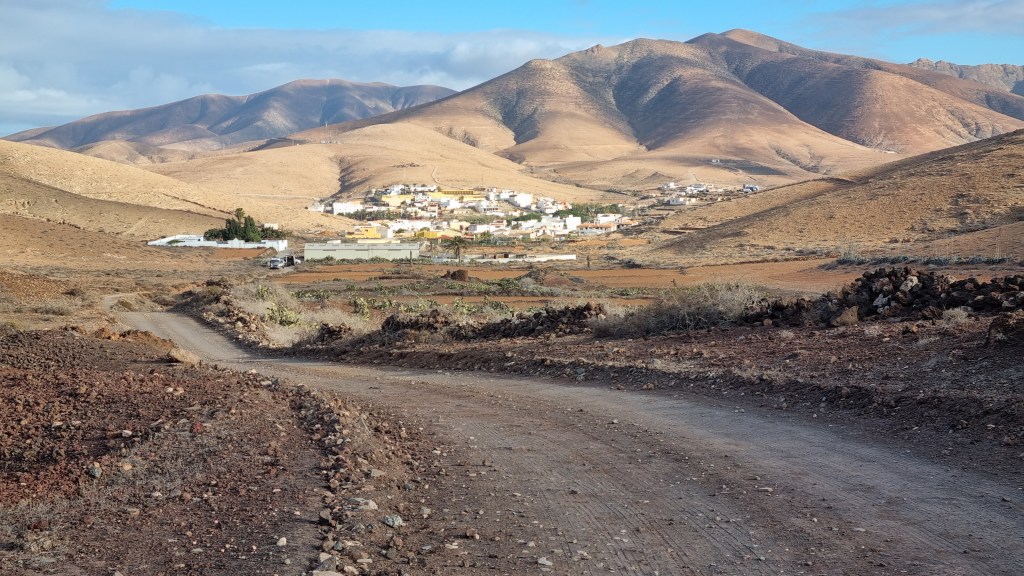
Another reason I was feeling good was that I was now into areas I knew extremely well. A couple of miles from Pajara is Toto (a town, not a dog or a band from the eighties). At Toto is the start of the climb up to the Degollada de Los Granadillos. It’s a beautiful path which we had done as part of a run two weeks earlier. It was great to see that some signs and QR codes had been placed along the route to encourage people to explore it. Degollada is the word for a pass in the Canaries. Once at the top of the pass it was downhill to Vega de Rio Palmas at the end of the Barranco de Las Penitas, a fantastic gorge containing a tiny church marking where some monks had a vision of the Virgin Mary (allegedly). The GR131 doesn’t go through the gorge but the point at which the paths join marks the start of the biggest climb on the whole path.

The climb starts innocuously enough, a gentle steady climb along the road and then the river bed until the path turns off into El Pinar, a sparsely wooded park-like area on the side of a ridge. The GR131 follows a road until it turns of onto a path. I’d only ever run the path downhill and had it in my head that it was only maybe 20-30 metres of descent. That may be true but going up its 100 metres of climb before a slight respite to the picnic area. After that I knew it was a challenging uphill, about another 100 metres of climb. As I left the park I stopped for a good drink before the next climb, up to the top of Morro de Cortijo (637m).
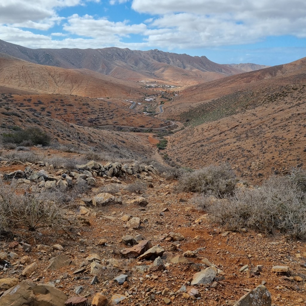
At least then it was downhill to the Degollada de Marrubio and down the ridge to Betancuria. Betancuria is named after Jean de Béthencourt, who founded the town in 1404 with Gadifer de La Salle. It was the original capital of the Kingdom of the Canary Islands, and later capital of Fuerteventura. It is a very pretty town and popular with tourists. Go to the bars and restaurants outside the centre, they are quieter.
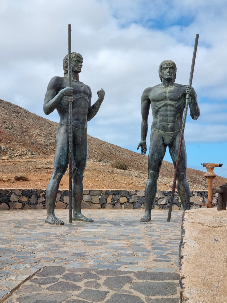
I chose not to stop in Betancuria as I knew I had one more significant climb to the Mirador de Guise y Ayose. This viewpoint includes two statues of Fuerteventura’s former kings (Guise and Ayose). One was king of Jandia, the other Maxorata, but I can’t remember who was king of what bit. There are usually a few tourists around and its always amusing to see the look on their faces as I jump over the wall and start the steep descent towards Valle de Santa Ines. Actually it’s only the first part of the path that is steep, it levels out into a very runnable gentle descent.
Sharon was, as promised, waiting for me at Valle de Santa Ines. I drank Coke and Fresh Gas – an apple drink that is a lot more appealing than the name sounds. Sharon refilled my soft bottles with Tailwind whilst we both watched the huge queue form as as tour bus disgorged its passengers into the only restaurant in the village.
By now it was past noon and quite warm. I’d been running for around sixteen hours and the strain was starting to tell. We agreed that Sharon would meet me at all the towns I had left to pass through, Tefia, La Oliva and Lajares. Because of this, and the fact that shops and bars were now open, I decided to stop carrying the two litre bottles of water I’d been running with since the start. I wouldn’t drop anything else as, whilst I knew the area fairly well (almost – see later) and there was easier road access than at the start, I still felt I should carry my pack and emergency kit – it can’t be denied though that two kilos less weight was a welcome reduction! I’m sorry if this disappoints anyone but this was never intended to be a tale of one man’s solo unsupported bid to cross the length of Fuerteventura, it was always the story of an old bloke with a stupid idea and a wonderful wife.

The section from Valle de Santa Ines to Tefia isn’t the most exciting but at his point in the run it was very welcome, mainly flat or even slightly downhill. With two kilos less on my back and getting ever closer to Corralejo I was able to run at a fairly reasonable pace considering I’d already covered 100km. As I got to a couple of miles outside Tefia I saw a familiar orange and purple t-shirt heading out to meet me. Sharon had decided I shouldn’t have all the fun and had parked at the Ecomuseo de la Alcogida (a living museum showing what life was like in the past in Fuerteventura – I’ve run past it a couple of times, next time I should go in) and run out to meet me. After I had refuelled she continued to run with me carrying a bottle of Coke for me as I’d left eating biscuits and she thought I might want to wash them down when I’d finished (told you she was amazing). We parted company on the outskirts of Tefia and went our separate ways to Tindaya.
I was now getting into familiar territory, which probably explains why I made exactly the same mistake in Tindaya as I’ve made before. It wasn’t a navigational error as such, I never left the GR131, but there is a point on the route where it looks for all the world as if you are leaving Tindaya when in fact in quarter of a miles time you are in the town centre (sort of, it’s hard to know exactly where the centre is). As I hadn’t seen Sharon I phoned to ask where she was. Standing in Tindaya under a sign marking the GR131 was the answer. After this long without sleep my brain functions even less well than normal so I assumed I must have taken a different route around the town and asked her to drive out to meet me – ran about 100 metres further and asked her to go back to where she was and I’d see her there… Fortunately she is well used to my random geographical errors and did so without comment.

By now the sun was getting low in the sky which cast an amazing light on Tindaya. The original inhabitants of Fuerteventura were called the Guanche, ‘Tindaya’ simply means ‘Large mountain’ in their language. They considered the mountain sacred and there are over 300 carvings of feet on its slopes. It is believed the mountain was used for rituals and to observe the sun and moon, possibly a little like Stonehenge was used in Britain. Due to its archaeological value it isn’t allowed to simply climb up it but one day I will find out who I need to ask to get permission to go up there. Anyway in the late afternoon sunset it was easy to see why the original inhabitants of the island would consider it special.

The road to La Oliva is well known to me, a very easy to follow dirt road. It does go uphill a little but the climb was insignificant compared to what I had already done. I was now really feeling I was nearing the end of my journey, every step was taking me closer on more and more familiar territory. I arrived at La Oliva in the last of the evening light. I must admit I was a little disappointed by this as the next stage involved crossing the Malpais. there is a path and it’s not bad but has sufficient trip hazards to mean that I wouldn’t be running it at any speed as I normally did in the daylight. However had I been earlier I wouldn’t have seen Tindaya in such wonderful light so I guess that overall my timing was OK.
The run into La Oliva is a little strange, I think the idea is to keep you away from the main roads, although there is a section about 600m long down the main road, however there is footpath on one side. As I approached this section I saw Sharon, who had parked by the side of the main road so I stopped and downed a can of Aquarius she had kindly bought me, I think I ate something too. I was down to the last 15 miles, it felt like I was on the home straight.
The Malpaís de La Arena Natural Monument is an area around the Montana de la Arena volcano. It is the landscape left by some of the last volcanic action on Fuerteventura 10 000 years ago and has been unchanged by human activity. Apparently you can find some of the best tabaibas, tarabillas, aulagas and lichen populations in the canary archipelago. I know what the last one is but no idea about the others. As it was now definitely dark I had to concentrate on not falling over rather than looking for tabaibas.
Everything looks very different to me in the dark so I was keeping a close eye on my GPS, I really didn’t want any bonus miles this late into the trip! As the Malpais gave way to open countryside I found it very hard to shake the feeling that the walls along the side of the road were around a church or big mansion. Obviously they weren’t but I get these strange feelings when I run in the dark and am tired.
As I got nearer to Lajares there were more houses than I remembered. I think this wasn’t due to hallucinations but simply the fact that the houses had their lights on and so were more obvious than they were in the daytime. I remembered the last section into Lajares from previous runs, it is flat, on tarmac and never ending. I saw someone walking towards me with a head torch. I turned my head to the side and tried to move away to avoid dazzling this person until I got nearer and discovered it was Sharon! She jogged with me to where she had parked and I downed another can of Aquarius. The next time I would see her would be in Corralejo at the end of my quest!
The final section was definitely a game of two halves. The section through Lajares and out on the rough track across the plain below Calderon Hondo, a favourite volcano with tourists, was much easier than I had been expecting and seemed to pass quite quickly. However once I joined the dirt road things seemed to slow a lot. This may well have been due to the fact that I know this road so well, I’d run it several times already during this holiday, that it was a bit of a shock to be running it so slowly. All I know is that it seemed to take forever to pass each landmark, the goat cheese farm, the cave, the track up Bayuyo, the waterworks, they all seemed to arrive at a snails pace.
Finally I was out of the volcanoes and crossing Tres Islas. As I passed the school the hallucinations started, quite why a white arrow painted on the road manifested as a child doing a magic trick I’ve no idea. As I reached the main road my torch announced it was almost out of battery. It didn’t matter, I could see streetlights just ahead. As I turned off the main road Sharon appeared and we ran together to the finish of my epic adventure!
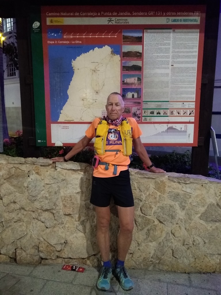
Technically I hadn’t run all of the GR131 – there is a section on the isle of Lobos but that was never in my plan and I don’t think you are even allowed to go there at night. I had done what I set out to do in 24 hours and 23 minutes, quite close to my guess of 24 hours. I’d run 94.9 miles and had no desire to round up to 95. After some finish line photos we walked along the main street of Corralejo to the hotel and a much needed beer. I was dirty and smelly and I apologise to anyone in the bar that night but I really did need a beer even more than a shower – in my mind at least.
So how does this fit into Spine training? Well I’ve learned that carrying three litres of water is hard and I’ll need to train more for that. My Fastpack is great but will take all the skin off my lower back if I don’t sort out my clothing better or tape my back. Big climbs, difficult terrain, night running, many hours on my feet, all these things will help in June. However it isn’t always about the Spine. this was an ambition I had had for almost as long as I’d known about the GR131. As well as that I raised £365 for the Accord Hospice that provided care at home for my Father-in-Law, Archie Radcliffe, who sadly passed away in November. He used to come to Fuerteventura with us at New Year and, whilst he would never have understood why I wanted to run the length of the island, I think he would have been happy to see my fundraising efforts. Depending on when you are reading this the JustGiving page may still be open if you fancy adding a pound or two to my total:
https://www.justgiving.com/fundraising/colin-harper-gr131
The last thing I must do is to thank Sharon for her amazing support. I know I always say my running wouldn’t happen without her but his time that is more true than it has ever been, to effectively give up two days of her holiday to support me on such a mad venture is truly incredible – thank you Sharon!
Anyway if you’ve read all this in one go you probably need a beer as much as I did after running it. Until next time, the only way is Pennine, unless it isn’t !

Hello I live and work in lanzarote. Met some friends of yours today. I run. I mentioned Fuerteventura. They mentioned you and your gr131 . I’ve done lanzarote gr131 … a few times . Less than half the distance but still a great run. One day I’ll get on the boat n do fuerte too. Would it b possible to pick your brains on a couple of details?
LikeLike
Hi Mark, Yes, I’ve sent you an email.
LikeLike