
I can’t remember if I had any more food before leaving Checkpoint One but I’m fairly sure I had a couple of cups of coffee. I don’t normally take sugar in coffee but on the Spine Race I wasn’t interested in the taste of the drink, it was just a means to obtain caffeine and calories. I started taking two sugars but by the end of the race it was a case of how much sugar will dissolve in one cup.
I had arrived at CP1 at around 10pm and was intending to stay for around four hours so this would mean I would leave about 2am. As it was I managed minimal faffing and was out of the door by about 1:20am. I was expecting the next leg to take around 24 hours. Ideally I would have been an hour ahead of this to get the optimum timing for the next leg but all things considered I felt I was doing OK.
I successfully negotiated the slippery steps and started on the mile long trek mostly along the road back to the Pennine Way.
It was dark and so I don’t remember anything hugely significant before Lothersdale. I do remember some reservoirs and passing Top Withens, mainly from the Haworth Hobble, which took in some of this section of the Pennine Way in the other direction. Looking at my GPS track, I appear to have had a little wander about in an area marked ‘The Sea’ on the OS map. It may have been a call of nature, I may have lost the track for a short while or it may have been the shock of finding I was in ‘The Sea’, I don’t know, I can’t remember. I would have thought I would have remembered suddenly being in the sea though.
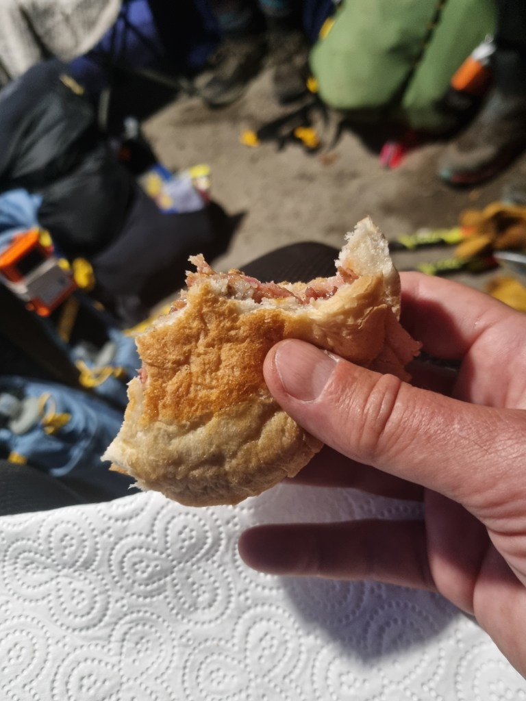
The next thing I very much do remember was the ‘pop up’ checkpoint in Lothersdale being run by the Craven Energy Triathlon Club. This was an unofficial feed station but it did have a 30 minute cut-off. This was more than enough time for a bacon roll, some coffee and a few bits of chocolate on the way out. Thanks very much to everyone involved, it was a great addition to the official feed stations. By the time I left it was light, I’d had bacon and all was well with the world.
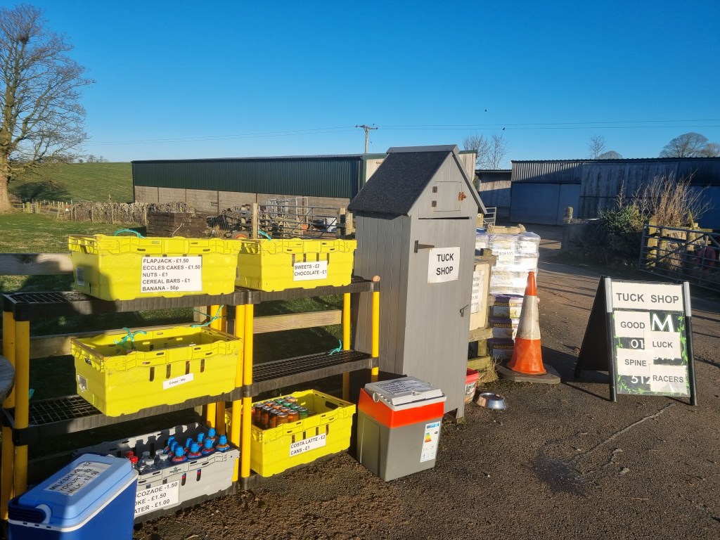
As it turned out, life would just get better. I had various points marked on my GPS course and my watch would count down to the next one. The thing was, the next one was simply described as ‘Hut’ but with a symbol indicating food. I really couldn’t remember what this was or what food I had been expecting when I put it on the map.

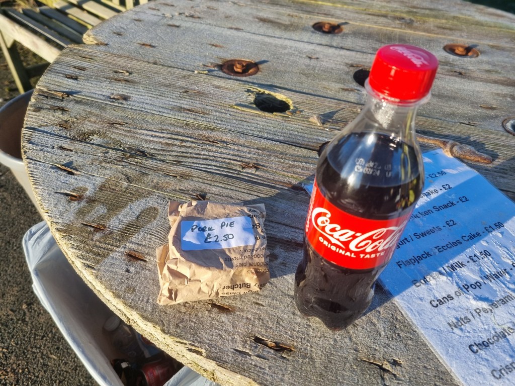
It was the Cam Lane Tuck Shop of course! I used this on the Summer Spine but for winter the proprietors appeared to have gone massively ‘above and beyond’ expectations. A bottle of Coke was good as I was mostly powered by caffeine but there was a cool box and I the cool box (amongst other things) PORK PIES!!! Not only a pork pie but one of the best pork pies I’ve ever tasted, bearing absolutely no relationship to the slightly dodgy supermarket fare often tagged with the same label. Thank you so much to whoever runs that little ‘hut’.
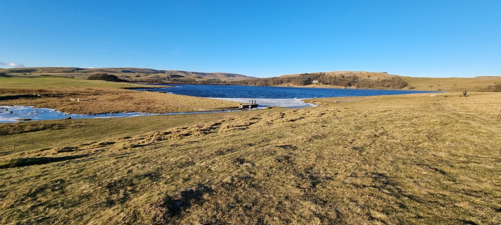
The next part of the Pennine Way takes you down to the Leeds and Liverpool Canal and through the double arched bridge at East Marton. After all the upping and downing, three quarters of a mile of flat is quite nice!

After leaving the canal, at a place marked as Trenet Laithe on the OS map, the Spine Race diverted from the official Pennine Way. I understand this is because the next section is very boggy and muddy. I really want to go back and check this out, just because – given some of the bits of the Pennine Way we do run on – I’m having trouble visualising just how muddy and boggy a path has to be for it to be too muddy and boggy for the Spine Race! Anyway the net result was a detour through Bank Newton, still quite flat and following the canal until the road into Gargrave, which roughly followed the river.
In some ways I was quite looking forward to the next twenty miles as it was the bit I had recce’d most recently. However it did also include Fountains Fell and Pen-y-Ghent. I wasn’t too worried about the climbs but it was bitterly cold. I wouldn’t really consider myself a cold weather runner – Fuerteventura is my location of choice for running – and the possibility of hypothermia was something which had been preying on my mind for some time. However before then I made a slightly controversial decision – I wouldn’t go to the Co-Op! I’d already had a bacon roll and a pork pie and I had my bottle of coke to drink. I’d been ‘de-gassing’ it since I bought it at Cam Lane so I chatted with the Safety Team at the bus shelter, drank my bottle of Coke, and carried on.
The next section wasn’t too taxing and it was a beautiful day.
Eventually I could see Malham Cove in the distance.

This was a great boost as, whilst a bit of a climb was involved, CP1.5 was at Malham Tarn. I had my freeze dried meal to eat there to prepare me for the nightmares ahead.
As I walked up the path towards the Cove I met Allan from the B&B. he seemed a little tired but we chatted for a while and I think it gave us both a bit of a lift to see that the other was still going strong.

It’s a bit of a lung busting ascent to the top of Malham Cove but I made it without incident. Damian Hall recommends staying North of the limestone pavement and this was my intended route. However the official GPX file does take you right through the pavement so was going North strictly allowed? My answer was given to me by the presence of the media team on the North edge of the pavement, who reassured me that all the front runners had gone this way. I still didn’t find the best way across I think but soon I could see Malham Tarn.
I had my freeze dried meal and some coffee at the checkpoint and pressed on. So far the day had gone well but it was now getting dark and was bitterly cold. Could I survive Fountains Fell and Pen-y-Ghent, and if I did, would I wish I hadn’t when I reached the Cam High Road?


As I was climbing Fountains Fell my mind started being silly. I’d changed my Facebook cover picture to Fountains Fell after my recent recce, had I jinxed myself to fail at that point? No, don’t be stupid, things don’t happen that way, only if you convince yourself they will. I got over Fountains Fell and marched purposefully on towards Pen-y-Ghent. I was slightly surprised not to see a marshal on the Silverdale Road but I was feeling OK, I wasn’t at all cold and Pen-y-Ghent beckoned. Fortunately the wind was coming from somewhere North and so I would be sheltered from it as I climbed. It might be a bit chilly coming down but that was better than being battered and frozen on the way up – battered and frozen is great for Birds Eye haddock, not so good for me.
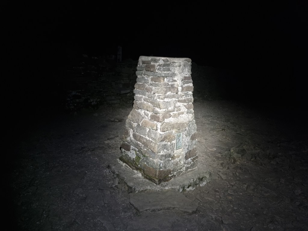
The climb up Pen-y-Ghent was absolutely fine until I got to the scramble at the top. A few weeks ago in daylight the route had been incredibly easy to find. In the dark and with slightly fewer brain cells functioning at full capacity I couldn’t make a decision. I appeared to have two options, dither and freeze to death or fall of the mountain. Fortunately a third option presented itself, man up and just climb upwards until you run out of rocks, that should be somewhere near the top. I say near the top because once you get over the rocks there is still a few hundred metres to go on a slabbed path until you reach the trig point.
Despite the cold, the descent from Pen-y-Ghent to Horton-in-Ribblesdale was nowhere near as icy as it had been on my recce. There was still a large patch of ice at the point where I fell over but this time I managed to remain upright.
I could have popped into the Crown where we stayed for the recce but I was planning a long stay at CP2 and the later I arrived the less daylight I would have when I left so I pushed on towards the most miserable right of way in the UK, the Cam High Road.
I should say that every time I’ve been on the Cam High Road it has been dark and I’ve been 50 odd miles into Leg 2 of the spine Race. If I was fresh and it was daylight I might like it more but at this point I was dreading it. Parts of the road are quite good, one section is even tarmacked but some of it really batters my feet. Again to be fair the previous 50 miles don’t help but I don’t think I will ever be persuaded to love the Cam High Road.

I even attempted to leave the Cam high road prematurely but the fact I started going down gave away my navigational error and I reluctantly returned to the road.
Eventually I reached Ten End and could start to feel the end (as well as the Ten End) was in sight. Apparently the whole track from Ten End down to Hawes is Gaudy Lane but its a while until it resolves into much of a ‘lane’. I ran down with far more confidence than my navigational abilities warranted but I’ve always been of the opinion that so long as you are going down and heading towards the lights of Hawes, everything will be alright. It was possibly luck but I arrived at the gate onto the tarmac road and ran down it – and then turned round and just went across it to run through Gayle to Hawes and finally a short search revealed CP3. Checkpoint Three is in Hawes Youth Hostel, in the Summer it is in a field in Hardraw.
I was planning on taking my full 8 hours at Hawes including a full change of clothes and a shower. I also needed to charge my torch, phone and watch. At CP1 I’d done this with a power bank. I’d packed a few power banks in case I couldn’t access a mains socket at any checkpoint. I came up with a charging strategy which I would successfully use for the rest of the race. I put the power bank and head torch on charge from the mains and connected my phone and watch to another power bank. This way I could have my phone and watch with me when I slept and would have a full power bank to use at the next checkpoint.
When I went to bed I did some calculations, redid some calculations and did them again. The reason for the checking and re-checking was that I’d really not faffed and only taken an hour to be ready for bed. I could have 5 hours sleep and still have 2 hours the next ‘morning’ to shower, eat, pack, sort my feet etc.
108 miles done and things are still going surprisingly well. How would I get on with Leg Three?…

I love the fact that the Pork Pie was so tasty that it didn’t even make it into the photo…
LikeLiked by 1 person
Typical – as soon as I make that comment, the damn photo downloads. (All the others were there straight away, but the PP had a blank place holder each of the three times I tried to view it. Honest 🙂 )
LikeLiked by 1 person
I have identified the supplier of the pork pie – Pitt’s Butchers in Earby. I’m hoping to get some when I’m up in Haworth for the Hobble in March.
LikeLiked by 1 person