As those that have followed my Pennine journey from the start will know, I initially entered the Spine Race without any research or real knowledge of the race, started it in the same state and ended with a DNF and a desire to return with the knowledge I gained (plus a bit more) and complete the event. This I managed and in the process I became totally obsessed with the Spine Race. As Sharon had supported me so completely and unquestioningly I persuaded her to run the 2023 Summer Sprint with me so she could see what it was like to run a Spine race. She didn’t totally hate it and was somehow persuaded to take the next step up and run the 2024 Spine Summer Challenger South and this is where this story starts…
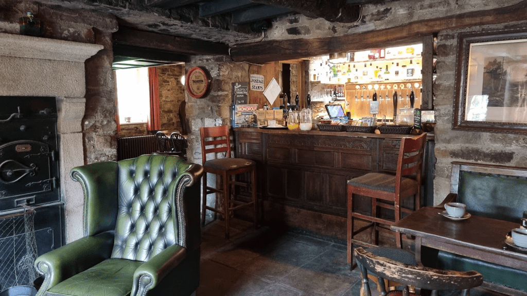
Well, sort of, this is me so nothing is every that simple if it can be a lot more complicated and long winded. We actually started at the finish of the Challenger South, in the Green Dragon pub in Hardraw, a lovely old pub with some fabulous rooms almost on the Challenger South finish line.
The plan was simple(ish). Spend Thursday night at the Green Dragon, leave the car there and take the train to Edale, do kit check and registration, get to Castleton, spend Friday night there, back to Edale on Saturday for the race and run back to the car – what could possibly go wrong?
The first challenge was getting from Hardraw to Garsdale railway station – except that was easy. There is a wonderful community run ‘Little White Bus’ service which connected Hardraw to Garsdale in time for the (fairly infrequent) trains. I was slightly worried about the capacity of the bus in case any more Spiners were doing a similar thing but but Tasha was the only other Spine racer on the bus, along with a few locals.

The journey was Garsdale to Leeds, Leeds to Sheffield, Sheffield to Edale. Trains from Sheffield to Edale run once an hour so there was a choice of train from Leeds to Sheffield. By taking a faster, later, train to Sheffield we had over an hour on Leeds station to improvise lunch from the various food outlets.
We were met at the station by a volunteer to make sure we didn’t get lost on our way to kit check. This was at the Village Hall for the Summer events, rather than the Peak Centre where I was kit checked in January.
Last year Sharon was chosen for a full kit check, this year as we both had the same items checked – I can’t quite remember what they were but we passed without any problem and got the all important stamp.

The Mark of Lindley (and some ID) was enough to get us issued with numbers.

Sharon talked nicely to John, one of the shuttle drivers, and secured us a lift to Castleton. All that was left was to attend the briefing. This was organised particularly well as it was a ‘rolling brief’ – instead of waiting for the start you could join at any point and leave after it got back to where you came in.
We got our lift to Castleton but was warned there was no shuttle service in the morning. Living in a city, we take taxis for granted, however in rural Derbyshire… We eventually managed to secure a taxi for the following morning. it was a little on the expensive side as it was coming from Buxton but after all the hard work thus far we weren’t going to be listed as DNF because we couldn’t get to the start! (As I understand it we would have been a DNF (Did Not Finish) rather than DNS (Did Not Start) as we had registered). We sorted our kit, ate our last meal in the hotel restaurant and went to bed.
Although our taxi was expensive at least it was on time so we arrived at Edale in plenty of time for tracker fitting and last minute toilet visits. Gary and Gill from our running club came to see us off – their son, Dan, was doing the full Spine the next day so they were in the area. I was hoping Dan would do well, mainly for Gary and Gill, but also because I had given him much ‘advice’ and so I was hoping it would be helpful.
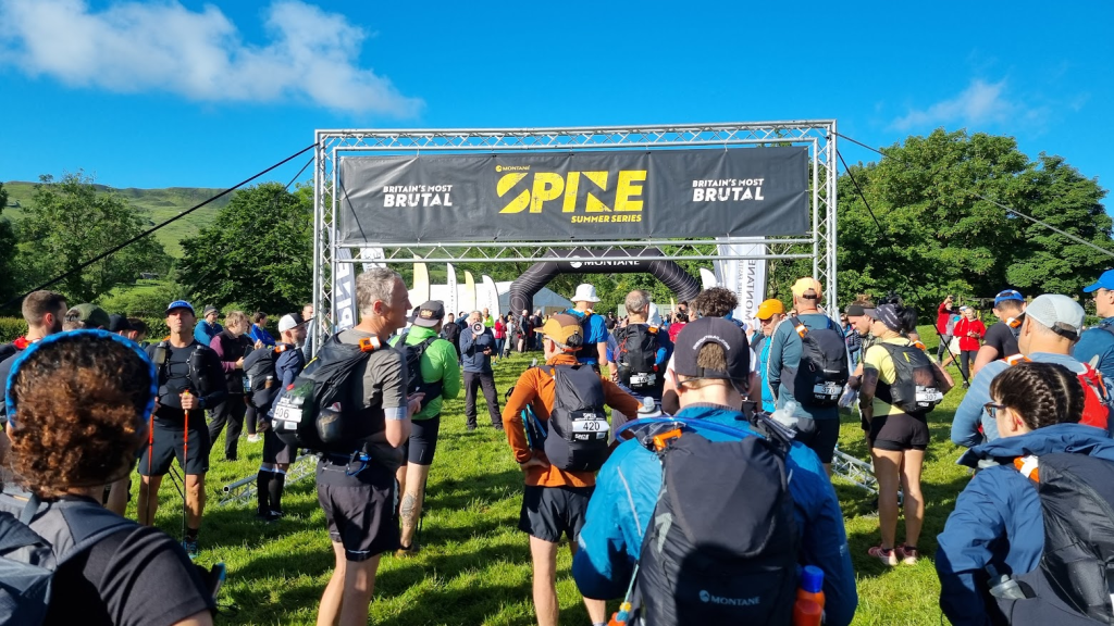
The weather was lovely on the start line but no-one was fooled – the forecast was for quite a lot of rain over the next few days. Kevin McCann (Deputy Race Director) told us as much before he set us off. He also told us to ‘be bothered’, a great piece of advice. What he meant was that we should sort problems out as soon as we notice them. If you’ve got a ‘hot spot’, be bothered and treat it before it becomes a blister. If you are cold, ‘be bothered’ and get an extra layer on before it becomes hypothermia. you get the idea. Anyway at exactly 8am we were sent on our way out onto Edale’s Mary’s Lane to join the Pennine Way.
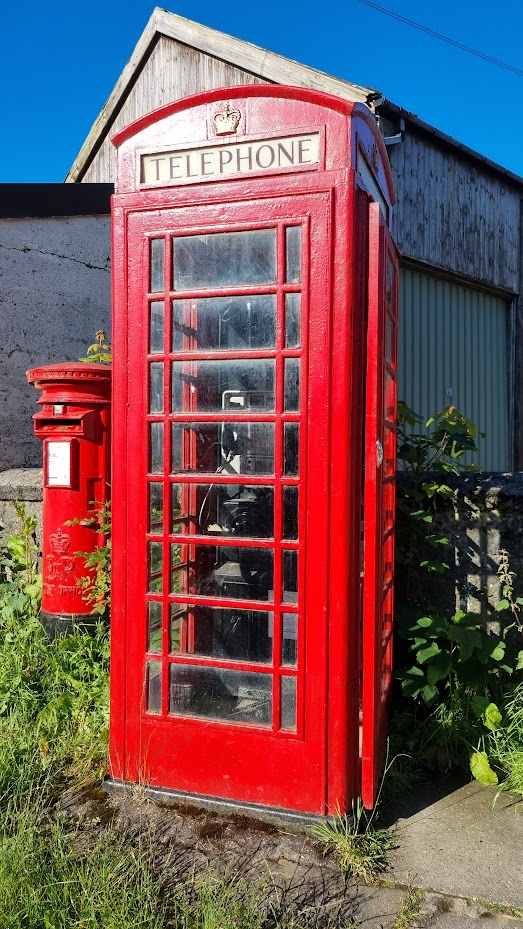
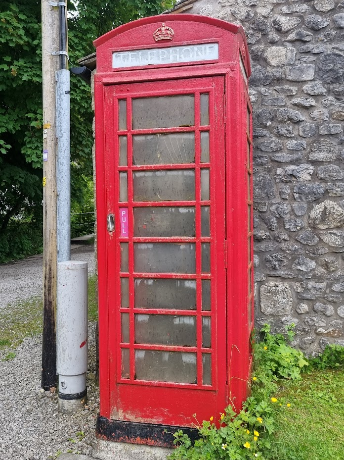
The first couple of miles are a fairly pleasant trot to Upper Booth. Gary and Gill had cycled round from the start to give us a wave. It is also the location of the second phone box on the Spine (the first is in Edale) and the first actually on the Pennine Way. I have photographed it before but, well, you know what’s coming…
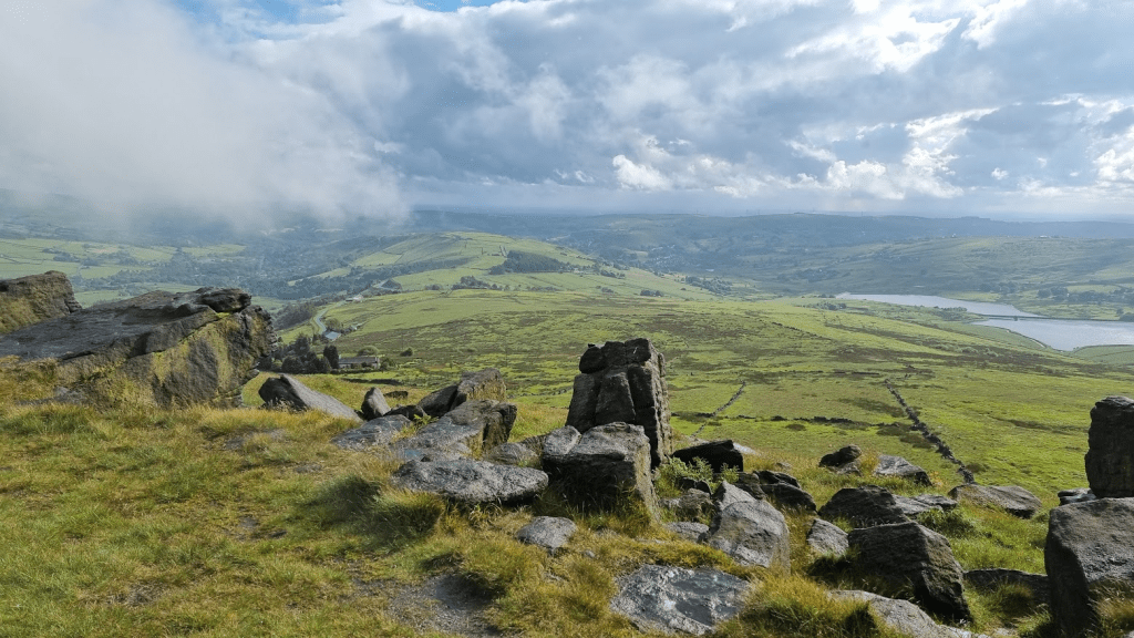
The next mile is the last ‘easy’ one for a while as it leads to the bottom of Jacob’s Ladder. After the second biggest climb on the Pennine Way we were at Kinder Low and our first trig point.

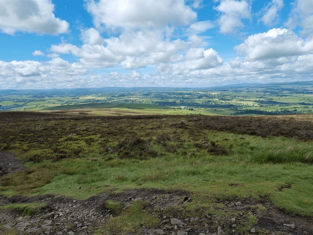
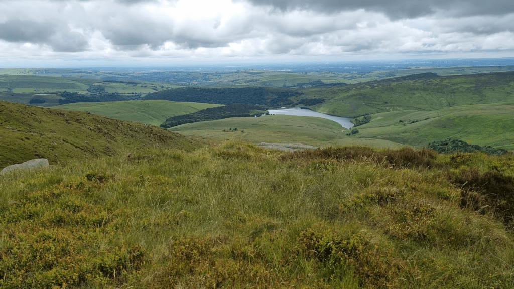
Clouds were gathering but there were still some good views from the plateau.
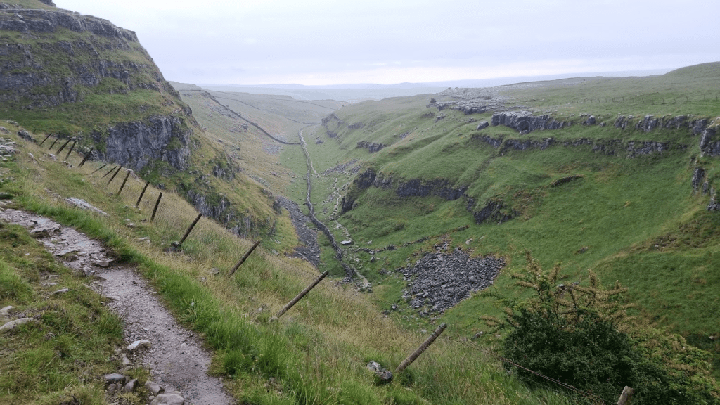
Just over a mile after the sharp turn at Kinder Downfall the Pennine Way drops sharply off the plateau.
The sgn at the footpath junction gives a choice of a pub or Bleaklow. The pub sounds more appealing but the Pennine Way is towards Bleaklow. Neither Sharon nor I were looking forward to this bit. The ground so far had been quite wet and we knew from our original recce, after crossing the A57, Devils Dyke, Hearn Clough, Bleaklow were likely to be a muddy, messy mix of mud and rock. It also started raining. It was at this point I decided to twist my ankle. It was more a shock than a real injury but my yelp of pain caused the two guys that had just passed us to stop and ask if I was OK. I had noted from their numbers that they were part of the MRT (Mountain Rescue Team) race. They got me to rotate my ankle and point my toes to make sure I wasn’t seriously injured. I thanked them for stopping and commented they were off duty – I was told MRTs are never ‘off duty’.
I was able to run/walk the pain in my ankle off and we continued on our way to Torside. There is a point where the path splits and the signage is slightly ambiguous. If the ground is dry it doesn’t matter which path you take, if it isn’t you really want to be on the ‘correct’ path as the other one will be boggy. Fortunately I remembered sliding down the hillside from one path to the other in January and therefore knew that the ‘correct’ path was the lower one.
Even the correct path was rocky, wet and slippery. It was narrow and with a bit of a drop off the side. it wasn’t a nice place to be. Sharon had a bit of a ‘moment’ along here, we were less than 15 miles in and she was concerned about how she would cope if this was the standard of path she would have to negotiate for another 93 miles. Fortunately the path improved a little and we made our way down to the Torside reservoir.
It would be entirely incorrect to even suggest that the climb up to Laddow Rocks is the last climb before the first checkpoint of the Spine Race – not even close. however it is the last steep climb before the climb up from the Rochdale Canal in Hebden Bridge.

The path drops a little to follow Crowden Great Brook for about a mile, a very muddy mile as it turned out – worse I think than it had been in January.
The author Alfred Wainwright described Black Hill as ‘a brute in any weather’ and advised walkers to be prepared for a tough and gruelling trek. ‘Nothing can grow in this acid waste, There is no root-hold in this sea of ooze. In the flutings and ripplings of the surface of the dunes caused by the action of rain and wind, a certain strange beauty, a patterned sculpturing beyond the skill of man, must, however, be conceded. But it is a frightening place in bad weather, a dangerous place after heavy rain. It is not a place to visit unaccompanied.’ It was certainly not the greatest place to be after heavy rain and I was quite happy to have company but it’s fair to say it has been improved since Wainwright’s time. He also said ‘The broad top really is black. It is not the only fell with a summit of peat, but no other shows such a desolate and hopeless quagmire to the sky. This is peat naked and unashamed.’ However since he wrote that the Pennine Way has been (mostly) slabbed across it and regeneration projects have made it a little less black and bare.
After Black Hill it’s a mostly downhill slabbed path with Dean Clough being the last significant obstacle before the A635 road crossing at Wessenden Head. I think this was probably the most water I’d ever seen in Dean Clough but it was far from the raging torrent it can apparently become at times.

I was hopeful that the food van at Wessenden Head would be there and we were in luck. Coffee (tea for Sharon) and a bacon sandwich went down very well at this point, about half way through the first leg.
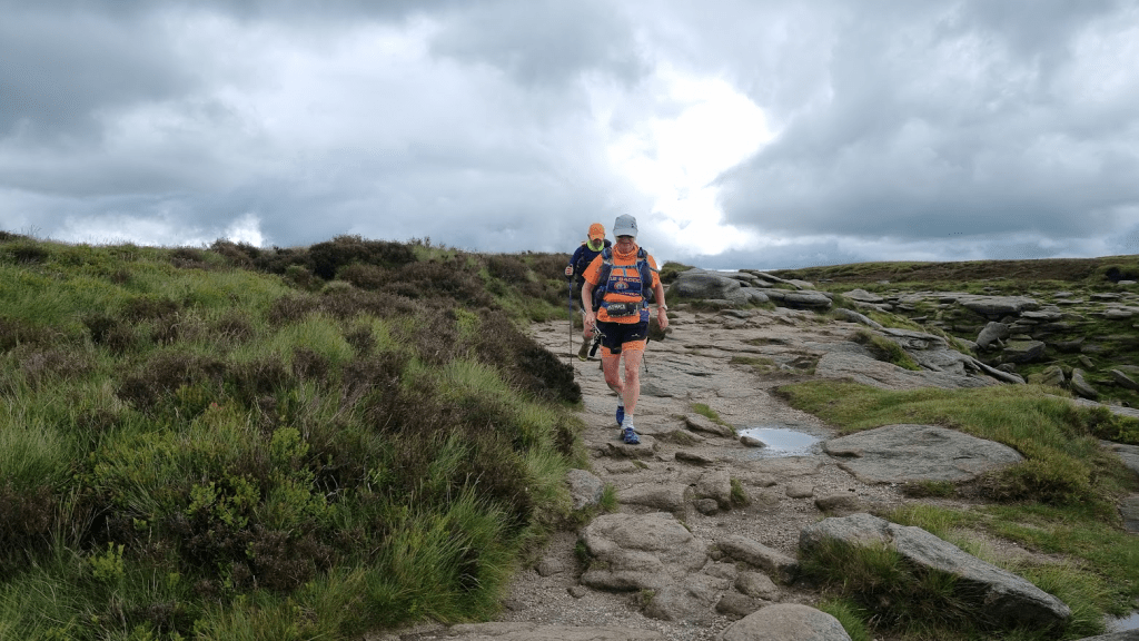
After crossing the A635 and turning off Wessenden Head Road, it was two miles of gentle downhill on a nice easy path. We took Kevin McCann’s advice and decided to ‘be bothered’ and sort Sharon’s hotspot before it became a blister. Soon I could see the new path which would take us up to Black Moss. In January this path was being built so we had a diversion. The path stood out quite starkly on the hillside, probably because it was so new.

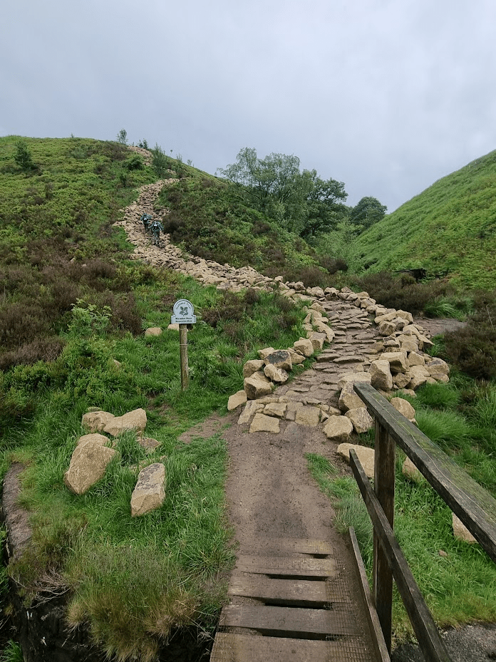
Hopefully the stone will weather and stand out less, however I was grateful it had been done as this would have been a very muddy climb before – now it was just hard.
The only point of real note was a large wooden ‘road’ alongside the Black Moss reservoir. We weren’t sure if we were meant to take it or the original path. We chose the ‘road’ as it looked more inviting. In fact it was quite slippery, we would probably have been better off on the original path, but as we were only on it for less than 200m and it was parallel to the path I don’t think it could have been considered any sort of advantage anyway.
After crossing the A62 we were on Standedge. We did the obligatory selfie at the trig point but didn’t linger for long as the next significant point of interest was Nicky’s Food Bar!
Nicky’s Food Bar was a delight as always. Sharon was struggling a bit with eating (I wasn’t) but she sort of had some cuppa soup and a roll. I had the obligatory bacon sandwich and a cup of coffee, and some flat coke, and various sugary things.
We have a friend from the running club from that part of the country and he always asks me if I’ve seen the red rose of Lancashire from the bridge over the M62. I always say no, because I haven’t. We had a really good look this time. The only thing we could see that might have been it was a small obelisk some way from the bridge – turns out this was it, not the huge monument I’d been lead to expect.
The other thing our friend has mentioned is a Roman Road called The Old Packhorse Road. This is a thing and I was slightly concerned about it as it’s cobbled in part and I thought it might be slippery. As it was it was fine and we followed it to the Broad Head Drain, which lead to the A58, our last major road crossing of the first leg.

We passed the White House pub and a friendly (they all are) SST and started the relatively easy section through the reservoirs.

Soon we were rewarded with our first sight of Stoodley Pike.
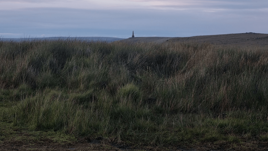
By the time we reached the Pike, the sun had set.
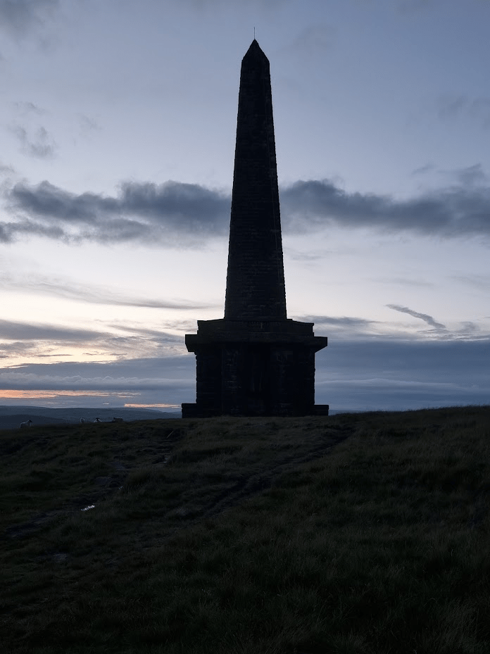
Stoodley Pike to Hebden Bridge is fairly easy to navigate. This was the point where the Sprint route diverged from the Pennine Way. Sharon hadn’t been this way before but I had as recently as January so I should have no problem right?
Thank you so much to the runners that pointed out the bridge at Colden Water before I tried to wade across. Thank you again for calling us back before I took us to Heptonstall.
Eventually we were at Slack Top and all that remained was the slightly muddy and slippery path to the Scout centre. I almost made it, I was that close. I had warned Sharon about the slippery descent, it was actually far worse than it had been in January, I should have warned me, as about 5 metres from the courtyard my legs went from under me and I landed flat on my back. it jarred my knee a bit but on major damage was done. The amusing part was that my watch decided I’d had an accident and tried to phone Sharon. There is no phone signal at Hebden Hey (not on the 3 network anyway) and also Sharon had had a ringside view of my fall so didn’t need a phone call to tell her her husband was an idiot.
One of the reasons I wanted Sharon to do the Spine Challenger South was so she could experience a Spine checkpoint. I have been lucky enough to run in some amazingly well organised events but the spine really is another level. The trackers aren’t simply used to make sure we follow the correct route, they are an integral part of keeping the race moving smoothly. The volunteers at the checkpoints use the trackers to know who is coming in and when. That way they can have a space for you and your bag ready, even if a large number of people are arriving at the same time. From a competitors point of view it all looks very simple but that’s the clever part – no matter how stressed the volunteers might get at times, that stress is never transferred to the runners. Checkpoint One was quite busy so we were taken to a different room to the one I got sorted in in January. Actually it was better as it was in the same building as all the other facilities. We were sat down, given tea and set about sorting ourselves out. Feet, as ever, were the main priority. There is nothing better for feet during a race than being out of shoes and socks and getting some air.
In January I only changed my socks at CP1. As we only had one checkpoint we were both planning on showering and changing here. When I next do the full summer spine I may well still change at CP1 as CP2 and CP3 are camping fields in summer and don’t have showers. if I do, I’ll remember there are two showers in the shower room, not one, and not sit outside for 10 minutes waiting for the shower to become available…
Checkpoint One is different to all the other Spine checkpoints in that it has a separate dining room. I’ve got quite good at eating on the spine Race so when faced with a choice between vegan bolognaise or chicken and rice the answer was clear, a portion of each. I also accidentally ate a bowlful of Iced Ring biscuits for ‘dessert’, just because they were there.
As I mentioned before, the checkpoint volunteers are brilliant at adapting. The checkpoint had three dormitories, two for men and one for women. As there were a significant number of women wishing to get some rest, one of the ‘male’ dormitories was reallocated as ‘mixed’. Sharon and I took advantage of this to get some rest together. I should point out we had no energy for anything ‘untoward’, and a dormitory in a Spine checkpoint was hardly the place if we had, it just meant we could could keep an eye on each other and get up at the same time. We set our alarms to give us a full 2 hours rest. I slept for about an hour, Sharon apparently didn’t sleep at all.
After ‘sleeping’ we went back to the dining room. I had beans on toast with cheese on top, Sharon doesn’t like beans so she just had the cheese and the toast. I was surprised I was struggling to eat it all (obviously I did though) until Sharon pointed out I’d had basically two full meals and a packet of biscuits only two hours earlier!
We returned to our drop bags so Sharon could sort her feet and we could get ourselves ready for the next leg of the race. Before leaving the checkpoint there was a kit check to be done. This was standard for the full event so was also part of the Challenger. It happens at every checkpoint, a small selection (five?) of items are checked. We had to have our drop bags packed so that we weren’t tempted to put things in there after kit check (We wouldn’t be as I feel that all the kit is there for a reason and I wouldn’t be confident enough to be certain there was any item I might not need in the next 62 miles. However in the past some people have). We weren’t however expected to be ready to leave immediately, we would be allowed to repack properly before going out of the door. Personally I wouldn’t like to be right on the time limit and have to rush out straight away so I always try and be ready well before the six hours is up.
We retraced our steps (without me falling over this time) until we rejoined the Pennine Way.

After a few miles of moorland the scenery we passed along Graining Water and the path became familiar to Sharon again, we were on the route of the Haworth Hobble.

The Hobble runs in the opposite direction so although the section past Walshaw Dean reservoirs was easy enough, it was a bit of a shock to discover how much harder it was going up to Top Withens rather than running down from it!
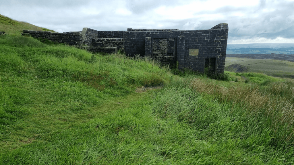
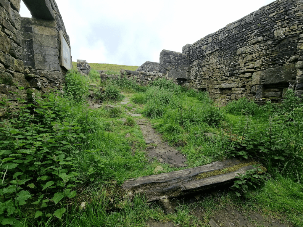
Although I’ve passed by Top Withens several times I’d never actually had much of a look at it. As it was a nice morning (that would change) I thought I’d have a quick nosey ‘inside’ (can you go ‘inside’ a building that doesn’t have a roof?)

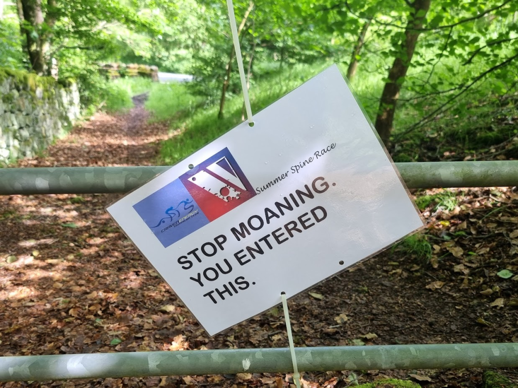
Not long after leaving Top Withens, various motivational messages started appearing on gates…
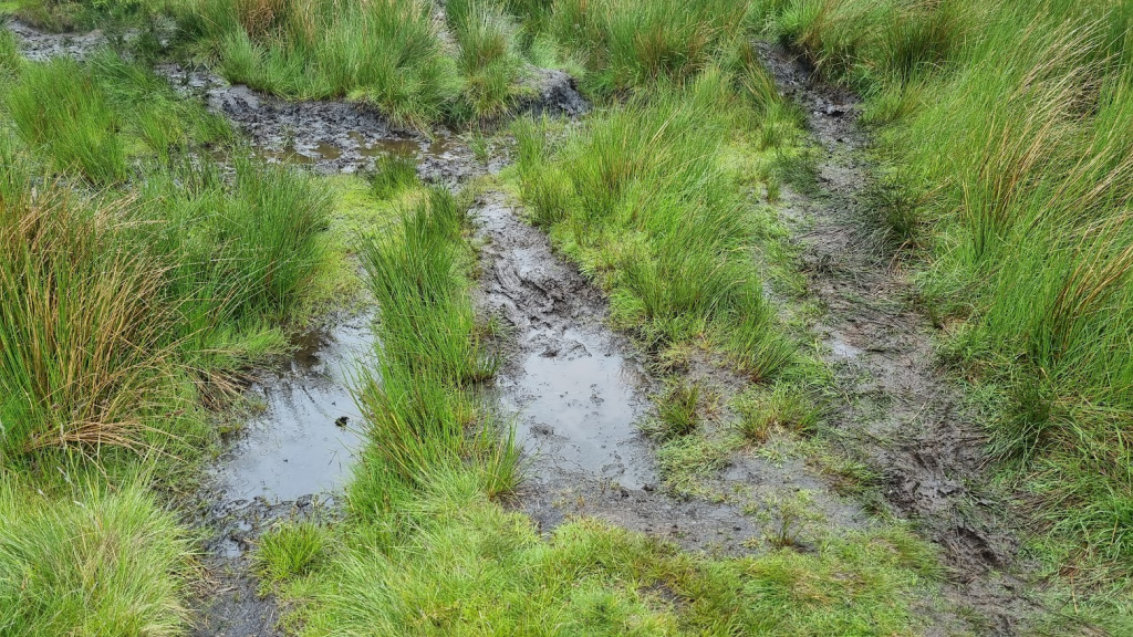
Soon we found ourselves on Ickornshaw Moor. Yeuckornshaw Moor would have been a more appropriate name as it was a boggy slippery mess, which neither of us enjoyed. To make things worse I was soon being accused of leaving my wife behind. Actually this was a good thing (not leaving Sharon behind obviously. Anyway I wasn’t, not deliberately, I’d just crossed the bog, sorry moor, a little ahead of her) as the person making the accusation was Spine Legend Gary Chapman. He was also behind the Craven Energy Triathlon Club’s unofficial but most welcome checkpoint. Gary escorted us to the tent and helpfully pointed out the least boggy way to get there. I don’t know if its deliberate, but the location of the tent means it only becomes visible once you are almost on top of it – the complete opposite to Stoodley Pike, which is visible long before you reach it!

I’m not sure when this unofficial oasis first appeared but up until 2021 (my Summer Spine DNF year) it was entirely unregulated and people would sleep at it. In Summer 2022 (my Summer Spine finish year) it didn’t happen as it was recognised it was being used as rather more than just a refreshment stop. However the following year (Summer Spine Sprint, didn’t come this far) it reappeared but with a 30 minute time limit, the same as the official ‘.5’ checkpoints.
We arrived just as it started to hail. 30 minutes, one bacon sandwich and a cuppa later the hail stopped, Perfect timing! Before we left Gary checked the weather forecast for us. As we expected, it was due to be raining heavily as we crossed Fountains Fell. Gary suggested we should spend a couple of hours in a pub in Malham to let it pass. When a Spine Legend gives you advice you are wise to at least think about it. We did, but decided against it as we weren’t entirely sure we would be able to get going again if we spent a couple of hours in a nice warm pub.
After a few miles we were at Lothersdale, the location of the Craven Energy Triathlon Club checkpoint on the Winter Spine and where I’d enjoyed a bacon sandwich in January. Speaking of bacon sandwiches, although Sharon hadn’t been able to keep her breakfast down the bacon sarnie she had at the Tri Club CP went down and stayed down without too much effort, which was a good thing. As we were running towards Pinhaw Beacon, I could see two runners in the distance coming towards us. As they got nearer they resolved into my Spine Angel Rachel and her boyfriend, who I hadn’t met before, Clive.
The Spine Race has a rule that you should only be met by friends and family once in the event, and of course they can’t give you anything (unless they are willing to stand there and give the same to every other runner). Technically you could argue we had already had our support meeting as we saw Gill and Gary at Nether Booth. However given that, at that point, we were less than two miles into the race and we only stopped for long enough for Gary to take a picture of me by the phone box, I don’t feel we were violating the unsupported nature of the Spine by seeing a couple more friends.
It was great to see Rachel and finally meet Clive but we had to say goodbye and get on with it. The weather was currently OK so we were keen to make progress before it changed. There was also something else on my mind…

Less than a mile outside Thornton-in-Craven, we came to it – the Cam End Tuck Shop.

I had seen on Facebook that this had been significantly expanded from the small grey shed I had visited in the winter, which was great but…

…would there be pork pies?

Oh yes! And milkshakes. Sharon was very happy with the crisps. I had a sausage roll to go with the pork pie. We chatted to an Australian couple who had come over to walk the Pennine Way and had also found the tuck shop. They were taking a far more sensible amount of time to walk the Pennine Way than us.
After crossing some fields we arrived at the Leeds and Liverpool Canal. Despite it being a water course it was still uphill from the last field to the canal – but then the general rule for the Spine Race is if you don’t know which way to go, it’s probably the uphill route you want. Anyway the canal at least was flat and a nice easy towpath to run on. At East Marton we passed under the double arch bridge. I took a picture despite having much better pictures from previous races.

On both my Spine finishes we had been diverted via Bank Newton between East Marton and Gargrave due to the Pennine Way being in a fairly bad state along that section. I was therefore a bit concerned as generally the underfoot conditions were worse than they had been in January (when we were diverted) so how bad would this be? As it turned out it was fine and we soon found ourselves in Gargrave and obviously, as I was trying to give Sharon the full Spine experience, we had to visit the legendary Co-op.
We bothy bought a drink and a packet of sandwiches. Well, we tried to. When we went to pay we were told if we added a snack it would be a meal deal and therefore cheaper than the drink and sandwiches alone. I’m not sure how that works economically but being paid to have a piece of Millionaire’s Shortbread sounded great so we didn’t argue.
We had recced Gargrave to Horton-in-Ribbledale in December so Sharon was back on part of the Pennine Way she had seen before. We left Gargrave and crossed a few fields until we met the River Aire, which we followed to Malham. I celebrated by photographing it’s phone box.
By now the weather was getting decidedly grey and miserable. It was also about 7:30 in the evening. I had feared that we would be dodging through crowds at Malham Cove, but the time of day and the weather meant there were less people there than there had been in January.
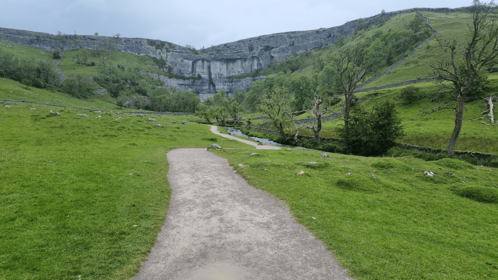
There are a lot of steps from the bottom of the Cove to the limestone pavement at the top so we both set off at our own pace and would regroup at the top.

The Pennine Way officially goes right through the limestone pavement. Looking at the trackers from January, the elite runners definitely don’t. Due to the rain the limestone was extremely slippery so I took us on a route that didn’t cut the corner quite as much as the elites but avoided most of the pavement as it was even more hazardous than usual.

It wasn’t possibly to avoid all the slippery limestone as there is over a mile of path and climb over limestone before the terrain opens out and becomes more grassy.
We negotiated the limestone without incident and headed towards Malham Tarn and Checkpoint 1.5.
By now the promised rain had very much set in and so we were very pleased to get indoors at the checkpoint. I was surprised how many people were there. We had been fairly much on our own for some time and so it was surprising to see were weren’t that far behind several other runners.
As I expected the legendary John Bamber was in charge of CP1.5. Last time I saw John I got noodles. This time there were no noodles but there was tea and coffee. Officially there is only water at intermediate checkpoints but I was fairly confident that John would have tea and coffee as that’s the sort of person he is, one who will do his best to make sure people get what they need to carry on. I also had some water added to my freeze dried meal. A bit too much really so it was more like soup than spaghetti carbonara but extra liquid wasn’t a bad thing.
John was also strongly advising us to stay in groups or at least pairs to cross Fountains Fell and Pen-y-Ghent. Obviously this was the plan for Sharon and me anyway but most of the others at the CP seemed to be taking his advice too. We put on a warm layer and full waterproofs and headed out towards Fountains Fell.
Despite having run this section twice in the last 6 months, I still manage to get confused at a couple of points. The first is where the Pennine Way meets a small road. I know not to take the road but the correct route is up the farm track, not the barely discernible path on the grass. Shortly after the path goes through a group of farm buildings. You go right to the buildings before turning up toward Fountains Fell. I turned a bit early, although I didn’t feel there was any need for Sharon to tell the runner that caught us up we were lost.
Anyway we were soon on the path up to Fountains Fell. By now it was properly dark, miserable and quite misty. I kept stopping to ensure I didn’t leave Sharon behind. I had my mandatory red rear light so she could see me but it was raining and I had my hood up so if I got too far ahead I may not have heard her had she tried to call me back.
There wasn’t much opportunity for photos on Fountains Fell but I’m always pleased to see the ‘DANGER Mine Shafts’ sign as it means the climb is almost over.

It’s not much over a mile from the top of Fountains Fell to the road that leads to the turn off for Pen-y-Ghent, but the dark, the rain and the mist combined with slippery underfoot conditions made it seem much further but eventually we were on the road and heading to the track up to Pen-y-Ghent. I think it was the runner that Sharon had told we were lost who asked if we would mind if he followed us up Pen-y-Ghent as he had never been over it before – obviously my failure to get lost again had reassured him that I might actually have some idea where I was going.
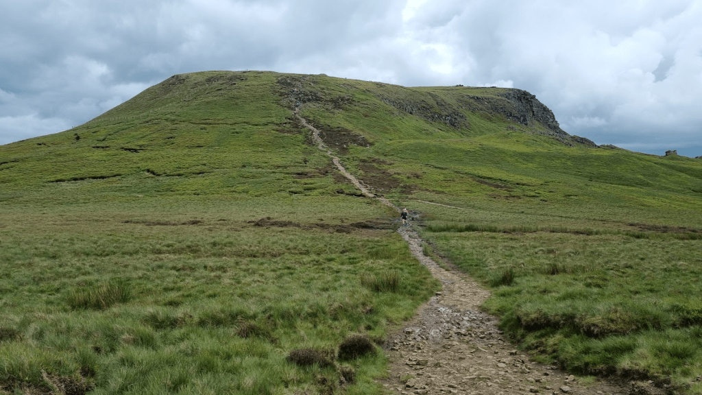
I guess I have always had the good fortune to go over Pen-y-Ghent in not too bad weather. This was about the worst I’d experienced on it but I was still fairly confident. There is actually only about half a mile of steep and tricky climbing to do. It is steep and tricky as a couple of places involve scrambling but that just takes my mind off how long it would take me to stop moving if I fell off.
As we approached the top there was a group of three runners in front of me. ‘Are you familiar with this mountain?’ I was asked. ‘Yes, just keep going up’ was my reply. I had learnt in January that if you just kept going up you would reach the top and all would be well. I diverted slightly right to avoid being right underneath them if something did go wrong and soon found myself on the slightly bizarre quarter of a mile long slabbed path that very gently climbs to the actual top pf Pen-y-Ghent. I looked behind me and Sharon and our new friend soon joined me.
The wet weather had brought the frogs out on Fountains Fell and Pen-y-Ghent so obviously I had to photograph one.

I’m blaming the mist and the dark but initially I couldn’t find the marker for the top.

We were about to attempt our usual mountain to selfie when our fellow runner kindly offered to help.

You can see in the photo that the left lens of Sharon’s glasses is completely covered in condensation. Unfortunately she didn’t realise this and assumed it was just the mist, which made getting down the mountain a little more challenging than it already was.
We went through the gate at the top and found the steps down followed by the track to Horton-in- Ribblesdale. Fortunately although the visibility was poor, it was good enough that when I followed a side path – presumably to a view point when it was light and not foggy – I could see ahead enough not to simply walk off the side of the mountain. It was soon clear that our mountain companion was much quicker than us so we told him to leave us and go at his own pace. He thanked us for our help and disappeared into the mist.
Horton-in-Ribblesdale was the last water refill point before Hardraw. This is probably not strictly true as I’m sure water is available in Hawes but there were no other water stops for the next 13 miles. We filled our bottles at the toilets. I had had a half a plan to have stop there but it was cold and wet outside and the toilets were quite busy with another group trying to warm up so we pressed on.
As we headed towards the dreaded Cam High Road the sun rose. Well, it got lighter anyway. The clouds were just a solid impenetrable grey which made it almost impossible to pick out which direction the sun was in, much less see it. I’d never been on the Cam High Road in daylight before but I wasn’t hopeful that this miserable version of daylight would make it any more pleasant.

After about twenty minutes, Sharon commented that she didn’t understand my intense dislike of the Cam High Road. Indeed it did have one or two points of interest I’d not seen in the dark.
However most of the Cam High Road was exactly as I assumed it to look – only worse, I could see just how far it stretched in the daylight.
After an hour or so Sharon commented that she completely understood my intense dislike of the Cam High Road! She now also agreed with my comment that, when she threw up on it earlier, that was the the best thing to do with the Cam High Road, vomit on it. The only highlight was being passed by the leader and eventual winner of the full Summer Spine, Chris Cope. Chris was very friendly and positive and commented on how bad the underfoot conditions were – at least the fast guys were finding it a challenge too!
I was really struggling to stay awake Sharon kept having to wait while I tried to ‘micro-nap’ hanging off my poles. After a while I remembered I was still carrying a sachet of caffeinated Tailwind – I’d just filled my bottles with water at Horton-in-Ribblesdale. I tipped it into my bottle and the effect was startlingly rapid. I had a good drink from the now caffeinated bottle and almost immediately perked up. The Cam High Road was still very boring but at least now I wasn’t falling asleep.
The only good thing was that I had overestimated how far along we went before we reached Ten End and so we turned off half a mile before I expected. Gaudy Lane was the final downhill section into Gayle and Hawes, from there is was a couple of fairly easy miles to Hardraw.
For most of its length Gaudy Lane is an extremely misleading name for a muddy moorland path. However it isn’t terribly hard to follow – keep going downhill and head for Hawes is the general gist of it – and after the Cam High Road it’s a nice downhill run. Apart form this time. It was the muddiest and slipperiest I have ever know it. Had we tried to run at any great speed we would undoubtedly arrived in Hawes caked in mud. As it was I had a few near misses but just about managed to stay upright until we reached the road.
Because this is the Pennine Way and nothing makes sense with regard to its route, it leaves the road and crosses a few more fields on the way to Gayle. The GPS route cut the corner between the road and the field a bit so it took a few seconds to find the gate into the fields. Fortunately these weren’t too muddy and overgrown as we had started running by now. My plan had been to get to Hawes and strip off our waterproofs there but we were getting quite hot so we stopped at the edge of a field and did it. As we were only a couple of miles from the finish and there were no more exposed or high sections, I wasn’t too bothered about how everything went into my pack as I wasn’t planning on opening it again before we finished.
We followed the GPS route through Hawes without incident until we reached the back of St. Margret’s Church. The footpath split and the Pennine Way marker appeared to be sending us to the left of the church so we went that way. I soon realised this wasn’t correct but we cut through the churchyard to get back onto our route with only a few bonus yards added. My (retrospective, having looked at the routes) excuse for getting it wrong is that in January, because the checkpoint is at Hawes Youth Hostel, the correct route was to the left of the church.
As this was the Summer Spine, we had another mile and a half to do to get to Hardraw. I remembered this bit correctly and we had no issues. There was much less sheep poo in fields to Hardraw than I remembered from my Summer Spine race too.
Our euphoria at being so close to the finish (and the fact I was full of sugar and caffeine) meant that we ran through the fields and over the bridge to cross the finish line had in hand. It had taken 49 hours and 22 minutes but we were 2024 Summer Spine Challenger South Finishers!
We were given medals, congratulations, t-shirts, certificates and food. The first thing we both wanted to do was get our shoes off though. Then we thought perhaps we should get a picture of us at the finish (there would be official photos but they take a while to come through). This is why we are wearing sandals in the photo!

As I’ve said earlier, Spine checkpoints are brilliantly organised. We had told the checkpoint manager we were in the Green Dragon pub so after we had recovered a bit she asked if we would mind going to the pub to free up space at the checkpoint if she found people to carry our bags for us – sounded like a great deal to us!
I’m sure that some of you are thinking that this must have been easy for me, given I did the full Winter event in January. Wrong. This was a tough event. The drop out rate was high, out of 157 starters , 59 did not finish. In the full Spine only 49 finished out of 109 starters, 47 of the 60 DNFs had pulled out by or at CP2, our finish line. I have no where near as much experience on the Pennine Way as many people but these were some of the worst underfoot conditions I’ve experienced on it. I’d be immensely proud of Sharon for having completed a 100+ mile race for the first time regardless but but to have completed that particular 100+ mile race is exceptional.
When I completed the Summer Spine my reward was a trip to the National Telephone Kiosk collection. This time we are in Wensleydale so really the only proper reward was a trip to the Wensleydale Creamery to see Wallace and Gromit.

The obvious next step for Sharon is Challenger North. She hasn’t said no yet, we are just waiting to hear about the date of another event which may unfortunately clash before deciding. Hopefully we will be back on the Pennine Way next year but if not I’m toying with the idea of me doing a Winter-Summer double full Spine in 2026…

’The obvious next step for Sharon is Challenger North’ – obvious to you, clearly. It wouldn’t be my ‘next step’ – have you told her about the midges?
LikeLiked by 1 person
We had head nets and insect repellent ready for CP1.5 at Malham Cove but it was raining so all sensible creatures (i.e. everything but Spiners) were under cover somewhere.
LikeLike