
As I’ve already mentioned, distance-wise I was already well over half way through the Spine Race in terms of distance, however most of the hardest parts were yet to come. That wasn’t to say what had already come had been easy, as you know if you’ve read the first three parts of this blog it wasn’t. Around forty people dropped out for various reasons at the first checkpoint, such was the difficulty of the very first leg.
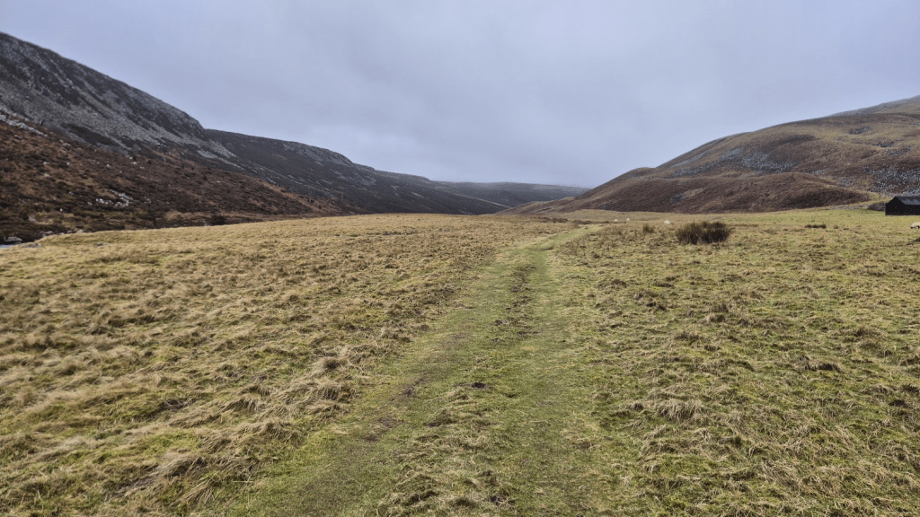
The first part of the leg is fairly straightforward, a little over a mile and a half across farmland to join the banks of the Tees, followed by around another mile of pleasant strolling by the riverbank.
In 2024 Cauldron Snout was deemed to icy to be climbed safely and so the whole section along the Tees was diverted. I wasn’t too disappointed by that as, while the Cauldron snout scramble is quite fun, the rock climbing to get to it isn’t.
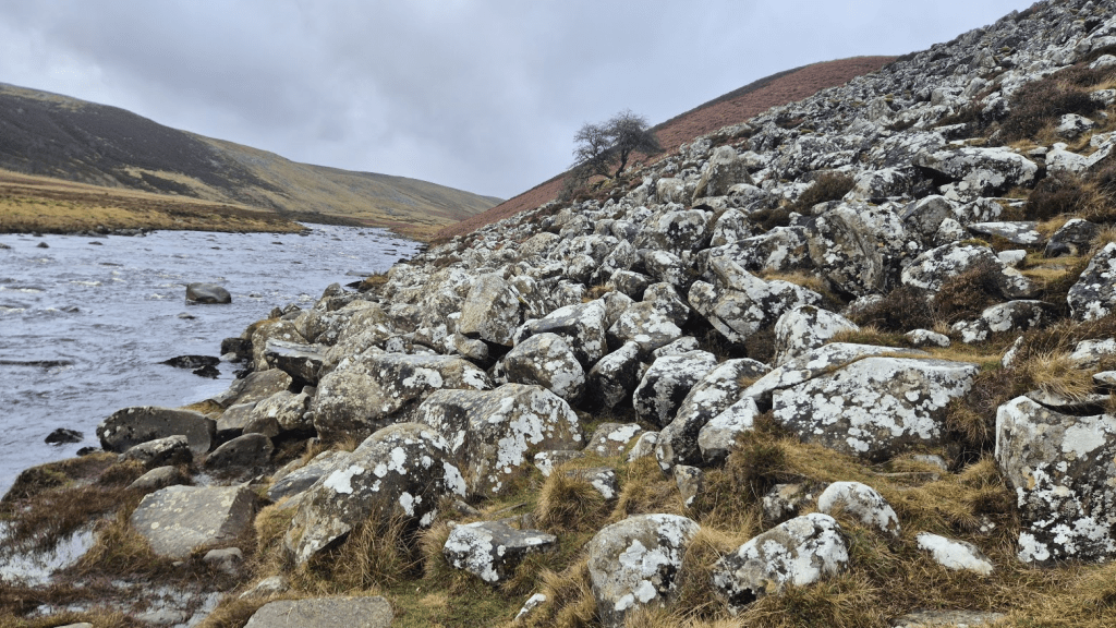
At a couple of point the rocks have fallen right down to the river, leaving no discernible path and requiring a certain amount of care and balance to successfully negotiate them. This isn’t a ‘how to’ guide to the Pennine Way or the Spine Race but my advice is to remain close to the waters edge. It may seem easier to ascend as you go along but you are then left with the task of getting back down again, staying low is (in my opinion) the best option.
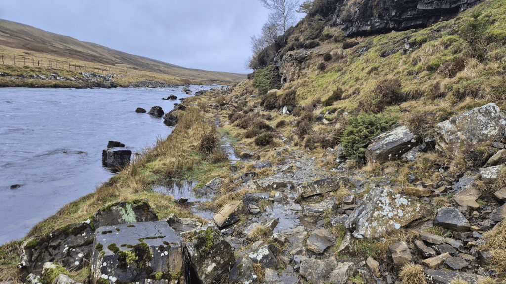
A vague path is visible over quite a lot of this section. The rocks still require care but there is some indication that others have been there before you. Obviously many, many others have been before over the whole route but the signs in among the rocks are subtle, mainly wear marks where countless people have come to the same conclusion when picking their way through.
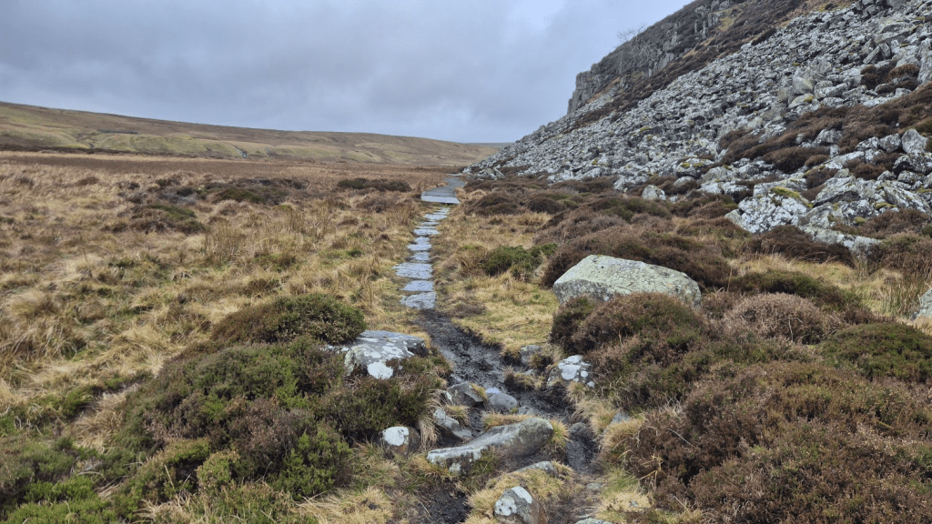
And then there are sections with slabs and walkways. The whole Pennine Way is full of these contradictions. There are many sections like these, which are only accessible via much trickier, muddier sections, which are suddenly slabbed or boarded. I accept there is only so much money available and so it is unreasonable to expect it all to be a beautifully manicured path (and it would remove some of its charm) but it does seem odd that apparently random sections are singled out for upgrading. I guess it is determined by the level of erosion of the path.
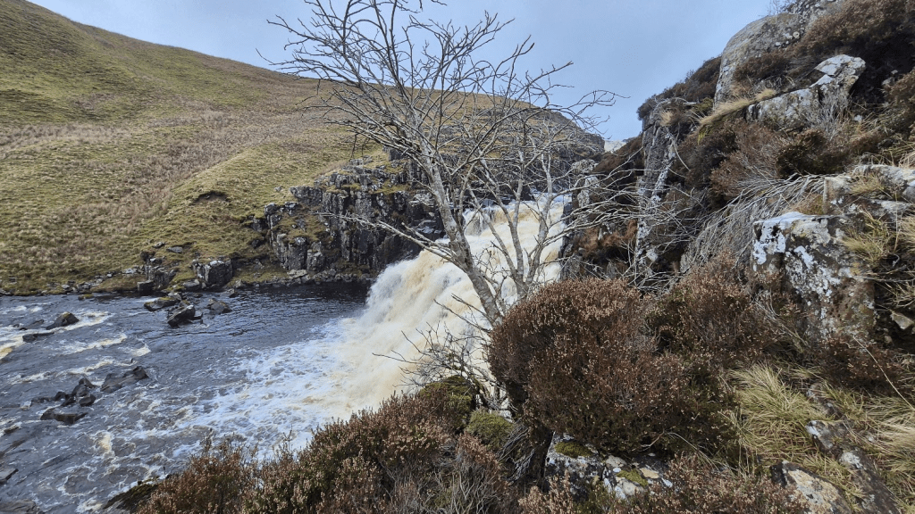
The scramble up the side of Cauldron Snout isn’t difficult but I always seem to manage to do it in the most inelegant way possible. I also always end up further right than is necessary but none of this matters as all routes lead to the road at the top.
The road remains a road for a while. Due to the complete lack of phone signal in the are the Spine organisers (presumably with the help of the owner) had set up a Wi-Fi hotspot at Birkdale. The primary purpose was for safety, we were all supposed to connect to it to check for any messages from Spine HQ, but we were told at the race briefing that we could use it for social media, calls to family, checking email, basically anything we wanted to do on the internet. I decided to do a livestream on Facebook. I’m not that great at keeping people updated on social media during these events and in the past I’d done a livestream because it’s easier than typing. I had received a lot of very positive feedback about my livestreams, people like them because it conveys a much better picture of how I am than writing. I’ve just viewed the video I made – it sort of made sense I guess…
Anyway a bit further along the road before turning off along the edge of Dufton Fell (probably, another bit of boggy moorland anyway) down to Maize Beck. Maize Beck is a small river that flows into the Tees just below Cauldron snout. It’s a small river with a very impressive bridge.
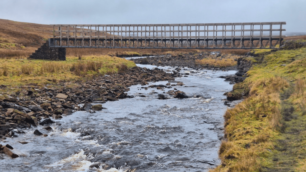
According to a small plaque, the bridge was built in memory of Ken Willson MBE 1914 – 2003 President of the Pennine Way Association. It is certainly a very impressive memorial in rather bleak surroundings. Looking at the OS map, it suggests that there may have been another route following the Maize Beck further North, where presumably it was easier to cross. This route would have caused the unwary hiker to miss High Cup Nick altogether however, so possibly that is why this particular location was chosen for the bridge, it certainly doesn’t look like it had previously been a good fording point for the beck.
Regardless of the reason for the location of the bridge, I was happy to cross it. Just over a mile further along the fell (possibly Murton Fell now, or possibly not) I got my first view of High Cup Nick.
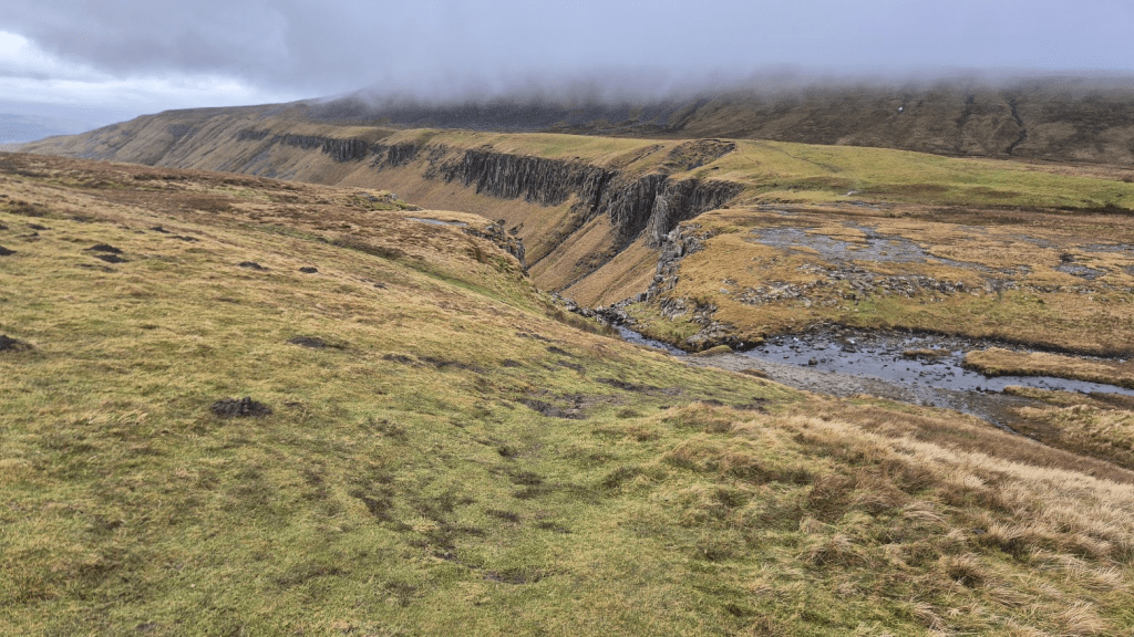
Last time I’d been here on the Challenger North it had been dark and foggy so I had had no view whatsoever. This time was better.
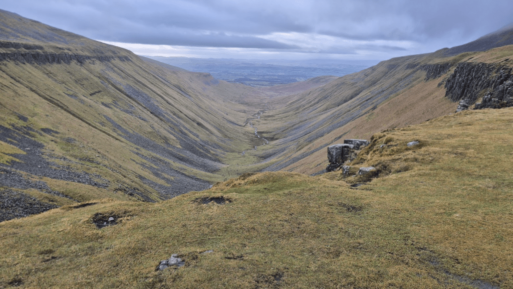
From High Cup Nick it was down to Dufton. The first mile or so follows the edge of the scar on the Narrowgate Path. I deviated slightly around Strands Beck as there was a lot of water around and I knew it was much easier to cross if you took the path about 20 metres further North.
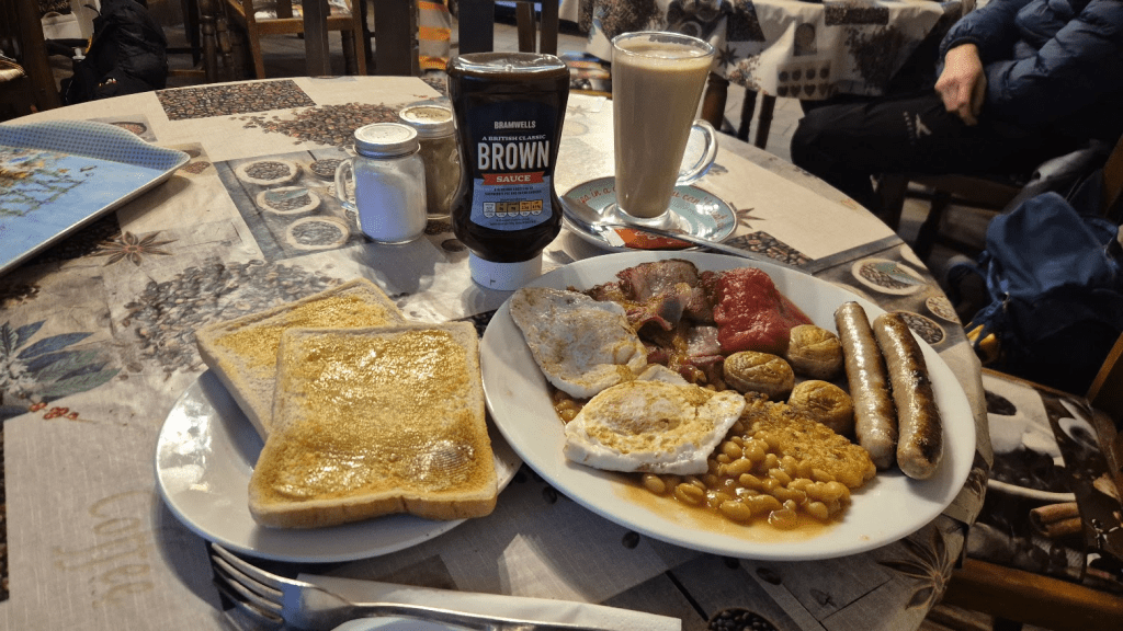
The descent to Dufton is all on well-defined paths and I soon found myself in the Post Box Pantry, where I ordered the full English Breakfast and a Latte as I always do,
After the Post Box Pantry I had to go the Checkpoint 3.5 in Dufton Village Hall. By now it was dark.
At the Checkpoint I used the toilet, had a cup of coffee, and was briefed on what to expect on Cross Fell. I nearly handed my tracker in (I couldn’t hand my number as it had been lost in the first couple of hours of the race). Apparently there wasn’t snow up there but there was ice, and a wind of 30+ mph. I’d need my spikes and warm layers. As I’d mentioned it was also by now dark and I have genuinely never felt less suited to the task ahead than I did at this moment.
I put my extra fleece on and went outside. Despite the fact it was still quite a way until I’d actually need them, I put my spikes on. On reflection if I’d remembered how far along Hurning Lane it was, and that there were plenty of suitable stopping points, I might have put them on later. The spikes are now definitely blunter than when I started and this part of the race probably contributed to that. However my fear was needing them and not being able to get them on when I did, so I judged it better to start with them on. It was the same story with the layers, I had my jacket and fleece undone for the first couple of miles as I was quite warm but again, I didn’t want to need my extra layer and not be in a position to get it on.
I spent most (all) of the trek up to Knock Fell telling myself what a stupid idea this was and that I should turn round and go back to Dufton. I lost the path a couple of times on the way to Knock Fell, I seemed to have a tendency to drift off left.
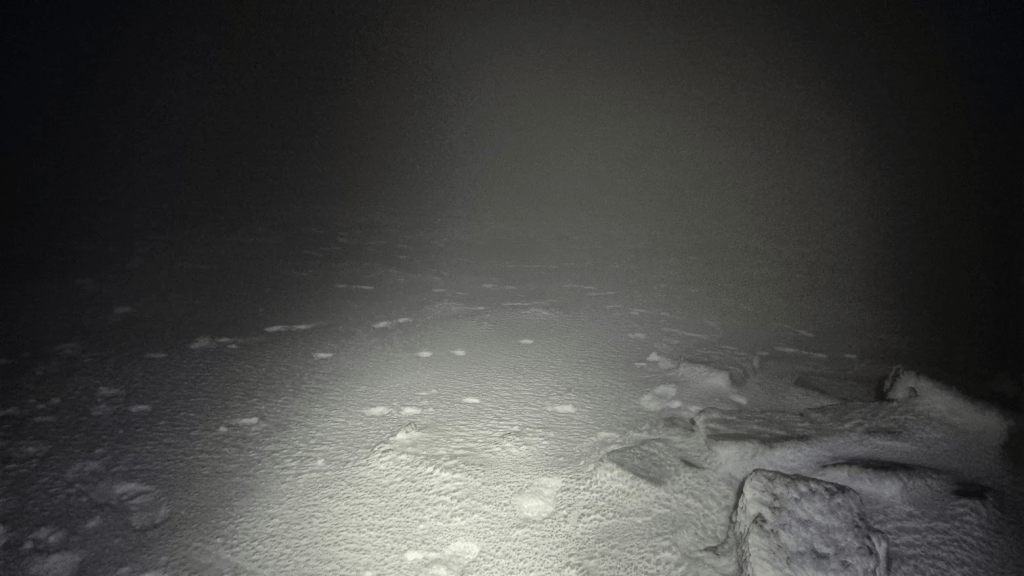
Once I was up the fun began. I had been told it was ice and not snow but it looked a lot like a very snowy landscape – however it was quite solid so I guess the volunteer that briefed me was correct, it was ice. The good news was that my spikes were behaving well, I wasn’t cold yet, and the wind was mainly behind me, just needed to find the path…
I’d never really thought about the poles before but obviously they marked the route. Then there were slabs. however the most reassuring thing was the footprints. With my position in the race plus the Challenger North, around 200 people had already been up here and left a lot of foot prints.
I also remembered a surprising amount of the route. The section to Great Dun Fell is slightly tricky as it follows the road to the radar installation for a while, and crosses Dunfell Hush (disused). Apparently a hush was made by collecting water behind a small dam and repeatedly releasing the built-up water to wash away the soil and reveal the mineral-bearing ore beneath. Basically it was a bit of a trench, the Pennine Way follows it for a brief while to its narrow end where it can be crossed with the help of some steps.
I couldn’t really see the radar installation but I saw some fences and was confident I was on the right path. From Great Dun Fell to Little Dun Fell I could see the path. Much of it is slabbed and there were a few decisions about where to trust my spikes on the icy slabs and where to walk off the side, however I conquered Little Dun Fell without incident.
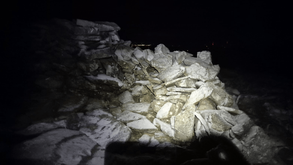
There was a somewhat dilapidated shelter on Little Dun Fell and I was feeling confident enough to hide behind it and try and take a picture – it isn’t the best picture I’ll ever take.
From Little Dun Fell there is a drop to Crowdundle Head – the head of the Tees is more or less in the same dip on the other side. I knew that the climb up to Cross Fell started easily enough but degenerated into picking your way through rocks before it levelled out for about a half a mile of gentle uphill to the top of Cross Fell.
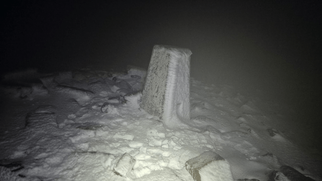
I was so happy to see the trig point I stopped for some very quick photos.
Apart from the usual issue of having to work out which way to go off the top, the mile or so from here to Greg’s Hut was fairly straightforward.
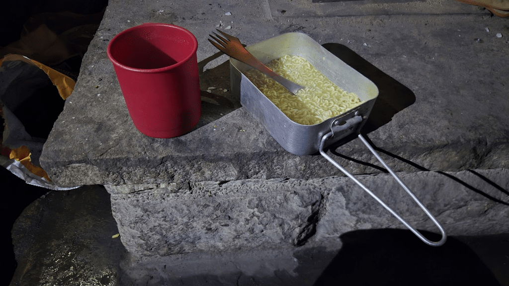
Greg’s Hut. for most of the year it’s a mountain bothy but during the Winter Spine Race, John Bamber turns it into Britain’s highest noodle bar.
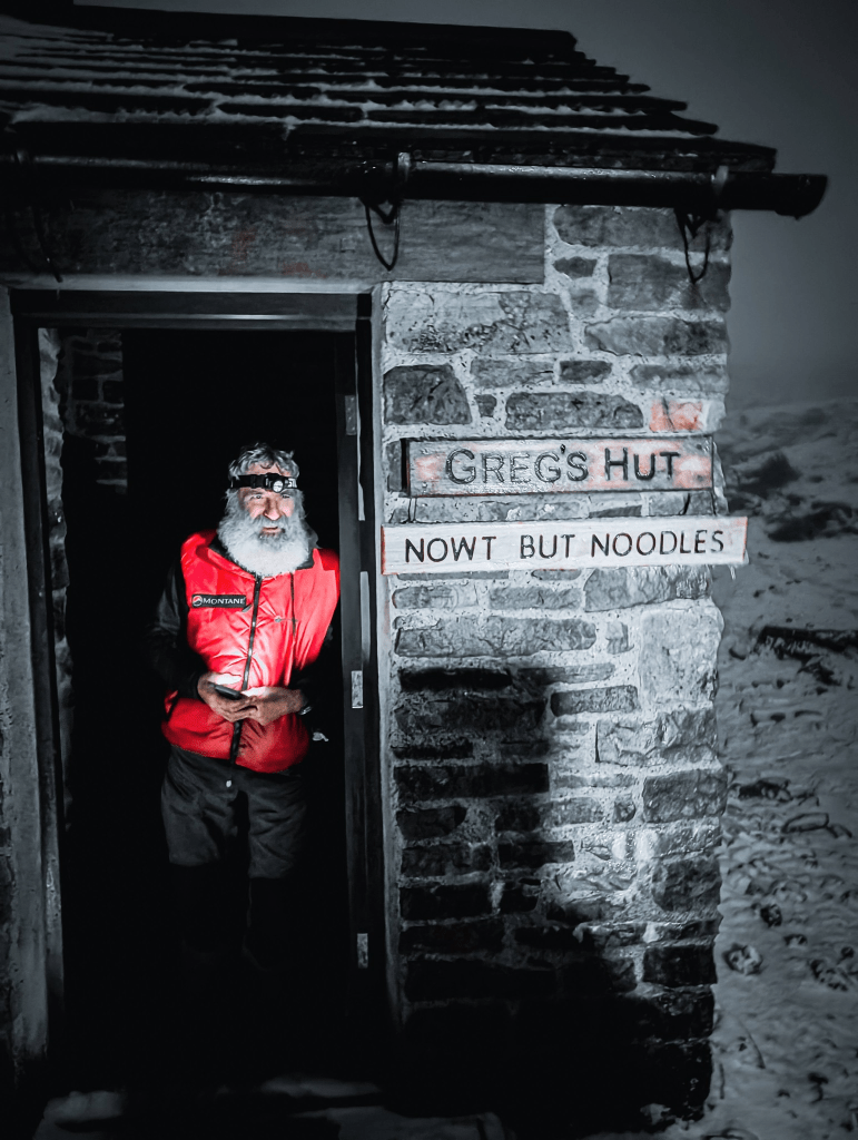
I opted for noodles with a small amount of chili. John’s chilis are home grown and quite powerful, so I decided caution was the best option.
After leaving Greg’s Hut I started the long journey to Garrigill. I was accompanied on some of the way by a photographer who had planned to hike up to Greg’s Hut. The wind that had accompanied me across Cross Fell had, if anything, got stronger and he had decided that he would return to Alston rather than endure an unpleasant hike into the wind.
At Garrigill I finally visited Annie’s house. Annie is one of the Spine Angels and opens her house to all Spiners. For some reason I’d never been in before but, despite the call of the Alston lasagne, I popped in and was made very welcome, more coffee and a ham and cheese toastie. I commented that I didn’t much like the path to Alston where it had been diverted and was told the locals were not happy as there wasn’t actually anything wrong with the bridge for which the detour had been put in place. It was a piece of concrete that deflected the water which had moved and the bridge was fine. This was interesting but unfortunately I had to follow the official Spine route.
Why don’t I like the alternative route? Well, one reason is that it does contain some very fine examples of the stone wall builders art in terms of incredibly user unfriendly stiles, it was also slippery (although to be fair the old route may well have been just as bad) and it isn’t very picturesque (although it was dark so I’m not sure why this bothered me).
Anyway I eventually arrived at Alston Youth Hostel (Checkpoint Four) home of the world famous lasagne, to be greeted by Chris Taylor, who, I think, has been volunteering at Alston every time I’ve been there on the Spine.
I was on a bit of a high when I arrived after my successful traverse of Cross Fell and posted a few pictures on Facebook when I arrived at the checkpoint. Sharon commented that she was glad I didn’t post the pictures until after I was safely at Alston as she might have been a bit concerned had she known what it was like up there.
The plan at Alston was similar to that at Hawes, eat, shower, sleep. I was hoping for better sleep than I got at Hawes. However, I had no idea what bizarre dreams my fatigue was going to give me this time…
